Hike Oregon
  • Home
  • *Store*
  • About the author
  • How to use this site
  • Resources
    • Wildflowers
    • Videos
  • Best Oregon Hikes
    • Top Fall Foliage Hikes In Oregon
    • Top 10 Oregon Fall Hikes
    • 20 Best Oregon Waterfall Hikes
    • Top 10 Oregon Hikes for Kids
    • Sno-Parks In Central Oregon
    • Top 10 Oregon Winter Hikes
    • Top Low Elevation Winter Hikes
    • 9 Amazing Oregon Summit Hikes
    • 20 Central Oregon Day Hikes
    • 20 Epic Oregon Wildflower Hikes
    • 5 Weekend Backpacking Trips in Oregon
    • Top One Night Backpacking Trips in Oregon
    • Top 10 Oregon Summer Hikes
    • Top 10 Swimming Spots In Oregon
    • Top 10 Oregon Spring Hikes
  • Oregon Sno-Parks
    • Maxwell Sno-Park
    • Potato Hill Sno-Park
    • Ray Benson Sno-Park
      • Brandenburg Shelter
    • Santiam Sno-Park
    • Three Creek Sno-Park
    • Virginia Meissner Sno-Park
      • Meissner Shelter Loop
      • Nordeen Shelter
    • Gold Lake Sno-Park
      • Westview Shelter to Eagle Rock Overlook
      • Marilyn Lakes Loop
  • Southern Washington
    • Hamilton Mountain
    • Dog Mountain
    • Coyote Wall
    • Mount St. Helens
  • Portland
    • Powell Butte
    • Forest Park
    • Latourell Falls
    • Multnomah/Wahkeena Falls
    • Eagle Creek
    • Mitchell Point
    • Table Rock
    • Tamanawas Falls
    • Trillium Lake
    • East Zigzag Mountain (members only)
  • Salem
    • Abiqua Falls
    • Silver Falls State Park
    • Dome Rock
    • Marion Lake to Marion Mountain
    • Jefferson Park
  • Corvallis
    • Marys Peak East Ridge
    • Marys Peak North Ridge
    • Alsea Falls and Green Peak Falls
    • Corvallis to Sea Trail - Sugarbowl Creek segment (members only)
  • Sweet Home
    • Crescent Mountain
    • Iron Mountain
    • McDowell Creek Falls
    • Middle Santiam River (members only)
    • Lower Soda Creek Falls (members only)
    • Rooster Rock (members only)
  • McKenzie Bridge/Blue River
    • Macduff Mountain
    • Proxy Falls
    • Clear Lake
    • Sahalie/Koosah Falls
    • Blue Pool
    • Erma Bell Lakes
    • Olallie Mountain
    • Horsepasture Mountain
    • Tidbits Mountain
    • Castle Rock
    • Lowder Mountain (members only)
    • East Fork Trail (members only)
    • Rainbow Falls Overlook (members only)
    • Frissell Point (members only)
    • Chucksney Mountain (members only)
    • Substitute Point (members only)
  • Sisters/Santiam Pass
    • Coffin Mountain
    • Trappers Butte and Scar Mountain
    • Maxwell Butte
    • Black Butte
    • Whychus Creek Trail
    • Tam McArthur Rim
    • Black Crater
    • Scott Mountain
    • Obsidian Trail
    • Metolius Preserve
    • Three Fingered Jack Loop
    • Square Lake
    • Canyon Creek Meadows
    • Patjens Lakes
    • Craig Lake (members only)
    • Chush Falls (members only)
    • Rockpile Lake (members only)
    • Santiam Lake (members only)
    • Camp Lake (members only)
    • Park Meadow to Golden Lake (members only)
  • Bend/Redmond/LaPine
    • Steins Pillar
    • Chimney Rock
    • Steelhead Falls
    • Tumalo State Park
    • Shevlin Park Loop
    • Tumalo Falls
    • Tumalo Mountain
    • No Name Lake
    • Green Lakes
    • Moraine Lake
    • South Sister Summit
    • Horse Lake
    • Muskrat Lake
    • Paulina Peak
    • Peter Skene Ogden Trail (members only)
  • Eugene
    • Ridgeline Trail
    • Mount Pisgah Summit
    • Mount Pisgah Arboretum
    • Shotgun Creek
    • Mount June
    • Lawler
    • Tire Mountain
    • Goodman Creek
    • Brice Creek
    • Trestle Creek Falls
    • Parker Falls
    • Moon Falls
    • Elijah Bristow State Park
    • South Willamette Trail (members only)
    • Eula Ridge (members only)
    • Eagle's Rest (members only)
  • Oakridge
    • Deception Creek
    • North Salmon Creek
    • Grasshopper Ridge
    • Larison Creek
    • Bunchgrass Ridge
    • Salt Creek Falls
    • Waldo Lake Loop
    • South Waldo Loop
    • The Twins
    • Rosary Lakes
    • Yoran Lake
    • Fawn Lake
    • Windy Lakes
    • Divide Lake
    • Diamond Peak Summit
    • Cowhorn Mountain
    • Wall Creek Warm Springs (members only)
    • Moon Point (members only)
    • Bobby Lake (members only)
    • Lillian Falls (members only)
    • Middle Fork Willamette Trail (members only)
    • Pool Creek Falls (members only)
    • Dead Mountain (members only)
    • Larison Rock (members only)
    • Quinn Lakes & Eddeeleo Lakes (members only)
    • Waldo Mountain Lookout (members only)
    • Blair Lake to Spring Prairie (members only)
    • Rigdon Lakes loop (members only)
  • Oregon Coast
    • Cascade Head
    • Drift Creek Falls
    • Sweet Creek Falls
    • Beaver Creek Falls
    • Kentucky Falls
    • Hobbit Trail to Heceta Head
    • Valley Trail to China Creek
    • Sutton Creek Trail (members only)
    • North Fork Smith River (members only)
    • Cummins Ridge (member's only)
    • Horse Creek (members only)
    • Siltcoos Lake (members only)
  • Southern Oregon
    • Fall Creek Falls
    • Watson Falls
    • Wild Rogue Loop
    • Mt. Thielsen
    • Crater Lake National Park
      • The Watchman
      • Mount Scott
      • The Pinnacles
    • Lower Table Rock
    • Pilot Rock
    • Wagner Butte
    • Mt. McLoughlin
    • Lemolo Falls (members only)
    • Fern Falls (members only)
  • Eastern Oregon
    • Painted Cove
    • Anthony Lake Loop
    • Mount Howard
    • Eagle Cap summit
    • Schneider Cabin (members only)
    • Strawberry Lake & Strawberry Falls (members only)
  • Oregon PCT sections
  • Tips & Tricks
    • Leave No Trace
    • How To Pick The Right Backpacking Tent
    • Top Tips For Hiking With Infants And Toddlers
    • Poison Oak, Ivy and Sumac
    • How to dress for cold weather hikes
    • Outdoorsy Holiday Gift Guide 2022
    • Hiker Holiday Gift Guide 2019
    • Outdoor Holiday Gift Guide 2018
    • Hiking Holiday Gift Guide 2017
  • Reviews/Gear
    • Storing Your Bear Canister When Backpacking
    • Stay Kühl This Summer
    • Outdoor Herbivore Backpacking Food Review
    • Osprey Aura AG 65 Backpack review
    • Big Agnes Fly Creek UL2 review
    • REI Quarter Dome 1 review
  • Adventure Stories
    • Hiking The Rae Lakes Loop
    • 110 Miles on the PCT
    • Three Fingered Jack Adventures
    • Jefferson Wilderness

Alsea Falls & Green Peak Falls

​
Get the printable version of this hike

Hike details​:

Mileage: 5.5 mile lollipop loop w/ 760 ft. elevation gain
Approximate hike time: 2 hours 23 minutes w/ an average pace of 2.3 mph
Difficulty: Easy 
Trail usage: Low during weekdays, medium on weekends
Highest elevation: 1,280 ft. Lowest elevation: 700 ft.
General location: 14 miles west of Monroe - Bureau of Land Management
Accessible: Year-round
​(Best time to go is October when the fall foliage is at its prime).
Permit required: $3 day use fee is required or annual Northwest Forest Pass
Pit toilet at trailhead: Yes
Trail allows: Dogs, mountain bike
Possible dangers: ​Slippery rocks near Alsea Falls
Alsea Falls Alsea Falls Recreational area
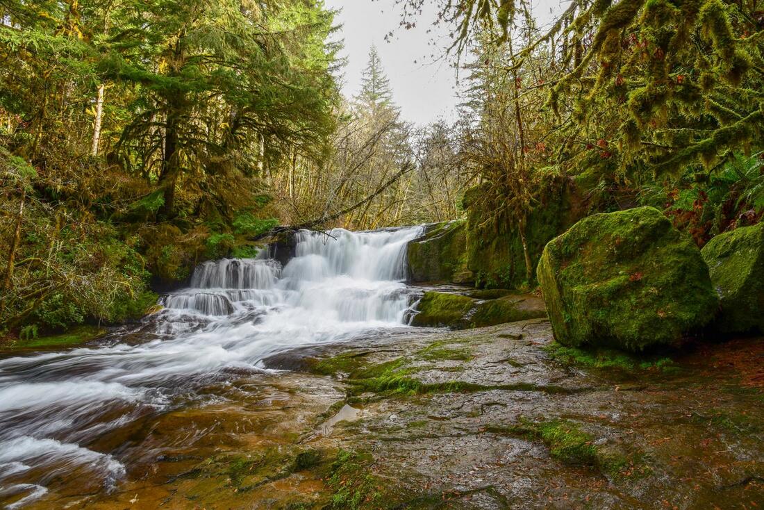
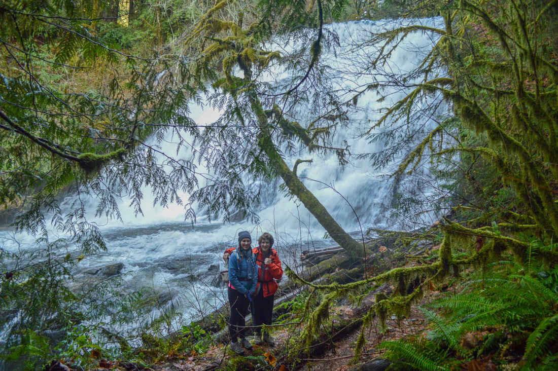
(Alsea Falls 30 ft.)
Bridge across South Fork Alsea River Alsea Falls Recreational area
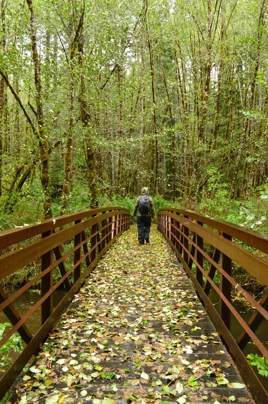
(bridge that crosses the South Fork Alsea River)

Description​:

Alsea Falls Recreation Area is a mountain biking recreation area, but it also has one of the best waterfall loop hikes in the area, perfect to do on those dreary winter days! This is also a great area to do some family camping, picnicking, fishing, and swimming in the summer months.
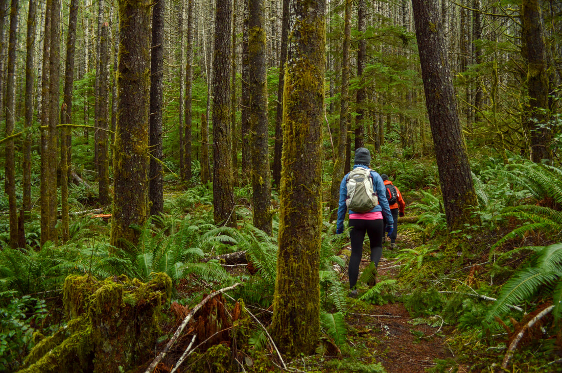
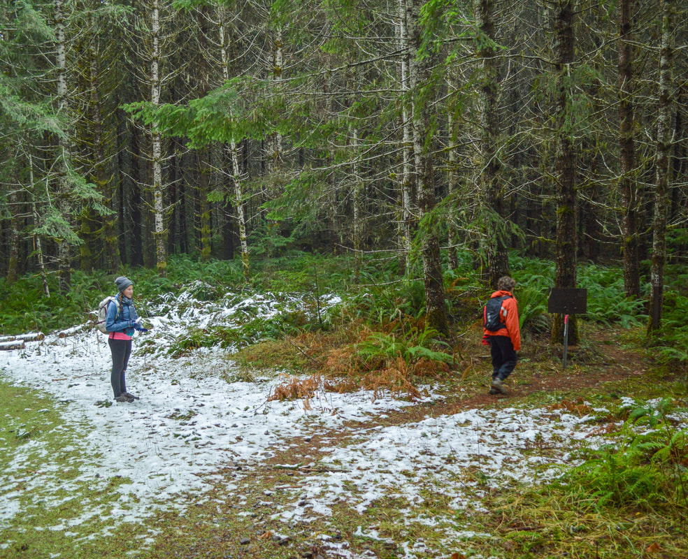
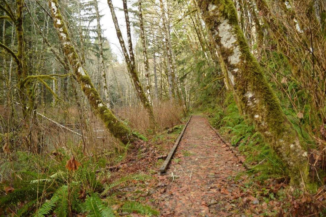
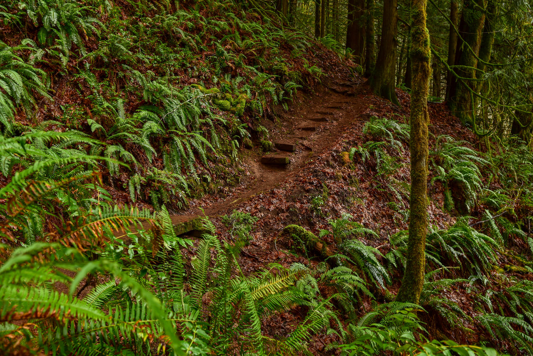
The parking area is not hard to find because there are multiple signs that lead you to the recreation area from the main highways. 
You can start the hike by going down to see Alsea Falls first, so you will take the short trail to your left before you cross the bridge. Alsea Falls is 30 feet tall and is absolutely stunning. Please be careful when walking on the rocks by the falls, as they are usually wet and can be very slippery. 
After checking out Alsea Falls, walk back up to the bridge and cross the South Fork Alsea River. Take a right after crossing the bridge for just 0.1 miles, and then take the trail that heads off into the woods to your left. These woods are incredibly beautiful, littered with giant ferns, and even if there are a lot of people at Alsea Falls you are guaranteed to get some solitude hiking on this loop. After 0.35 miles in the woods, the trail dead T's into a forest service road. Turn right and walk on the road for half a mile.
Hiking at Alsea Falls
(loop trail through the forest)
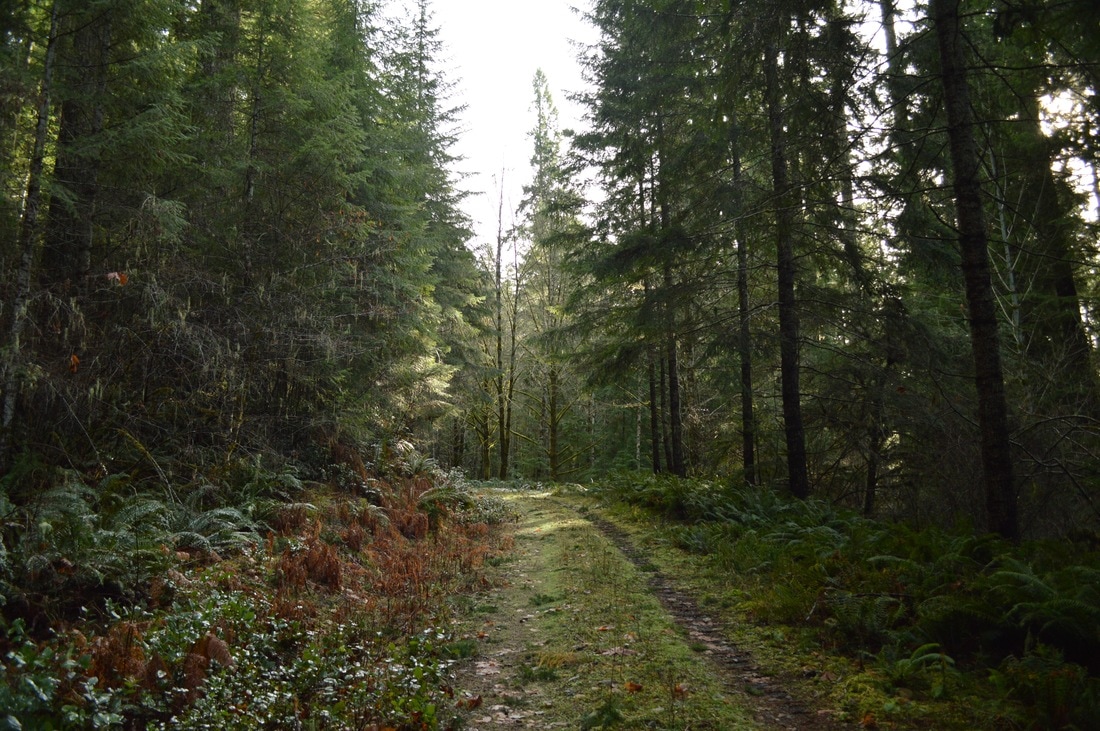
Walking on Forest Service Road Alsea Falls Recreational area
(road walk section)
End of walk on Forest Service Road Alsea Falls Recreational area
(sign that takes you back into the forest on the trail)
There is a small sign where the trail goes back into the woods from the road, so keep your eyes out for it. The trail then meanders through the forest, taking you downhill on the Buckhorn Trail for 0.45 miles until it T's into the South Fork Mile Trail. Here you will want to take a right, and after 0.75 miles and passing the Alsea Falls Campground, you will be back to where you started the loop by the bridge.
Alsea Falls Loop Trail
Alsea Falls trail Alsea Falls Recreational area
Sign to McBee Park Alsea Falls Recreational area
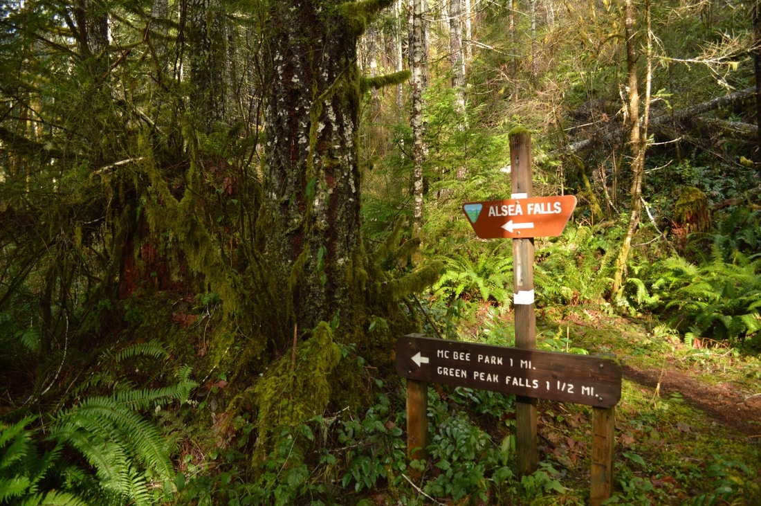
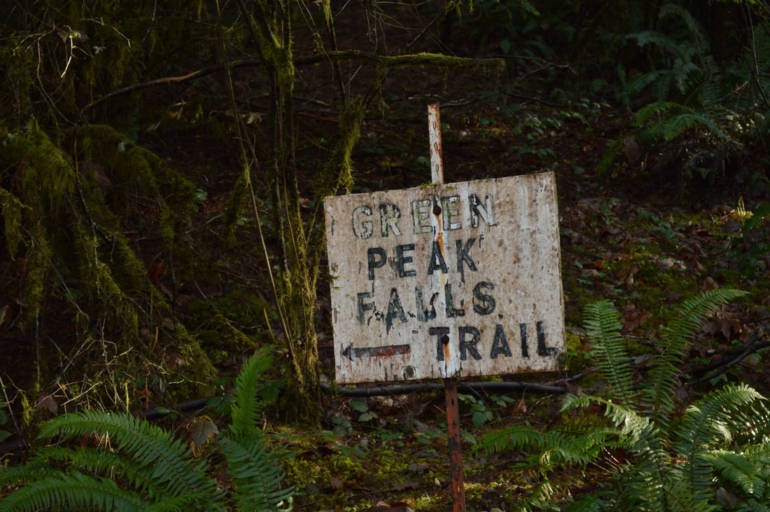
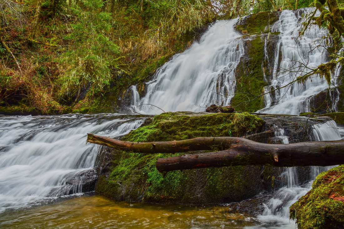
From here to you can go check out Green Peak Falls. The trail to Green Peak Falls can be very muddy, and you are walking through a very leafy forest, so in the late fall you will need to be careful, because all of the big leaves on the ground and can be incredibly slippery! At the junction where the bridge is, continue straight on the McBee Trail for 0.7 miles to where it can get slightly confusing near McBee Park. ​There are make-shift signs that will lead you to the trail, which continues at the far end of a large circular parking area. From there the trail re-enters the forest and becomes very narrow, as you go up stream toward the waterfall for 0.45 miles. Green Peak Falls is 45 feet tall and depending on the season, it is almost just as wide. After enjoying a little snack break at the falls, head back the way you came to the bridge, and cross it to get back to your car.
sign to Green Peak Falls trail Alsea Falls Recreational area
stairs leading to Green Peak Falls
​Alsea Falls Recreation Area is a fantastic place to bring your entire family to. Enjoy the campground and the creek in the summer, enjoy fall foliage in autumn, and enjoy raging waterfalls in the winter and spring. This truly is a wonderful place to hike with the kids and the dogs and experience the beauty of the outdoors.
Green Peak Falls
(Green Peak Falls 45 ft.)
the bottom of Green Peak Falls

Directions​:

From Eugene
  • Drive Hwy. 99 N through Junction City. At the last light in Junction City, turn left and continue on Hwy. 99 W for 8.6 miles. Just north of Monroe turn left onto Alpine Cutoff Rd. and continue for 8.9 miles. This road then turned into BLM South Fork Rd. and after another mile  turn right into a picnic area entrance, and park at the far end of the loop. (Total of  36.7 miles)
From Salem
  • Drive I-5 south for 52.9 miles, then take exit 228 for OR-34 toward Lebanon/Corvallis. Use the right 2 lanes to turn right onto OR-34 W Corvallis-Lebanon Hwy 210 for 9.6 miles then use the left 2 lanes to turn left onto OR-34 Bypass W for 0.7 miles. Merge onto OR-99W via the ramp to Junction City/South Corvallis and continue on OR-99W for 15.6 miles. Right before the town of Monroe, turn right onto Alpine Rd. and continue for 9.2 miles. This road then turned into BLM South Fork Rd. and after another mile  turn right into a picnic area entrance, and park at the far end of the loop. (Total of 68.5 miles)
From Portland
  • Take I-5 south for 72 miles, then take exit 228 for OR-34 toward Lebanon/Corvallis. Use the right 2 lanes to turn right onto OR-34 W Corvallis-Lebanon Hwy 210 for 9.6 miles then use the left 2 lanes to turn left onto OR-34 Bypass W for 0.7 miles. Merge onto OR-99W via the ramp to Junction City/South Corvallis and continue on OR-99W for 15.6 miles. Right before the town of Monroe, turn right onto Alpine Rd. and continue for 9.2 miles. This road then turned into BLM South Fork Rd. and after another mile  turn right into a picnic area entrance, and park at the far end of the loop. (Total of 111 miles)
From Bend
  • Drive US-97 north then take exit 135A to merge onto US-20 W toward Sisters and Salem for 19.9 miles. In Sisters at the roundabout, take the 2nd exit and stay on US-20 W for another 25.1 miles. At the Santiam Junction keep left to stay on US-20 W for 47.6 miles. In the town of Sweet Home, turn left onto Holley Rd and then continue onto OR-228 W for 14.5 miles. In Brownsville turn left onto Washburn St. and then continue on Gap Rd. Turn right onto Creek Dr./Lake Creek Dr. for 2.7 miles and then turn right onto Lake Creek Rd. for 4 miles. Turn left onto OR-99E S for 9.2 miles and then turn right onto Lingo Ln. for 1.9 miles. Turn right onto OR-99 W N/Pacific Hwy W for 6.3 miles, just north of Monroe turn left onto Alpine Cutoff Rd. and continue for 8.9 miles. This road then turned into BLM South Fork Rd. and after another mile  turn right into a picnic area entrance, and park at the far end of the loop. (Total of 149 miles)
From Medford
  • Drive I-5 north 165 miles to Eugene. Use the right 2 lanes to take exit 195A-195B for Randy Pape Beltline/OR-569 W. Merge onto OR-569 W for 5.7 miles then take exit 6 toward Airport Junction City/Eugene. Turn left onto OR-99 N for 9.6 miles and drive through the town of Junction City. At the last light in Junction City, turn left and continue on Hwy. 99 W for 8.6 miles. Just north of Monroe turn left onto Alpine Cutoff Rd. and continue for 8.9 miles. This road then turned into BLM South Fork Rd. and after another mile  turn right into a picnic area entrance, and park at the far end of the loop. (Total of 205 miles)
-This trail write-up was last updated June, 2022-
*All photos are taken by Franziska Weinheimer
​*Disclaimer: The trail descriptions, mileage, GPS tracks and difficulty ratings depicted on this website are never 100% accurate. Always hike at your own risk, using your own knowledge, equipment and common sense. Franziska Weinheimer/Hike Oregon are not responsible if you or anyone in your party gets injured or lost while attempting one of these or any other hikes. ​

HIKED HERE RECENTLY? PLEASE LEAVE A TRIP REPORT BELOW:

© Hike Oregon 2023
P.O. Box 41911
​Eugene, OR 97404
Proudly powered by Weebly
  • Home
  • *Store*
  • About the author
  • How to use this site
  • Resources
    • Wildflowers
    • Videos
  • Best Oregon Hikes
    • Top Fall Foliage Hikes In Oregon
    • Top 10 Oregon Fall Hikes
    • 20 Best Oregon Waterfall Hikes
    • Top 10 Oregon Hikes for Kids
    • Sno-Parks In Central Oregon
    • Top 10 Oregon Winter Hikes
    • Top Low Elevation Winter Hikes
    • 9 Amazing Oregon Summit Hikes
    • 20 Central Oregon Day Hikes
    • 20 Epic Oregon Wildflower Hikes
    • 5 Weekend Backpacking Trips in Oregon
    • Top One Night Backpacking Trips in Oregon
    • Top 10 Oregon Summer Hikes
    • Top 10 Swimming Spots In Oregon
    • Top 10 Oregon Spring Hikes
  • Oregon Sno-Parks
    • Maxwell Sno-Park
    • Potato Hill Sno-Park
    • Ray Benson Sno-Park
      • Brandenburg Shelter
    • Santiam Sno-Park
    • Three Creek Sno-Park
    • Virginia Meissner Sno-Park
      • Meissner Shelter Loop
      • Nordeen Shelter
    • Gold Lake Sno-Park
      • Westview Shelter to Eagle Rock Overlook
      • Marilyn Lakes Loop
  • Southern Washington
    • Hamilton Mountain
    • Dog Mountain
    • Coyote Wall
    • Mount St. Helens
  • Portland
    • Powell Butte
    • Forest Park
    • Latourell Falls
    • Multnomah/Wahkeena Falls
    • Eagle Creek
    • Mitchell Point
    • Table Rock
    • Tamanawas Falls
    • Trillium Lake
    • East Zigzag Mountain (members only)
  • Salem
    • Abiqua Falls
    • Silver Falls State Park
    • Dome Rock
    • Marion Lake to Marion Mountain
    • Jefferson Park
  • Corvallis
    • Marys Peak East Ridge
    • Marys Peak North Ridge
    • Alsea Falls and Green Peak Falls
    • Corvallis to Sea Trail - Sugarbowl Creek segment (members only)
  • Sweet Home
    • Crescent Mountain
    • Iron Mountain
    • McDowell Creek Falls
    • Middle Santiam River (members only)
    • Lower Soda Creek Falls (members only)
    • Rooster Rock (members only)
  • McKenzie Bridge/Blue River
    • Macduff Mountain
    • Proxy Falls
    • Clear Lake
    • Sahalie/Koosah Falls
    • Blue Pool
    • Erma Bell Lakes
    • Olallie Mountain
    • Horsepasture Mountain
    • Tidbits Mountain
    • Castle Rock
    • Lowder Mountain (members only)
    • East Fork Trail (members only)
    • Rainbow Falls Overlook (members only)
    • Frissell Point (members only)
    • Chucksney Mountain (members only)
    • Substitute Point (members only)
  • Sisters/Santiam Pass
    • Coffin Mountain
    • Trappers Butte and Scar Mountain
    • Maxwell Butte
    • Black Butte
    • Whychus Creek Trail
    • Tam McArthur Rim
    • Black Crater
    • Scott Mountain
    • Obsidian Trail
    • Metolius Preserve
    • Three Fingered Jack Loop
    • Square Lake
    • Canyon Creek Meadows
    • Patjens Lakes
    • Craig Lake (members only)
    • Chush Falls (members only)
    • Rockpile Lake (members only)
    • Santiam Lake (members only)
    • Camp Lake (members only)
    • Park Meadow to Golden Lake (members only)
  • Bend/Redmond/LaPine
    • Steins Pillar
    • Chimney Rock
    • Steelhead Falls
    • Tumalo State Park
    • Shevlin Park Loop
    • Tumalo Falls
    • Tumalo Mountain
    • No Name Lake
    • Green Lakes
    • Moraine Lake
    • South Sister Summit
    • Horse Lake
    • Muskrat Lake
    • Paulina Peak
    • Peter Skene Ogden Trail (members only)
  • Eugene
    • Ridgeline Trail
    • Mount Pisgah Summit
    • Mount Pisgah Arboretum
    • Shotgun Creek
    • Mount June
    • Lawler
    • Tire Mountain
    • Goodman Creek
    • Brice Creek
    • Trestle Creek Falls
    • Parker Falls
    • Moon Falls
    • Elijah Bristow State Park
    • South Willamette Trail (members only)
    • Eula Ridge (members only)
    • Eagle's Rest (members only)
  • Oakridge
    • Deception Creek
    • North Salmon Creek
    • Grasshopper Ridge
    • Larison Creek
    • Bunchgrass Ridge
    • Salt Creek Falls
    • Waldo Lake Loop
    • South Waldo Loop
    • The Twins
    • Rosary Lakes
    • Yoran Lake
    • Fawn Lake
    • Windy Lakes
    • Divide Lake
    • Diamond Peak Summit
    • Cowhorn Mountain
    • Wall Creek Warm Springs (members only)
    • Moon Point (members only)
    • Bobby Lake (members only)
    • Lillian Falls (members only)
    • Middle Fork Willamette Trail (members only)
    • Pool Creek Falls (members only)
    • Dead Mountain (members only)
    • Larison Rock (members only)
    • Quinn Lakes & Eddeeleo Lakes (members only)
    • Waldo Mountain Lookout (members only)
    • Blair Lake to Spring Prairie (members only)
    • Rigdon Lakes loop (members only)
  • Oregon Coast
    • Cascade Head
    • Drift Creek Falls
    • Sweet Creek Falls
    • Beaver Creek Falls
    • Kentucky Falls
    • Hobbit Trail to Heceta Head
    • Valley Trail to China Creek
    • Sutton Creek Trail (members only)
    • North Fork Smith River (members only)
    • Cummins Ridge (member's only)
    • Horse Creek (members only)
    • Siltcoos Lake (members only)
  • Southern Oregon
    • Fall Creek Falls
    • Watson Falls
    • Wild Rogue Loop
    • Mt. Thielsen
    • Crater Lake National Park
      • The Watchman
      • Mount Scott
      • The Pinnacles
    • Lower Table Rock
    • Pilot Rock
    • Wagner Butte
    • Mt. McLoughlin
    • Lemolo Falls (members only)
    • Fern Falls (members only)
  • Eastern Oregon
    • Painted Cove
    • Anthony Lake Loop
    • Mount Howard
    • Eagle Cap summit
    • Schneider Cabin (members only)
    • Strawberry Lake & Strawberry Falls (members only)
  • Oregon PCT sections
  • Tips & Tricks
    • Leave No Trace
    • How To Pick The Right Backpacking Tent
    • Top Tips For Hiking With Infants And Toddlers
    • Poison Oak, Ivy and Sumac
    • How to dress for cold weather hikes
    • Outdoorsy Holiday Gift Guide 2022
    • Hiker Holiday Gift Guide 2019
    • Outdoor Holiday Gift Guide 2018
    • Hiking Holiday Gift Guide 2017
  • Reviews/Gear
    • Storing Your Bear Canister When Backpacking
    • Stay Kühl This Summer
    • Outdoor Herbivore Backpacking Food Review
    • Osprey Aura AG 65 Backpack review
    • Big Agnes Fly Creek UL2 review
    • REI Quarter Dome 1 review
  • Adventure Stories
    • Hiking The Rae Lakes Loop
    • 110 Miles on the PCT
    • Three Fingered Jack Adventures
    • Jefferson Wilderness