Coffin Mountain
Hike details:
Mileage: 2.75 miles round trip w/ 1,100 ft. elevation gain
Approximate hike time: 1 hour 10 minutes w/ an average pace of 2.3 mph
Difficulty: Moderate
Trail usage: High on weekends during wildflower blooms, low on weekdays and during the fall
Highest elevation: 5,770 ft. Lowest elevation: 4,680 ft.
General location: 44 miles northwest of Sisters - Willamette National Forest
Accessible: June through November
(Best time to go is mid-June to mid July when the wildflowers are blooming. If you are going just for the view and want the trail to be less busy, go during a clear day in the fall, end of September and early October are gorgeous up there!)
Permits required: N/A
Pit toilet at trailhead: No
Trail allows: Dogs on leash
Possible dangers: None
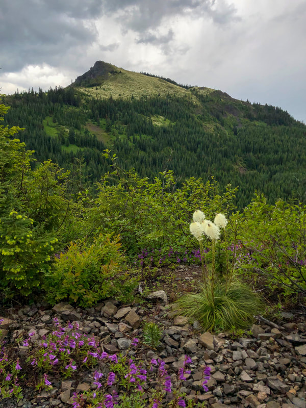
(view of Coffin Mountain from the approach road)
|
Description:Coffin Mountain is a short hike located between Sisters and Detroit that offers amazing views and plenty of early summer wildflowers. You will get a great taste of the amazing views that you will get on this hike during the drive to the trailhead, and you will get to see Coffin Mountain from the road.
This trail was not well known until the summer of 2019 when there was a bear grass super bloom. Bear grass plants only bloom once every 5-7 years, so about every 35 years when conditions are just right, there is what is known as a "super bloom" where almost all the plants flower during the same time. Because there is so much bear grass covering Coffin Mountain, the bear grass super bloom became a state-wide phenomena and tourists flocked from far and wide to see this spectacular once in a lifetime event! |
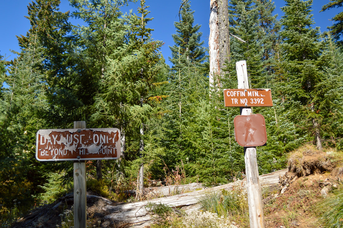
(Coffin Mountain trailhead signs)
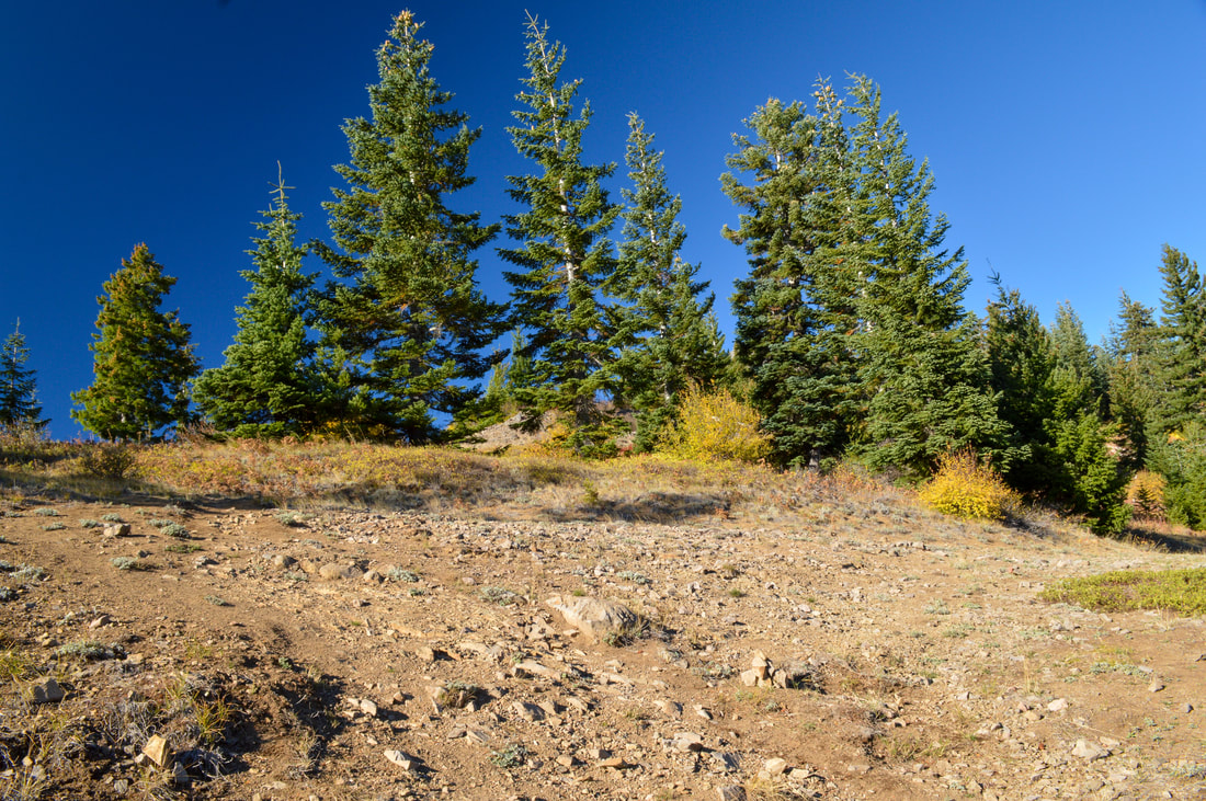
(confusing 'trail junction')
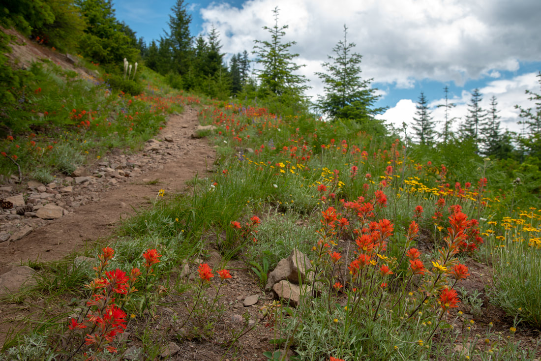
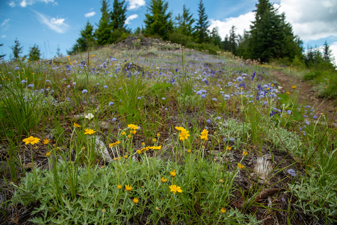
Because almost all of the bear grass flowered in 2019, there will be almost no bear grass flowering along this trail for the next few years. But, this trail does have many other wildflowers that do flower yearly, such as larkspur, fuzzy cat's ears, red Indian paintbrush and balsamroot.
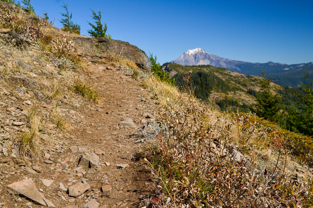
The trailhead is small and doesn't allow much room for parking. The trail immediately starts heading uphill. At 0.1 miles you will come to an open rocky spot where the trail isn't very clear and where it looks like the trail goes straight and to the left (see picture above). Make sure to stick to the trail to the left and continue going uphill. The other path that looks like a trail doesn't lead anywhere.
The trailhead is small and doesn't allow much room for parking. The trail immediately starts heading uphill. At 0.1 miles you will come to an open rocky spot where the trail isn't very clear and where it looks like the trail goes straight and to the left (see picture above). Make sure to stick to the trail to the left and continue going uphill. The other path that looks like a trail doesn't lead anywhere.
(Red Indian Paintbrush)
|
(Larkspur and Penstemon)
|
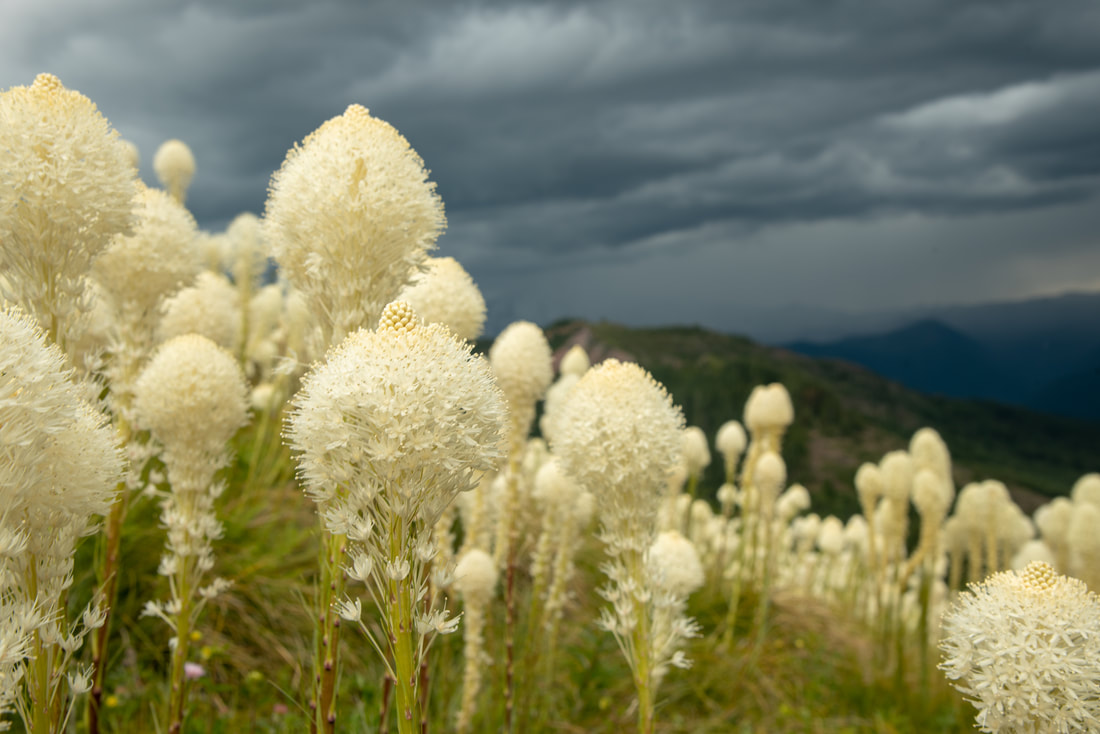
(blooming bear grass)
(Balsamroot flowers)
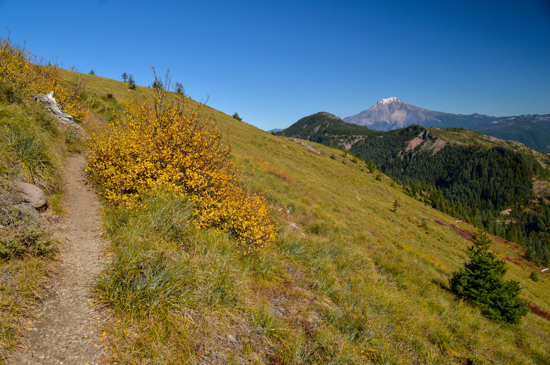
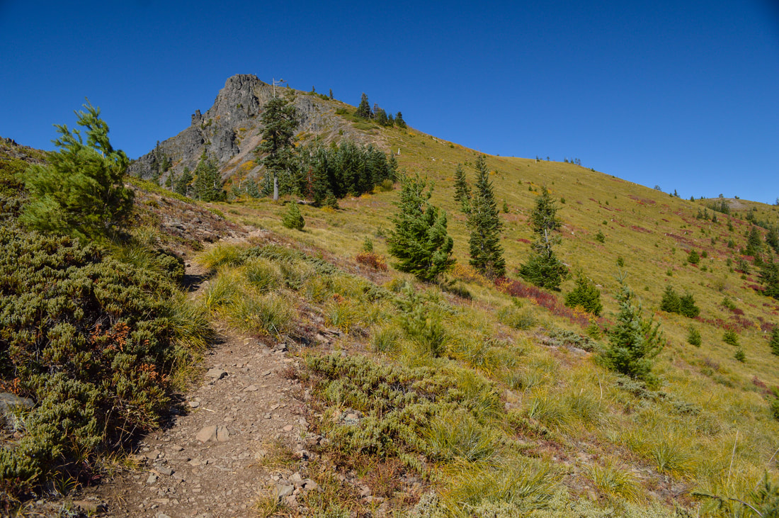
The trail goes through a sparse forest for the first half mile, then it opens up and you start to walk through a very large open meadow full of bear grass. In the distance you can see amazing views of nearby Bachelor Mountain and Mt. Jefferson. You will hike up a total of 12 switchbacks through the meadow until you come to a ridge. The trail tread is a mixture of rocks, both loose and in the ground, as well as some roots to watch out for. Because the bear grass is very thick on either side of the trail, there are spots where you can't see the trail very well, so watch your step. The more that people use this trail, the more this trail becomes eroded and the footing can become a little bit tricky. Be careful and take it slow so that you don't turn and ankle.
(bear grass meadow June 29, 2019)
|
(bear grass meadow October 14, 2018)
|
(an example of the trail tread)
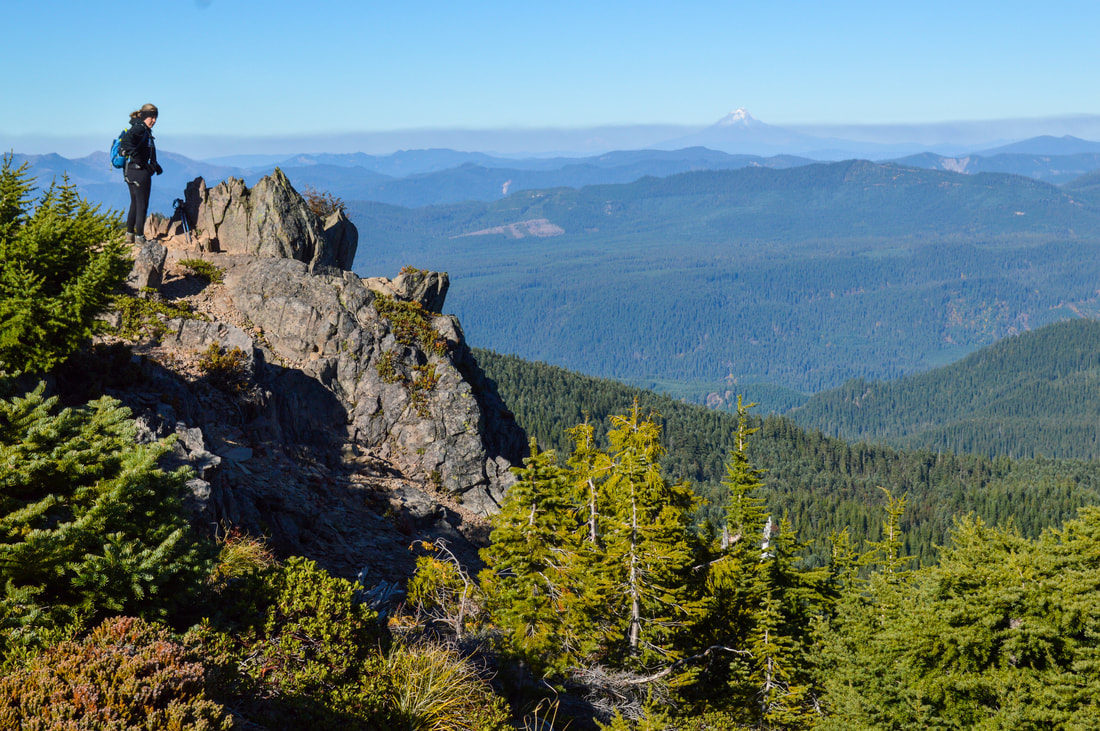
(view of bear grass meadow with Bachelor Mountain and Mount Jefferson)
|
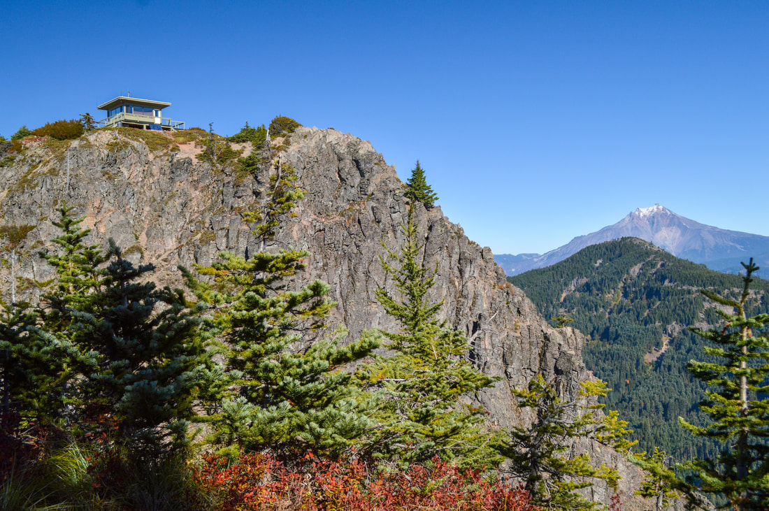
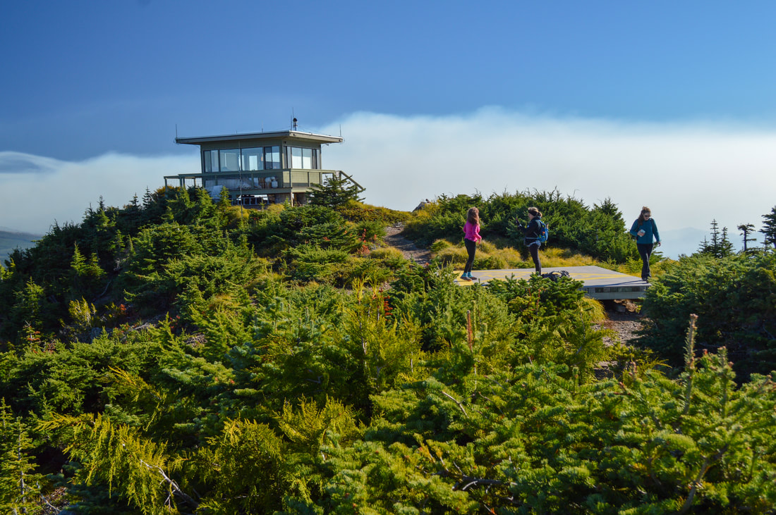
(Coffin Mountain fire lookout and Mount Jefferson)
|
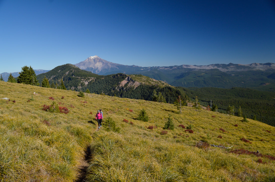
Once you reach the ridge, the hard part of the hike is over, and it is now an easy 0.3 miles to the Coffin Mountain fire lookout. This lookout is amazing, with a wrap around porch and windows on all four sides of the cabin. This lookout is staffed during summer months and they get supplies such as water and firewood dropped off via the helipad that is up there. The ranger who staffs this lookout is there to watch out for wildfires that might start during summer months, but they are more than happy to chat and answer any questions you might have about the surrounding area.
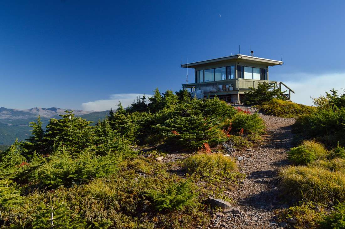
(Coffin Mountain fire lookout which is staffed in the summer)
(view of Mount Hood to the north)
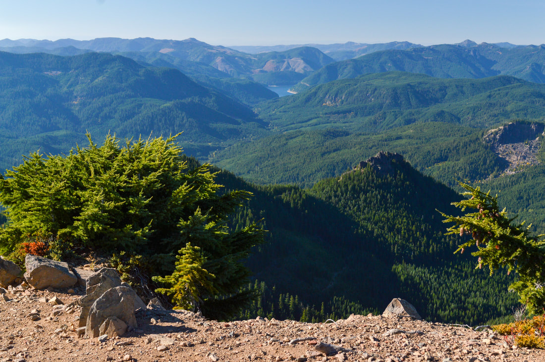
(view of Detroit Lake in the distance before the 2020 wildfires)
(Coffin Mountain helicopter landing pad)
|
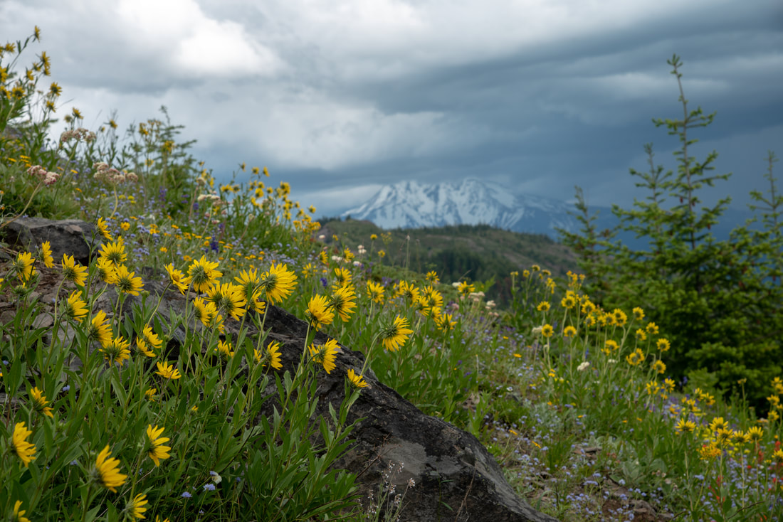
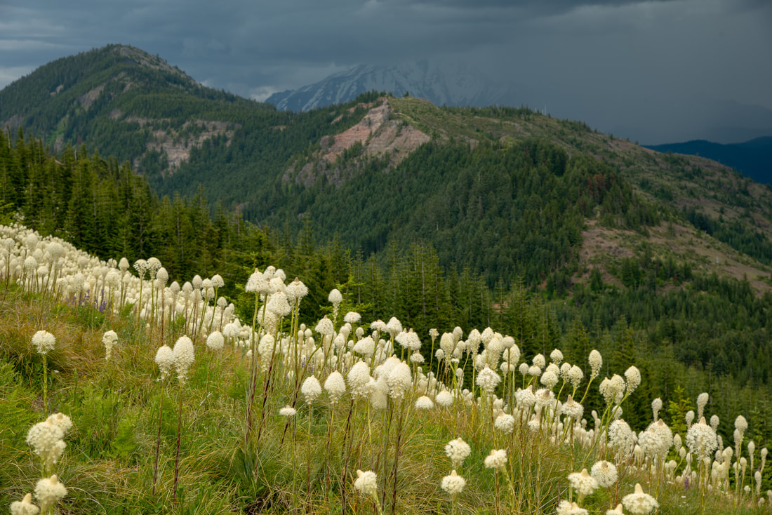
From the summit of Coffin Mountain you can see Mt. Jefferson straight in front of you to the east, Mt. Hood and Detroit Lake to the north, and you can also see Three Fingered Jack, Mt. Washington and the Three Sisters to the south. The hill right in front of Mt. Jefferson is Bachelor Mountain, another short hike that is nearby. Bachelor Mountain offers similar views, however it is higher than Coffin Mountain and closer to Mt. Jefferson, so the view is a little bit better.
|
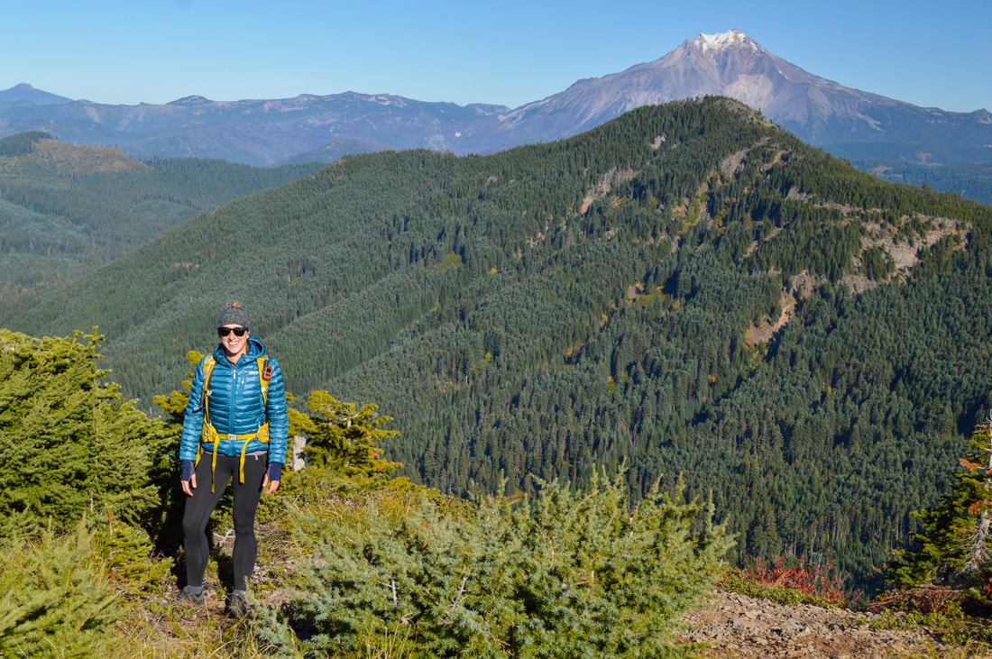
(Bachelor Mountain in front of Mount Jefferson)
Overall, this is a very short hike but it does offer some challenges which is why it is rated moderate and not easy. The rocky tread and steepness of the hike make this trail not hikeable for everyone. Trekking poles will help assist you on the way up and down. If you are hiking this trail in the summer months, make sure to bring enough water. The forest service staff who reside in the lookout have a limited supply and cannot give you water. This is a perfect hike for those who want to see the seasonal wildflowers, a fire lookout and the beautiful mountain views in a short excursion.
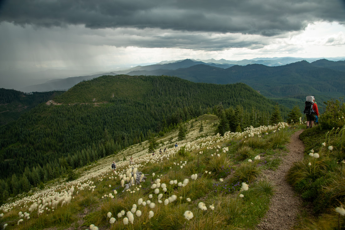
(summer thunderstorm and bear grass super bloom of 2019)
Directions:
From Bend
- Drive US-97 north then take exit 135A to merge onto US-20 W toward Sisters. Stay on US-20 west for 45 miles then make a slight right onto OR-22 W for 12.5 miles. Near milepost 69 turn left onto Straight Creek Road for 4.2 miles, then turn right onto gravel road 1168 for another 3.8 miles. If you're afraid of heights, road 1168 can be a little bit scary. (Total of 68.7 miles)
- Drive OR-22 east towards Bend for 67.7 miles. Near milepost 69 turn right onto Straight Creek Road for 4.2 miles, then turn right onto gravel road 1168 for another 3.8 miles. If you're afraid of heights, road 1168 can be a little bit scary. (Total of 79.3 miles)
- Drive OR-126 east for 75 miles then take a slight right onto US-20 E for 3.1 miles, then make a slight left toward OR-22 W and stay on OR-22 west for 12.2 miles. Near milepost 69 turn left onto Straight Creek Road for 4.2 miles, then turn right onto gravel road 1168 for another 3.8 miles. If you're afraid of heights, road 1168 can be a little bit scary. (Total of 100 miles)
- It is a total of 120 miles via Salem.
- It is a total of 262 miles via Eugene.
-This trail write-up was last updated July 2019-
*All pictures are taken by Franziska Weinheimer
*All pictures are taken by Franziska Weinheimer
*Disclaimer: The trail descriptions, mileage, GPS tracks and difficulty ratings depicted on this website are never 100% accurate. Always hike at your own risk, using your own knowledge, equipment and common sense. Franziska Weinheimer/Hike Oregon are not responsible if you or anyone in your party gets injured or lost while attempting one of these or any other hikes.