Mitchell Point
Hike details:
Mileage: 1.8 miles round trip w/ 940 ft. elevation gain
Approximate hike time: 45 minutes w/ an average pace of 2.3 mph
Difficulty: Moderate
Trail usage: High on weekends, medium on weekdays
Highest elevation: 1,145 ft. Lowest elevation: 170 ft.
General location: 60 miles east of Portland - Wygant State Natural Area
Accessible: March through December (or whenever it gets snowy/icy)
(Best time to go is any time from April through October. Avoid winter months when there might be snow and/or ice as well as wind storms in the Gorge).
Permits required: N/A
Pit toilet at trailhead: Yes
Trail allows: Dogs, but it is not recommended due to the steepness of the trail it can be dangerous for yourself and the dog.
Possible dangers: Loose rocky trail and extremely dangerous and steep drop off at the summit.
|
Description:Mitchell Point is a moderate hike to an exceptional lookout point in the Columbia River Gorge. Because it is such a short hike, it is quite popular with folks who want to watch the sunrise or sunset.
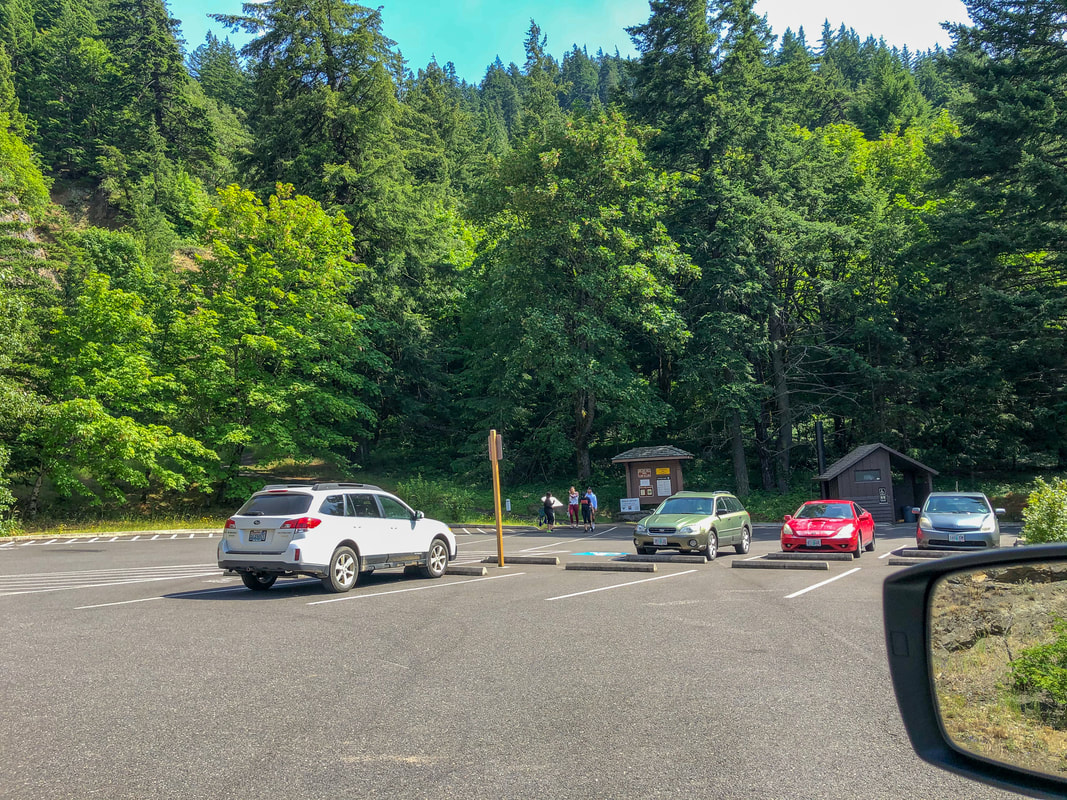
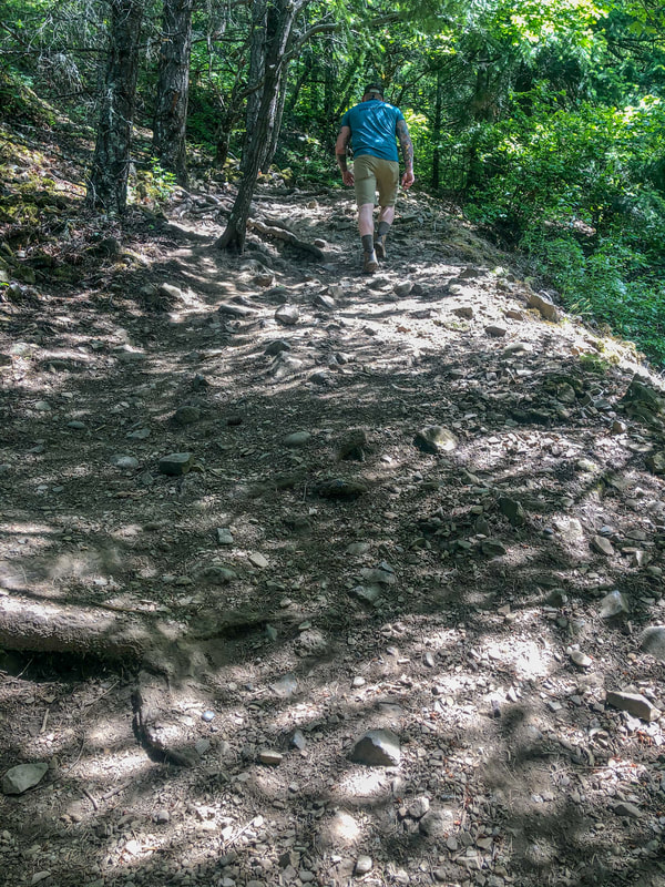
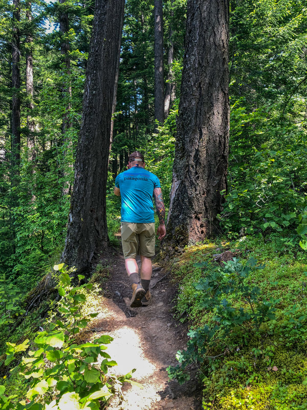
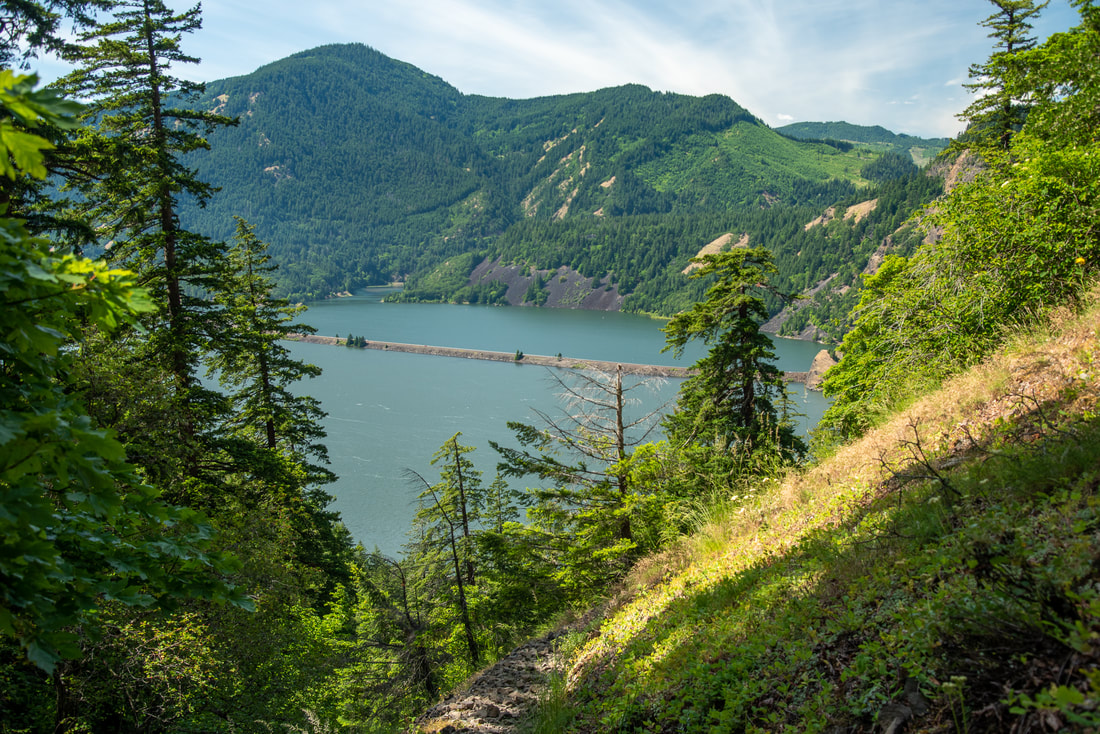
The parking lot is right off of I-84 and it isn't very large, with room for about 20 cars. The trail starts off heading uphill through a lush forest. There are 6 switchbacks right away, and then you come to a section of trail that feels like it is going straight uphill as you gain 300 feet of elevation in just 0.3 miles. The trail is generally pretty rocky, even some of the sections that are through the forest. |
|
|
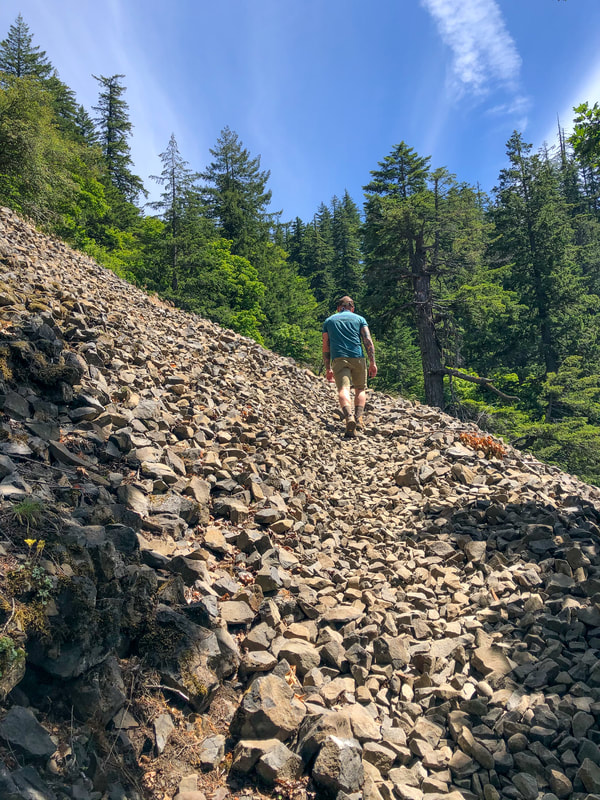
There is one section in particular where you have to navigate larger rocks that are very loose. Make sure you wear good footwear on this hike to avoid twisting an ankle. At around the 0.6 mile mark you will start to see some views of the Columbia River to the north. At the 0.75 mile mile you will come to an area that has undergone some brush clearing and it can be a little bit confusing as to where to go. Keep in mind you are still heading uphill, so keep following the path that goes uphill towards the north.
|
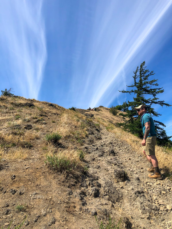
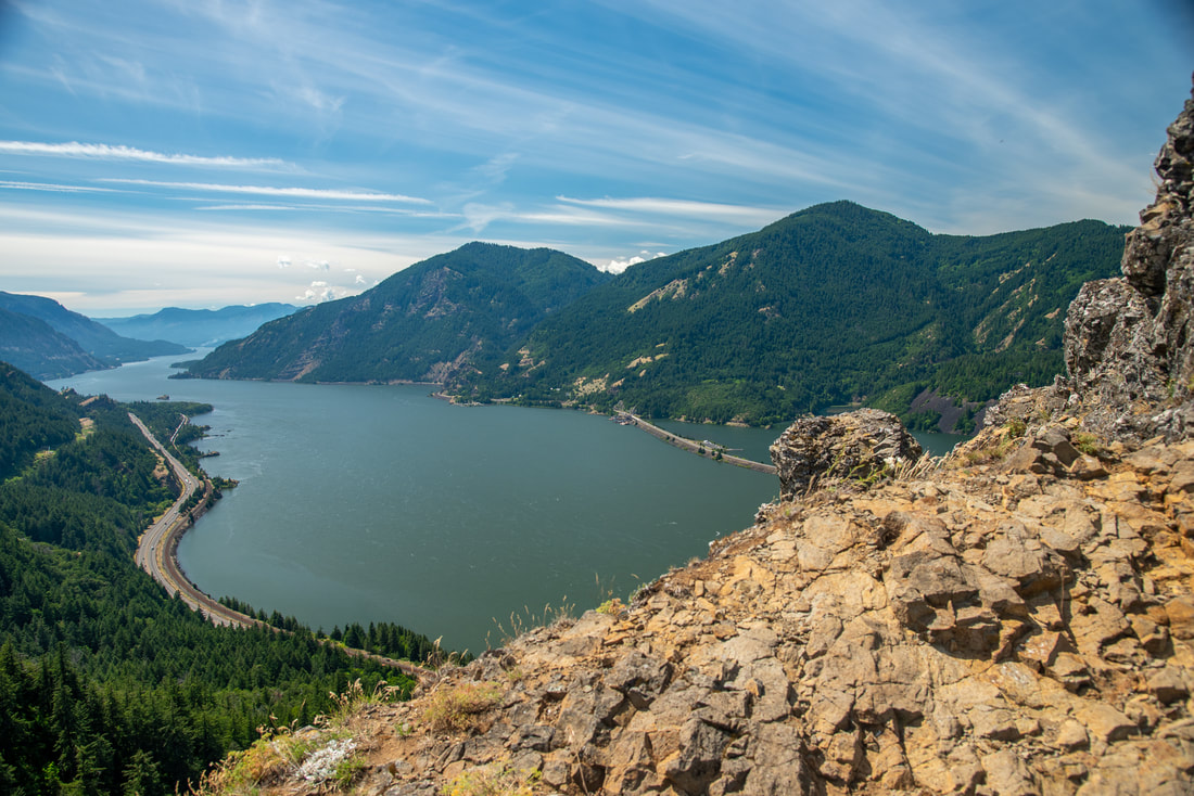
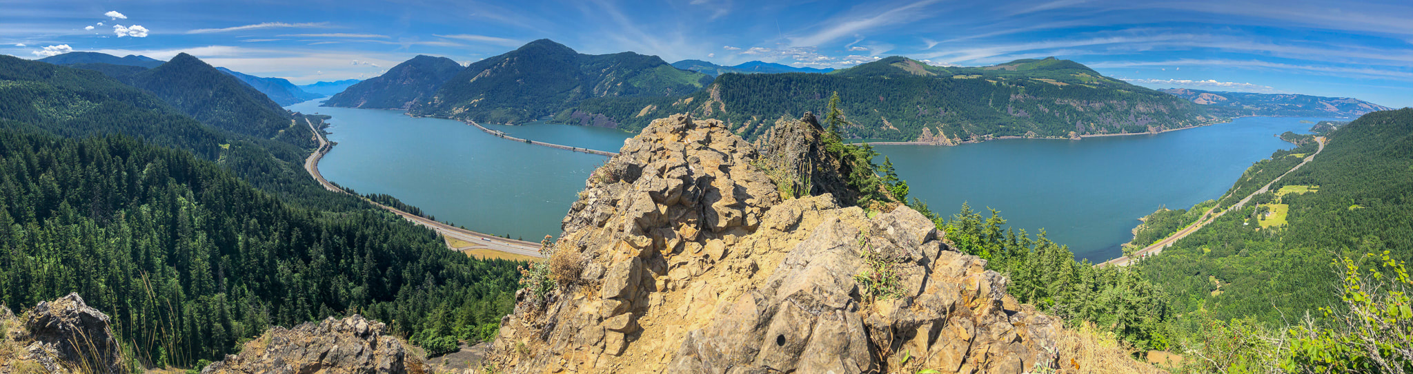
The last 0.2 mile push to the summit is very steep and you are walking on loose rock/gravel which is easy to slip on, especially on the way back down. Trekking poles will help a lot. The top of Mitchell Point is NOT for the faint of heart or for those who are afraid of heights or cliff drop offs. The summit is very small and narrow and there are sheer 900 foot drop offs on all three sides of you. If you do decide to venture out to the top most vantage point, please be careful. It is not worth risking your life for a picture! Because of the drop offs, it is not recommended that you bring dogs up here. It is not only dangerous for them, but also for you when they are on leash, as well as for others who might be uncomfortable with dogs. From the top of Mitchell point you can look down at the Columbia River and you will see it stretch to the east and west for as far as the eyes can see, and the hills stretch out in front of you, lush and green like a painting. It is definitely a sight to see and the Columbia River Gorge provides some of the best sunsets, which makes this lookout point a popular destination. If you do visit here for sunset, please be very careful coming back down when it is dark.
|
|
Mitchell Point is a stunning Columbia Gorge viewpoint hike that is not for the faint of heart and those afraid of heights. Even though the hike to the top is short, it is gruelingly steep and very rocky. It is rated 'moderate' because of the steepness and rockiness of the trail, as well as the exposure at the top. Hike Oregon doesn't usually like to put limitations on young ones, but it should be noted that this is not a kid friendly hike!
Directions:
From Portland
- From downtown Portland drive northwest toward I-405 N and then use the left lane to merge onto I-5 S for 1.4 miles. Take exit 301 for I-84 E/US-30 E toward The Dalles and continue onto I-84 E/US-30 E for 55.4 miles. Take exit 58 toward Mitchell Point Overlook and find the destination on your right. (Total of 60 miles)
- Drive US-97 north for 41.2 miles. In the town of Madras, US-97 N forks right and becomes SW 5th St/S Adams Dr. for 1.4 miles through town. Then continue onto US-26 W 59.5 miles, and then take the State Route 35 N exit toward Hood River for 0.3 miles. Merge onto OR-35 N for 38.2 miles. In Hood River turn left onto US-30 W/E State St. for 0.4 miles, then turn right onto Front St. and then Front St turns left and becomes Oak St. After 0.1 miles turn right onto 2nd St. for 0.2 miles, then turn left to merge onto I-84 W toward Portland. Merge onto I-84 W and continue for 7.4 miles, then take exit 56 toward Viento State Park and turn left to cross the interstate and then immediately turn left to merge onto I-84 E for 2.3 miles. Take exit 58 toward Mitchell Point Overlook and find the destination on your right. (Total of 153 miles)
- Total of 102 miles via Portland.
- Total of 166 miles via Portland.
- Total of 329 miles via Portland.
-This trail write-up was last updated August 2020-
*All pictures unless otherwise marked are taken by Franziska Weinheimer
*All pictures unless otherwise marked are taken by Franziska Weinheimer
*Disclaimer: The trail descriptions, mileage, GPS tracks and difficulty ratings depicted on this website are never 100% accurate. Always hike at your own risk, using your own knowledge, equipment and common sense. Franziska Weinheimer/Hike Oregon are not responsible if you or anyone in your party gets injured or lost while attempting one of these or any other hikes.