Hike Oregon
  • Home
  • *Store*
  • About the author
  • How to use this site
  • Resources
    • Wildflowers
    • Videos
  • Best Oregon Hikes
    • Easy Hikes in Oregon
    • Top 10 Oregon Fall Hikes
    • Underrated Fall Foliage Hikes In Oregon
    • Top 10 Oregon Hikes for Kids
    • 20 Best Oregon Waterfall Hikes
    • 5 Weekend Backpacking Trips in Oregon
    • Top 10 Swimming Spots In Oregon
    • 9 Amazing Oregon Summit Hikes
    • Top 10 Oregon Summer Hikes
    • 20 Central Oregon Day Hikes
    • Top One Night Backpacking Trips in Central Oregon
    • 20 Epic Oregon Wildflower Hikes
    • Best Rainy Day Hikes In Oregon
    • Sno-Parks In Central Oregon
    • Top 10 Oregon Winter Hikes
    • Top Low Elevation Winter Hikes
    • Top 10 Oregon Spring Hikes
  • Oregon Sno-Parks
    • Maxwell Sno-Park
    • Potato Hill Sno-Park
    • Ray Benson Sno-Park
      • Brandenburg Shelter
    • Santiam Sno-Park
    • Three Creek Sno-Park
    • Virginia Meissner Sno-Park
      • Meissner Shelter Loop
      • Nordeen Shelter
    • Gold Lake Sno-Park
      • Westview Shelter to Eagle Rock Overlook
      • Marilyn Lakes Loop
    • Ikenick Sno-Park (members only)
  • Southern Washington
    • Hamilton Mountain
    • Dog Mountain
    • Coyote Wall
    • Mount St. Helens
  • Portland
    • Powell Butte
    • Forest Park
    • Latourell Falls
    • Multnomah/Wahkeena Falls
    • Eagle Creek
    • Mitchell Point
    • Table Rock
    • Tamanawas Falls
    • Trillium Lake
    • East Zigzag Mountain (members only)
  • Salem
    • Abiqua Falls
    • Silver Falls State Park
    • Dome Rock
    • Marion Lake to Marion Mountain
    • Jefferson Park via Whitewater Trail
  • Corvallis
    • William Finley Wildlife Refuge
      • Campbell Boardwalk
      • Woodpecker Loop
      • Mill Hill Loop
      • Beaver Pond Loop
    • Marys Peak East Ridge
    • Marys Peak North Ridge
    • Alsea Falls and Green Peak Falls
    • Corvallis to Sea Trail - Sugarbowl Creek segment (members only)
  • Sweet Home
    • Crescent Mountain
    • Iron Mountain
    • McDowell Creek Falls
    • Middle Santiam River (members only)
    • Lower Soda Creek Falls (members only)
    • Rooster Rock (members only)
  • McKenzie Bridge/Blue River
    • Macduff Mountain
    • Proxy Falls
    • Clear Lake
    • Sahalie/Koosah Falls
    • Blue Pool
    • Erma Bell Lakes
    • Olallie Mountain
    • Horsepasture Mountain
    • Tidbits Mountain
    • Castle Rock
    • Separation Lake (members only)
    • Lowder Mountain (members only)
    • East Fork Trail (members only)
    • Rainbow Falls Overlook (members only)
    • Frissell Point (members only)
    • Substitute Point (members only)
  • Sisters/Santiam Pass
    • Coffin Mountain
    • Trappers Butte and Scar Mountain
    • Maxwell Butte
    • Black Butte
    • Whychus Creek Trail
    • Tam McArthur Rim
    • Black Crater
    • Scott Mountain
    • Obsidian Trail
    • Metolius Preserve
    • Three Fingered Jack Loop
    • Square Lake
    • Canyon Creek Meadows
    • Patjens Lakes
    • Scott Trail to Minnie Scott Spring (members only)
    • Craig Lake (members only)
    • Chush Falls (members only)
    • Rockpile Lake (members only)
    • Santiam Lake (members only)
    • Camp Lake (members only)
    • Park Meadow to Golden Lake (members only)
  • Bend/Redmond/LaPine
    • Steins Pillar
    • Chimney Rock
    • Steelhead Falls
    • Tumalo State Park
    • Shevlin Park Loop
    • Tumalo Falls
    • Tumalo Mountain
    • No Name Lake
    • Green Lakes
    • Moraine Lake
    • South Sister Summit
    • Horse Lake
    • Muskrat Lake
    • Paulina Peak
    • The Badlands - Flatiron Rock Trail
    • Peter Skene Ogden Trail (members only)
  • Eugene
    • Ridgeline Trail
    • Mount Pisgah Summit
    • Mount Pisgah Arboretum
    • Shotgun Creek
    • Mount June
    • Lawler
    • Tire Mountain
    • Hardesty Mountain
    • Goodman Creek
    • Brice Creek
    • Trestle Creek Falls
    • Parker Falls
    • Moon Falls
    • Elijah Bristow State Park
    • South Willamette Trail (members only)
    • Eula Ridge (members only)
    • Eagle's Rest (members only)
  • Oakridge
    • Deception Butte
    • North Salmon Creek
    • Sourgrass Mountain
    • Grasshopper Ridge
    • Larison Creek
    • Bunchgrass Ridge
    • Salt Creek Falls
    • Waldo Lake Loop
    • South Waldo Loop
    • The Twins
    • Rosary Lakes
    • Yoran Lake
    • Fawn Lake
    • Windy Lakes
    • Divide Lake
    • Diamond Peak via Rockpile Lake Trailhead
    • Diamond Peak via Summit Lake
    • Cowhorn Mountain
    • Klovdahl Bay (members only)
    • Verdun Trail (members only)
    • Heckletooth Mountain (members only)
    • Wall Creek Warm Springs (members only)
    • Moon Point (members only)
    • Bobby Lake (members only)
    • Lillian Falls (members only)
    • Middle Fork Willamette Trail (members only)
    • Pool Creek Falls (members only)
    • Dead Mountain (members only)
    • Larison Rock (members only)
    • Quinn Lakes & Eddeeleo Lakes (members only)
    • Waldo Mountain Lookout (members only)
    • Blair Lake to Spring Prairie (members only)
    • Rigdon Lakes loop (members only)
  • Oregon Coast
    • Cascade Head
    • Drift Creek Falls
    • Sweet Creek Falls
    • Beaver Creek Falls
    • Kentucky Falls
    • Hobbit Trail to Heceta Head
    • Valley Trail to China Creek
    • Sutton Creek Trail (members only)
    • North Fork Smith River (members only)
    • Cummins Ridge (member's only)
    • Horse Creek (members only)
    • Siltcoos Lake (members only)
  • Southern Oregon
    • Fall Creek Falls
    • Watson Falls
    • Wild Rogue Loop
    • Mt. Thielsen
    • Crater Lake National Park
      • The Watchman
      • Mount Scott
      • The Pinnacles
    • Lower Table Rock
    • Pilot Rock
    • Wagner Butte
    • Mt. McLoughlin
    • Lemolo Falls (members only)
    • Fern Falls (members only)
  • Eastern Oregon
    • Painted Cove
    • Anthony Lake Loop
    • Mount Howard
    • Eagle Cap summit
    • Schneider Cabin (members only)
    • Strawberry Lake & Strawberry Falls (members only)
  • Northern California
    • Taylor & Hogan Lake (members only)
  • Oregon PCT sections
    • PCT: CA border to Callahan's
  • Tips & Tricks
    • Leave No Trace
    • Safety Tips for Solo Hiking & Backpacking
    • Nutrition On The Trail
    • How Much Water To Carry When Backpacking
    • Storing Your Bear Canister When Backpacking
    • How To Pick The Right Backpacking Tent
    • Top Tips For Hiking With Infants And Toddlers
    • Poison Oak, Ivy and Sumac
    • How to dress for cold weather hikes
  • Reviews and Gear
    • Choosing and Using Trekking Poles
    • A Guide to Choosing the Perfect Backpacking Pack
    • Hiking Pants and Leggings
    • Jackets for Hiking and Backpacking
    • Long Sleeved Shirts For Cold Weather Hiking
    • Stay Kühl This Summer
    • Outdoor Herbivore Backpacking Food Review
    • Osprey Aura AG 65 Backpack review
    • Big Agnes Fly Creek UL2 review
    • REI Quarter Dome 1 review
    • Hike Oregon's Gear Favorites
    • Outdoorsy Holiday Gift Guide 2022
    • Hiker Holiday Gift Guide 2019
    • Outdoor Holiday Gift Guide 2018
    • Hiking Holiday Gift Guide 2017
  • Adventure Stories
    • Hiking The Rae Lakes Loop
    • 110 Miles on the PCT
    • Three Fingered Jack Adventures
    • Jefferson Wilderness

5 Weekend Backpacking Trips in Oregon

Do you have time to do a two week backpacking trip or a long distance trail thru-hike? Probably not. Most of us don't have time for a month long backpacking trip and most folks really just prefer to go on weekend backpacking trips and keep our excursions to 2-4 nights. ​​Finding these routes and loops can be difficult, annoying and just plain time consuming. So here are 5 awesome weekend backpacking trips ranging from 20-60 miles!

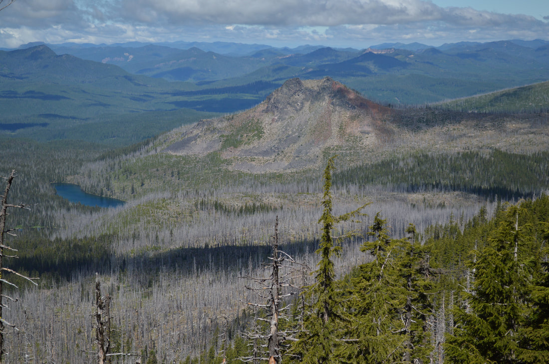
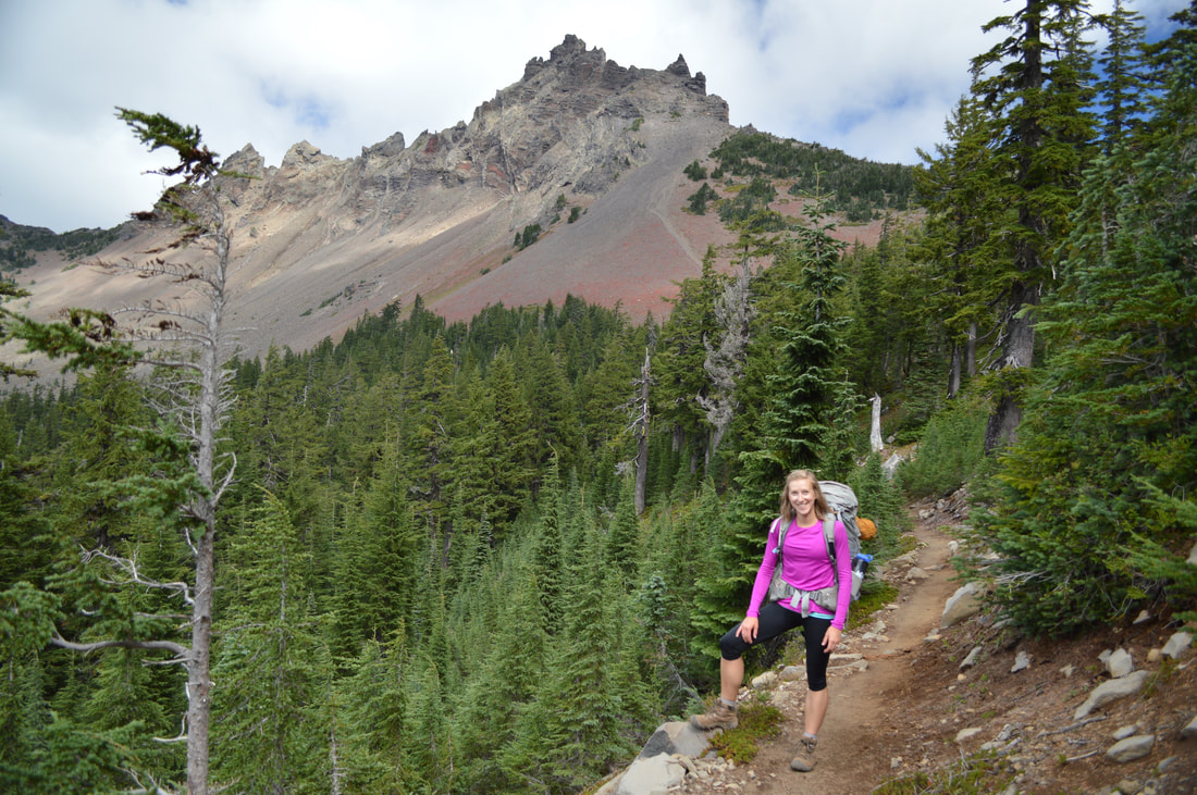
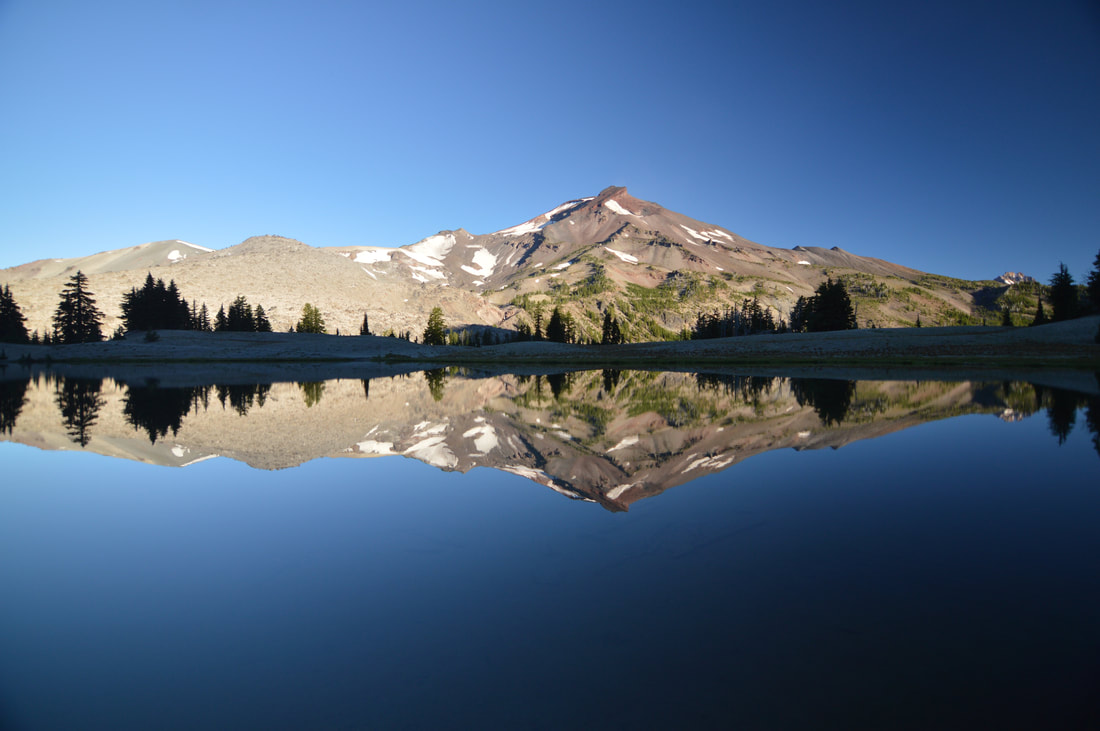
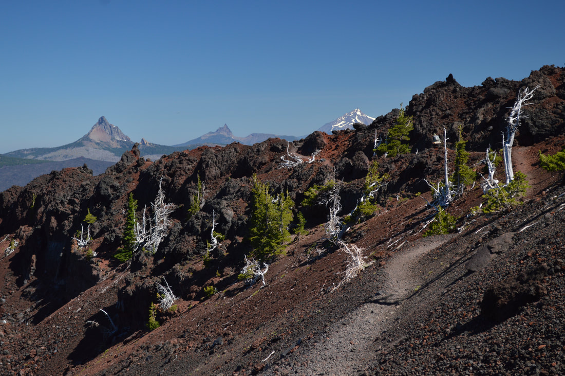
1) Three Fingered Jack Loop with camping at Canyon Creek Meadows

Duffy-Lake-from-Three-Fingered-Jack-Loop
View-of-Mt.-Jefferson-from-Three-Fingered-Jack-Loop
Three Fingered Jack from the PCT
Closest town: Sisters
Trail type: Loop
Mileage: 25 miles w/ 3,000 ft. elevation gain 
Terrain difficulty: Moderate to difficult
Trail usage: Medium to heavy 
Camping options: ​Primitive dispersed camping 
Permits required: Central Cascades Wilderness Permit must be pre purchased at recreation.gov
About the hike: This 25-mile loop around Three Fingered Jack offers incredible mountain views of Three Fingered Jack, Mount Jefferson, Mount Washington and the Three Sisters, as well as many wildflowers in the mid-summer season. There are a few places to spend the night along the loop like Wasco Lake and Booth Lake, but the most scenic spot is Canyon Creek Meadows.
(Click here to read more about this hike and to get directions)

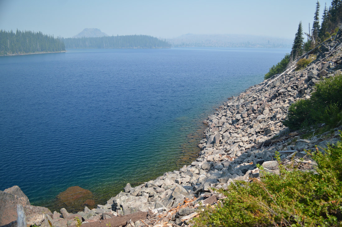
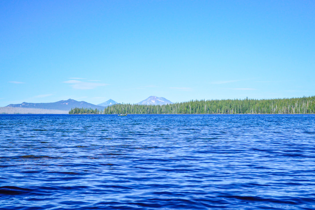
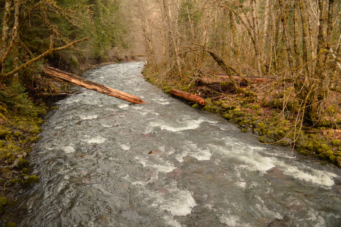
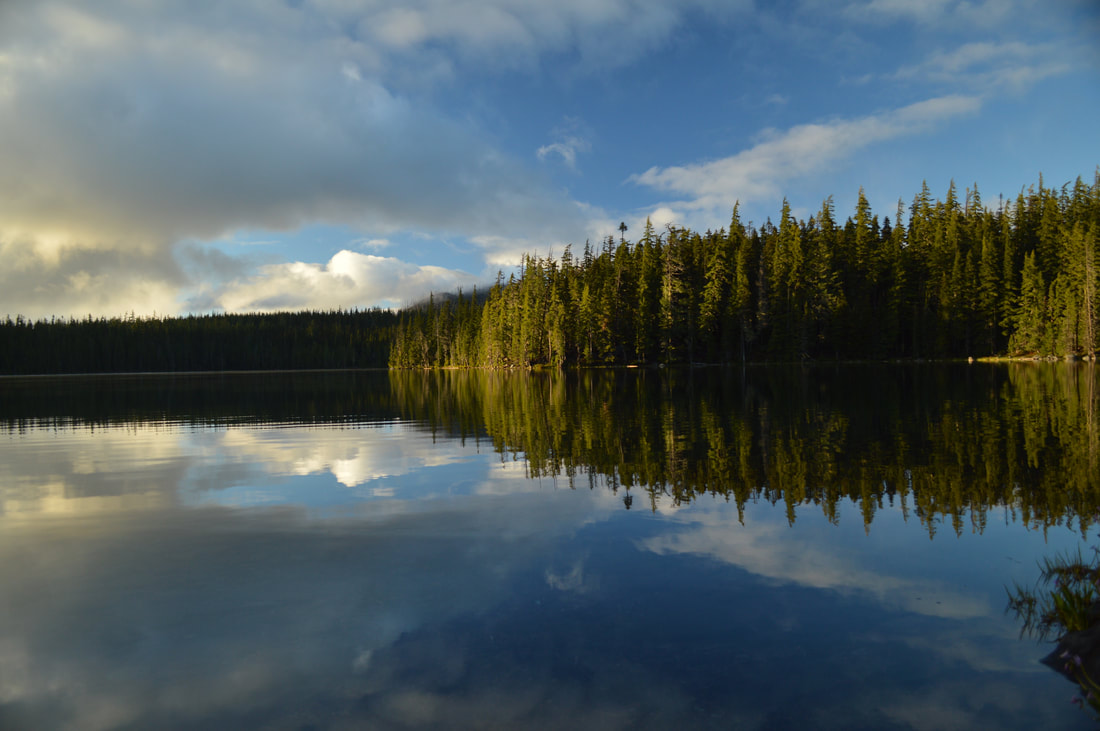
2) Waldo Lake Loop with Rigdon Lakes side trail

Waldo Lake Oregon
South-Waldo-Lake-Shelter
Waldo Lake Trail Jim Weaver Loop Trail
Closest town: Oakridge
Trail type: Loop
Mileage: 20.5 miles w/ 1,830 ft. elevation gain 
Terrain difficulty: Moderate
Trail usage: Medium
Camping options: ​Primitive dispersed camping available as well as a shelter
Permits required: Wilderness permit available at the trailhead/entry to the Waldo Lake Wilderness
About the hike: This 20 mile loop around Waldo Lake can easily be done in two days and one night, as the trail offers easy terrain and not much elevation gain. There are some beautiful camping spots on the west side of Waldo Lake, as well as a camping option at the shelter on the southeast side. 
(Click here to read more about this hike and to get directions)

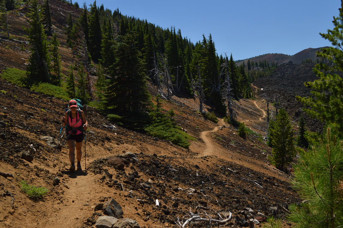
3) Three Sisters Loop

Oregon-Pacific-Crest-Trail-Yapoah-Crater
South-Sister-reflection-at-Green-Lakes
Mt.-Washington-Three-Fingered-Jack-Mt.-Jefferson-Opie-Dilldock-Pass-Oregon-Pacific-Crest-Trail
Closest town: Sisters or Bend
Trail type: Loop
Mileage: 50-60 miles w/ up to 9,090 ft. elevation gain 
Terrain difficulty: Moderate to difficult
Trail usage: Medium to high
Camping options: ​Primitive dispersed camping near lakes
​
Permits required: Central Cascades Wilderness Permit must be pre purchased at recreation.gov
About the hike: This loop ranges in mileage depending on which trailhead you start from and which side attractions you go see while on the loop. This hike has so much to offer, it is best done as a 3-4 day excursion. You can camp at a lake or stream every night which means you don't have to worry about water, and if you go in late July or early August, you will witness the splendor of all the wildflowers blooming! Some of the side-trips from this loop include a stop at Camp Lake, Golden Lake, South Sister summit, and North Matthieu Lake.
(Click here to make your very own personalized itinerary for this amazing loop)

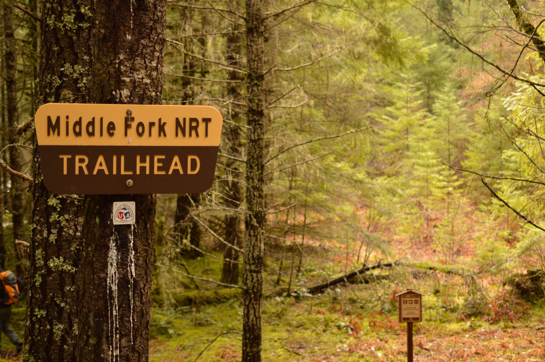
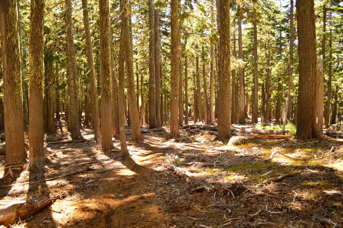
4) Middle Fork Willamette Trail

Cool-Creek-Middle-Fork-Willamette-Trail
Middle-Fork-Willamette-Trail-sign
Middle-Fork-Willamette-River
Closest town: Oakridge
Trail type: Out and back so carpool is needed
Mileage: 31.7 miles w/ 4,000 ft. elevation gain one way
Terrain difficulty: Moderate
Trail usage: Low
Camping options: ​Primitive dispersed camping 
Permits required: None 
About the hike: ​​This trail is perfect for those looking for solitude in the wilderness. There are rarely other hikers here, but you will see some mountain bikers enjoying a shuttled ride down this almost 32 miles of beautiful trail. There is no shortage of spots to camp along the river, so you can make this trip last 2 or 3 days, depending on how many miles you want to do each day. The best time to visit this area is in late summer and early fall. 
(Click here to read more about this hike and to get directions- this post is for members only, you can purchase the seasonal membership for $9.99)
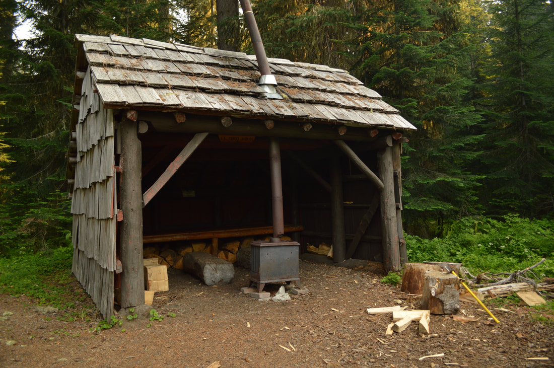
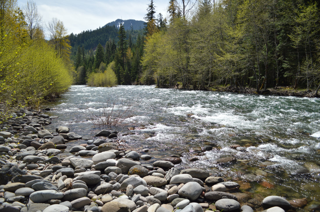
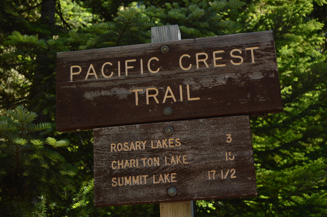
5) PCT: Highway 58 to Charlton Lake w/ side trail up to The Twins

Rosary-Lakes-Pacific-Crest-Trail-sign
Charlton-Lake-Oregon
Oregon-Pacific-Crest-Trail-to-Charlton-Lake
Closest town: Oakridge
Trail type: Out and back so carpool is needed
Mileage: 17.1 miles w/ 3,250 ft. elevation gain one way (or 20.1 miles if you summit The Twins)
Terrain difficulty: Moderate
Trail usage: Medium
Camping options: ​Primitive dispersed camping is available​ as well as a shelter 
Permits required: None
About the hike: This is also a hike that your group will need to take two cars on since it is 22.4 miles one way. This section of the Pacific Crest Trail offers many beautiful blue-green lakes, views to the south of Diamond Peak, Odell Lake, Crescent Lake and Summit Lake, as well as a really neat shelter with a sleeping loft. There are plenty of camping spots to choose from at either the shelter or the many lakes. Do try to avoid this area from mid-June to early to mid July, as the mosquitoes are really bad and could put a serious damper on your trip.
(Click here to read more about this hike and to get directions)
*All pictures are taken by Franziska Weinheimer
*Disclaimer:  the trail descriptions, mileage, GPS tracks and difficulty ratings depicted on this website are never 100% accurate. Always hike at your own risk, using your own knowledge, equipment and common sense. Franziska Weinheimer/Hike Oregon are not responsible if you or anyone in your party gets injured or lost while attempting one of these or any other hikes. ​​
© Hike Oregon 2025
P.O. Box 41911
​Eugene, OR 97404
Proudly powered by Weebly
  • Home
  • *Store*
  • About the author
  • How to use this site
  • Resources
    • Wildflowers
    • Videos
  • Best Oregon Hikes
    • Easy Hikes in Oregon
    • Top 10 Oregon Fall Hikes
    • Underrated Fall Foliage Hikes In Oregon
    • Top 10 Oregon Hikes for Kids
    • 20 Best Oregon Waterfall Hikes
    • 5 Weekend Backpacking Trips in Oregon
    • Top 10 Swimming Spots In Oregon
    • 9 Amazing Oregon Summit Hikes
    • Top 10 Oregon Summer Hikes
    • 20 Central Oregon Day Hikes
    • Top One Night Backpacking Trips in Central Oregon
    • 20 Epic Oregon Wildflower Hikes
    • Best Rainy Day Hikes In Oregon
    • Sno-Parks In Central Oregon
    • Top 10 Oregon Winter Hikes
    • Top Low Elevation Winter Hikes
    • Top 10 Oregon Spring Hikes
  • Oregon Sno-Parks
    • Maxwell Sno-Park
    • Potato Hill Sno-Park
    • Ray Benson Sno-Park
      • Brandenburg Shelter
    • Santiam Sno-Park
    • Three Creek Sno-Park
    • Virginia Meissner Sno-Park
      • Meissner Shelter Loop
      • Nordeen Shelter
    • Gold Lake Sno-Park
      • Westview Shelter to Eagle Rock Overlook
      • Marilyn Lakes Loop
    • Ikenick Sno-Park (members only)
  • Southern Washington
    • Hamilton Mountain
    • Dog Mountain
    • Coyote Wall
    • Mount St. Helens
  • Portland
    • Powell Butte
    • Forest Park
    • Latourell Falls
    • Multnomah/Wahkeena Falls
    • Eagle Creek
    • Mitchell Point
    • Table Rock
    • Tamanawas Falls
    • Trillium Lake
    • East Zigzag Mountain (members only)
  • Salem
    • Abiqua Falls
    • Silver Falls State Park
    • Dome Rock
    • Marion Lake to Marion Mountain
    • Jefferson Park via Whitewater Trail
  • Corvallis
    • William Finley Wildlife Refuge
      • Campbell Boardwalk
      • Woodpecker Loop
      • Mill Hill Loop
      • Beaver Pond Loop
    • Marys Peak East Ridge
    • Marys Peak North Ridge
    • Alsea Falls and Green Peak Falls
    • Corvallis to Sea Trail - Sugarbowl Creek segment (members only)
  • Sweet Home
    • Crescent Mountain
    • Iron Mountain
    • McDowell Creek Falls
    • Middle Santiam River (members only)
    • Lower Soda Creek Falls (members only)
    • Rooster Rock (members only)
  • McKenzie Bridge/Blue River
    • Macduff Mountain
    • Proxy Falls
    • Clear Lake
    • Sahalie/Koosah Falls
    • Blue Pool
    • Erma Bell Lakes
    • Olallie Mountain
    • Horsepasture Mountain
    • Tidbits Mountain
    • Castle Rock
    • Separation Lake (members only)
    • Lowder Mountain (members only)
    • East Fork Trail (members only)
    • Rainbow Falls Overlook (members only)
    • Frissell Point (members only)
    • Substitute Point (members only)
  • Sisters/Santiam Pass
    • Coffin Mountain
    • Trappers Butte and Scar Mountain
    • Maxwell Butte
    • Black Butte
    • Whychus Creek Trail
    • Tam McArthur Rim
    • Black Crater
    • Scott Mountain
    • Obsidian Trail
    • Metolius Preserve
    • Three Fingered Jack Loop
    • Square Lake
    • Canyon Creek Meadows
    • Patjens Lakes
    • Scott Trail to Minnie Scott Spring (members only)
    • Craig Lake (members only)
    • Chush Falls (members only)
    • Rockpile Lake (members only)
    • Santiam Lake (members only)
    • Camp Lake (members only)
    • Park Meadow to Golden Lake (members only)
  • Bend/Redmond/LaPine
    • Steins Pillar
    • Chimney Rock
    • Steelhead Falls
    • Tumalo State Park
    • Shevlin Park Loop
    • Tumalo Falls
    • Tumalo Mountain
    • No Name Lake
    • Green Lakes
    • Moraine Lake
    • South Sister Summit
    • Horse Lake
    • Muskrat Lake
    • Paulina Peak
    • The Badlands - Flatiron Rock Trail
    • Peter Skene Ogden Trail (members only)
  • Eugene
    • Ridgeline Trail
    • Mount Pisgah Summit
    • Mount Pisgah Arboretum
    • Shotgun Creek
    • Mount June
    • Lawler
    • Tire Mountain
    • Hardesty Mountain
    • Goodman Creek
    • Brice Creek
    • Trestle Creek Falls
    • Parker Falls
    • Moon Falls
    • Elijah Bristow State Park
    • South Willamette Trail (members only)
    • Eula Ridge (members only)
    • Eagle's Rest (members only)
  • Oakridge
    • Deception Butte
    • North Salmon Creek
    • Sourgrass Mountain
    • Grasshopper Ridge
    • Larison Creek
    • Bunchgrass Ridge
    • Salt Creek Falls
    • Waldo Lake Loop
    • South Waldo Loop
    • The Twins
    • Rosary Lakes
    • Yoran Lake
    • Fawn Lake
    • Windy Lakes
    • Divide Lake
    • Diamond Peak via Rockpile Lake Trailhead
    • Diamond Peak via Summit Lake
    • Cowhorn Mountain
    • Klovdahl Bay (members only)
    • Verdun Trail (members only)
    • Heckletooth Mountain (members only)
    • Wall Creek Warm Springs (members only)
    • Moon Point (members only)
    • Bobby Lake (members only)
    • Lillian Falls (members only)
    • Middle Fork Willamette Trail (members only)
    • Pool Creek Falls (members only)
    • Dead Mountain (members only)
    • Larison Rock (members only)
    • Quinn Lakes & Eddeeleo Lakes (members only)
    • Waldo Mountain Lookout (members only)
    • Blair Lake to Spring Prairie (members only)
    • Rigdon Lakes loop (members only)
  • Oregon Coast
    • Cascade Head
    • Drift Creek Falls
    • Sweet Creek Falls
    • Beaver Creek Falls
    • Kentucky Falls
    • Hobbit Trail to Heceta Head
    • Valley Trail to China Creek
    • Sutton Creek Trail (members only)
    • North Fork Smith River (members only)
    • Cummins Ridge (member's only)
    • Horse Creek (members only)
    • Siltcoos Lake (members only)
  • Southern Oregon
    • Fall Creek Falls
    • Watson Falls
    • Wild Rogue Loop
    • Mt. Thielsen
    • Crater Lake National Park
      • The Watchman
      • Mount Scott
      • The Pinnacles
    • Lower Table Rock
    • Pilot Rock
    • Wagner Butte
    • Mt. McLoughlin
    • Lemolo Falls (members only)
    • Fern Falls (members only)
  • Eastern Oregon
    • Painted Cove
    • Anthony Lake Loop
    • Mount Howard
    • Eagle Cap summit
    • Schneider Cabin (members only)
    • Strawberry Lake & Strawberry Falls (members only)
  • Northern California
    • Taylor & Hogan Lake (members only)
  • Oregon PCT sections
    • PCT: CA border to Callahan's
  • Tips & Tricks
    • Leave No Trace
    • Safety Tips for Solo Hiking & Backpacking
    • Nutrition On The Trail
    • How Much Water To Carry When Backpacking
    • Storing Your Bear Canister When Backpacking
    • How To Pick The Right Backpacking Tent
    • Top Tips For Hiking With Infants And Toddlers
    • Poison Oak, Ivy and Sumac
    • How to dress for cold weather hikes
  • Reviews and Gear
    • Choosing and Using Trekking Poles
    • A Guide to Choosing the Perfect Backpacking Pack
    • Hiking Pants and Leggings
    • Jackets for Hiking and Backpacking
    • Long Sleeved Shirts For Cold Weather Hiking
    • Stay Kühl This Summer
    • Outdoor Herbivore Backpacking Food Review
    • Osprey Aura AG 65 Backpack review
    • Big Agnes Fly Creek UL2 review
    • REI Quarter Dome 1 review
    • Hike Oregon's Gear Favorites
    • Outdoorsy Holiday Gift Guide 2022
    • Hiker Holiday Gift Guide 2019
    • Outdoor Holiday Gift Guide 2018
    • Hiking Holiday Gift Guide 2017
  • Adventure Stories
    • Hiking The Rae Lakes Loop
    • 110 Miles on the PCT
    • Three Fingered Jack Adventures
    • Jefferson Wilderness