Valley Trail to China Creek
Hike details:
Mileage: 2.8 mile lollipop loop w/ 235 ft. elevation gain
Approximate hike time: 1 hour 13 minutes w/ an average pace of 2.3 mph
Difficulty: Easy
Trail usage: Medium
Highest elevation: 213 ft. Lowest elevation: 21 ft.
General location: 12.5 miles north of Florence
Accessible: Year-round
(Best time to go is January and February when the Oregon Coast typically has really nice weather).
Permits required: N/A
Pit toilet at trailhead: No
Trail allows: Dogs
Possible dangers: N/A
|
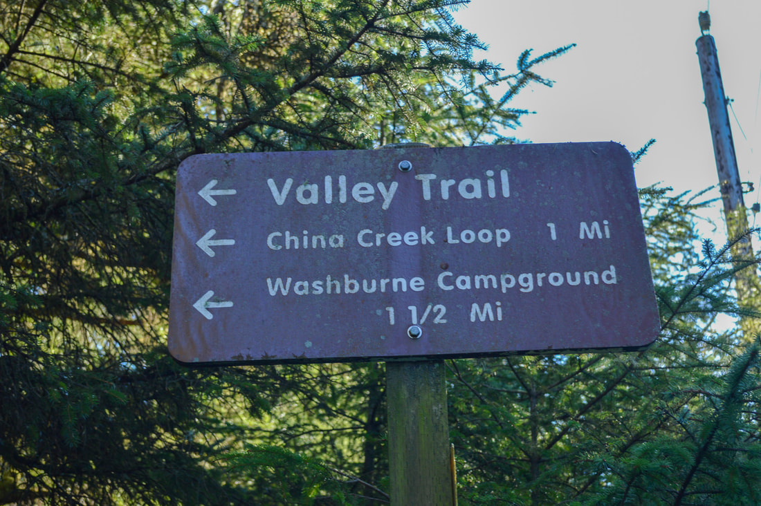
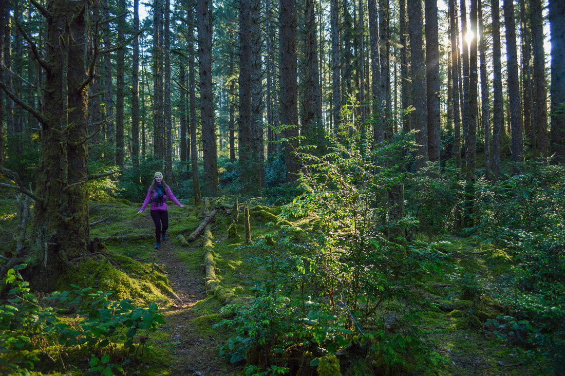
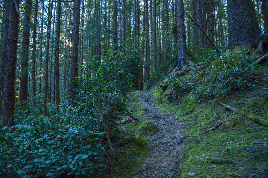
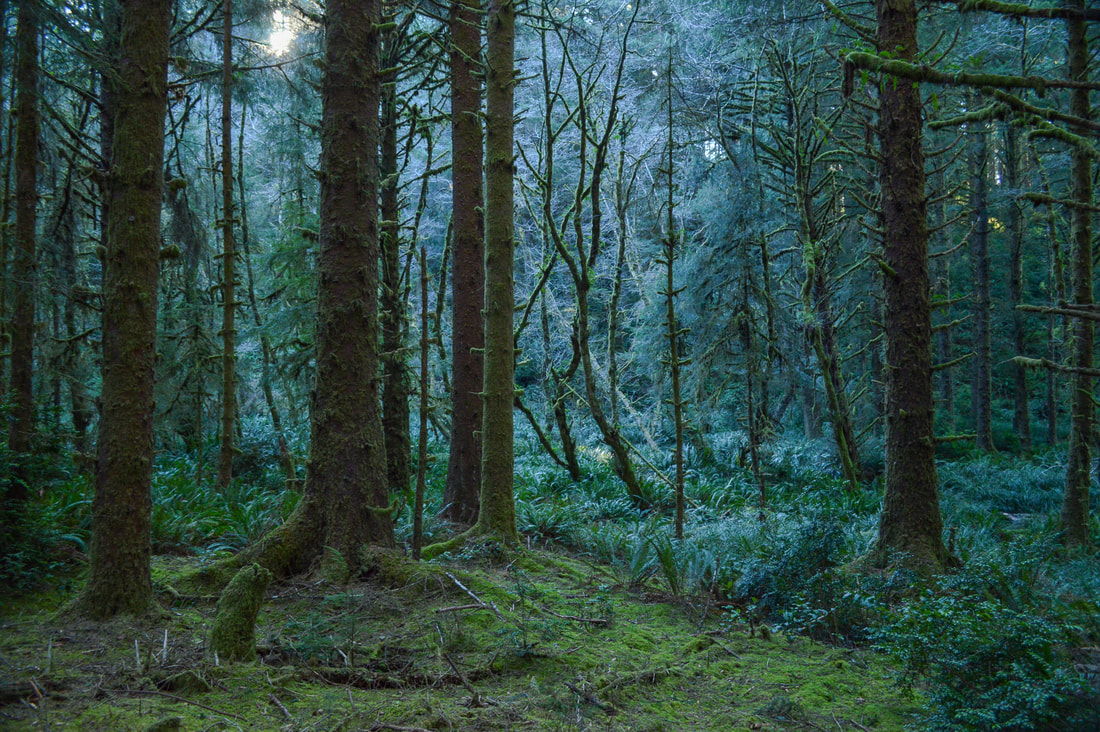
Description:The Valley Trail and China Creek loop is a gentle, family friendly hike that takes you through a magical forest in the Oregon Coast Range. If you are camping at Washburne State Park Campground you can easily hike directly from your campsite without even having to drive to the trailhead. If you are not camping, you will park at the same parking area on the side of Highway 101 as the parking for Hobbit Trail but instead of crossing the highway you will stay on the east side and follow the sign for the Valley Trail. This lesser traveled trail is absolutely stunning and takes you through a lush green forest where the trees and forest floor are covered in bright green moss and seasonal mushrooms.
|
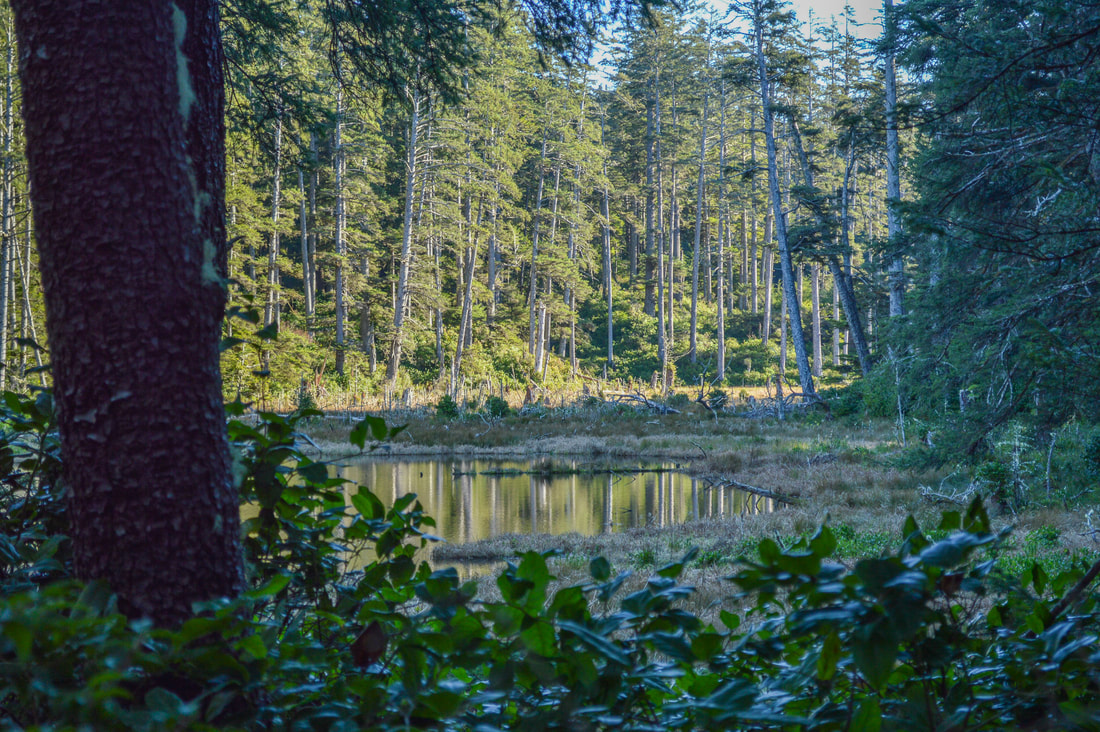
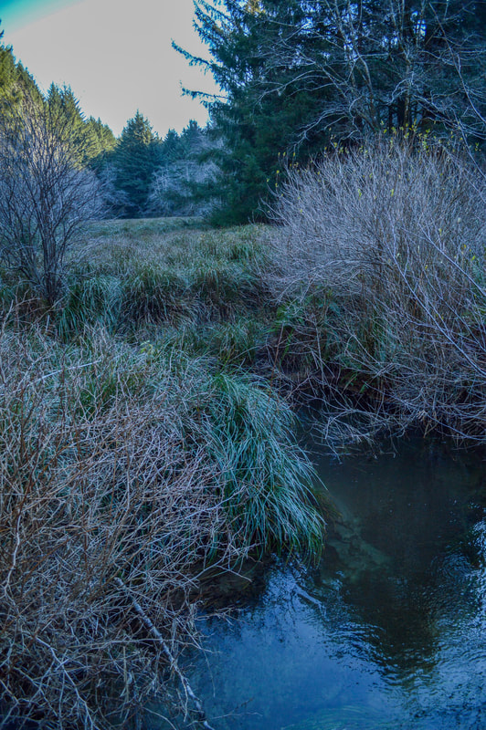
0.3 miles into the hike you will see a small pond on the right where frequently you can see loons, herons and other water foul. At 0.5 miles you will cross Blowout Creek on a small bridge. The trail continues through this gorgeous green park-like setting for another half mile until you come to a trail split. This is where the China Creek Loop portion of the hike begins. To go clockwise, stay on the Valley Trail for another 0.1 miles to where this trail splits off to another trailhead and you will continue on the China Creek Loop Trail and cross China Creek in an open area with lots of reed grass.
|
|
After crossing China Creek you will see the trail that goes to Carl Washburne State Park off to the left. Continue to the right and follow the China Creek Loop Trail around the northeast side of China Creek. After another 0.2 miles you will cross China Creek again and then hike another 0.4 miles through more mossy forest where huge ferns grow in abundance. You will complete the China Creek loop portion of the hike and at the sign you will take a left on the Valley Trail and hike the 1 mile back to your car.

The Valley Trail and China Creek Loop is a lovely hike option that is perfect for all level of hikers. This is an especially awesome trail for kids because the trail is wide, they can run around, check out the ferns, rocks along the creek and touch the moss and see little mushrooms, slugs and snails and potentially even birds in the open meadows and ponds along the way. This trail is located between Florence and Yachats, making it the perfect excursion if you are staying at one of these coastal towns or camping nearby.
|
Directions:From Florence
|
-This trail write-up was last updated January, 2023-
*All pictures are taken by Franziska Weinheimer
*All pictures are taken by Franziska Weinheimer
*Disclaimer: The trail descriptions, mileage, GPS tracks and difficulty ratings depicted on this website are never 100% accurate. Always hike at your own risk, using your own knowledge, equipment and common sense. Franziska Weinheimer/Hike Oregon are not responsible if you or anyone in your party gets injured or lost while attempting one of these or any other hikes.