Silver Falls State Park
Trail of 10 Falls
Hike details:
Mileage: 8.6 mile loop w/ 1,480 ft. elevation gain
Approximate hike time: 3 hours 44 minutes w/ an average pace of 2.3 mph
Difficulty: Moderate
Trail usage: Very high except on rainy winter weekdays
High point: 1,535 ft. Low point: 955 ft.
General location: 25 miles east of Salem - Silver Falls State Park
Accessible: Year-round
(Best time to go is spring when the waterfalls are full and raging)
Permits required: Annual State Park Pass or you can also buy a day pass at the trailhead.
Pit toilet at trailhead: Yes
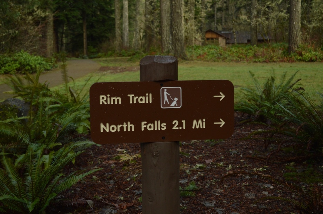
Trail allows: Dogs are ONLY allowed on the Rim Trail, they are NOT allowed on the Canyon Trail.
Possible dangers: Slippery/icy trail/stairs when temperatures are below freezing.
Approximate hike time: 3 hours 44 minutes w/ an average pace of 2.3 mph
Difficulty: Moderate
Trail usage: Very high except on rainy winter weekdays
High point: 1,535 ft. Low point: 955 ft.
General location: 25 miles east of Salem - Silver Falls State Park
Accessible: Year-round
(Best time to go is spring when the waterfalls are full and raging)
Permits required: Annual State Park Pass or you can also buy a day pass at the trailhead.
Pit toilet at trailhead: Yes
Trail allows: Dogs are ONLY allowed on the Rim Trail, they are NOT allowed on the Canyon Trail.
Possible dangers: Slippery/icy trail/stairs when temperatures are below freezing.
Description:
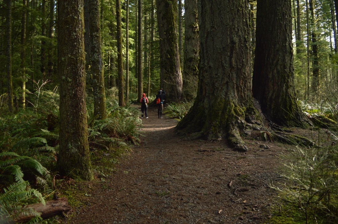
Silver Falls State Park is one of the most popular destinations in Oregon and offers an amazing loop trail known by the name of the Trail of Ten Falls. This 8.6 mile hike takes you by ten waterfalls and through a large old growth forest.
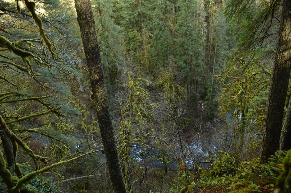
The most popular place to park is at the State Park’s main entrance, however if this parking lot is too crowded, you can continue driving and park a few miles down the road at North Falls. If you park at the main entrance, you will probably be inclined to start the hike clockwise and head down to South Falls, like most people do. South Falls is one of the waterfalls that you have to walk behind and it gets you extremely wet. I don't recommend starting an 8.6 mile hike soaking wet, especially on a cold day. Therefore it is advised to start the loop counter clockwise which takes you through the old growth forest on the Rim Trail for a few miles before you see any of the waterfalls.
The most popular place to park is at the State Park’s main entrance, however if this parking lot is too crowded, you can continue driving and park a few miles down the road at North Falls. If you park at the main entrance, you will probably be inclined to start the hike clockwise and head down to South Falls, like most people do. South Falls is one of the waterfalls that you have to walk behind and it gets you extremely wet. I don't recommend starting an 8.6 mile hike soaking wet, especially on a cold day. Therefore it is advised to start the loop counter clockwise which takes you through the old growth forest on the Rim Trail for a few miles before you see any of the waterfalls.
|
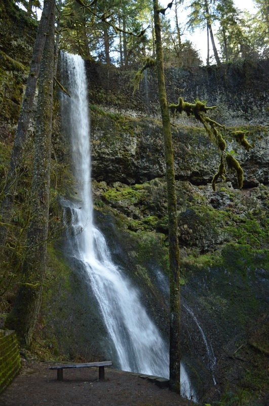
(Winter Falls 134 ft.)
|
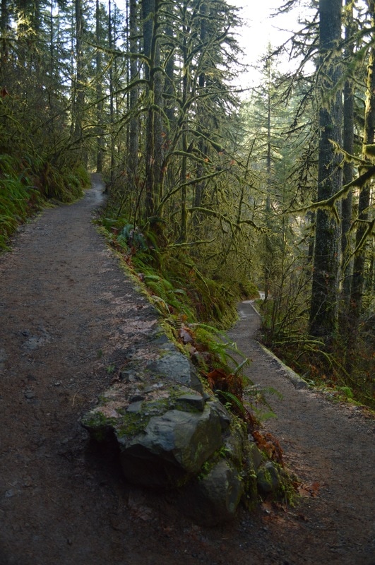
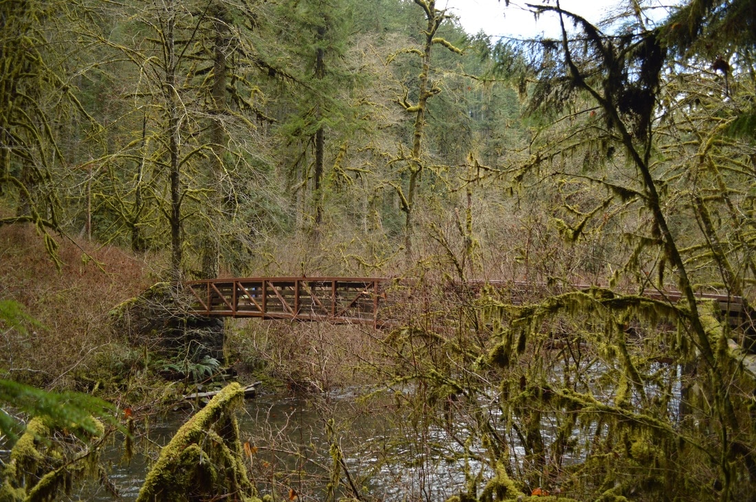
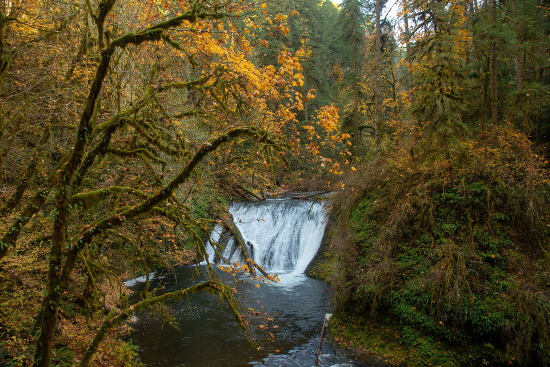
If you do the hike counter clockwise, you will first walk 1.8 miles on the Rim Trail. *Dogs are only allowed on the Rim Trail, NOT on the Canyon Trail so please keep your eyes on the signs. On this portion of the Rim Trail, you will see very large old growth trees. After the 1.8 miles, you will come to Winter Falls (134 ft. tall). To view this waterfall you have to go .2 miles down a steep path. This path can be icy and slippery in the winter time if temperatures are around freezing, so please be careful. At the bottom of Winter Falls is a bridge, so if you didn't want to hike the entire loop because it is too long, you can make it shorter by crossing this bridge. If you do so, you will not see Upper North Falls, North Falls and Twin Falls.
(creek from the top of the rim trail)
(North Falls from Rim trail)
|
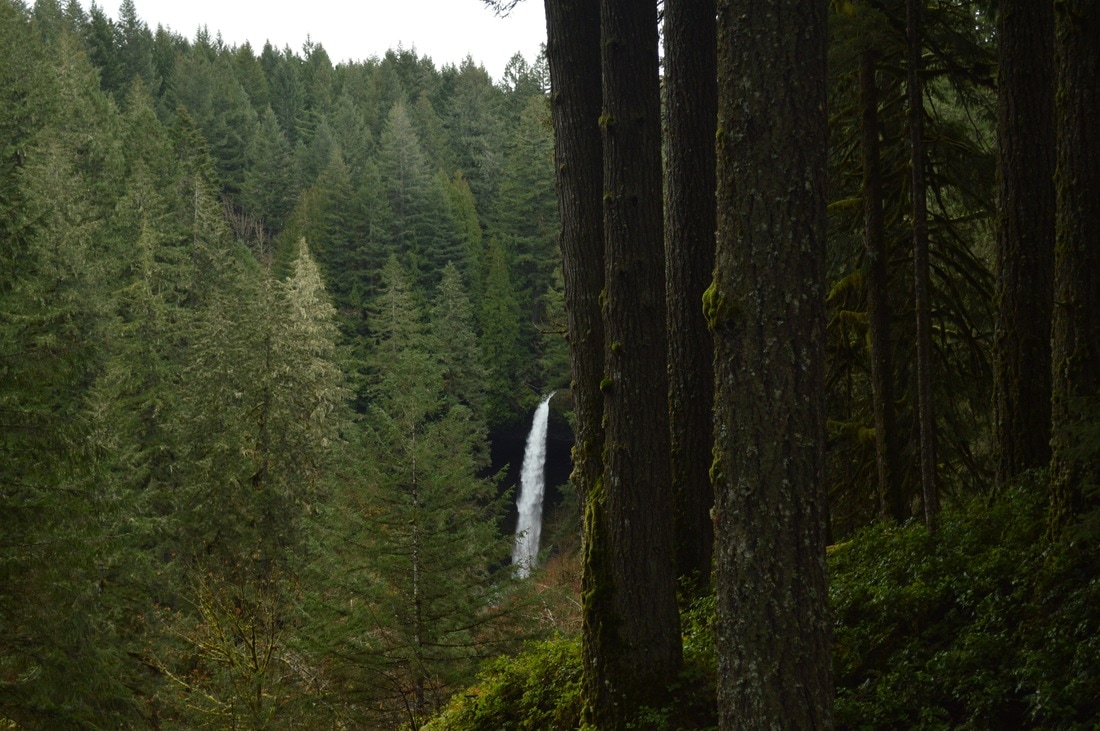
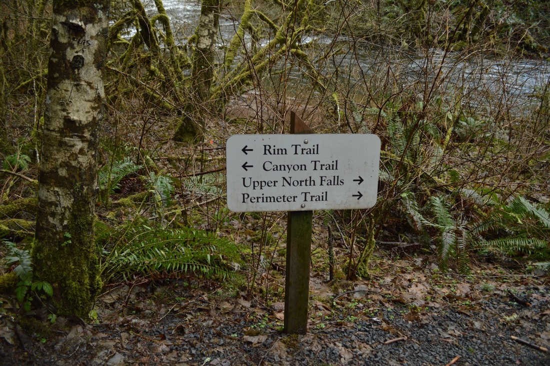
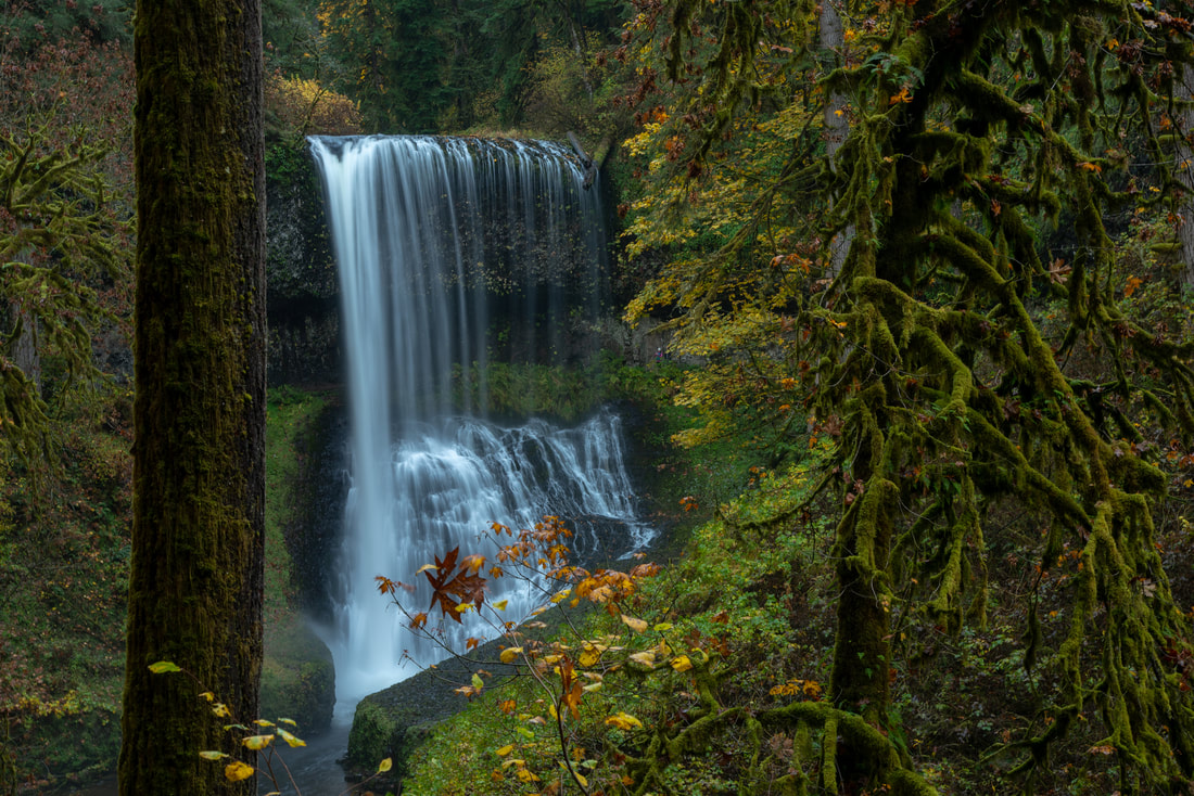
Once you have viewed Winter Falls, you will go back up to the Rim Trail and continue for another mile. The trail starts to head downhill a little bit, and you can see and hear North Falls in the distance roaring through the trees. You will see the North Falls parking area, which is much smaller than the South Falls main parking area. Here you can use the restroom if needed since there is no other place to go during this hike. Head 0.2 miles over to see Upper North Falls (65 ft. tall), and then head back and down to the Canyon Trail.
|
|
(Upper North Falls 65 ft.)
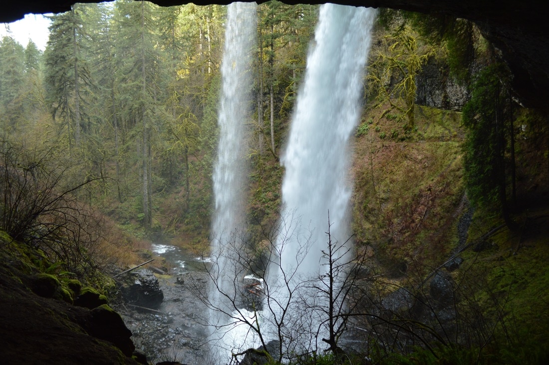
(behind North Falls)
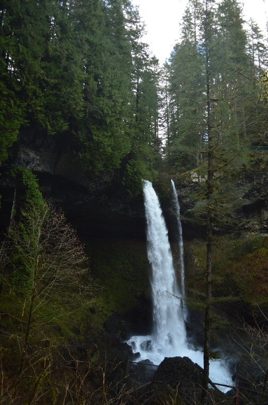
(North Falls 136 ft.)
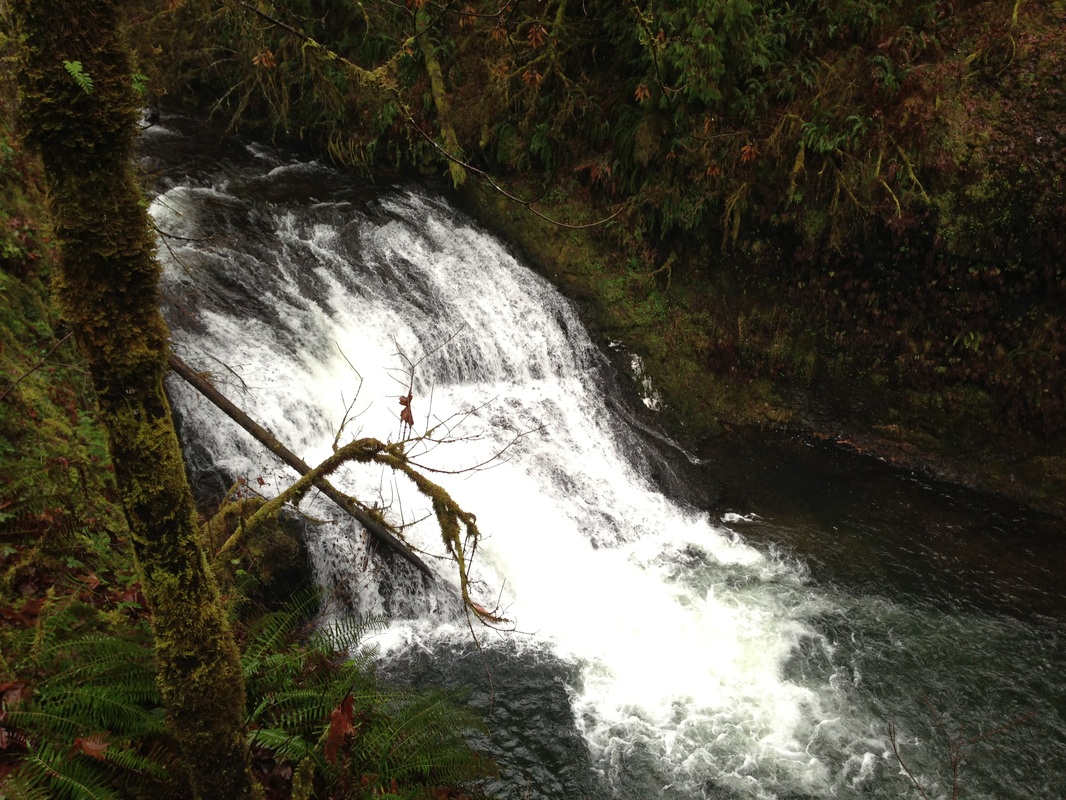
(Twin Falls 31 ft.)
|
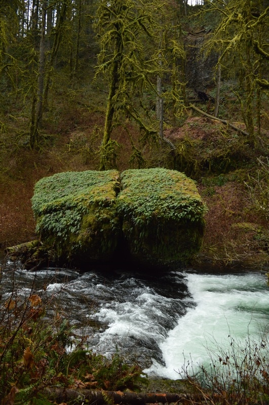
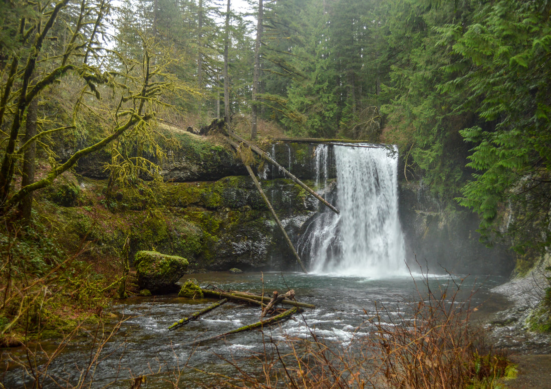
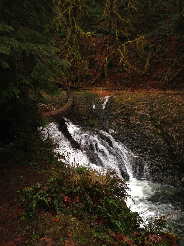
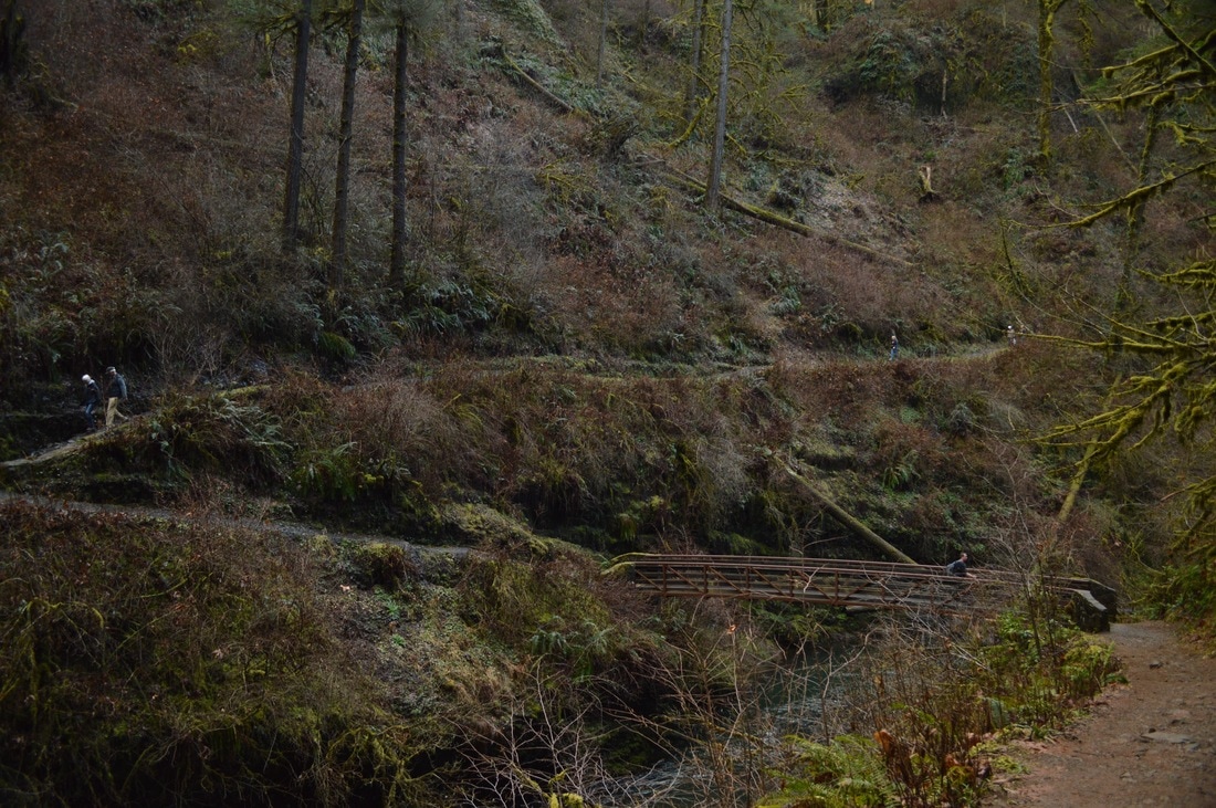
If you're hiking the Trail of 10 Falls in the winter, be careful when walking down to North Falls. There are some old stone steps that can form ice over them which makes them incredibly slippery! North Falls (136 ft. tall) is one of the waterfalls that you can walk behind. It is a pretty neat experience. The path walking behind North Falls is very wide, so you only get a little wet in one spot, but you're not getting sprayed the entire time. After walking behind North Falls the trail continues down closer to the river. You will see huge moss covered rocks in the river that look like islands that you could set up a tent on. After 1.8 miles you will come to Twin Falls (31 ft. tall).
|
After Twin Falls you will see the bridge that completes the shorter 5 mile loop, and then you will see Middle North Falls (106 ft. tall). This is another waterfall that you have to take a short path down to see up close and you can also walk behind it until the small trail dead ends on the other side of the falls. This trail is very narrow and the waterfall is a very wide curtain shape, so you will get wet on this one. You certainly don't have to go behind this waterfall, but it is a cool experience. The views of Middle North Falls when you are leaving it, are pretty spectacular, so don’t forget to turn around a few times as you’re heading down the trail!
(Middle North Falls 106 ft.)
(Drake Falls 27 ft.)
Right after Middle North Falls, you will see Drake Falls (27 ft. tall), which is viewed from a small platform, but it is really hard to get the right angle on the waterfall to take a decent picture. Continue down the path to Double Falls (184 ft.), which is very tall and thin. This is another waterfall that you have to take a small 0.1 mile path to be able to see it. Right after Double Falls, you will see Lower North Falls (30 ft. tall). After completing this mile packed full of waterfalls, the trail takes you along the river for another mile. The trail crosses the river via a bridge, and starts heading uphill. You had previously been following a river downstream, and once you cross the bridge, you are following a different river up-stream. It can be a little disorienting, but just remember there are two rivers here. After hiking less than half a mile from the bridge, you will come across Lower South Falls (93 ft. tall). This waterfall is also a curtain style, where you walk behind it. This one is extremely loud and quite the rush when you’re behind it.
|
(Double Falls 184 ft.)
|
(Lower North Falls 30 ft.)
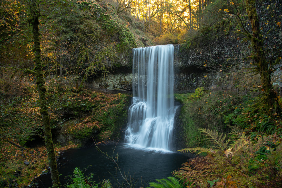
(Lower South Falls 93 ft.)
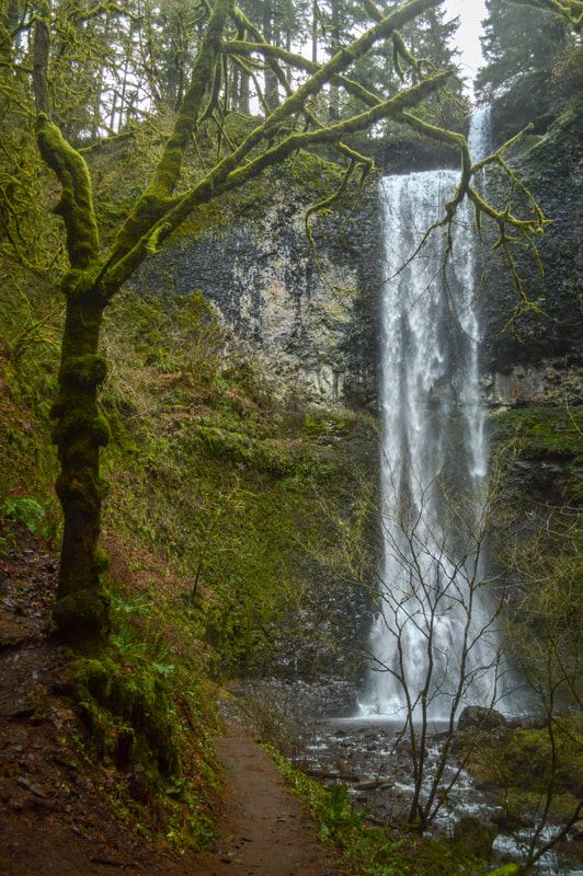
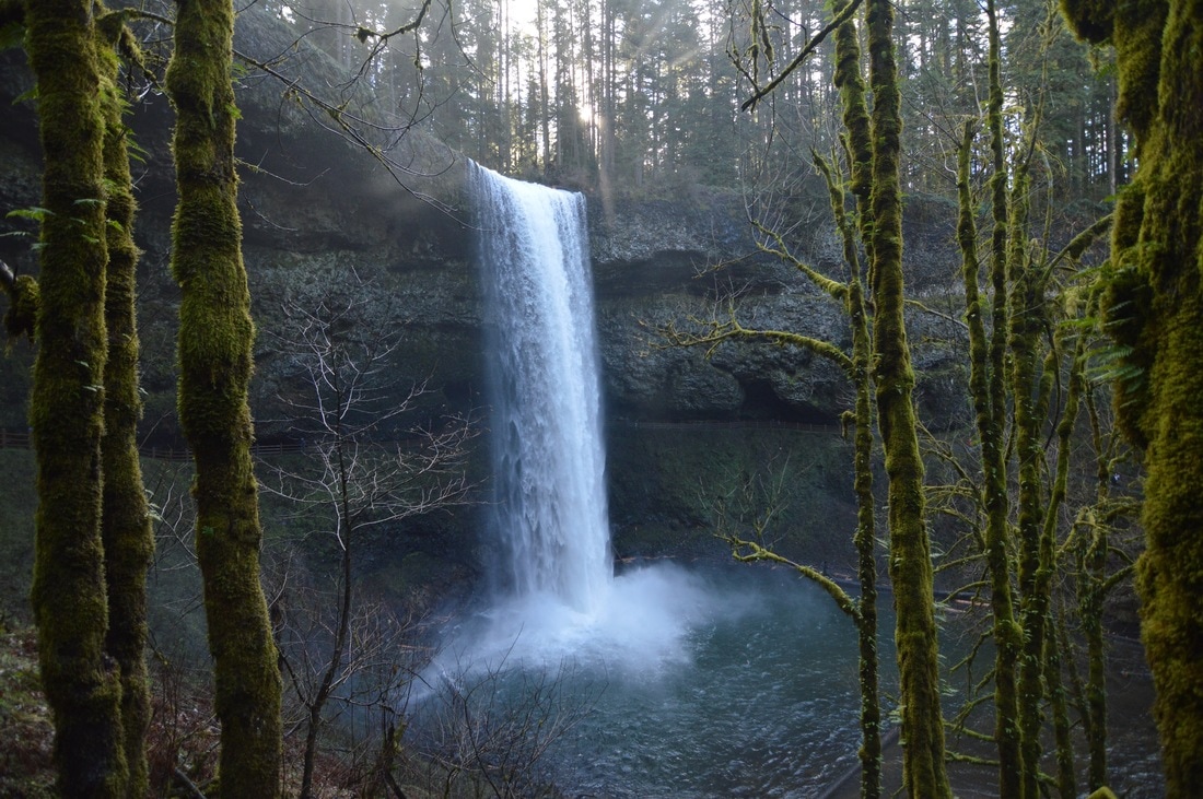
After Lower South Falls you will walk up many stairs! These stairs are quite large and can also be slippery in the winter due to the spray from the waterfall freezing on the stone. Once you have completed the stairs, you will walk less than a mile and you will get the full reveal of South Falls, the iconic symbol of this State Park. There is an awesome viewing bridge, where you can stand and take pictures from below, getting in all of the surrounding scenery. Once you get closer to this very large 177 foot waterfall, there will be no chance of taking any pictures, as the spray is just too much and would get all of your equipment wet. You will walk behind this 10th and last waterfall, and you will get pretty darn wet, especially if it is winter or spring.
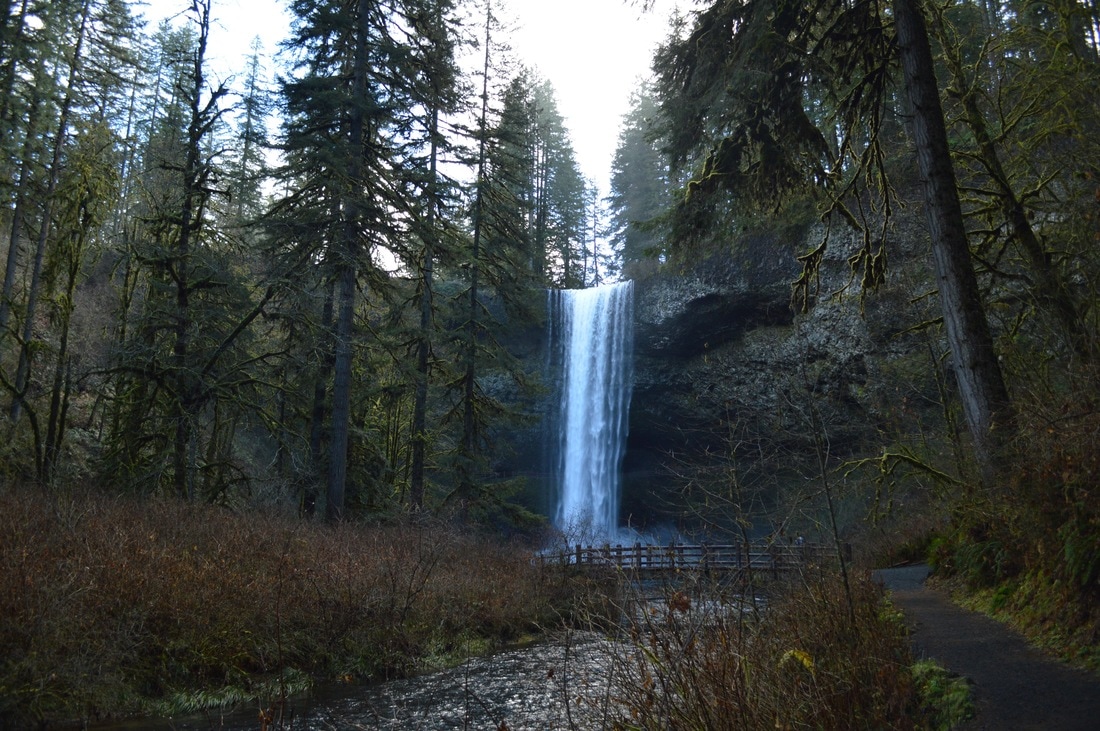
(South Falls 177 ft.)
This loop hike is recommended for every age group and experience level. It is very easy, even though the hike is 8.6 miles long. You can choose to skip 3 waterfalls and do the shorter 5 mile loop, by crossing over the bridge at Winter Falls. This hike really shows off Oregon's beauty, and with the trail being so easy and well maintained, it allows you to look around and take it all in.
Directions:
From Salem
- Drive 10 miles east of Salem on N. Santiam Highway 22. Turn north at a sign for Silver Falls Park and follow Highway 214 southeast for 16 miles to a large South Falls sign. If you want to start the loop here you can, but if you want to start at the North Falls, continue along this road for another 2 miles until you see the North Falls parking lot on your left. (Total of 23.6 miles)
- Drive OR-99E S/SE for 3.3 miles then use the right 2 lanes to merge onto OR-224 Evia the ramp to Clackamas/Estacada. Stay on OR-224 for 4.1 miles then take the I-205/State Hwy 213 S/State Hwy 224 exit toward Oregon City/Estacada. Merge onto I-205 S/State Hwy 213 S/War Veterans Memorial Fwy. and stay on this road for 2.9 miles. Use the right lane to take exit 10 toward Molalla. Turn left onto Valley View Rd NE for 1.4 miles, then turn right onto Evans Valley Rd NE and immediately turn left onto Madrona Heights Dr NE for 0.8 miles. Continue onto Quall Rd NE for 0.6 miles then turn right onto Forest Ridge Rd NE for 0.4 miles and then take a slight left onto OR-214 S for 9.9 miles. See North Falls parking area on your right. For the main parking area, continue on for another 2 miles. (Total of 55 miles)
- Drive I-5 north towards Salem for 59.7 miles. Take exit 253 for OR-22 toward OR-99E BUS/Detroit Lake/Bend then turn right onto OR-22 E for 7.3 miles. Take exit 9 toward Shaw/Aumsville and turn right onto 1st St/Shaw Hwy SE for 0.9 miles, then continue straight onto Brownell Dr SE for 1.3 miles. Continue onto OR-214 N for 12.5 miles until you see Silver Falls State Park on your left. (Total of 84.2 miles)
- Drive Hwy. 97 north and then merge west onto US-20 towards Sisters. At the Santiam Junction merge right onto OR-22 and continue past the town of Mehama. In Stayton turn right onto Boedingheimer Rd. SE which turns into Triumph Rd. SE. Then turn left at a Y split onto Carter Rd. SE then stay straight on Silver Falls Hwy. SE and follow signs to Silver Falls State Park. (Total of 129 miles)
- Drive I-5 north towards Salem for 223 miles. Take exit 253 for OR-22 toward OR-99E BUS/Detroit Lake/Bend then turn right onto OR-22 E for 7.3 miles. Take exit 9 toward Shaw/Aumsville and turn right onto 1st St/Shaw Hwy SE for 0.9 miles, then continue straight onto Brownell Dr SE for 1.3 miles. Continue onto OR-214 N for 12.5 miles until you see Silver Falls State Park on your left. (Total of 245 miles)
|
To get a more in-depth and personal view of this hike, watch the YouTube video.
|
-This trail write-up was last updated October 2019-
*All pictures are taken by Franziska Weinheimer *Disclaimer: The trail descriptions, mileage, GPS tracks and difficulty ratings depicted on this website are never 100% accurate. Always hike at your own risk, using your own knowledge, equipment and common sense. Franziska Weinheimer/Hike Oregon are not responsible if you or anyone in your party gets injured or lost while attempting one of these or any other hikes.
|