No Name Lake
Hike details:
Mileage: 5.5 miles round trip w/ 1,300 ft. elevation gain (from Broken Top trailhead)
8.6 miles round trip w/ 1,600 ft. elevation gain (from Crater Ditch trailhead)
14 miles round trip w/ 2,500 ft. elevation gain (from Todd Lake trailhead)
Approximate hike time: 2 hours 23 minutes w/ an average pace of 2.3 mph (from Broken Top trailhead)
3 hours 44 minutes w/ an average pace of 2.3 mph (from Crater Ditch trailhead)
6 hours 5 minutes w/ an average pace of 2.3 mph (from Todd Lake trailhead)
Difficulty: Difficult
Trail usage: High
Highest elevation: 8,388 ft. Lowest elevation: 6,127 ft.
General location: 24 miles east of Bend - Three Sisters Wilderness - Deschutes National Forest
Accessible: Mid-July to mid-November
(Best time to go is end of July to mid-August for best lake color/clarity).
Permits required: Central Cascades Wilderness Permit for day hikes & overnight (June 15 - October 15 via recreation.gov). Outside of those dates you will need a free self issue wilderness permit & Northwest Forest Pass for parking.
Pit toilet at trailhead: Yes
Trail allows: Dogs - on leash July 15 - September 15
Possible dangers: N/A
Description:
This is among the top 3 most popular hikes in Central Oregon, and for good reason. No Name Lake is one of the most beautiful alpine lakes in the state, and therefore had to be added to this book. Like many of the hikes in Central Oregon, in 2021 No Name Lake was added to the Central Cascades Wilderness Permit system, which limits the amount of people that can access this area. Each trailhead has a set daily permit quota, and this has helped lessen the influx of people that No Name Lake has had to deal with over the past few years. Because there are three different trailheads that you can get to No Name Lake from, it makes getting a permit for this hike a little bit easier. The shortest hike to No Name Lake is via the Broken Top trailhead and this trailhead has the most permits available per day so most people start there.
|
|
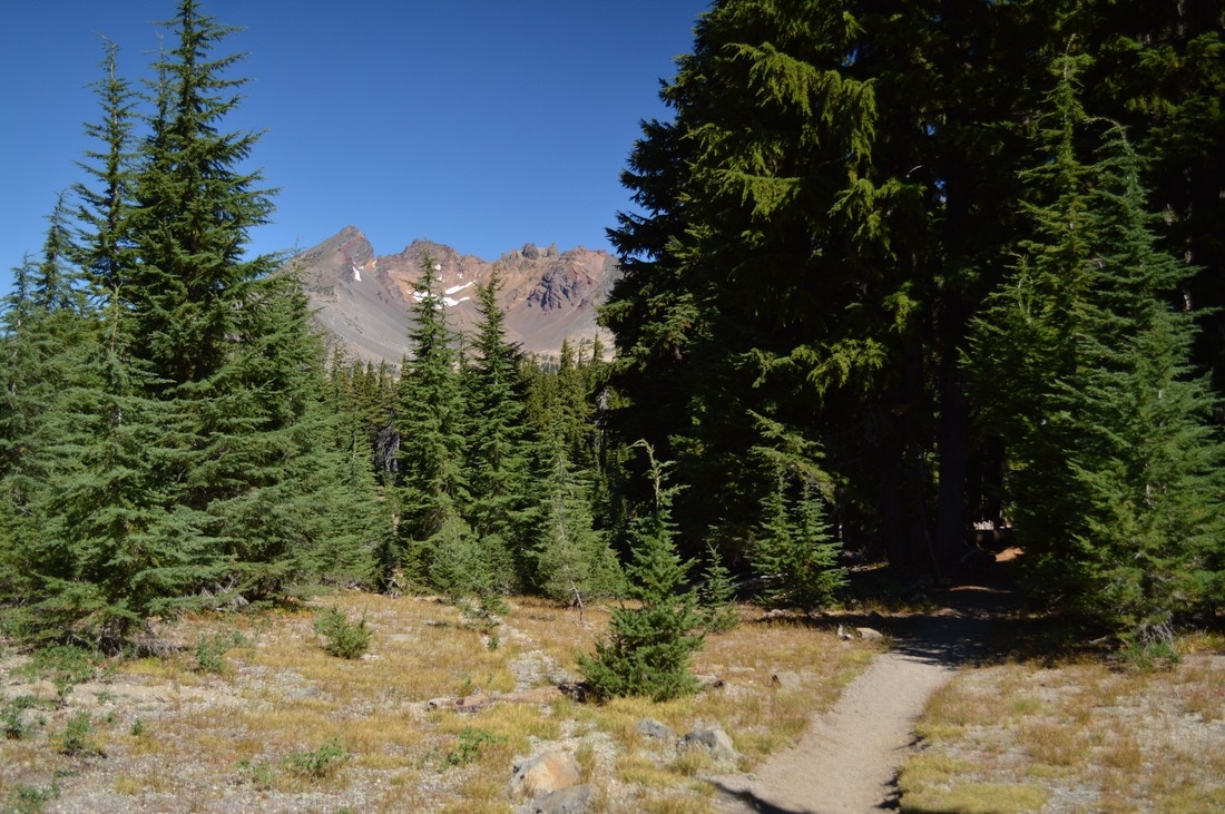
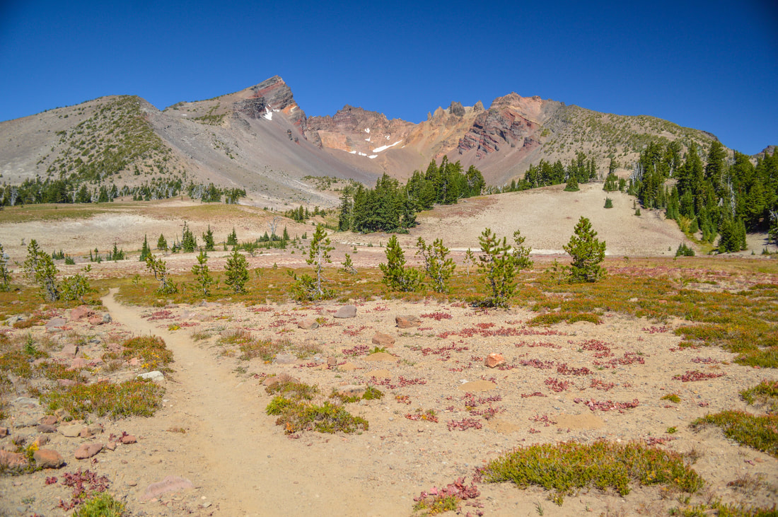
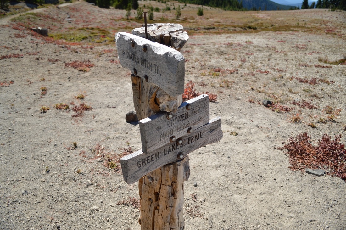
However, this trail description is for the longest hike via Todd Lake, because the Crater Ditch and Broken Top trailheads are both very difficult to access for those folks who don’t have cars with high clearance, making the Todd Lake trailhead the easiest access point. And even though the hike is quite long, the trail and terrain itself is fairly easy. From the Todd Lake parking area, walk up about 100 feet to the official trailhead where you will see some information about Todd Lake, the beginning of the Todd Lake Loop trail and a pit toilet. Make sure to take the Todd Trail #34 to the right. The hike begins in the forest and as you slowly gain some elevation you will catch glimpses of Broken Top through the trees. The trail takes you through some meadows where in mid-July the wildflower display is stunning.
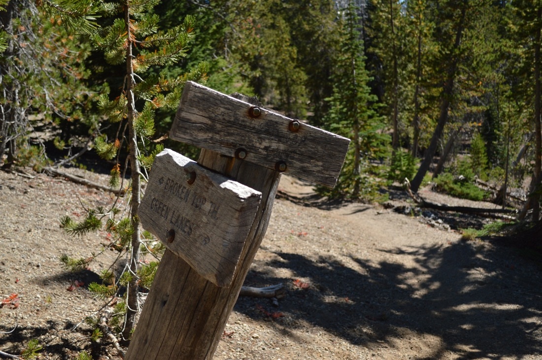
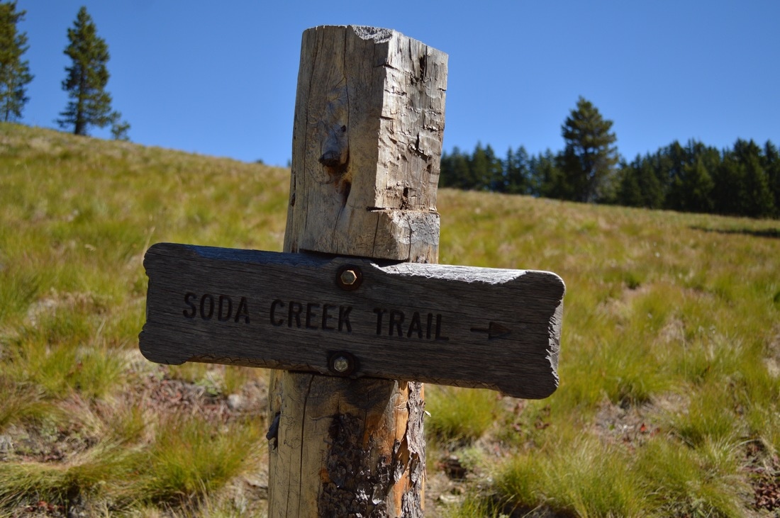
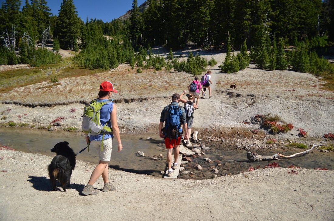
After 2 miles you will cross Soda Creek and shortly after, you will see the Soda Creek Trail #11 on your left, and the trail you are on now becomes the Soda Creek Trail. Keep straight on the Soda Creek Trail for 1.1 miles until you come to another trail junction. Here you will turn sharply to the right to get onto the Broken Top Trail #10. From this point on you are basically above the tree line. You will now only see very small pine and mountain hemlock trees. After another mile through open terrain with impressive views of Broken Top, you will cross Crater Ditch Creek and see the Crater Ditch Trail come up from the right. Continue straight for another half mile until you see the Broken Top Trail come up from the Broken Top trailhead on your right. If you have had solitude on your hike up until now, this will probably change after these trail unions.
|
|
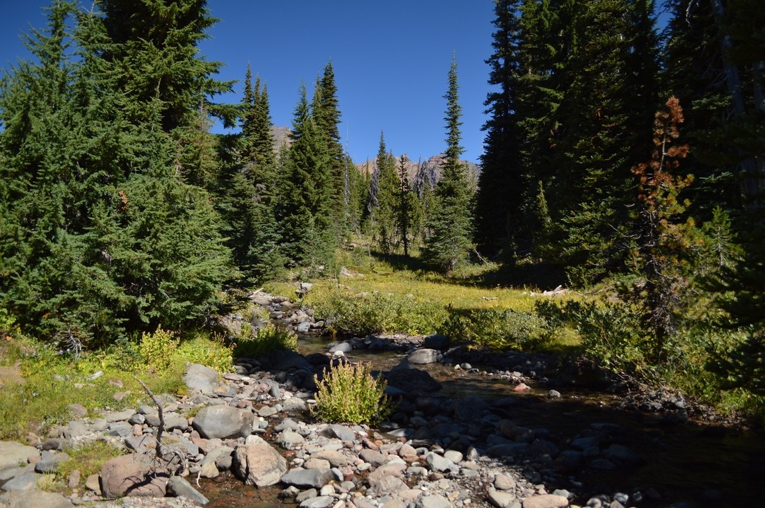
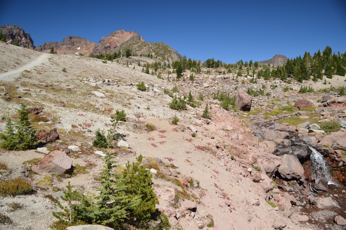
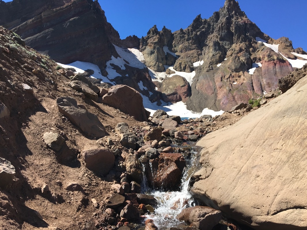
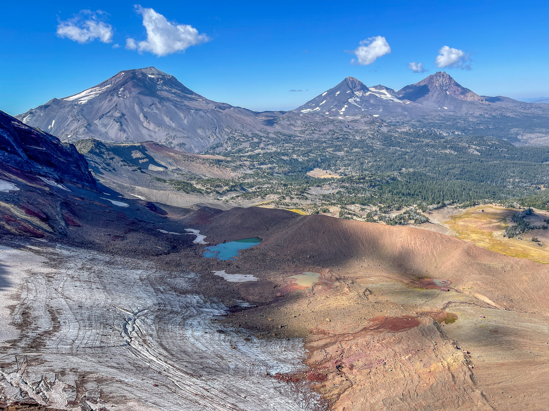
From here you will gain 800 feet of elevation in the next 1.3 miles as the trail follows the creek that spills out of No Name Lake. The views all around you are expansive. There is Ball Butte (7,916 ft.) to the east, Mount Bachelor (9,068 ft.) to the south, and most years even in September you will still see large snow fields at this high elevation. The only section of this hike with difficult footing is the short jaunt right before you reach No Name Lake where you have to scramble up a very steep creek bed. This is why it is recommended to do this hike later in the season, as this creek (that flows out of No Name Lake) can be raging in early July when the lake is thawing out, making it that much more difficult to climb up. Once you are over the lip of the creek bed, you are greeted with an amazing view of No Name Lake and the top crown of Broken Top.
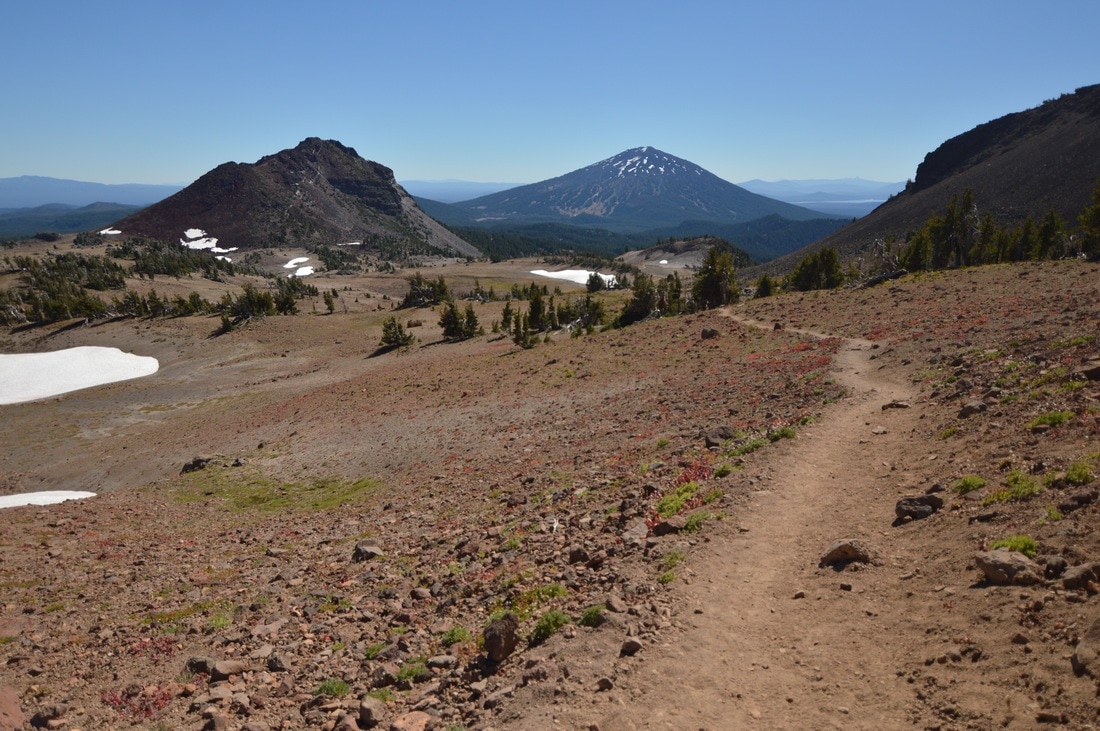
(view of Mount Bachelor)
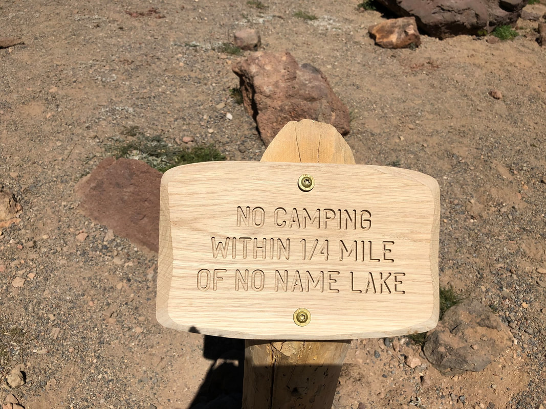
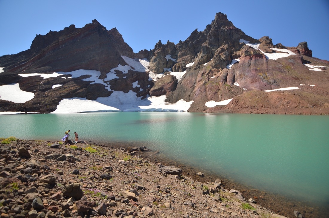
As of August 2019 you are no longer allowed to camp within 1/4 of a mile of No Name Lake, meaning that you cannot camp in the lake's basin. Rangers have put up a sign and patrol the area heavily. No Name Lake is entirely glacier fed, there are no inlets. In late July and early August as the lake thaws out, it is the most beautiful turquoise green color. Later in the season when the lake takes on lots of silt runoff from the mountain, No Name Lake can actually turn brown by September/October. The trail curves around the edge of the lake and you can go up to a viewpoint where you will see the Three Sisters and the tarns below on the northern side of Broken Top. This view is absolutely breathtaking and worth the extra 1 mile round trip from the lake, to make it an even 14 mile hike.
(picture taken by Monica Ozwoeld)
|
|
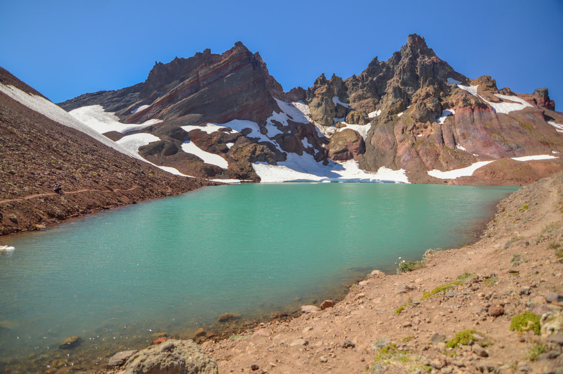
(No Name Lake)
No Name Lake is one of the most spectacular things you will ever see! It is the highest lake mentioned in this book at 8,018 ft. elevation, so keep this in mind when planning your hike. Even though the Todd Lake trailhead will usually be completely snow free by early to mid-June, the lake will still be completely frozen over. It generally doesn’t start to thaw until mid-July and there are usually still chunks of ice in the lake even in August. The upper trailheads aren’t going to be accessible until snow has completely melted and the dirt has had some time to dry out, which usually happens by the end of July.
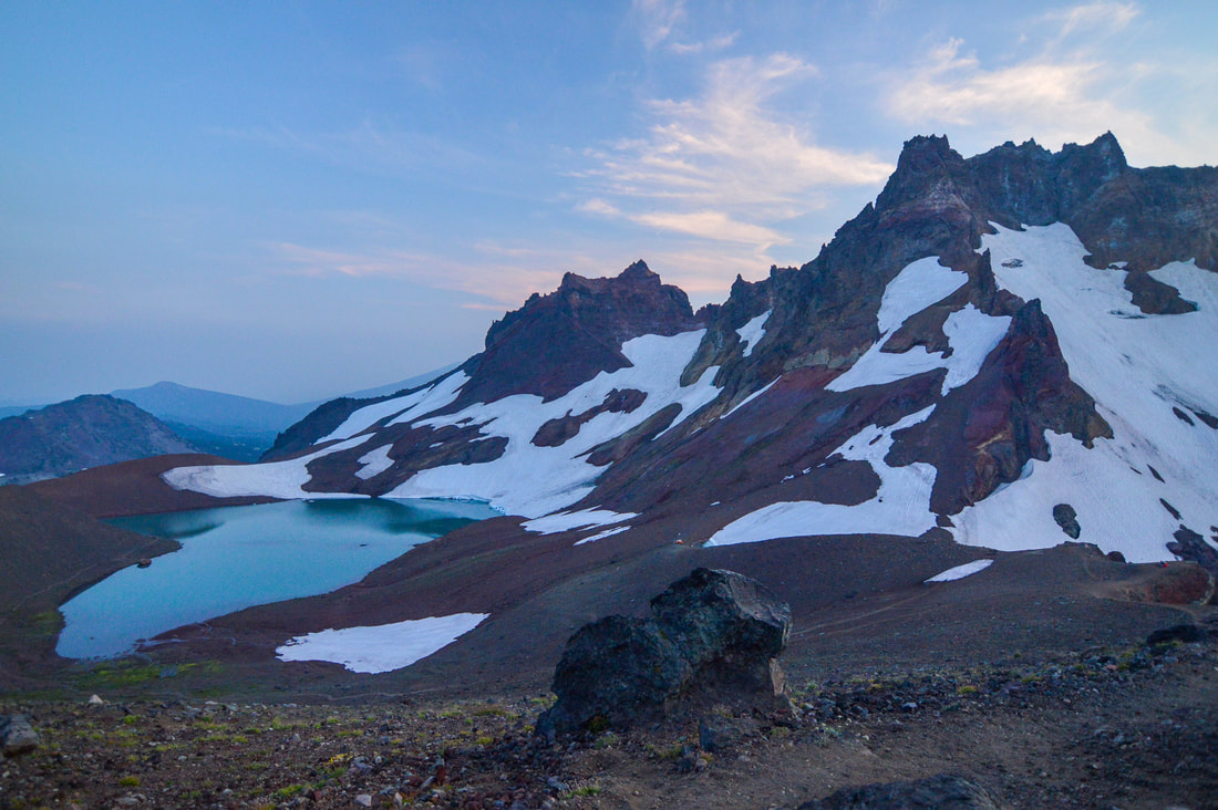
(No Name Lake from viewpoint)
|
(the Three Sisters from the viewpoint above the lake)
|
Directions:
From Bend
- Drive west on the Cascade Lakes Highway for 24 miles, then turn right onto Road 4600-380 for 0.5 miles to the Todd Lake trailhead.
- To the Crater Ditch trailhead, continue past the Todd Lake parking on Road 370 for 2.6 rough miles and then turn left onto Road 378 for 0.5 miles the trailhead.
- To the Broken Top trailhead, continue past the Todd Lake parking on Road 370 for 3.5 rough miles, then turn left onto Road 380 for another 1.3 miles to its end. Only high clearance vehicles should go up Road 380. (Total of 29 miles)
- Drive OR-58 E for 72.7 miles to the Cascade Lakes National Scenic Byway/Crescent Cutoff Rd/NF-61. Turn left and follow this road for 3.2 miles and then turn left at a sign for Cascade Lakes National Scenic Byway. Stay on this scenic road for 44.8 miles and turn left onto Road 4600-380 for 0.5 miles to the Todd Lake trailhead. (Total of 121.2 miles)
- Total of 155 miles via Bend.
- Total of 186 miles via Bend.
- Total of 181 miles via Sunriver.
|
|
|
To get a more in-depth and personal view of this hike, watch the YouTube video.
-This trail write-up was last updated in October 2022-
*All pictures unless otherwise marked are taken by Franziska Weinheimer
*All pictures unless otherwise marked are taken by Franziska Weinheimer
*Disclaimer: the trail descriptions, mileage, GPS tracks and difficulty ratings depicted on this website are never 100% accurate. Always hike at your own risk, using your own knowledge, equipment and common sense. Franziska Weinheimer/Hike Oregon are not responsible if you or anyone in your party gets injured or lost while attempting one of these or any other hikes.