Hike Oregon
  • Home
  • *Store*
  • About the author
  • How to use this site
  • Resources
    • Wildflowers
    • Videos
  • Best Oregon Hikes
    • Best Rainy Day Hikes In Oregon
    • Top 10 Oregon Fall Hikes
    • Underrated Fall Foliage Hikes In Oregon
    • 20 Best Oregon Waterfall Hikes
    • Sno-Parks In Central Oregon
    • Top 10 Oregon Winter Hikes
    • Top Low Elevation Winter Hikes
    • Easy Hikes in Oregon
    • Top 10 Oregon Hikes for Kids
    • Top 10 Oregon Spring Hikes
    • Top One Night Backpacking Trips in Oregon
    • 5 Weekend Backpacking Trips in Oregon
    • 20 Epic Oregon Wildflower Hikes
    • 9 Amazing Oregon Summit Hikes
    • Top 10 Oregon Summer Hikes
    • Top 10 Swimming Spots In Oregon
    • 20 Central Oregon Day Hikes
  • Oregon Sno-Parks
    • Maxwell Sno-Park
    • Potato Hill Sno-Park
    • Ray Benson Sno-Park
      • Brandenburg Shelter
    • Santiam Sno-Park
    • Three Creek Sno-Park
    • Virginia Meissner Sno-Park
      • Meissner Shelter Loop
      • Nordeen Shelter
    • Gold Lake Sno-Park
      • Westview Shelter to Eagle Rock Overlook
      • Marilyn Lakes Loop
    • Ikenick Sno-Park (members only)
  • Southern Washington
    • Hamilton Mountain
    • Dog Mountain
    • Coyote Wall
    • Mount St. Helens
  • Portland
    • Powell Butte
    • Forest Park
    • Latourell Falls
    • Multnomah/Wahkeena Falls
    • Eagle Creek
    • Mitchell Point
    • Table Rock
    • Tamanawas Falls
    • Trillium Lake
    • East Zigzag Mountain (members only)
  • Salem
    • Abiqua Falls
    • Silver Falls State Park
    • Dome Rock
    • Marion Lake to Marion Mountain
    • Jefferson Park via Whitewater Trail
  • Corvallis
    • William Finley Wildlife Refuge
      • Campbell Boardwalk
      • Woodpecker Loop
      • Mill Hill Loop
      • Beaver Pond Loop
    • Marys Peak East Ridge
    • Marys Peak North Ridge
    • Alsea Falls and Green Peak Falls
    • Corvallis to Sea Trail - Sugarbowl Creek segment (members only)
  • Sweet Home
    • Crescent Mountain
    • Iron Mountain
    • McDowell Creek Falls
    • Middle Santiam River (members only)
    • Lower Soda Creek Falls (members only)
    • Rooster Rock (members only)
  • McKenzie Bridge/Blue River
    • Macduff Mountain
    • Proxy Falls
    • Clear Lake
    • Sahalie/Koosah Falls
    • Blue Pool
    • Erma Bell Lakes
    • Olallie Mountain
    • Horsepasture Mountain
    • Tidbits Mountain
    • Castle Rock
    • Separation Lake (members only)
    • Lowder Mountain (members only)
    • East Fork Trail (members only)
    • Rainbow Falls Overlook (members only)
    • Frissell Point (members only)
    • Substitute Point (members only)
  • Sisters/Santiam Pass
    • Coffin Mountain
    • Trappers Butte and Scar Mountain
    • Maxwell Butte
    • Black Butte
    • Whychus Creek Trail
    • Tam McArthur Rim
    • Black Crater
    • Scott Mountain
    • Obsidian Trail
    • Metolius Preserve
    • Three Fingered Jack Loop
    • Square Lake
    • Canyon Creek Meadows
    • Patjens Lakes
    • Craig Lake (members only)
    • Chush Falls (members only)
    • Rockpile Lake (members only)
    • Santiam Lake (members only)
    • Camp Lake (members only)
    • Park Meadow to Golden Lake (members only)
  • Bend/Redmond/LaPine
    • Steins Pillar
    • Chimney Rock
    • Steelhead Falls
    • Tumalo State Park
    • Shevlin Park Loop
    • Tumalo Falls
    • Tumalo Mountain
    • No Name Lake
    • Green Lakes
    • Moraine Lake
    • South Sister Summit
    • Horse Lake
    • Muskrat Lake
    • Paulina Peak
    • The Badlands - Flatiron Rock Trail
    • Peter Skene Ogden Trail (members only)
  • Eugene
    • Ridgeline Trail
    • Mount Pisgah Summit
    • Mount Pisgah Arboretum
    • Shotgun Creek
    • Mount June
    • Lawler
    • Tire Mountain
    • Hardesty Mountain
    • Goodman Creek
    • Brice Creek
    • Trestle Creek Falls
    • Parker Falls
    • Moon Falls
    • Elijah Bristow State Park
    • South Willamette Trail (members only)
    • Eula Ridge (members only)
    • Eagle's Rest (members only)
  • Oakridge
    • Deception Butte
    • North Salmon Creek
    • Sourgrass Mountain
    • Grasshopper Ridge
    • Larison Creek
    • Bunchgrass Ridge
    • Salt Creek Falls
    • Waldo Lake Loop
    • South Waldo Loop
    • The Twins
    • Rosary Lakes
    • Yoran Lake
    • Fawn Lake
    • Windy Lakes
    • Divide Lake
    • Diamond Peak via Rockpile Lake Trailhead
    • Diamond Peak via Summit Lake
    • Cowhorn Mountain
    • Klovdahl Bay (members only)
    • Verdun Trail (members only)
    • Heckletooth Mountain (members only)
    • Wall Creek Warm Springs (members only)
    • Moon Point (members only)
    • Bobby Lake (members only)
    • Lillian Falls (members only)
    • Middle Fork Willamette Trail (members only)
    • Pool Creek Falls (members only)
    • Dead Mountain (members only)
    • Larison Rock (members only)
    • Quinn Lakes & Eddeeleo Lakes (members only)
    • Waldo Mountain Lookout (members only)
    • Blair Lake to Spring Prairie (members only)
    • Rigdon Lakes loop (members only)
  • Oregon Coast
    • Cascade Head
    • Drift Creek Falls
    • Sweet Creek Falls
    • Beaver Creek Falls
    • Kentucky Falls
    • Hobbit Trail to Heceta Head
    • Valley Trail to China Creek
    • Sutton Creek Trail (members only)
    • North Fork Smith River (members only)
    • Cummins Ridge (member's only)
    • Horse Creek (members only)
    • Siltcoos Lake (members only)
  • Southern Oregon
    • Fall Creek Falls
    • Watson Falls
    • Wild Rogue Loop
    • Mt. Thielsen
    • Crater Lake National Park
      • The Watchman
      • Mount Scott
      • The Pinnacles
    • Lower Table Rock
    • Pilot Rock
    • Wagner Butte
    • Mt. McLoughlin
    • Lemolo Falls (members only)
    • Fern Falls (members only)
  • Eastern Oregon
    • Painted Cove
    • Anthony Lake Loop
    • Mount Howard
    • Eagle Cap summit
    • Schneider Cabin (members only)
    • Strawberry Lake & Strawberry Falls (members only)
  • Northern California
    • Taylor & Hogan Lake (members only)
  • Oregon PCT sections
    • PCT: CA border to Callahan's
  • Tips & Tricks
    • Leave No Trace
    • Safety Tips for Solo Hiking & Backpacking
    • Nutrition On The Trail
    • How Much Water To Carry When Backpacking
    • Storing Your Bear Canister When Backpacking
    • How To Pick The Right Backpacking Tent
    • Top Tips For Hiking With Infants And Toddlers
    • Poison Oak, Ivy and Sumac
    • How to dress for cold weather hikes
  • Reviews and Gear
    • Choosing and Using Trekking Poles
    • A Guide to Choosing the Perfect Backpacking Pack
    • Hiking Pants and Leggings
    • Jackets for Hiking and Backpacking
    • Long Sleeved Shirts For Cold Weather Hiking
    • Stay Kühl This Summer
    • Outdoor Herbivore Backpacking Food Review
    • Osprey Aura AG 65 Backpack review
    • Big Agnes Fly Creek UL2 review
    • REI Quarter Dome 1 review
    • Hike Oregon's Gear Favorites
    • Outdoorsy Holiday Gift Guide 2022
    • Hiker Holiday Gift Guide 2019
    • Outdoor Holiday Gift Guide 2018
    • Hiking Holiday Gift Guide 2017
  • Adventure Stories
    • Hiking The Rae Lakes Loop
    • 110 Miles on the PCT
    • Three Fingered Jack Adventures
    • Jefferson Wilderness

**THIS WRITE UP HAS NOT YET BEEN FULLY UPDATED SINCE THE 2020 LIONSHEAD FIRE SWEPT THROUGH THE AREA. THE WHITEWATER TRAIL IS OPEN BUT LOOKS A BIT DIFFERENT THAN THE PICTURES BELOW.

Jefferson Park

​

via the Whitewater Trail

​
Get the printable version of this hike

Hike details:

Mileage: 10.5 miles round trip w/ 2,000 ft. elevation gain (to Scout Lake & Bays Lake)
12.5 miles round trip w/ 2,150 ft. elevation gain (to Russell Lake)
Approximate hike time: 4 hours 43 minutes w/ an average pace of 2.3 mph (to Scout Lake)
5 hours 26 minutes w/ an average pace of 2.3 mph (to Russell Lake)
Difficulty: Difficult
Trail usage: High in late July, August and early September. Low foot traffic mid-September until the snow falls (usually late October/early November).
Highest elevation: 5,841 ft. Lowest elevation: 4,114 ft.
General location: 70 miles east of Salem - Mount Jefferson Wilderness - Willamette National Forest 
Accessible: July to mid-November
(Best time to go is early to mid-August for prime wildflowers and October for fall colors). 
Permits required: Central Cascades Wilderness Permit for day hikes & overnight (June 15 - October 15). Outside of those dates you will need a free self issue wilderness permit & Northwest Forest Pass for parking.
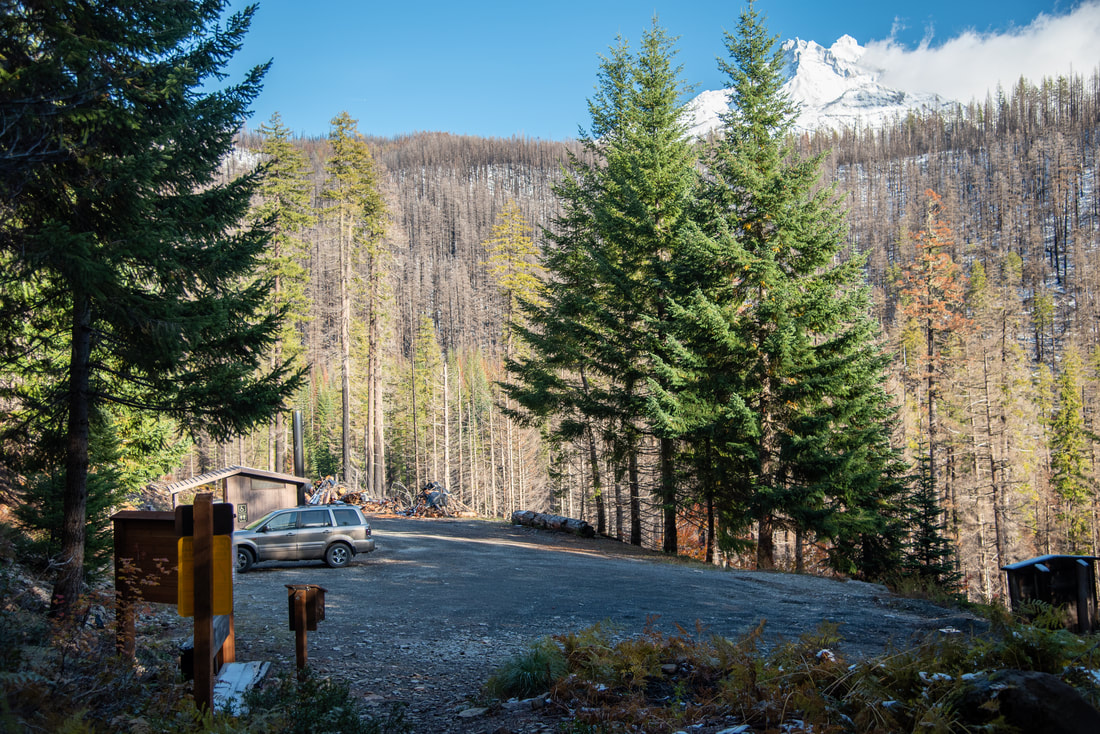
Pit toilet at trailhead: Yes
Trail allows: ​Dogs, horses, camping
Possible dangers: Trail has some steep drop offs with loose rock. Tree fall during high winds is also a danger here due to wildfire damage.
Whitewater Trailhead

Description:

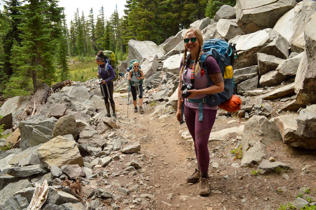
Jefferson Park is one of the most popular and sought after summer destinations for hikers and backpackers from all over the Pacific Northwest, and for good reason. There are multiple ways to enter Jefferson Park, either from the Whitewater Creek Trail, the South Breitenbush Trail, or from farther south on the Pacific Crest Trail via Woodpecker Ridge, all of which were badly burned in the 2020 Lionshead fire, but somehow Jefferson Park was left unscorched. Because Jefferson Park is so popular, only 30 day use permits and 8 overnight Limited Entry Permits are issued per day from the Whitewater Trailhead, which helps limit the number of people who enter this beautiful area. Consider yourself very lucky if you are able to snag one of these permits, because the season to get up to these lakes is short (only about 3.5 months). Because of its popularity, you will see rangers here checking permits and making sure that campers are adhering to the Leave No Trace Principles.
Whitewater Fire map
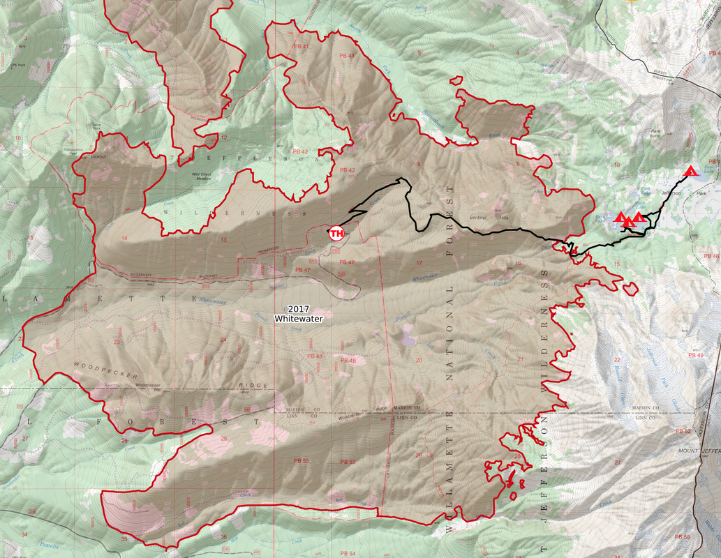
In 2017 the Whitewater Fire was started by lightning and it devastated this area, as it burned a total of about 14,463 acres. The Whitewater Trail was closed for 2 years and reopened in August 2019. Unfortunately in September 2020 the Lionshead Fire ripped through this area, burning 204,469 acres of pristine forest and wilderness, closing Jefferson Park once again for a few years.
Whitewater Trail before the fire
(2014 pre Whitewater Fire)
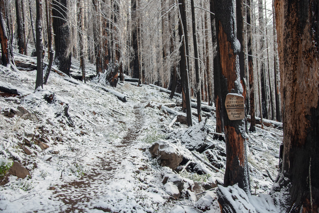
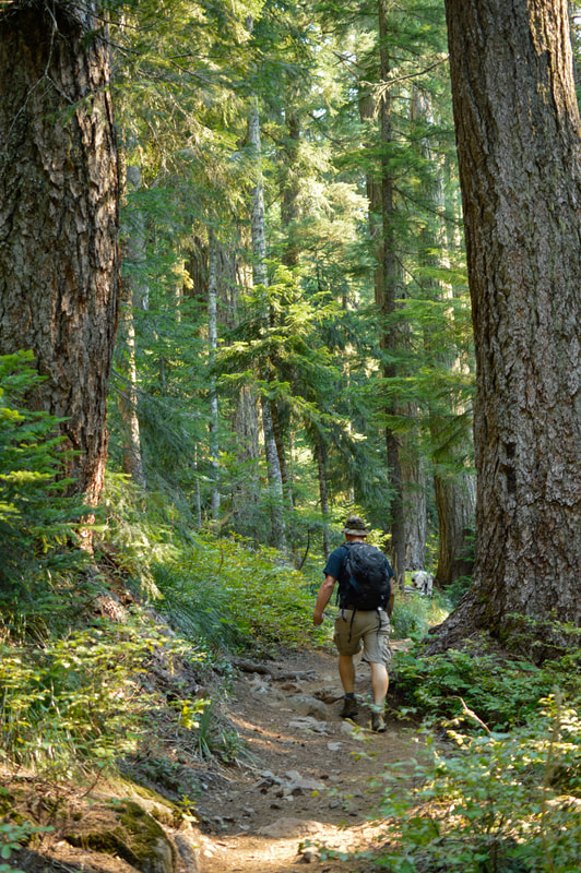
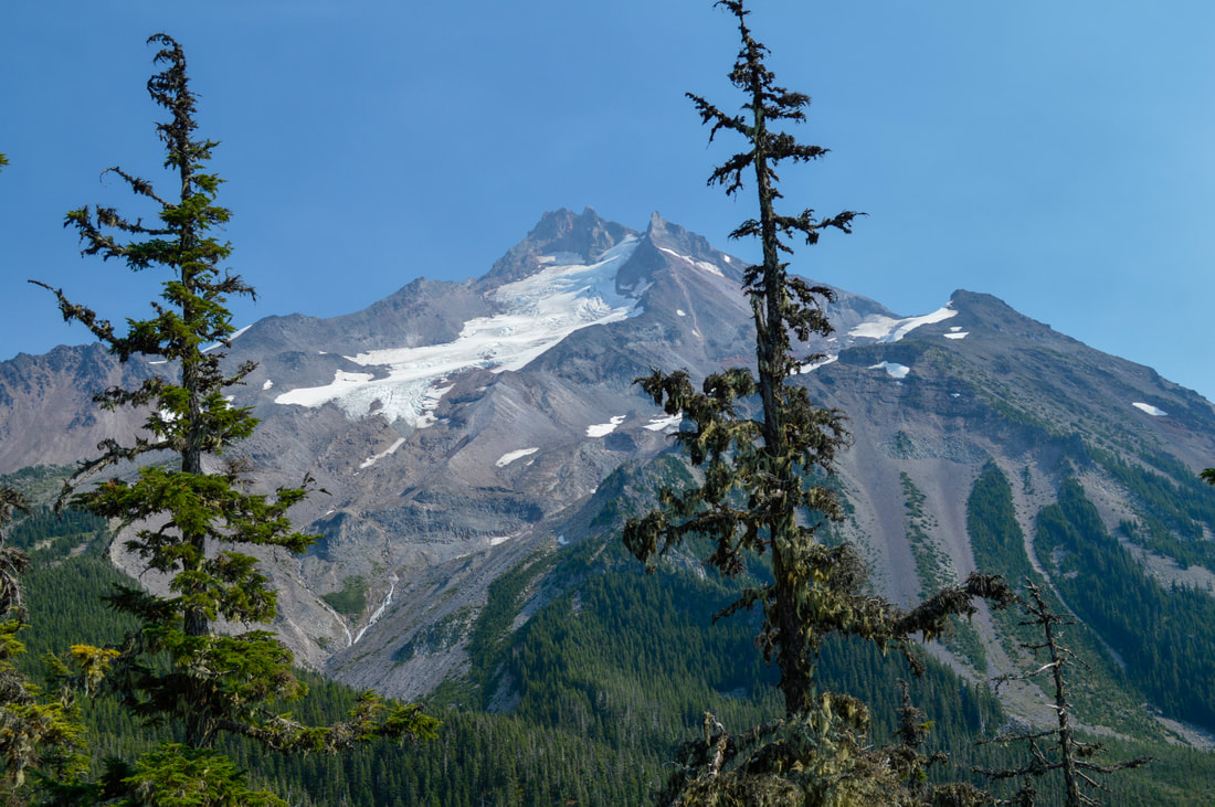
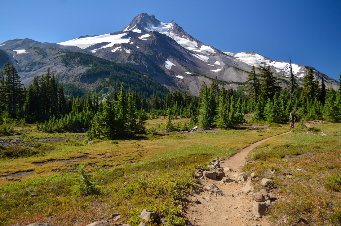
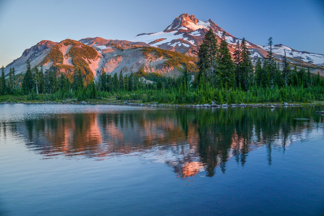
The first 1.5 miles are fairly steep switchbacks, climbing about 850 feet up to the Sentinel Hills Ridge. The trail up to the ridge has lots of loose rocks and exposed roots especially after the fires, and you will definitely have to watch where you are stepping. It helps to have trekking poles. Once you have climbed to the ridge, you will see breathtakingly close-up views of Mount Jefferson, which is Oregon's second tallest mountain, standing at 10,495 ft. tall. 
Whitewater Trail after the fire
(2019 post Whitewater Fire)
Whitewater Trail Mount Jefferson Wilderness boundary 2025
(2025 post Lionshead Fire)
Mt. Jefferson before the Whitewater Fire
(2014 pre Whitewater Fire)
Burned trees on the Whitewater Trail
(2019 post Whitewater Fire)
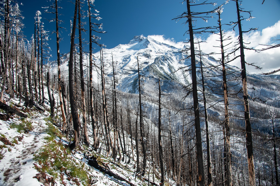
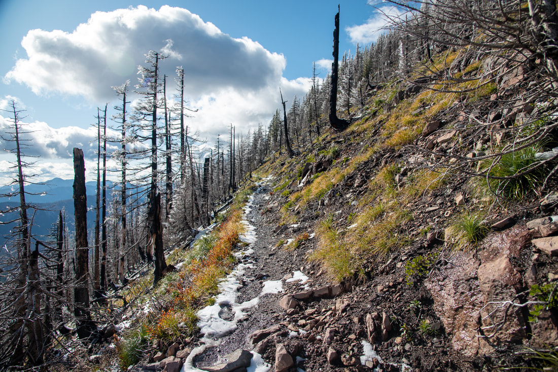
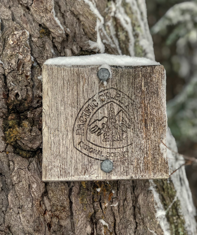
This ridge section of the hike is 2.7 miles long and you continue to climb another 500 feet in elevation. The trail here is very narrow and the hillside is a bit crumbly from the fire damage, so be careful when passing people on the trail. After the 2.7 miles along the ridge, you will need to cross Whitewater Creek. Before the fire there used to be a bridge across the creek, now you will need to rock hop, which can prove challenging early in the season when there is significant snowmelt, but the crossing should be no problem by the end of July. Shortly after crossing Whitewater Creek, you will come to a junction with the Pacific Crest Trail.
Steep section of the Whitewater Trail
(2019 post Whitewater Fire)
The Pacific Crest Trail marker
Milk Creek along the Pacific Crest Trail
(Milk Creek)
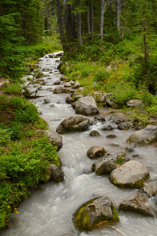
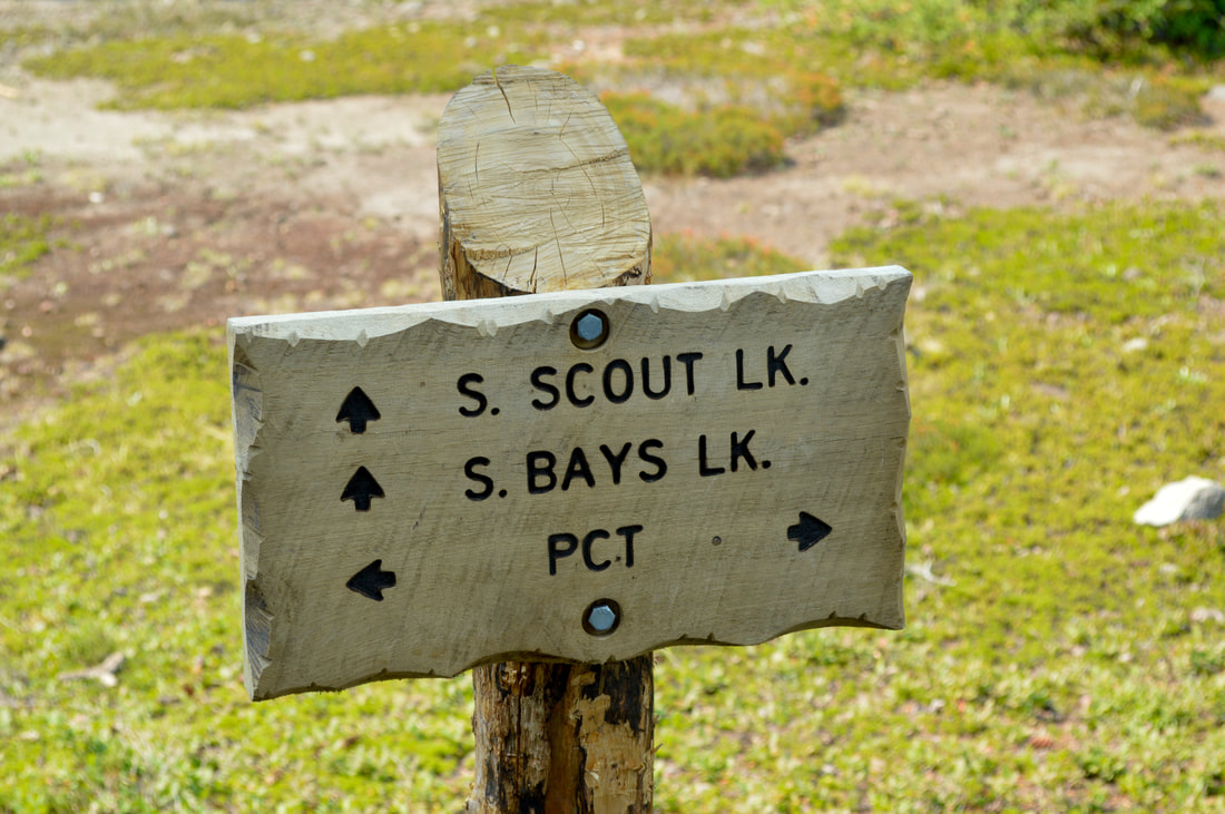
To see the amazing lakes at Jefferson Park, you will go northbound (left) onto the Pacific Crest Trail. 0.4 miles after the junction you will cross Whitewater Creek on a cute little bridge. This creek is almost milky white with glacial silt, which is how it got its name. After the creek crossing it is only another 0.5 miles to a trail junction, where a trail heading off to the left leads to the south end of Scout and Bays Lakes and the campsites that are there. 
Pacific Crest Trail on the way to Jefferson Park
Scout and Bays Lake trail sign
(Russel Lake)
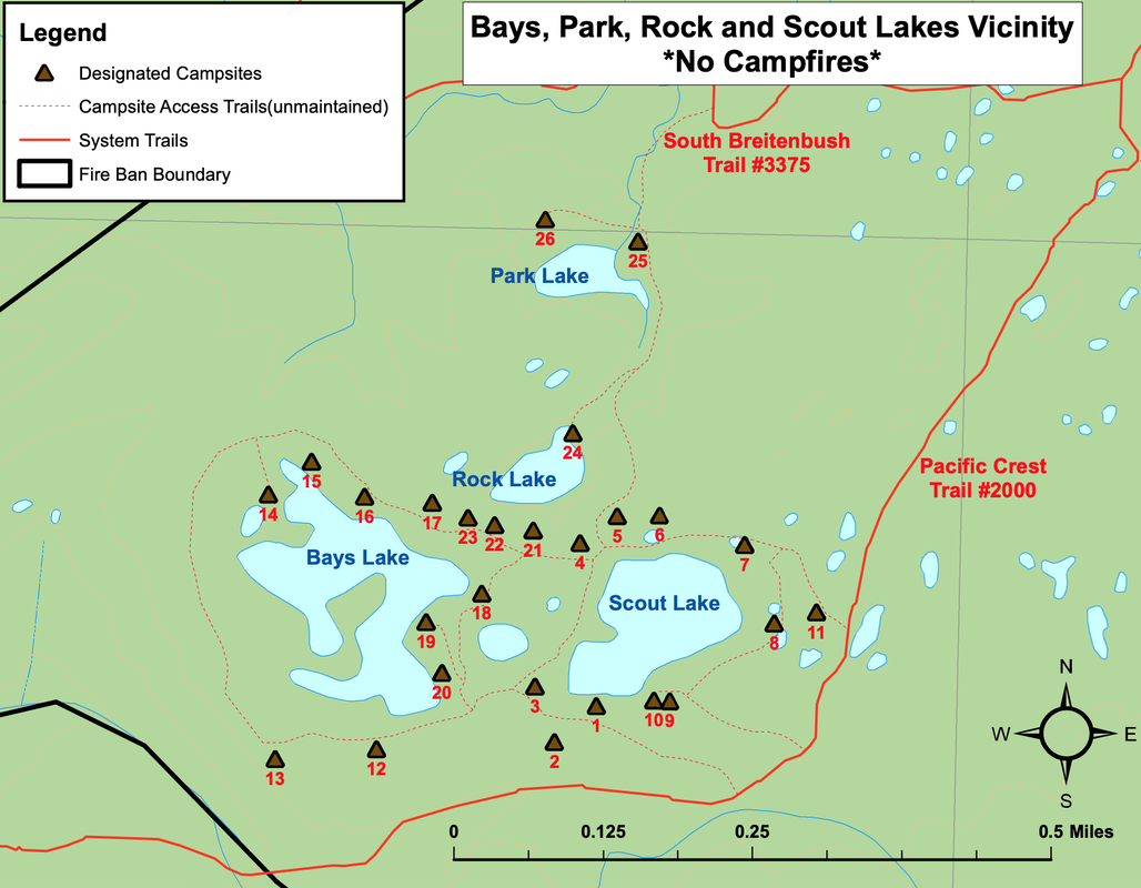
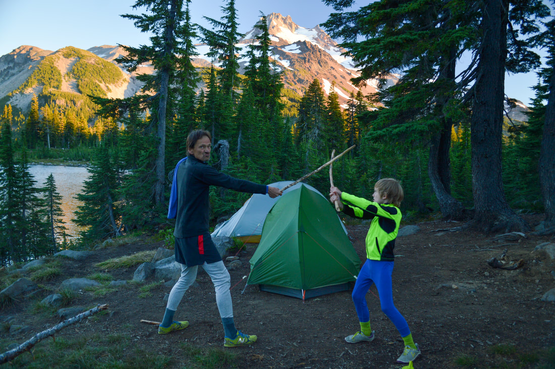
Within the Jefferson Park boundary there are a total of 30 designated campsites and if you are camping within the boundary you must camp at one of these designated sites. They are marked on the map posted at the park boundary, and each site is then marked with a post that has a number on it. The campsites on the south side of Scout and Bays Lakes are further away from the lakes than all of the other sites and require quite a bit of walking to go get water for filtering.
Designated campsites at Jefferson Park
PictureDesignated campsites at Jefferson Park
Camping near Bays Lake at Jefferson Park
(campsite #13)
Bays Lake at Jefferson Park
(Bays Lake and Park Butte pre wildfire)
(Bays Lake and Park Butte post Lionshead Fire)
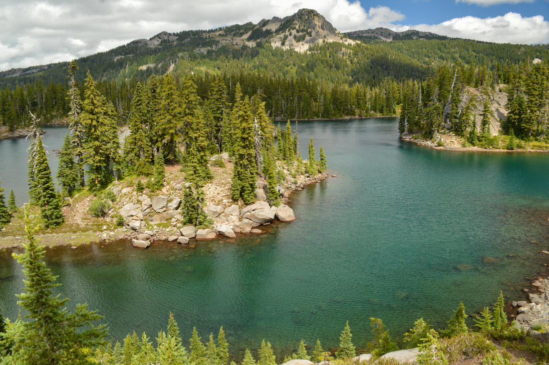
Continue up the PCT another 0.25 miles and come to where another trail splits off to the left. This is where you can get to the north side of Scout and Bays Lakes and this is where you will find the 10 best campsites because you have views of the lakes and Mount Jefferson. There is also the much smaller Rock Lake, which has one campsite and Park Lake which has two campsites. Scout Lake has a maximum depth of 31 feet and within its blue-green waters you can find brook trout, and Bays Lake is 20 feet deep and has a really cool peninsula in the middle. In these turquoise waters you will also find good size brook trout. All of the lakes here have rocky shorelines, which makes for easy casting if you’re fishing and very easy access for swimming during the hot summer months. ​
Scout Lake with Mt. Jefferson in the background at Jefferson Park
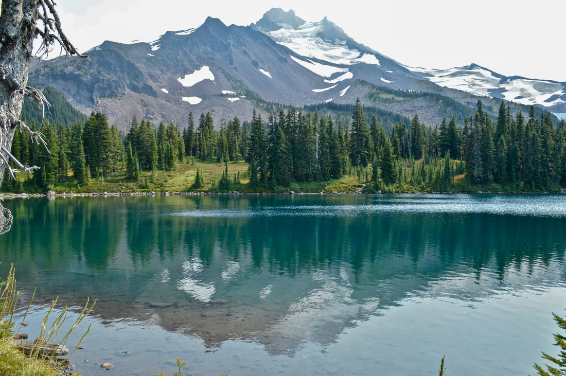
(Scout Lake in early September 2014)
Scout Lake in early fall
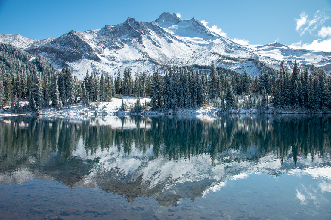
(Scout Lake in October 2019)
Scout Lake after the Lionshead Fire
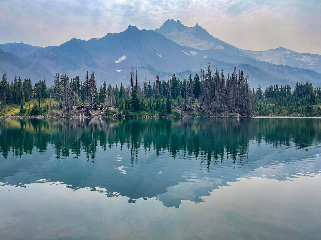
(Scout Lake after the Lionshead Fire - September 2022)
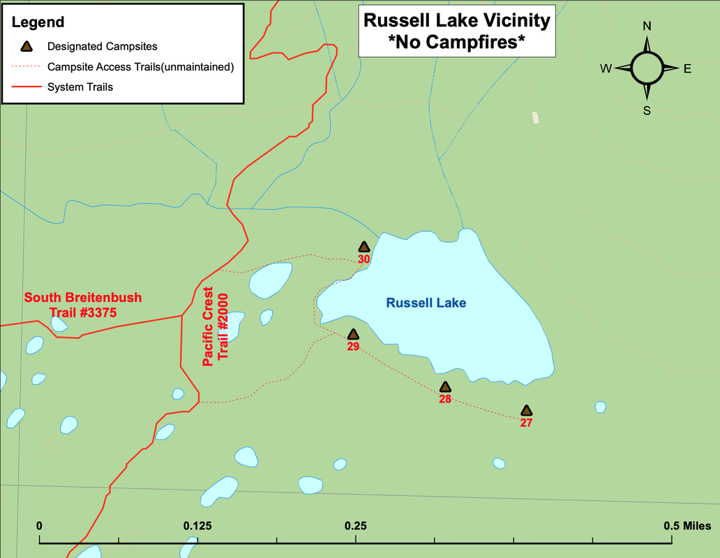
Scout Lake was named by Boy Scout Troop #20 out of Albany in August 1931. They spent multiple days camped by the lake and before they left, they marked 'Scout Lake' with a pencil onto a wooden pointer along the Skyline Trail (which is now known as the Pacific Crest Trail). On a trip a few years later, they found that the words they had written in pencil were no longer readable, so Scout Lake was carved into the wooden marker. From Scout Lake it is another mile north on the PCT to Russell Lake. ​
Pacific Crest Trail to Russell Lake
​Russell lake is gorgeous, and gives you a different view of Mount Jefferson than the other lakes do. It is a bit more shallow along the shoreline, but has a maximum depth of 27 feet. There is a beautiful grassy area to sit by and hang out, perfect for a lunch break before turning around and heading back to the trailhead. At Russell Lake you will find cutthroat trout and a total of 4 campsites. If you are backpacking, this lake is the perfect place to watch the sun set and the moon rise over the mountain, and site #30 is prime real estate.
Russell Lake
(Russell Lake)
Camping at Russell Lake Jefferson Park
(campsite #30)
The time to visit these spectacular lakes is limited by how long the snow lingers in the summer and how soon the snow falls in autumn. If you want to view the many wildflowers that grow in the alpine meadows between the lakes, come in late July or early August. If you are looking for some crisp mountain air and some beautiful fall colors, come in mid to late September or even early October. 
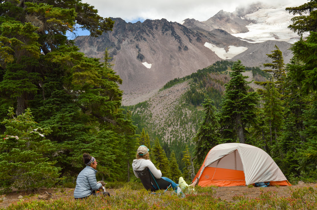
Jefferson Park is an amazing place to come for a day hike and an even more amazing place to spend the night if you can snag one of the 8 limited permits per night. This hike is definitely one of the top 3 Oregon hikes! The hike is rated as difficult not only because of the mileage and elevation gain, but also because of the tread of the trail and the steep drop offs along certain sections of trail can be quite dangerous. Because the majority of the trail travels through a burn scar, most of the hike is sun-exposed and it can get very hot during the summer months. Bring a hat, sunscreen and plenty of water and electrolytes!
Small pink flowers blooming in September Jefferson Park
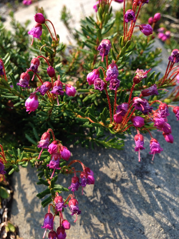
(flowering heather in mid-September)

Directions:

From Salem
  • Drive on OR-22 E for 61.4 miles. Between mileposts 60 and 61 turn left onto Whitewater Creek Rd./NF-2243. Follow this road 7.4 miles, where it ends at a large parking area. (Total of 70 miles)
From Bend
  • Drive US-20 W to the Santiam junction and stay right to merge onto OR-22. Between mileposts 61 and 60 turn right onto Whitewater Creek Rd. 2243. Follow this road 7.4 miles, where it ends at a large parking area. (Total of 77.7 miles)
From Eugene
  • Drive on OR-126 E for 68.2 miles and then make a slight right onto US-20 E for 3.1 miles. Turn left onto OR-22 W for 20.9 miles. Between mileposts 60 and 61 turn right onto Whitewater Creek Rd./NF-2243. Follow this road 7.4 miles, where it ends at a large parking area. (Total of 109 miles)
From Portland
  • It is a total of 116 miles via Salem.
From Medford
  • It is a total of 249 via Bend.
-This trail write-up was last updated April 2025-
*All pictures are taken by Franziska Weinheimer
*Disclaimer: The trail descriptions, mileage, GPS tracks and difficulty ratings depicted on this website are never 100% accurate. Always hike at your own risk, using your own knowledge, equipment and common sense.  Franziska Weinheimer/Hike Oregon are not responsible if you or anyone in your party gets injured or lost while attempting one of these or any other hikes. 
© Hike Oregon 2025
P.O. Box 41911
​Eugene, OR 97404
Proudly powered by Weebly
  • Home
  • *Store*
  • About the author
  • How to use this site
  • Resources
    • Wildflowers
    • Videos
  • Best Oregon Hikes
    • Best Rainy Day Hikes In Oregon
    • Top 10 Oregon Fall Hikes
    • Underrated Fall Foliage Hikes In Oregon
    • 20 Best Oregon Waterfall Hikes
    • Sno-Parks In Central Oregon
    • Top 10 Oregon Winter Hikes
    • Top Low Elevation Winter Hikes
    • Easy Hikes in Oregon
    • Top 10 Oregon Hikes for Kids
    • Top 10 Oregon Spring Hikes
    • Top One Night Backpacking Trips in Oregon
    • 5 Weekend Backpacking Trips in Oregon
    • 20 Epic Oregon Wildflower Hikes
    • 9 Amazing Oregon Summit Hikes
    • Top 10 Oregon Summer Hikes
    • Top 10 Swimming Spots In Oregon
    • 20 Central Oregon Day Hikes
  • Oregon Sno-Parks
    • Maxwell Sno-Park
    • Potato Hill Sno-Park
    • Ray Benson Sno-Park
      • Brandenburg Shelter
    • Santiam Sno-Park
    • Three Creek Sno-Park
    • Virginia Meissner Sno-Park
      • Meissner Shelter Loop
      • Nordeen Shelter
    • Gold Lake Sno-Park
      • Westview Shelter to Eagle Rock Overlook
      • Marilyn Lakes Loop
    • Ikenick Sno-Park (members only)
  • Southern Washington
    • Hamilton Mountain
    • Dog Mountain
    • Coyote Wall
    • Mount St. Helens
  • Portland
    • Powell Butte
    • Forest Park
    • Latourell Falls
    • Multnomah/Wahkeena Falls
    • Eagle Creek
    • Mitchell Point
    • Table Rock
    • Tamanawas Falls
    • Trillium Lake
    • East Zigzag Mountain (members only)
  • Salem
    • Abiqua Falls
    • Silver Falls State Park
    • Dome Rock
    • Marion Lake to Marion Mountain
    • Jefferson Park via Whitewater Trail
  • Corvallis
    • William Finley Wildlife Refuge
      • Campbell Boardwalk
      • Woodpecker Loop
      • Mill Hill Loop
      • Beaver Pond Loop
    • Marys Peak East Ridge
    • Marys Peak North Ridge
    • Alsea Falls and Green Peak Falls
    • Corvallis to Sea Trail - Sugarbowl Creek segment (members only)
  • Sweet Home
    • Crescent Mountain
    • Iron Mountain
    • McDowell Creek Falls
    • Middle Santiam River (members only)
    • Lower Soda Creek Falls (members only)
    • Rooster Rock (members only)
  • McKenzie Bridge/Blue River
    • Macduff Mountain
    • Proxy Falls
    • Clear Lake
    • Sahalie/Koosah Falls
    • Blue Pool
    • Erma Bell Lakes
    • Olallie Mountain
    • Horsepasture Mountain
    • Tidbits Mountain
    • Castle Rock
    • Separation Lake (members only)
    • Lowder Mountain (members only)
    • East Fork Trail (members only)
    • Rainbow Falls Overlook (members only)
    • Frissell Point (members only)
    • Substitute Point (members only)
  • Sisters/Santiam Pass
    • Coffin Mountain
    • Trappers Butte and Scar Mountain
    • Maxwell Butte
    • Black Butte
    • Whychus Creek Trail
    • Tam McArthur Rim
    • Black Crater
    • Scott Mountain
    • Obsidian Trail
    • Metolius Preserve
    • Three Fingered Jack Loop
    • Square Lake
    • Canyon Creek Meadows
    • Patjens Lakes
    • Craig Lake (members only)
    • Chush Falls (members only)
    • Rockpile Lake (members only)
    • Santiam Lake (members only)
    • Camp Lake (members only)
    • Park Meadow to Golden Lake (members only)
  • Bend/Redmond/LaPine
    • Steins Pillar
    • Chimney Rock
    • Steelhead Falls
    • Tumalo State Park
    • Shevlin Park Loop
    • Tumalo Falls
    • Tumalo Mountain
    • No Name Lake
    • Green Lakes
    • Moraine Lake
    • South Sister Summit
    • Horse Lake
    • Muskrat Lake
    • Paulina Peak
    • The Badlands - Flatiron Rock Trail
    • Peter Skene Ogden Trail (members only)
  • Eugene
    • Ridgeline Trail
    • Mount Pisgah Summit
    • Mount Pisgah Arboretum
    • Shotgun Creek
    • Mount June
    • Lawler
    • Tire Mountain
    • Hardesty Mountain
    • Goodman Creek
    • Brice Creek
    • Trestle Creek Falls
    • Parker Falls
    • Moon Falls
    • Elijah Bristow State Park
    • South Willamette Trail (members only)
    • Eula Ridge (members only)
    • Eagle's Rest (members only)
  • Oakridge
    • Deception Butte
    • North Salmon Creek
    • Sourgrass Mountain
    • Grasshopper Ridge
    • Larison Creek
    • Bunchgrass Ridge
    • Salt Creek Falls
    • Waldo Lake Loop
    • South Waldo Loop
    • The Twins
    • Rosary Lakes
    • Yoran Lake
    • Fawn Lake
    • Windy Lakes
    • Divide Lake
    • Diamond Peak via Rockpile Lake Trailhead
    • Diamond Peak via Summit Lake
    • Cowhorn Mountain
    • Klovdahl Bay (members only)
    • Verdun Trail (members only)
    • Heckletooth Mountain (members only)
    • Wall Creek Warm Springs (members only)
    • Moon Point (members only)
    • Bobby Lake (members only)
    • Lillian Falls (members only)
    • Middle Fork Willamette Trail (members only)
    • Pool Creek Falls (members only)
    • Dead Mountain (members only)
    • Larison Rock (members only)
    • Quinn Lakes & Eddeeleo Lakes (members only)
    • Waldo Mountain Lookout (members only)
    • Blair Lake to Spring Prairie (members only)
    • Rigdon Lakes loop (members only)
  • Oregon Coast
    • Cascade Head
    • Drift Creek Falls
    • Sweet Creek Falls
    • Beaver Creek Falls
    • Kentucky Falls
    • Hobbit Trail to Heceta Head
    • Valley Trail to China Creek
    • Sutton Creek Trail (members only)
    • North Fork Smith River (members only)
    • Cummins Ridge (member's only)
    • Horse Creek (members only)
    • Siltcoos Lake (members only)
  • Southern Oregon
    • Fall Creek Falls
    • Watson Falls
    • Wild Rogue Loop
    • Mt. Thielsen
    • Crater Lake National Park
      • The Watchman
      • Mount Scott
      • The Pinnacles
    • Lower Table Rock
    • Pilot Rock
    • Wagner Butte
    • Mt. McLoughlin
    • Lemolo Falls (members only)
    • Fern Falls (members only)
  • Eastern Oregon
    • Painted Cove
    • Anthony Lake Loop
    • Mount Howard
    • Eagle Cap summit
    • Schneider Cabin (members only)
    • Strawberry Lake & Strawberry Falls (members only)
  • Northern California
    • Taylor & Hogan Lake (members only)
  • Oregon PCT sections
    • PCT: CA border to Callahan's
  • Tips & Tricks
    • Leave No Trace
    • Safety Tips for Solo Hiking & Backpacking
    • Nutrition On The Trail
    • How Much Water To Carry When Backpacking
    • Storing Your Bear Canister When Backpacking
    • How To Pick The Right Backpacking Tent
    • Top Tips For Hiking With Infants And Toddlers
    • Poison Oak, Ivy and Sumac
    • How to dress for cold weather hikes
  • Reviews and Gear
    • Choosing and Using Trekking Poles
    • A Guide to Choosing the Perfect Backpacking Pack
    • Hiking Pants and Leggings
    • Jackets for Hiking and Backpacking
    • Long Sleeved Shirts For Cold Weather Hiking
    • Stay Kühl This Summer
    • Outdoor Herbivore Backpacking Food Review
    • Osprey Aura AG 65 Backpack review
    • Big Agnes Fly Creek UL2 review
    • REI Quarter Dome 1 review
    • Hike Oregon's Gear Favorites
    • Outdoorsy Holiday Gift Guide 2022
    • Hiker Holiday Gift Guide 2019
    • Outdoor Holiday Gift Guide 2018
    • Hiking Holiday Gift Guide 2017
  • Adventure Stories
    • Hiking The Rae Lakes Loop
    • 110 Miles on the PCT
    • Three Fingered Jack Adventures
    • Jefferson Wilderness