Gold Lake Sno-Park
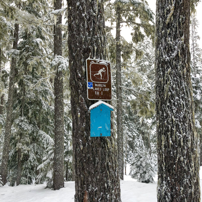
Marilyn Lakes Loop
Hike details:
Mileage: 6.6 mile loop w/ 400 ft. elevation gain
Approximate hike time: 3 hours 40 minutes w/ an average pace of 1.8 mph
Difficulty: Moderate to difficult (depending on if you have to break trail)
Trail usage: Medium on sunny weekends, low any other time
Highest elevation: 5,086 ft. Lowest elevation: 4,764 ft.
General location: 27 miles east of Oakridge - Willamette National Forest
Accessible: Year-round
(Best time to go snowshoeing and cross-country skiing is as soon as we get about 3 feet of snow built up, which usually lasts until mid-April).
Permits required: Sno-park pass is required from November 1 - April 30
Pit toilet at trailhead: Yes
Trail allows: Dogs, snowshoes & cross-country skiing, camping
Possible dangers: Falling through the frozen over lake
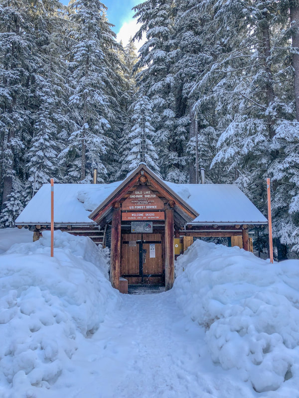
(Gold Lake Sno-Park warming shelter)
|
(Gold Lake Sno-Park pit toilets)
Description:The Marilyn Lakes Loop is located on the north side of highway 58 from Gold Lake Sno-Park, a popular place for winter recreation for folks who live in the southern Willamette Valley. This moderate loop features three lakes, wildlife, a fun 3-sided shelter and beautiful trails through a thick forest. It also gives you access to many other trail options if you want to do a winter backcountry overnight trip.
|
|
|
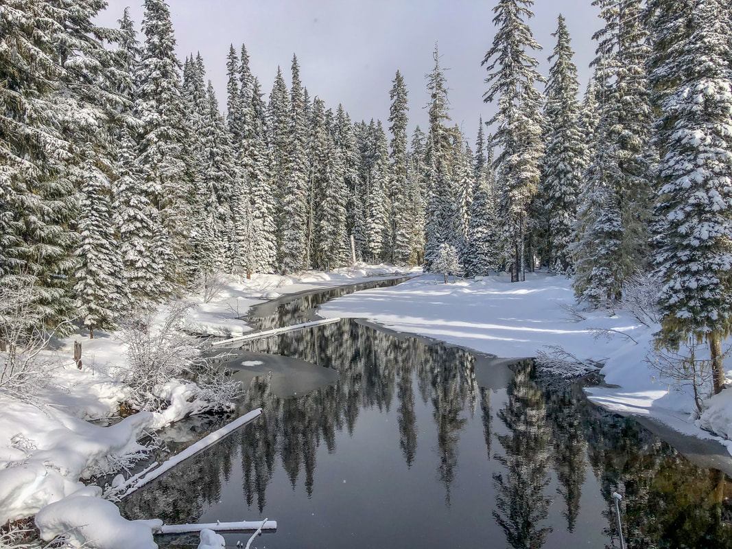
(Upper Marilyn Lake)
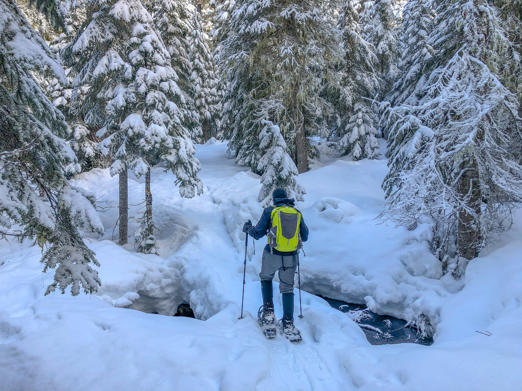
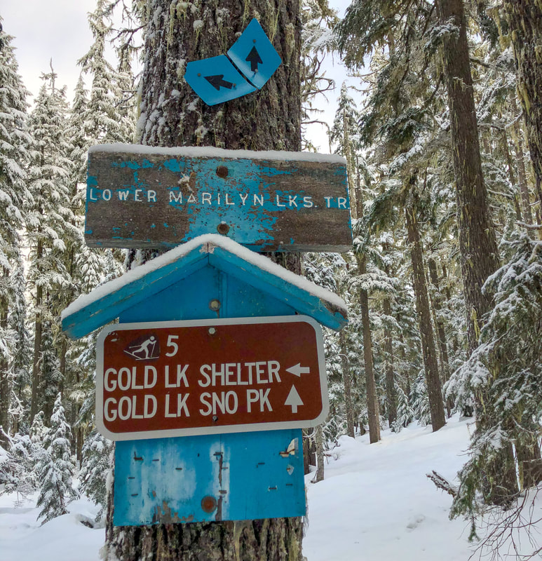
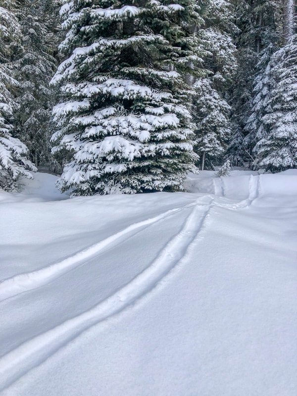
To begin your trek, you will have to cross highway 58, but please do so carefully. Do not cross the highway with your snowshoes on, that could be really dangerous! Put your gear on once you have crossed the road and you will start snowshoeing or cross-country skiing up Gold Lake Road, which is closed and gated during the winter and early spring months. After 0.45 miles you will see a trail split off to the left and you will start your loop here.
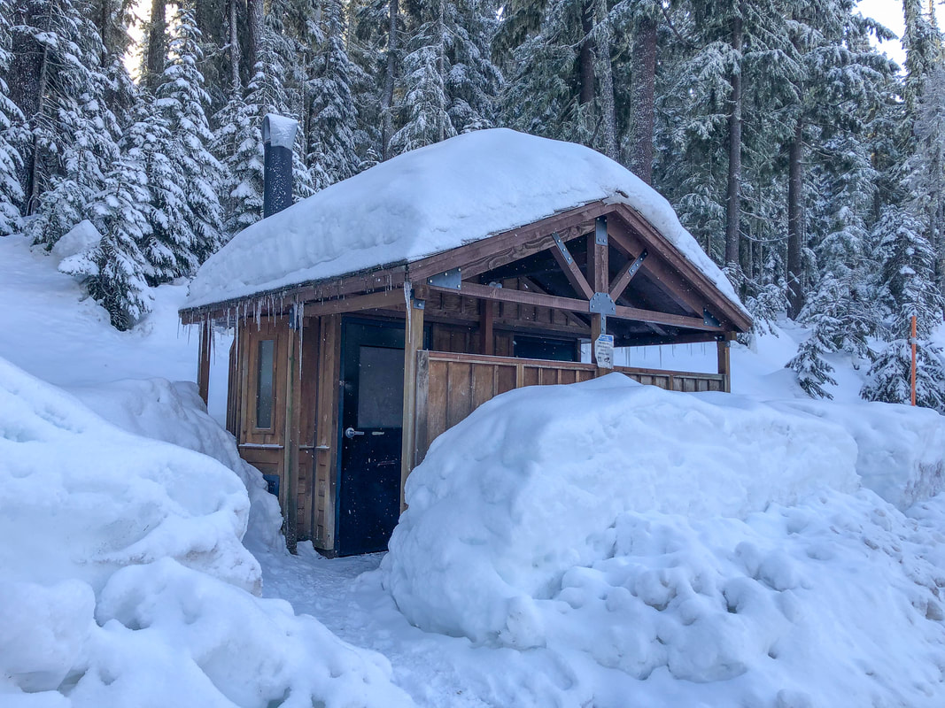
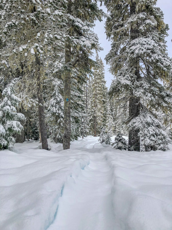
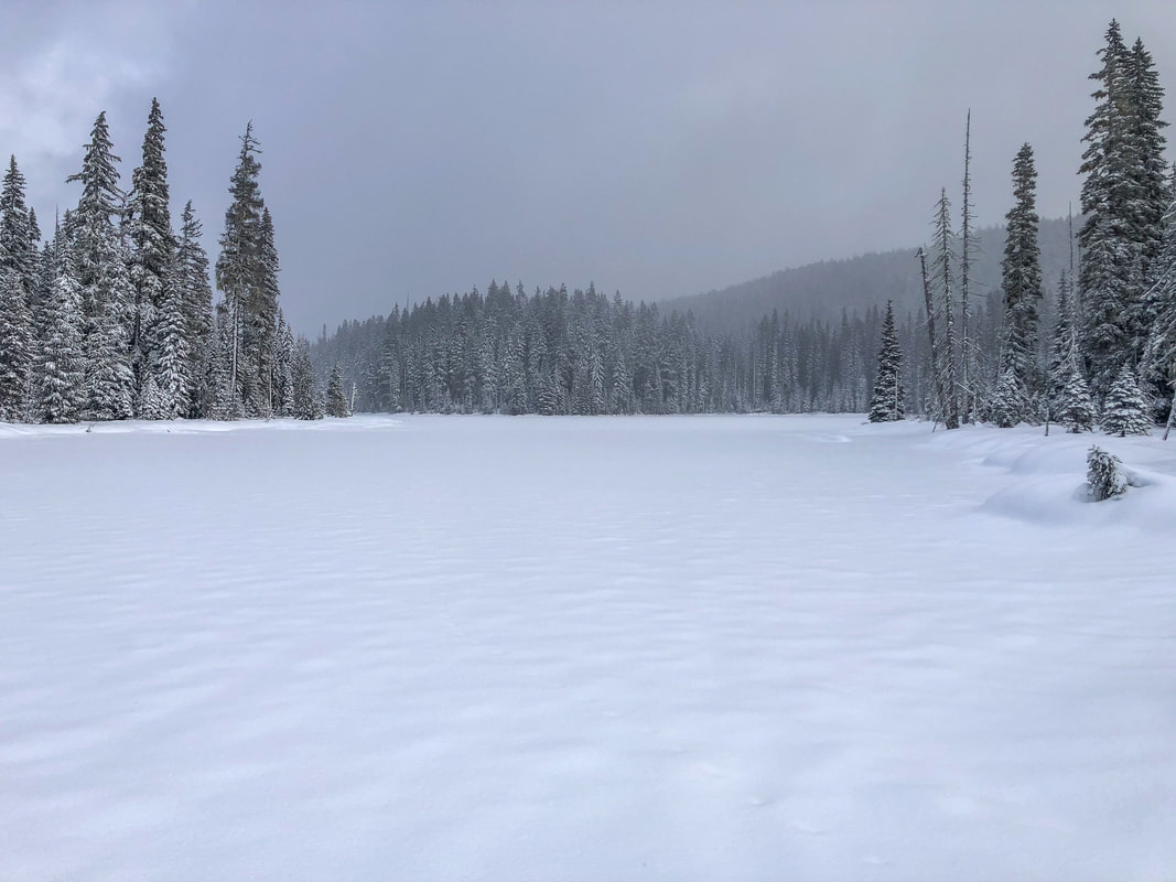
After 0.85 miles of hiking through a forest of mountain hemlock and Douglas fir trees, you will see Upper Marilyn Lake on your right. Continue another 0.2 miles and see Lower Marilyn Lake on your left. The trail skirts the lake for 0.25 miles until you come to a trail junction. If you want to make your excursion shorter, you can take a right on the Marilyn Lakes Trail #3689 to complete the loop, or take the Marilyn Lakes Trail to the left to continue on to Gold Lake and the shelter. After 0.5 miles north of the trail junction, you will arrive at the Gold Lake day use area. Cross Salt Creek on a bridge (the outlet of Gold Lake), and you will see the 3-sided shelter that has a wood stove inside and a table inside to sit at. This is the perfect place to warm up, rest and have lunch. Bringing a backpacking stove and a delicious drink, like CS instant coffee will not only warm you up but also put a pep in your step for the rest of the trek.
After 0.85 miles of hiking through a forest of mountain hemlock and Douglas fir trees, you will see Upper Marilyn Lake on your right. Continue another 0.2 miles and see Lower Marilyn Lake on your left. The trail skirts the lake for 0.25 miles until you come to a trail junction. If you want to make your excursion shorter, you can take a right on the Marilyn Lakes Trail #3689 to complete the loop, or take the Marilyn Lakes Trail to the left to continue on to Gold Lake and the shelter. After 0.5 miles north of the trail junction, you will arrive at the Gold Lake day use area. Cross Salt Creek on a bridge (the outlet of Gold Lake), and you will see the 3-sided shelter that has a wood stove inside and a table inside to sit at. This is the perfect place to warm up, rest and have lunch. Bringing a backpacking stove and a delicious drink, like CS instant coffee will not only warm you up but also put a pep in your step for the rest of the trek.
(Lower Marilyn Lake)
|
|
(Salt Creek)
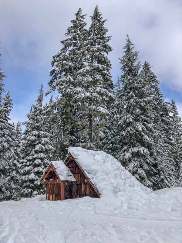
(Gold Lake shelter)
|
After enjoying a break at the shelter, you can venture to the shores of Gold Lake. On a clear day you can see Maiden Peak across the lake. Maiden Peak is an awesome summer and fall viewpoint hike, and the information for that trip can be found in the Hike Oregon guidebook ‘Oregon’s Best Views’. Some people even choose to walk across the lake to access backcountry camping spots on the other side of the lake. Walking across a frozen lake can be extremely dangerous, especially in the backcountry because you never know how solid the ice is, and if you fall through, hyperthermia can set in very quickly, so approach at your own risk.
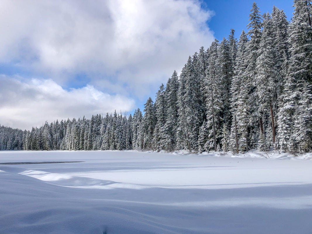
After checking out Gold Lake, head back across the bridge and pass the trail you came in on and continue down Gold Lake road for 0.3 miles until you see a trail split off to your right. This is just a different way to get back into the Marilyn Lakes Trail system. Even though most of the forest looks the same, it can be nice to take a different route than the one you took in. After 0.3 miles you will connect with the Marilyn Lakes Trail, take a left for just 0.1 miles, then take the fork to the left to go around the east side of Upper Marilyn Lake. 0.2 miles after the junction, you will see a beautiful view of Diamond Peak across the lake on a clear day. The trail continues to skirt along the edge of the lake for another 0.25 miles. There are some otters that live in the area and sometimes you can see their tracks as they slide on their bellies down the hill and into the lake’s edge where they keep a hole open in the ice and go fishing. It’s a pretty neat thing to see. The trail will trend uphill away from the lake for 0.25 miles until you are back at Gold Lake Road. From here you will head downhill on the road for 1.25 miles to arrive back at the beginning of the hike and the highway 58 crossing. |
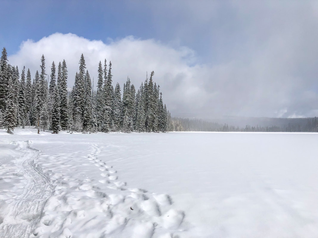
(Gold Lake)
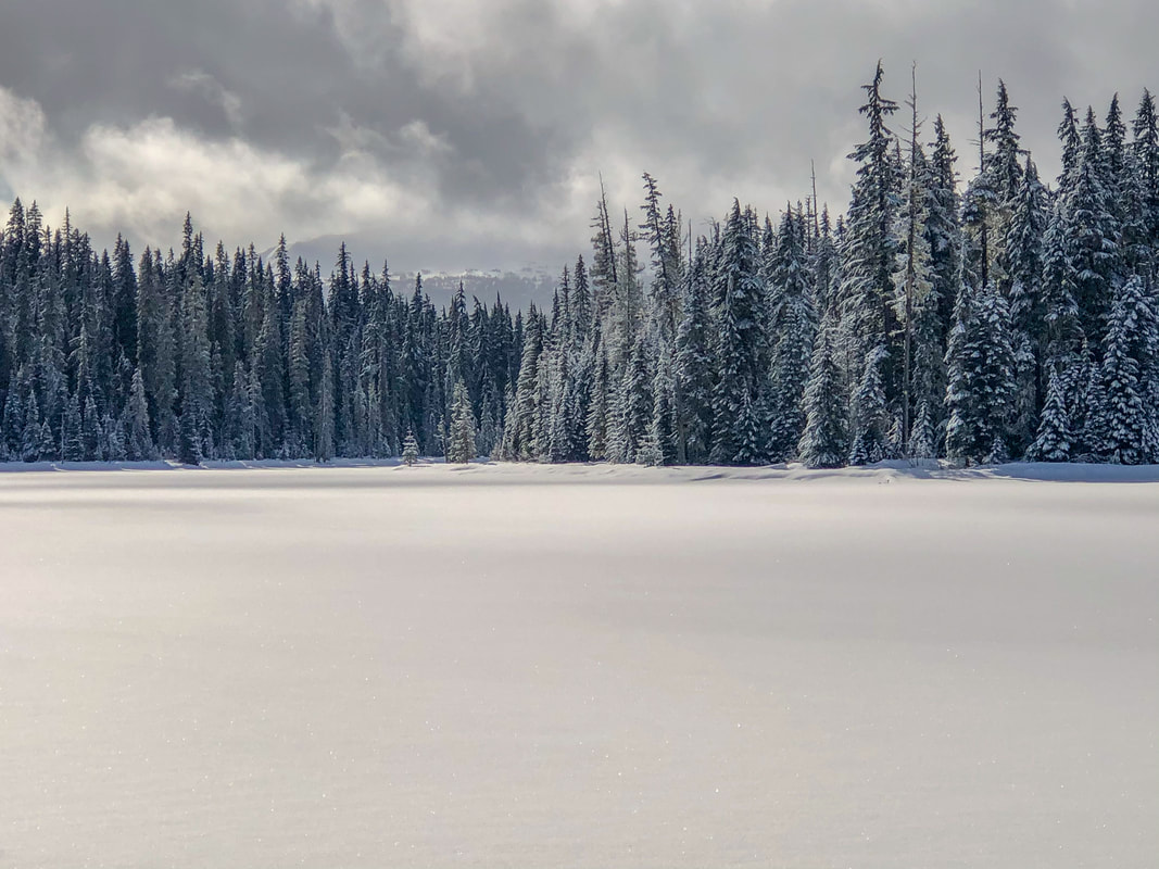
(Diamond Peak viewpoint from Upper Marilyn Lake)
|
The Marilyn Lakes Loop is a great place to snowshoe and cross-country ski, especially if you want to get away from the crowds on some of the easier trails that are located on the south side of Gold Lake Sno-Park. There is a lot more solitude on these trails, and it allows you access for winter backcountry camping if you want to camp at Gold Lake, head up to the Maiden Peak shelter, or even trek up to Waldo Lake. This snowshoe/cross-country ski route is rated as moderate because of the mileage and because these trails aren’t as groomed as the ones on the south side of the highway, which means sometimes you will have to break trail.
|
(otter tracks in the snow)
|
Directions:
From Eugene
- Drive OR-58 east about 35.4 miles to the town of Oakridge. Here you can stop to grab a snack, gas or a coffee as well as take a restroom break at the rest area. Then continue on OR-58 east 25.5 miles where you will see a sign for Gold Lake Sno Park and turn into the parking area on your right. (Total of 69 miles)
- Take US-97 south for about 47 miles, then turn right onto Crescent Rd/Crescent Cutoff Rd for 12 miles until the road T’s into highway 58. Turn right onto OR-58 and drive west for 11.4 miles, right after Willamette Pass Ski Area, you will see a sign for Gold Lake Sno Park and turn into the parking area on your left. (Total of 71 miles)
- Drive I-5 south about 65 miles down to Eugene. Just south of town, merge onto OR-58 east and continue 35.4 miles to the town of Oakridge. Here you can stop to grab a snack, gas or a coffee as well as take a restroom break at the rest area. Then continue on OR-58 east 25.5 miles where you will see a sign for Gold Lake Sno Park and turn into the parking area on your right. (Total of 130 miles)
- Take OR-62 east towards Crater Lake for 49.5 miles then take a slight left onto OR-230 north for 23.8 miles. Near Diamond Lake turn right onto OR-138 east for 17.7 miles until it T’s into highway 97. Turn left onto US-97 north for 17.8 miles and then use the left lane to take the exit onto OR-58 west. Stay on OR-58 for 24.6 miles, right after Willamette Pass Ski Area, you will see a sign for Gold Lake Sno Park and turn into the parking area on your left. (Total of 141 miles)
- Drive I-5 south about 111 miles down to Eugene. Just south of town, merge onto OR-58 east and continue 35.4 miles to the town of Oakridge. Here you can stop to grab a snack, gas or a coffee as well as take a restroom break at the rest area. Then continue on OR-58 east 25.5 miles where you will see a sign for Gold Lake Sno Park and turn into the parking area on your right. (Total of 173 miles)
-This trail write-up was last updated March 2023-
*All pictures are taken by Franziska Weinheimer
*All pictures are taken by Franziska Weinheimer
*Disclaimer: The trail descriptions, mileage, GPS tracks and difficulty ratings depicted on this website are never 100% accurate. Always hike at your own risk, using your own knowledge, equipment and common sense. Franziska Weinheimer/Hike Oregon are not responsible if you or anyone in your party gets injured or lost while attempting one of these or any other hikes.