Fall Creek Falls
This hike burned entirely in the 2020 Archie Creek Fire but the trail has been reopened as of spring 2022.
Hike details:
Mileage: 1.6 miles out and back w/ 400 ft. elevation gain
Approximate hike time: 40 minutes w/ an average pace of 2.3 mph
Difficulty: Easy
Trail usage: High on weekends, low to medium on weekdays
Highest elevation: 1,410 ft. Lowest elevation: 805 ft.
General location: 31 miles east of Roseburg - Umpqua National Forest
Accessible: Year-round
(This waterfall is best seen in the early spring. There are less people here in the late fall, winter and early spring).
Permits required: N/A
Pit toilet at trailhead: No
Trail allows: Dogs
Possible dangers: old burn area, watch out for falling trees and branches.
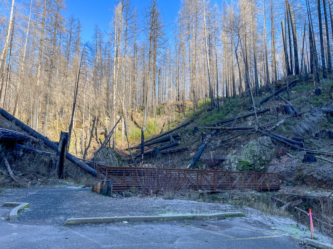
(Fall Creek Falls trailhead parking post wildfire)
Description:
Fall Creek Falls is a short and sweet Southern Oregon waterfall hike off of beautiful OR-138. People take advantage of the many waterfalls along this scenic highway and oftentimes take a whole day to check out all of the waterfalls, all of them very short hikes (Susan Creek Falls, Fall Creek Falls, Toketee Falls, Watson Falls, Clearwater Falls, Lemolo Falls, Warm Springs Falls).
The Fall Creek Falls Trail starts at a small trailhead with room for a maximum of 6-8 cars, depending on how people park, so arrive early if you can. From the parking lot you will immediately cross a bridge where before the wildfire, there used to be restrooms with flushable toilets. One of the first cool things about this trail is that all of a sudden the trail comes to some semi-truck sized boulders, which you end up walking through. It is a really cool experience to walk between these giant moss covered rocks for a few hundred feet.
The Fall Creek Falls Trail starts at a small trailhead with room for a maximum of 6-8 cars, depending on how people park, so arrive early if you can. From the parking lot you will immediately cross a bridge where before the wildfire, there used to be restrooms with flushable toilets. One of the first cool things about this trail is that all of a sudden the trail comes to some semi-truck sized boulders, which you end up walking through. It is a really cool experience to walk between these giant moss covered rocks for a few hundred feet.
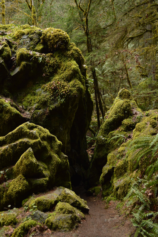
(pre wildfire)
|
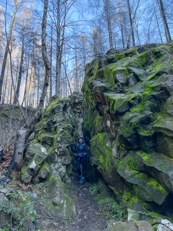
(post wildfire)
|
(pre wildfire)
|
Once you pop out of the rock crevasse, the trail immediately starts heading uphill via two switchbacks as you continue going upstream. You will see old-growth Douglas fir trees and what used to be, and what will eventually be again, a very lush, mossy green environment (I have included a few pre and post wildfire pictures).
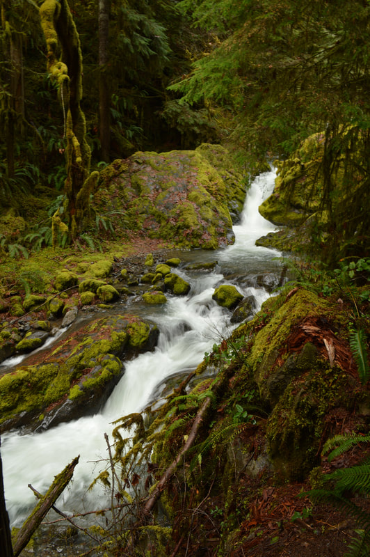
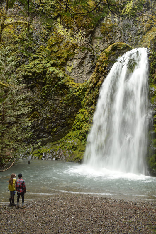
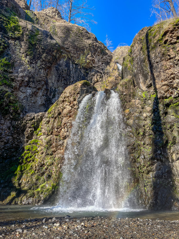
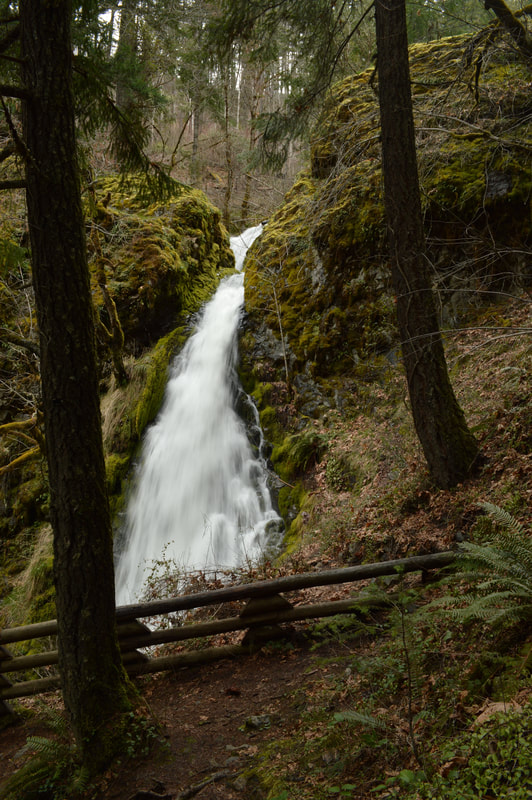
After a short walk through the forest, you will see the bottom tier of Fall Creek Falls dropping 50 feet into a beautiful clear pool of rocks below. The spray here is quite strong especially in the spring, so if you want to take some pictures, you might want to take cover behind some of the large boulders nearby so that your lens doesn't get wet. From further away, and a little to the left of the trail, you can also catch a glimpse of the second tier of the waterfall. 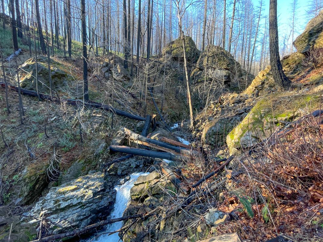
(post wildfire)
|
(the trail pre wildfire)
|
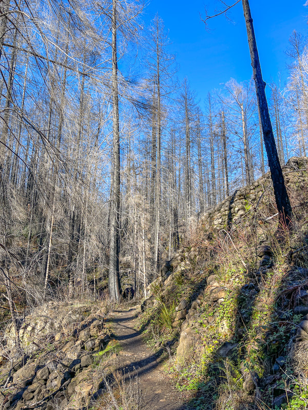
(the trail post wildfire)
|
(bottom tier of Fall Creek Falls pre fire)
|
(bottom tier of Fall Creek Falls post wildfire)
|
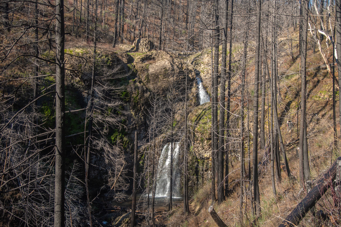
(after the wildfire you can see the bottom and middle tiers of the waterfall from the trail)
(middle tier of Fall Creek Falls pre wildfire)
|
After admiring the bottom tier, make your way up another two switchbacks to a viewpoint of the second waterfall tier which is 35 feet tall. Most people stop at the bottom waterfall drop, so you'll lose some of the crowds going up.
From here the trail does continue up even further another two switchbacks to the upper two tiers of Fall Creek Falls, which is hard to see because it just drops off the cliff and you don't want to get too close to the edge. With all 4 tiers, the total height of Fall Creek Falls is 120 feet. 
(1st and 2nd tier of Fall Creek Falls pre wildfire)
|
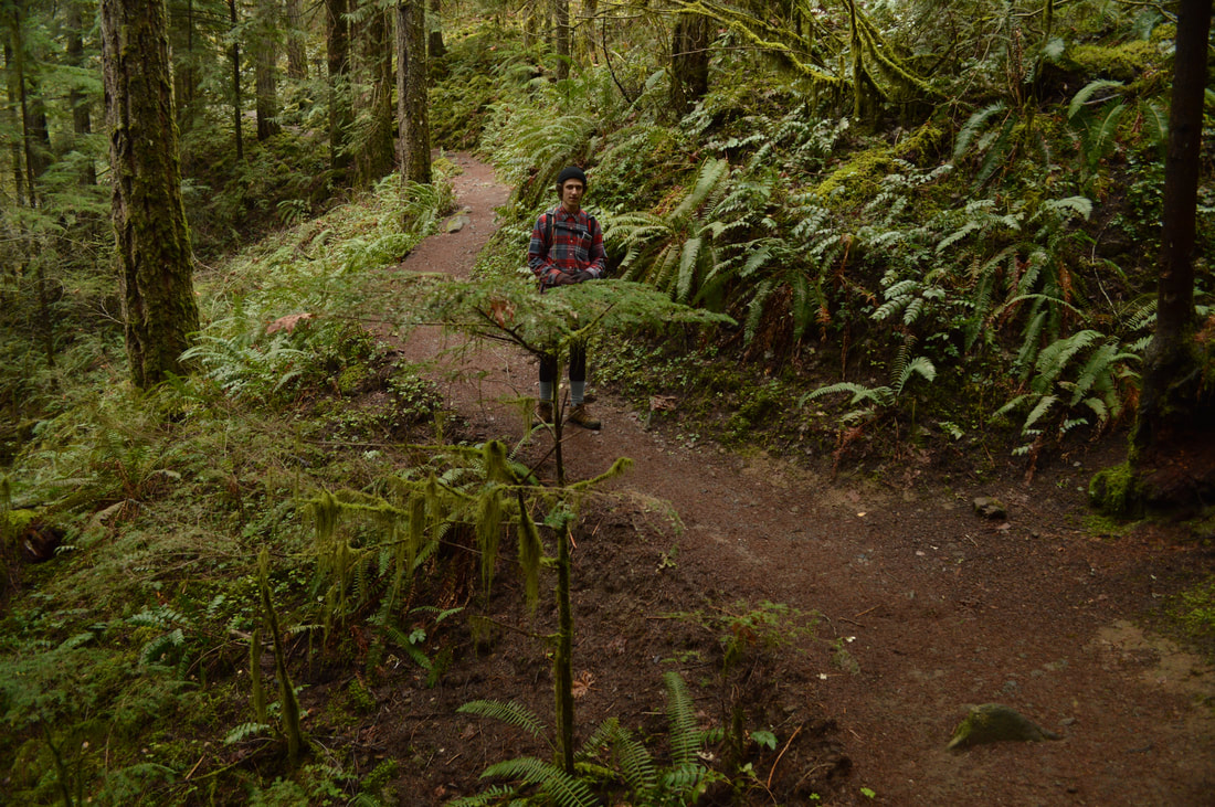
This is an easy hike with lots to see. The trail is generally well maintained but can have a few trees down in the early spring season, especially since the Archie Creek wildfire. The trail also gets muddy after a lot of rain in the springtime. The trail is not very wide, so please be respectful of other hikers that you are passing, especially on the steep switchbacks. And always remember to follow the 7 Leave No Trace Principles.
On your drive back home, you should definitely make a pitstop at the Tioga foot bridge. It is made out of cedar wood and it smells absolutely amazing! This bridge has replaced Young's Bay Bridge and was finished in 2013. It is built out of a single 137-foot timber glu-lam tied arch main span, flanked by two 70-foot timber glu-lam girder approach spans. It is very reminiscent of the old Young's Bay Bridge but has a modern touch to it. The purpose of this bridge is to connect Highway 138 to the 79 mile long North Umpqua River Trail. This makes it so that the nearly 16 mile Tioga section can be easily split up into two day hikes.
On your drive back home, you should definitely make a pitstop at the Tioga foot bridge. It is made out of cedar wood and it smells absolutely amazing! This bridge has replaced Young's Bay Bridge and was finished in 2013. It is built out of a single 137-foot timber glu-lam tied arch main span, flanked by two 70-foot timber glu-lam girder approach spans. It is very reminiscent of the old Young's Bay Bridge but has a modern touch to it. The purpose of this bridge is to connect Highway 138 to the 79 mile long North Umpqua River Trail. This makes it so that the nearly 16 mile Tioga section can be easily split up into two day hikes.
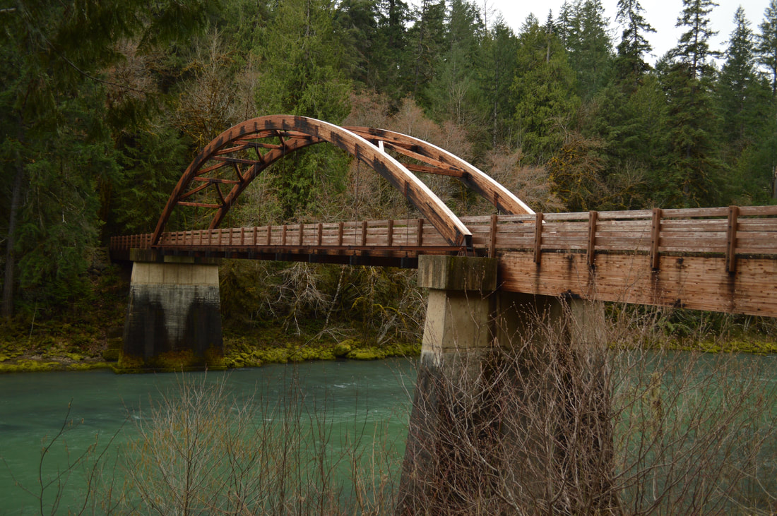
(Tioga Bridge)
Directions:
From Roseburg
- Drive OR-138 E towards Diamond Lake for a total of 32.3 miles. About 4.3 miles after the Tioaga Bridge, keep your eyes out for the Fall Creek Falls trailhead on your left. (Total of 36.6 miles)
|
To get a more in-depth and personal view of this hike, watch the YouTube video.
|
-This trail write-up was last updated April, 2023-
*All pictures are taken by Franziska Weinheimer *Disclaimer: The trail descriptions, mileage, GPS tracks and difficulty ratings depicted on this website are never 100% accurate. Always hike at your own risk, using your own knowledge, equipment and common sense. Franziska Weinheimer/Hike Oregon are not responsible if you or anyone in your party gets injured or lost while attempting one of these or any other hikes.
|