Underrated Fall Foliage Hikes in Oregon
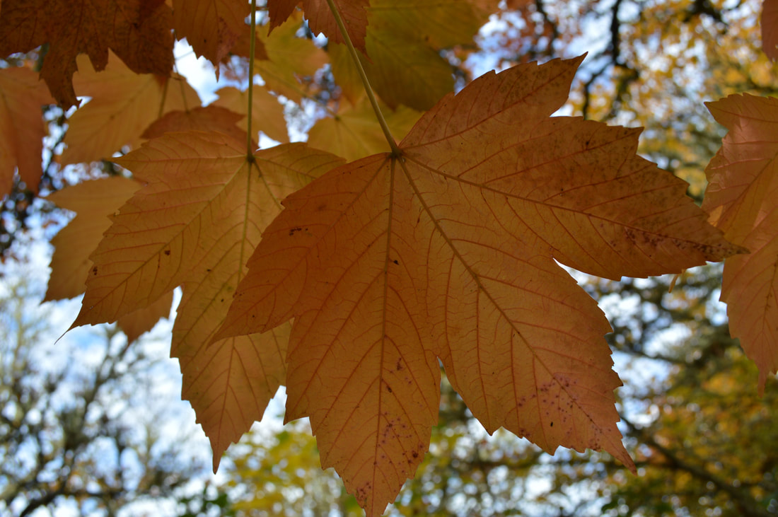
Because there are so many evergreen trees here in Oregon, most people don't think about spectacular fall foliage when they think about this state. There are definitely some gorgeous areas where fall foliage is in abundance and the bright reds, yellows, and deep orange colors pop out among the dark evergreens. Fall is a beautiful time of year in Oregon, and here are some of the best underrated fall foliage hikes in the Central Oregon Cascades and Coast area for everyone to enjoy!
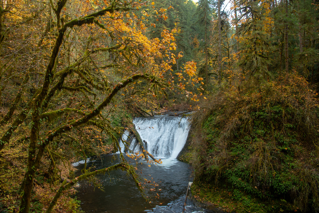
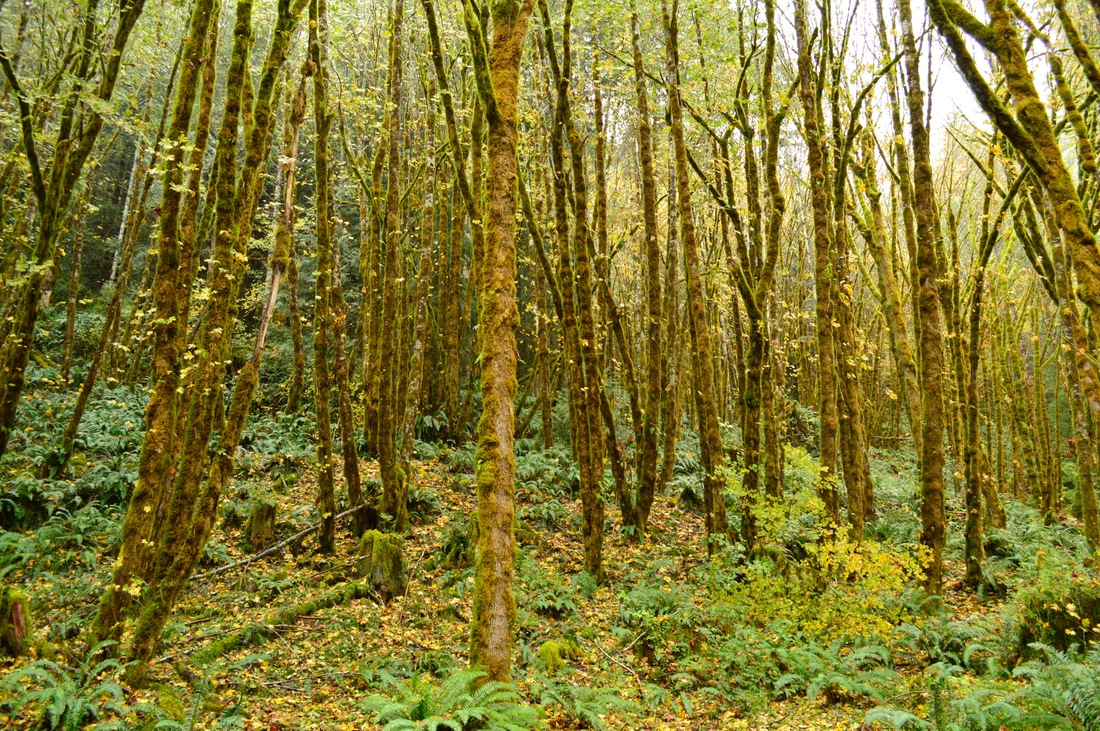
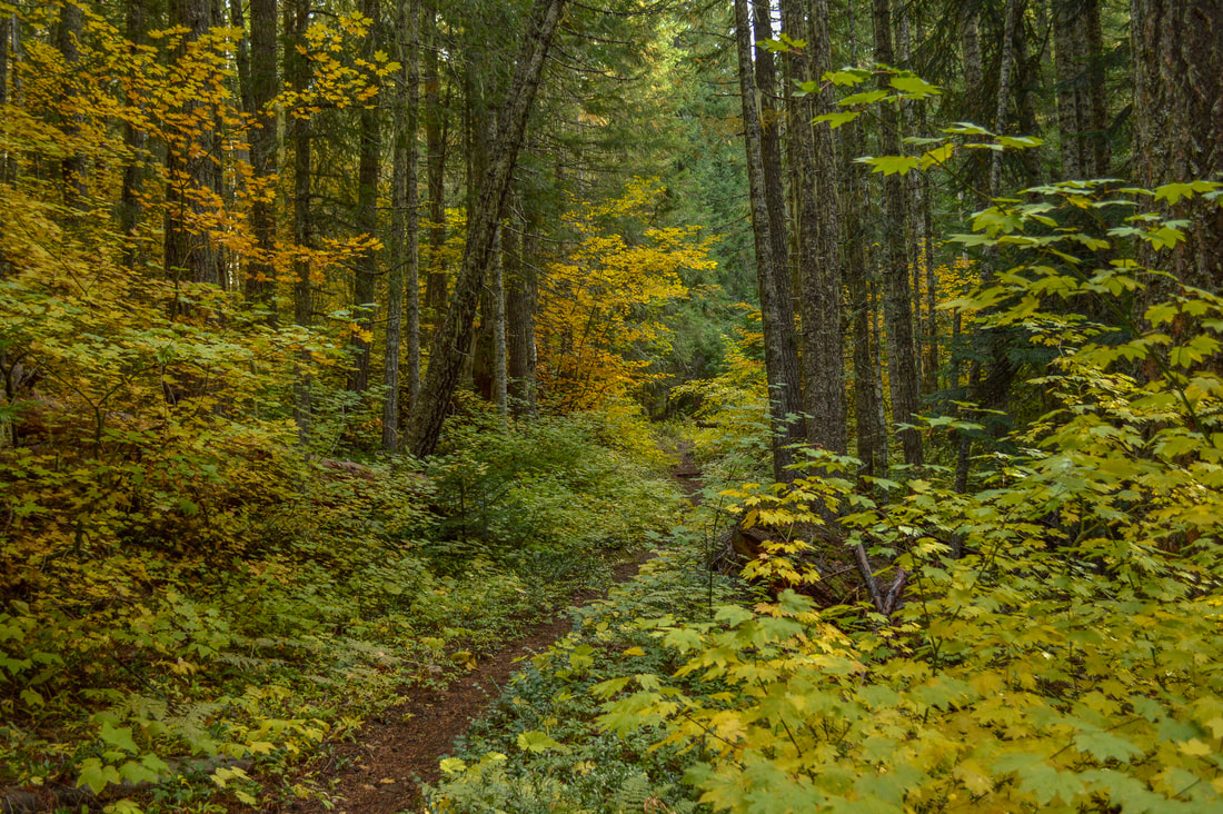
1) Silver Falls State Park

|
|
Closest town: Silverton
Trail type: Loop
Mileage: 8.6 loop w/ 1,480 ft. elevation gain
Terrain difficulty: Easy to moderate (trail can be slippery on wet days).
Trail usage: Heavy on weekends
About the hike: This 8.6 mile loop is absolutely fantastic for seeing some fall foliage along with 10 gorgeous waterfalls! This is one of Oregon's most iconic hikes, and what better time to do it than in the fall when the vine maple turns bright yellow among the dark green old growth trees and vibrant moss.
(Click here to read more about this hike and to get directions)
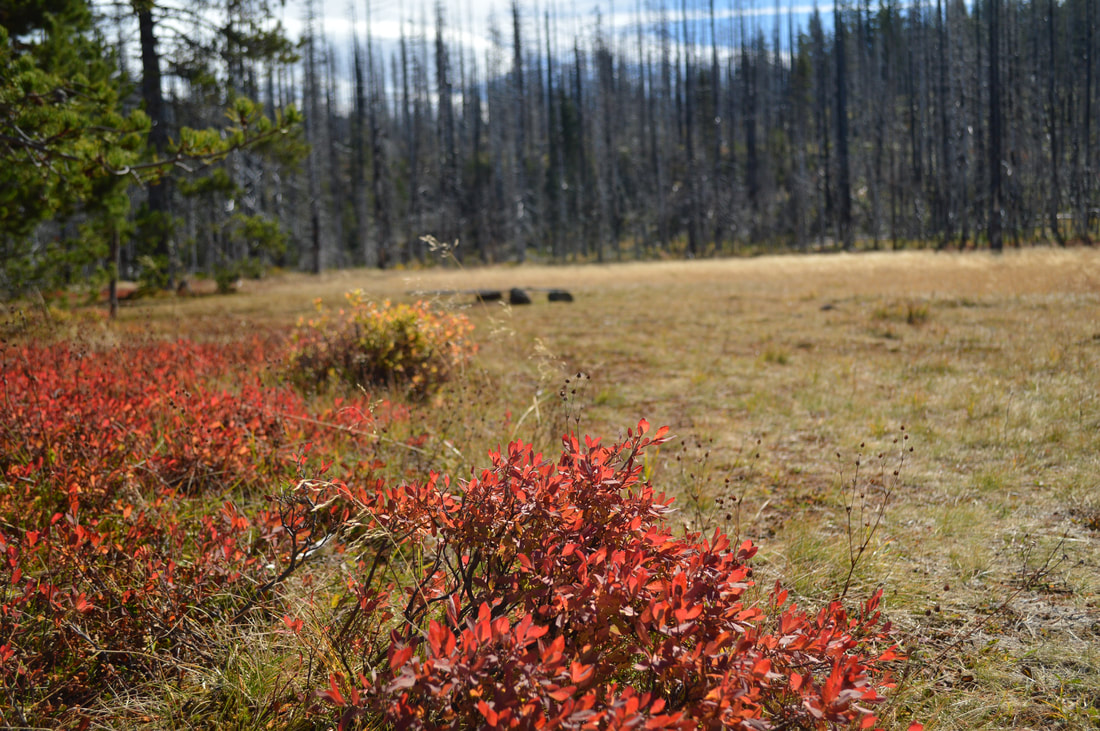
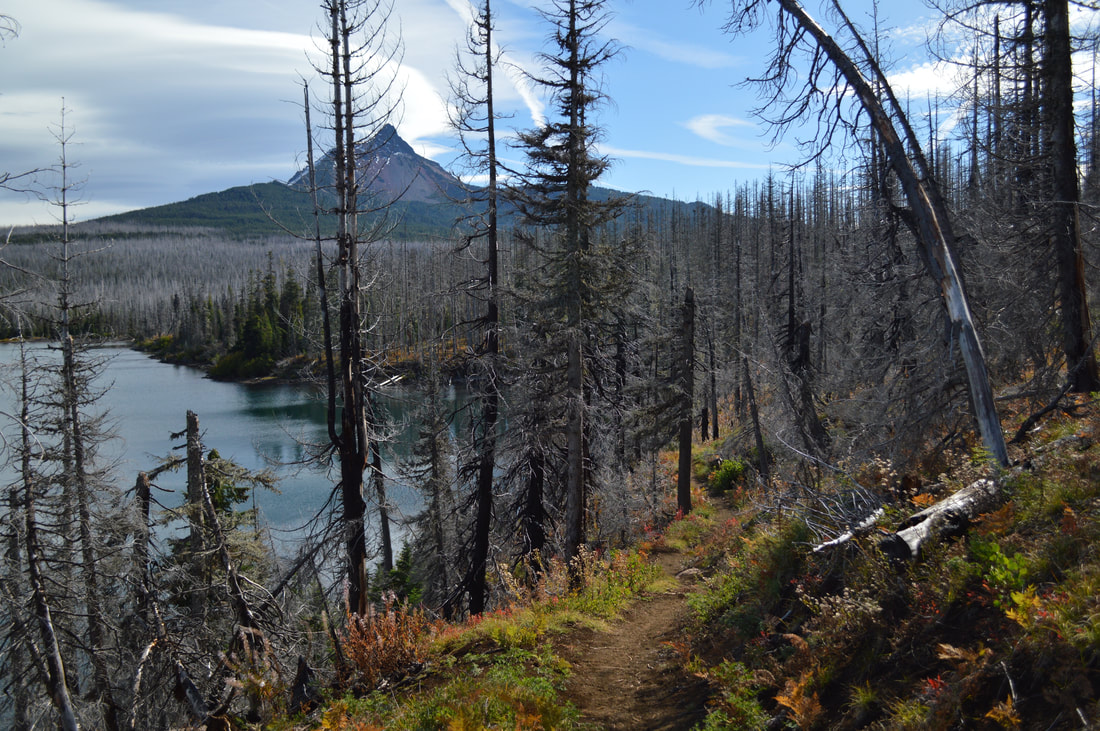
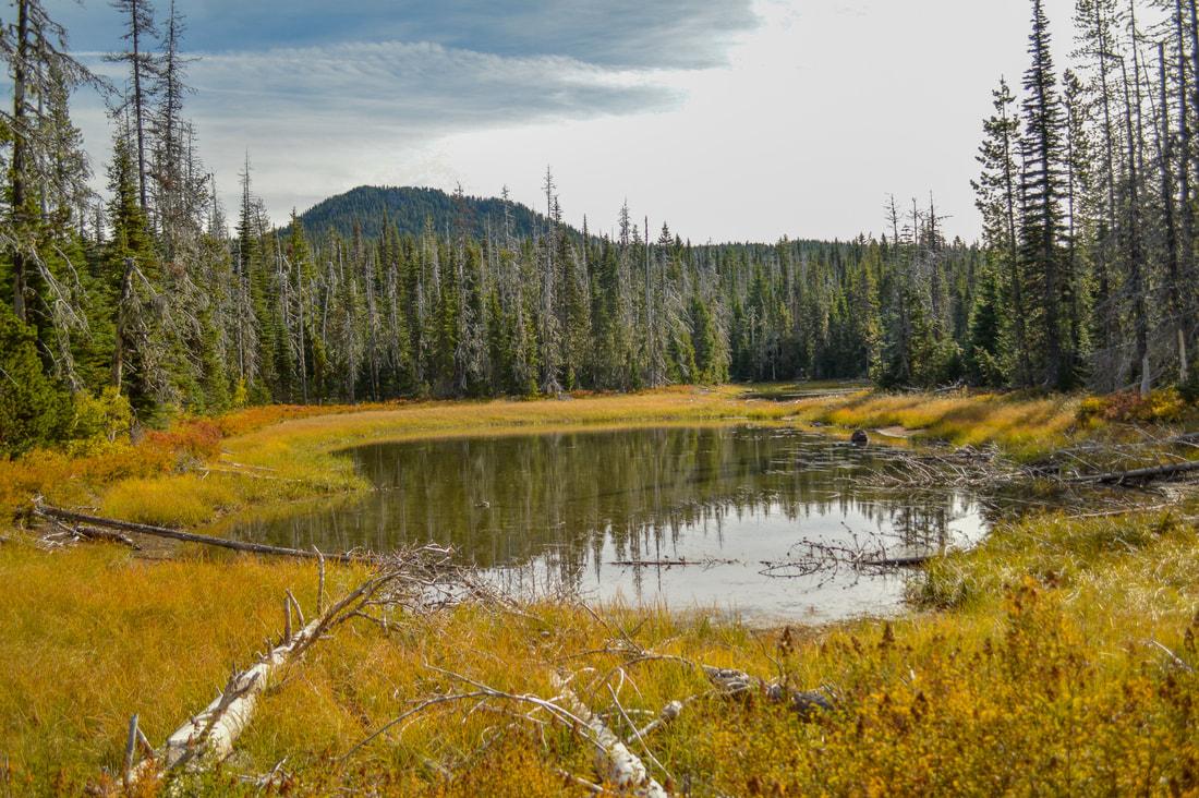
2) Patjens Lakes
|
|
Closest town: Sisters
Trail type: Loop
Mileage: 6.75 loop w/ 965 ft. elevation gain
Terrain difficulty: Easy (trail is very flat and straight forward. No large rocks or roots).
Trail usage: Light
About the hike: This easy 6.75 mile loop is one of the higher elevation hikes best done in early October before the snow falls. A lot of the hike takes you through burn and beetle kill area so you wouldn't think this to be a beautiful fall foliage hike, however the many bushes along the hike turn blood red, and the meadows turn an almost orange color. Contrast that with the clear blue Central Oregon sky and views of Mt. Washington, we couldn't think of a better hike this time of year!
(Click here to read more about this hike and to get directions)
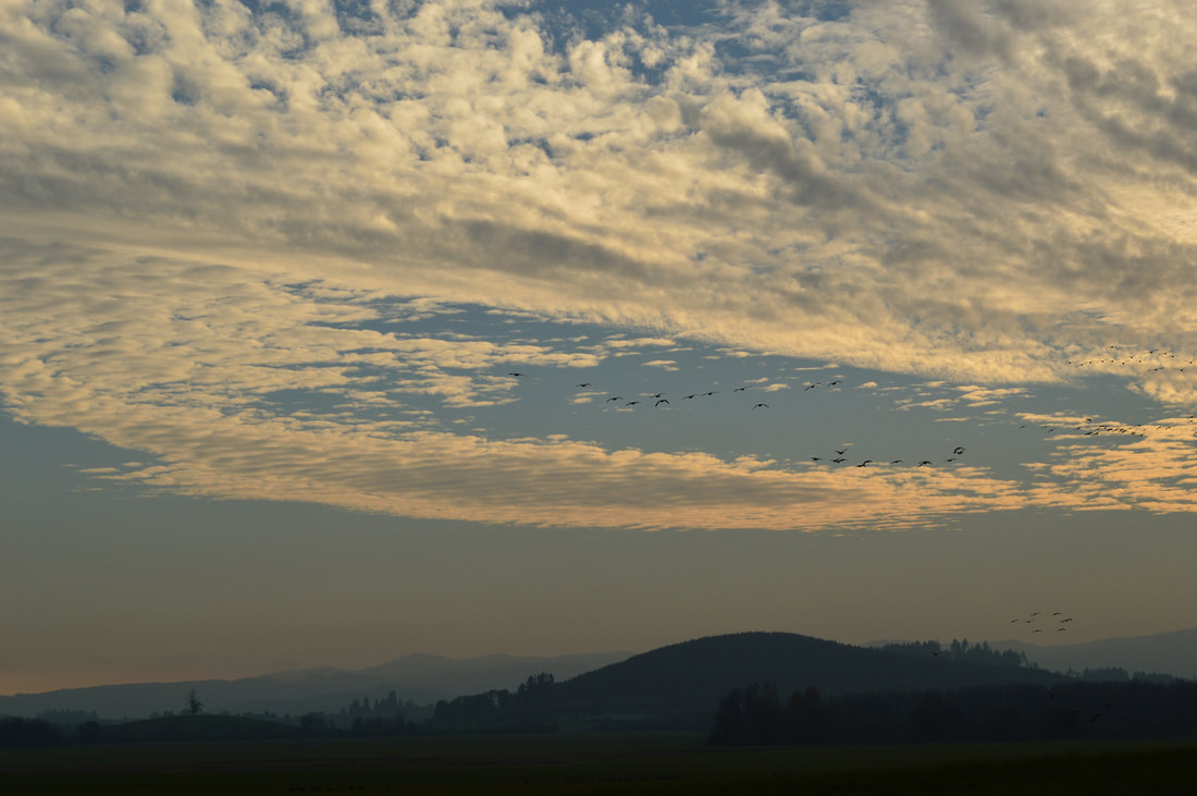
3) William Finley Wildlife Refuge
|
|
Closest town: 4 miles to Monroe & 10 miles to Corvallis
Trail type: Out and back as well as loop options
Mileage: 1/2 a mile up to 10 mile trails and loop options
Terrain difficulty: Easy (trails are very flat and straight forward. No large rocks or roots).
Trail usage: Light
About the hike: William L. Finley National Wildlife Refuge is a hidden gem in between Eugene and Corvallis. Not many people are familiar with this area, but it is a beautiful place to see lots of wildlife including migrating and native birds, herons, osprey, many species of duck, owls, and deer. There are a total of 12 miles of various hiking trails and loops around the refuge, including boardwalks where you can view waterfowl, and historic buildings where birds nest. Fall is a great time to visit the refuge because you will not only see tons of fall foliage, you will also see many geese and birds migrating south.
(Click here to read more about this hike and to get directions- this post is for members only, you can purchase the seasonal membership for $9.99)
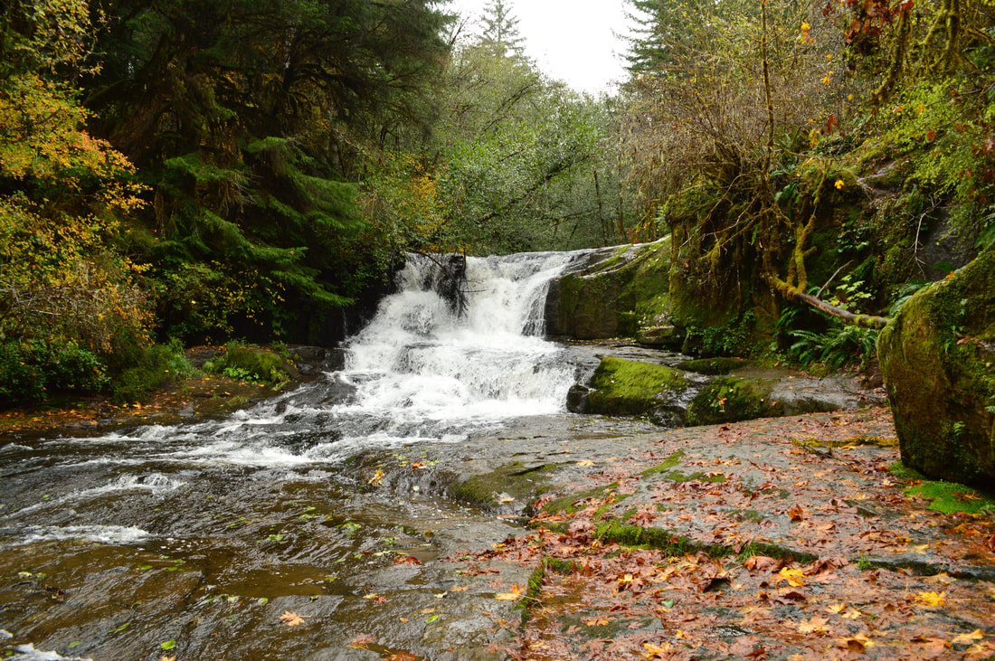
4) Alsea Falls & Green Peak Falls
|
|
Closest town: Alpine & Corvallis
Trail type: Out and back and small loop
Mileage: 4.7 miles out and back w/ 1,620 ft. elevation gain
Terrain difficulty: Easy (trails are very well maintained due to this also being a mountain bike area).
Trail usage: Moderate
About the hike: Alsea Falls recreation area offers some beautiful hiking options for fall foliage viewing. There is a 4.7 mile loop with a short out and back over to Green Peak Falls that features lots of Aspen, Birch and Maple trees among the evergreens.
(Click here to read more about the hike and to get directions)
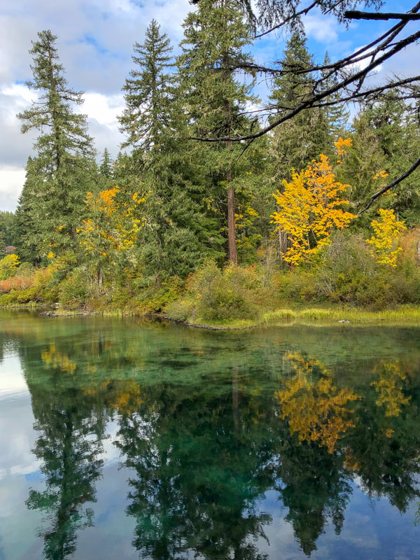
5) Clear Lake
Closest town: McKenzie Bridge
Trail type: Loop Mileage: 5.5 mile loop w/ 570 ft. elevation gain Terrain difficulty: Easy (trails are very well maintained due to this also being a mountain bike area). Trail usage: Medium to high on the weekends About the hike: Clear Lake is a wonderful loop to take your whole family on, and it is one of the best places to take fall foliage pictures. The entire lake shore is overgrown with vine maple which change colors beautifully in the fall. The bright colors in contrast with the evergreen trees and the crystal clear water of the lake, make for some stunning pictures! (Click here to read more about the hike and to get directions) |
|
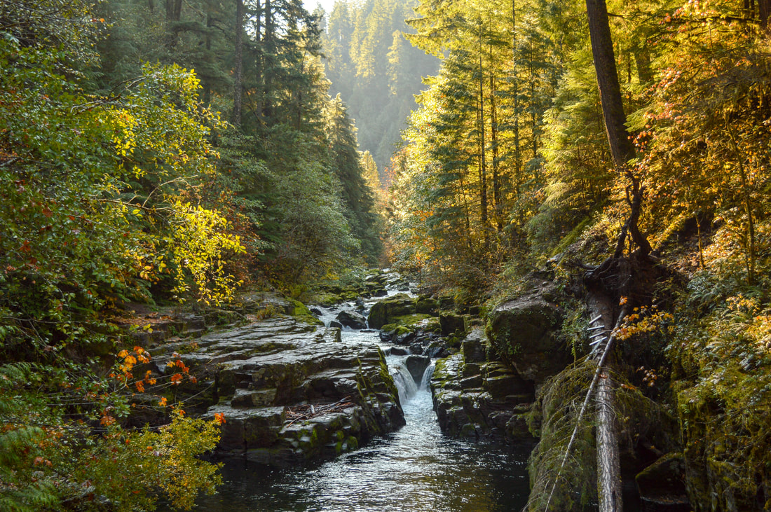
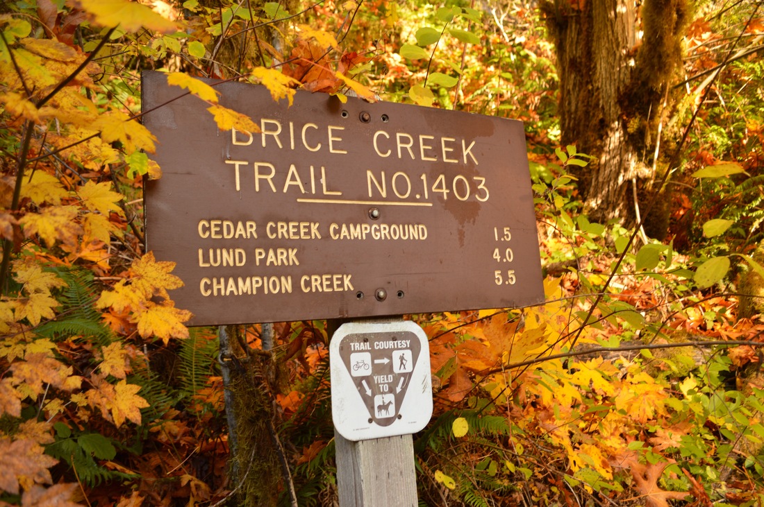
6) Brice Creek
|
|
Closest town: Cottage Grove
Trail type: Out and back
Mileage: 11 miles w/ 1,350 ft. elevation gain
Terrain difficulty: Moderate (trail is very well maintained due to this also being a mountain bike trail, but it can get a bit muddy when it has been raining a lot).
Trail usage: Low to moderate on the weekends
About the hike: Brice Creek is a beautiful trail right along a creek. The many big leaf maple trees nestled among the old growth evergreen trees turn a bright yellow and orange at the end of September and well into October. This beautiful trail is close to town and also offers fall camping options if you want to explore more of the area.
(Click here to read more about the hike and to get directions)
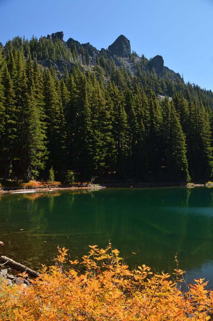
7) Divide Lake
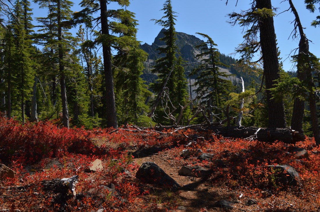
Closest town: Oakridge
Trail type: Out and back Mileage: 8 miles (to Divide Lake) 9.4 miles (to Mt. Yoran) w/ 2,215 ft. elevation gain Terrain difficulty: Moderate (trail is well maintained with some rocks and a steep incline). Trail usage: Low About the hike: Divide Lake is one of the most underrated fall hikes. Most people don't think of the Diamond Peak Wilderness as a great place to see fall colors, but what most people don't realize is that the forest here is littered with Huckleberry bushes which turn a bright yellow, orange and red in the fall time. When the autumn sun shines on these bushes that are lining the turquoise lake, it literally takes your breath away! (Click here to read more about the hike and to get directions) |
|
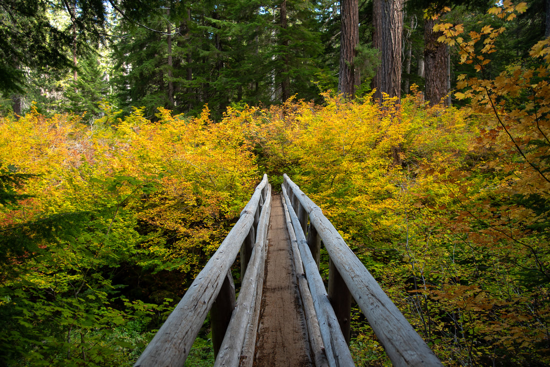
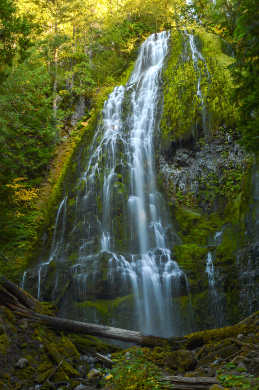
8) Proxy Falls
|
Closest town: McKenzie Bridge
Trail type: Loop Mileage: 2 miles w/ 250 ft. elevation gain Terrain difficulty: Easy Trail usage: High on weekends About the hike: Proxy Falls is a beautiful easy hike off of McKenzie Scenic Byway 242 which is only open for a few months out of the year (usually mid-June to early November, but it depends on snowfall). Most people tend to stop here in the summer to enjoy the refreshing spray and cool air among the giant trees, but coming here in autumn is such a treat! You will get to experience this trail with less people around and the vine maples turn from yellow to crimson around October. (Click here to read more about the hike and to get directions) 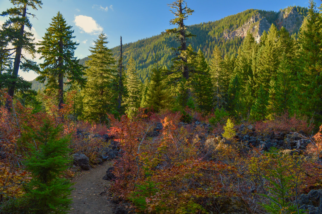
|
9) Maxwell Butte
|
|
Closest town: Idanha
Trail type: Out and back
Mileage: 9.75 miles w/ 2,515 ft. elevation gain
Terrain difficulty: Difficult
Trail usage: Low
About the hike: Maxwell Butte is one of the best view-laden hikes in the Santiam Pass area and it is most definitely worth the climb! In the fall this trail becomes a rainbow of color from the vine maples, huckleberry bushes and grasses that all turn bright yellow, orange and crimson red! This hike absolutely has it all, hiking through the forest, open areas with lakes and high Cascade mountain views from the top.
(Click here to read more about the hike and to get directions)
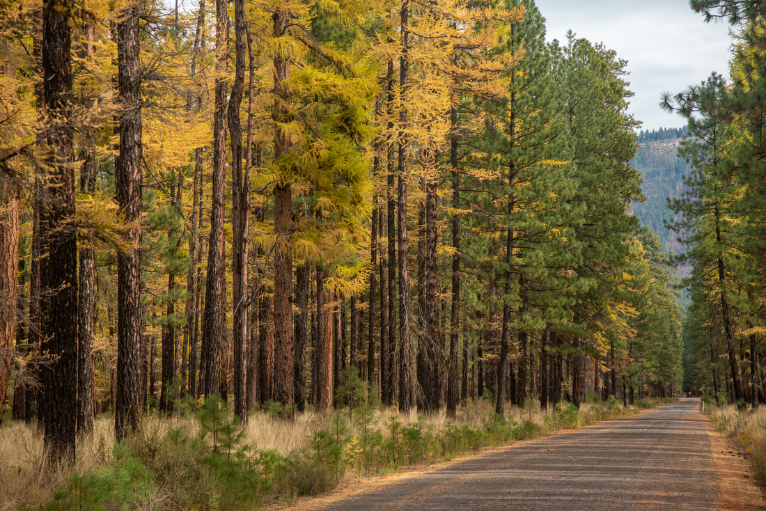
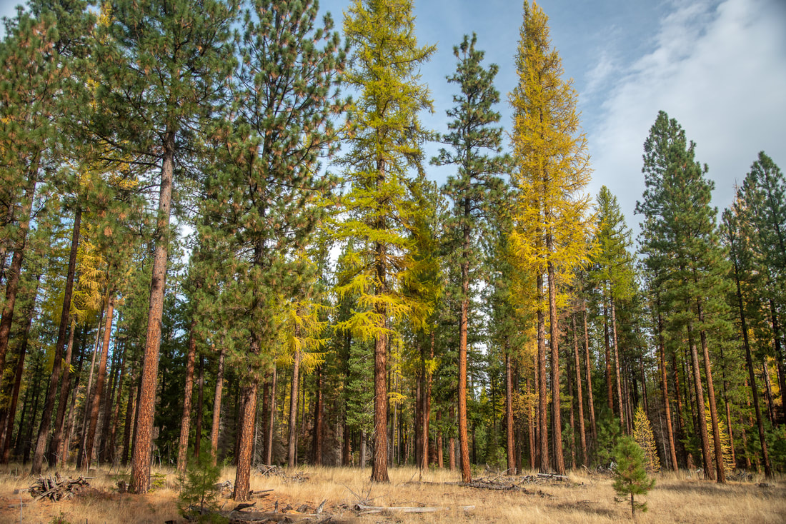
10) Metolius Preserve
|
|
Closest town: Sisters
Trail type: Loop
Mileage: 2.8 miles w/ 60 ft. elevation gain
Terrain difficulty: Easy
Trail usage: Medium during prime larch season
About the hike: The Metolius Preserve is 1,240 acres of protected forest and offers 10+ miles of easy trails open for foot and bike traffic. At the preserve you can see over 80 species of birds throughout the year, elk, deer, black bears, cougar and bobcats. Lake Creek flows through the preserve and is home to otters, beavers and redband trout, Chinook salmon and sockeye salmon. During the fall season the preserve is a great place to see the Western larch trees that grow in groves here, their needles turning a beautiful bright golden yellow during the end of October/early November.
(Click here to read more about the hike and to get directions)
*All pictures unless otherwise marked are taken by Franziska Weinheimer
*Disclaimer: The trail descriptions, mileage, GPS tracks and difficulty ratings depicted on this website are never 100% accurate. Always hike at your own risk, using your own knowledge, equipment and common sense. Franziska Weinheimer/Hike Oregon are not responsible if you or anyone in your party gets injured or lost while attempting one of these or any other hikes.