Tumalo State Park
& Riley Ranch Nature Reserve
Hike details:
Mileage: 4 miles round trip w/ 90 ft. elevation gain
6.6 mile lollipop loop w/ 286 ft. elevation gain
Approximate hike time: 1 hour 44 minutes w/ an average pace of 2.3 mph (4 miles round trip)
2 hours 52 minutes w/ an average pace of 2.3 mph (6.6 mile lollipop loop)
Difficulty: Easy to moderate
Trail usage: High on weekends, low to medium on weekdays depending on the weather and season
Highest elevation: 3,484 ft. Lowest elevation: 3,170 ft.
General location: 7 miles north of Bend - Tumalo State Park
Accessible: Year-round
(Best time to go is April, May and June. Summer months July, August and early September tend to be hot. October and November are gorgeous as well. This trail can be icy in the winter months of January and February is there is snow in Bend).
Permits required: Oregon State Park pass or $5 day pass available at the park entrance
Pit toilet at trailhead: Yes
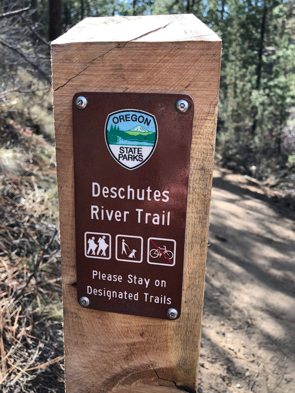
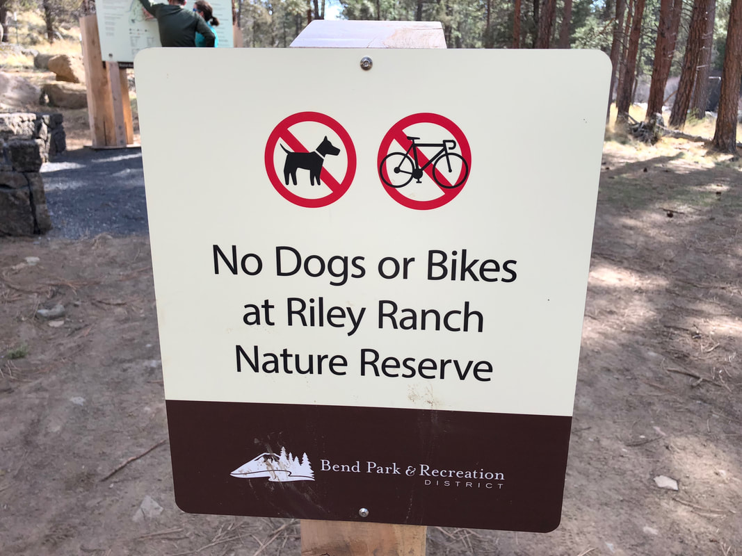
Trail allows: Dogs on leash at Tumalo State Park ONLY, dogs are NOT allowed at Riley Ranch Reserve.
Possible dangers: N/A
6.6 mile lollipop loop w/ 286 ft. elevation gain
Approximate hike time: 1 hour 44 minutes w/ an average pace of 2.3 mph (4 miles round trip)
2 hours 52 minutes w/ an average pace of 2.3 mph (6.6 mile lollipop loop)
Difficulty: Easy to moderate
Trail usage: High on weekends, low to medium on weekdays depending on the weather and season
Highest elevation: 3,484 ft. Lowest elevation: 3,170 ft.
General location: 7 miles north of Bend - Tumalo State Park
Accessible: Year-round
(Best time to go is April, May and June. Summer months July, August and early September tend to be hot. October and November are gorgeous as well. This trail can be icy in the winter months of January and February is there is snow in Bend).
Permits required: Oregon State Park pass or $5 day pass available at the park entrance
Pit toilet at trailhead: Yes
Trail allows: Dogs on leash at Tumalo State Park ONLY, dogs are NOT allowed at Riley Ranch Reserve.
Possible dangers: N/A
|
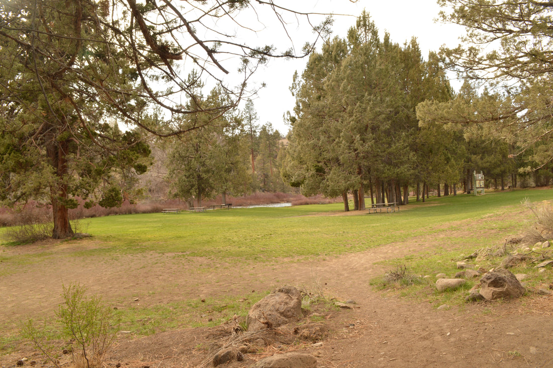
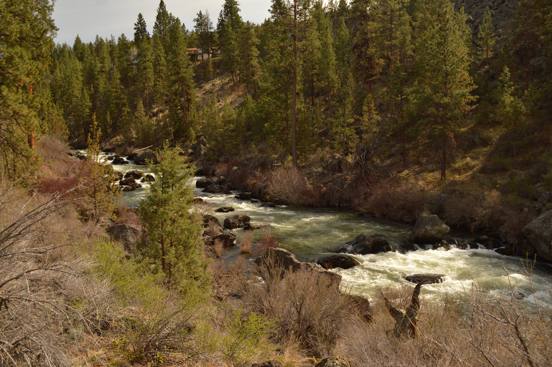
Description:Tumalo State Park is a wonderful recreation area only 7 miles northwest of downtown Bend where you can camp, swim, fish, and hike. Don't confuse this with the hike called Tumalo Falls or Tumalo Mountain, which are both in totally different places, but also near Bend. Tumalo State Park is right on the Deschutes River which is lined with reeds and beautiful red bushes as well as large ponderosa pines.
|
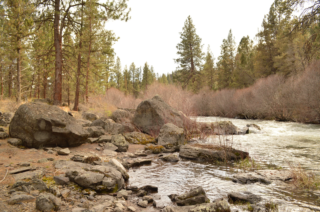
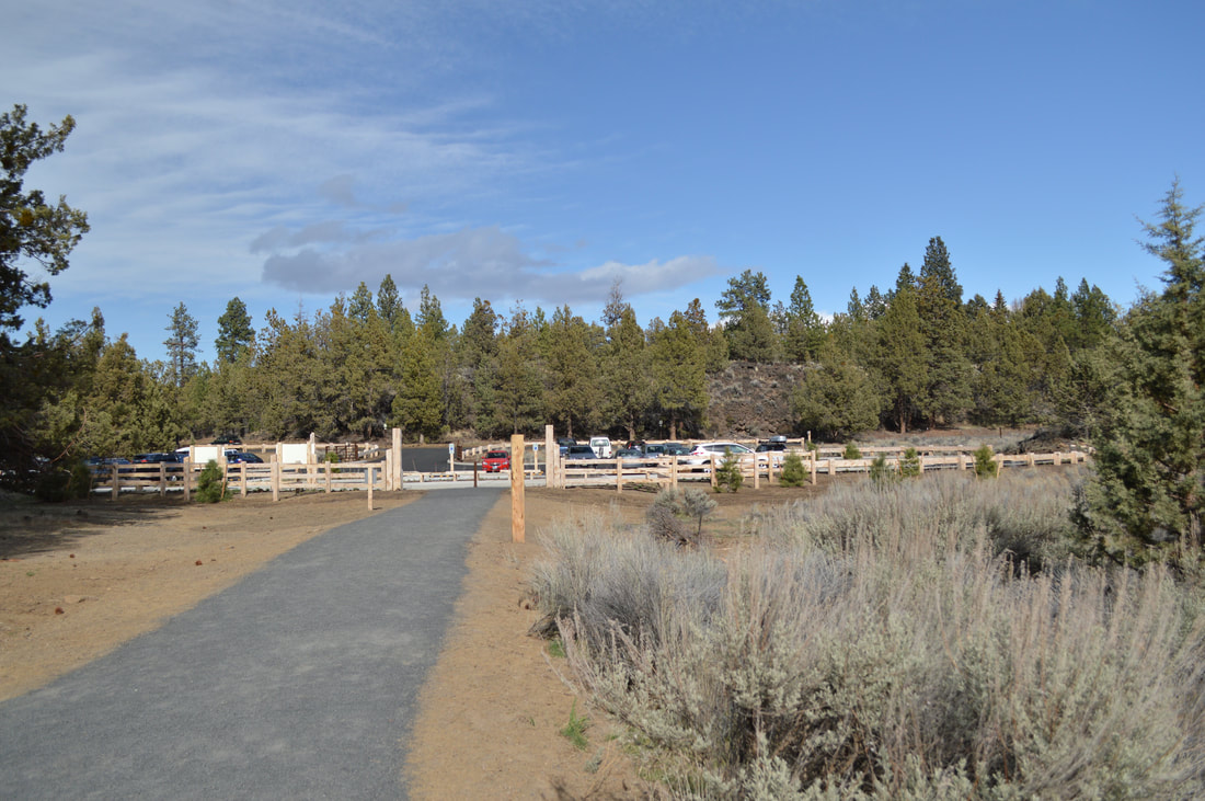
There is only one trail that goes up and down the river, so you can't miss it. The main day use parking is by the designated recreation area, across the road from the Tumalo State Campground. The trail that goes downstream starts at the campground and the trail that goes upstream starts at the day use area. Hiking downstream is a very dusty and open trail that goes for about two miles. There is little shade here, however on this side you do have better access to slow river water where you could easily take a swim in the summer.
|
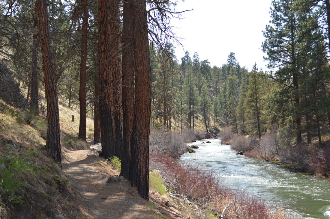
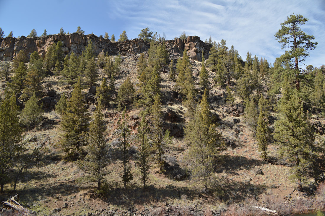
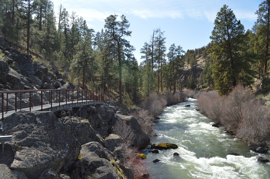
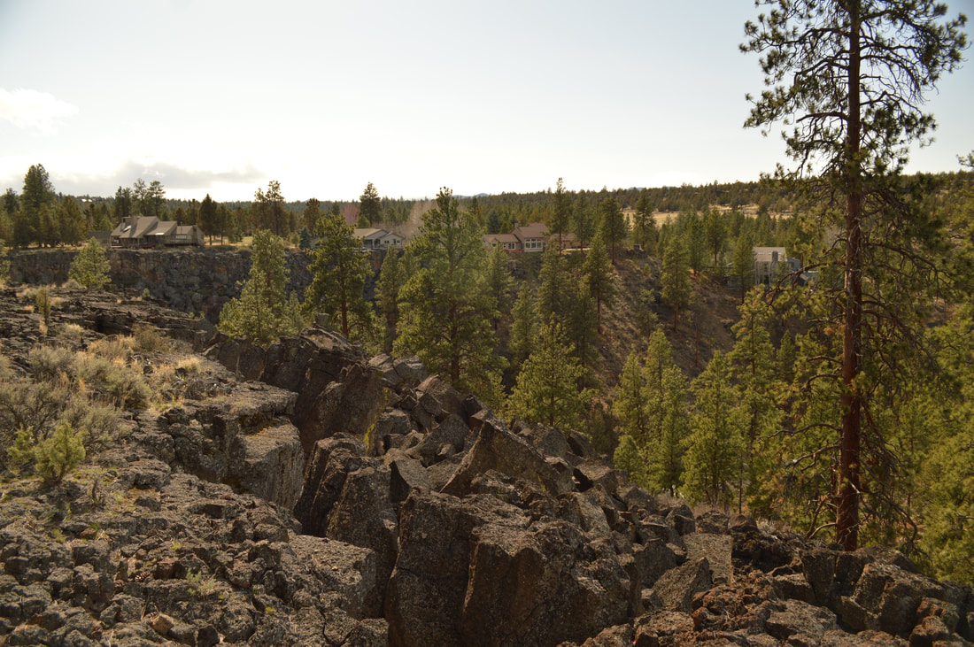
The trail that goes upstream is very beautiful and a little more rugged. This particular section of the Deschutes River Trail goes into a canyon with high bluffs on either side and a new continuation of the trail was opened in January 2018, leading all the way to Riley Ranch Nature Reserve and the many loop trails there.
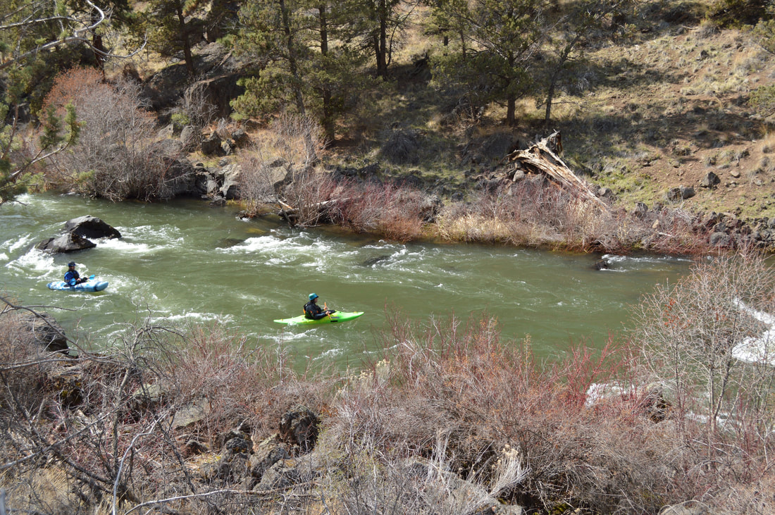
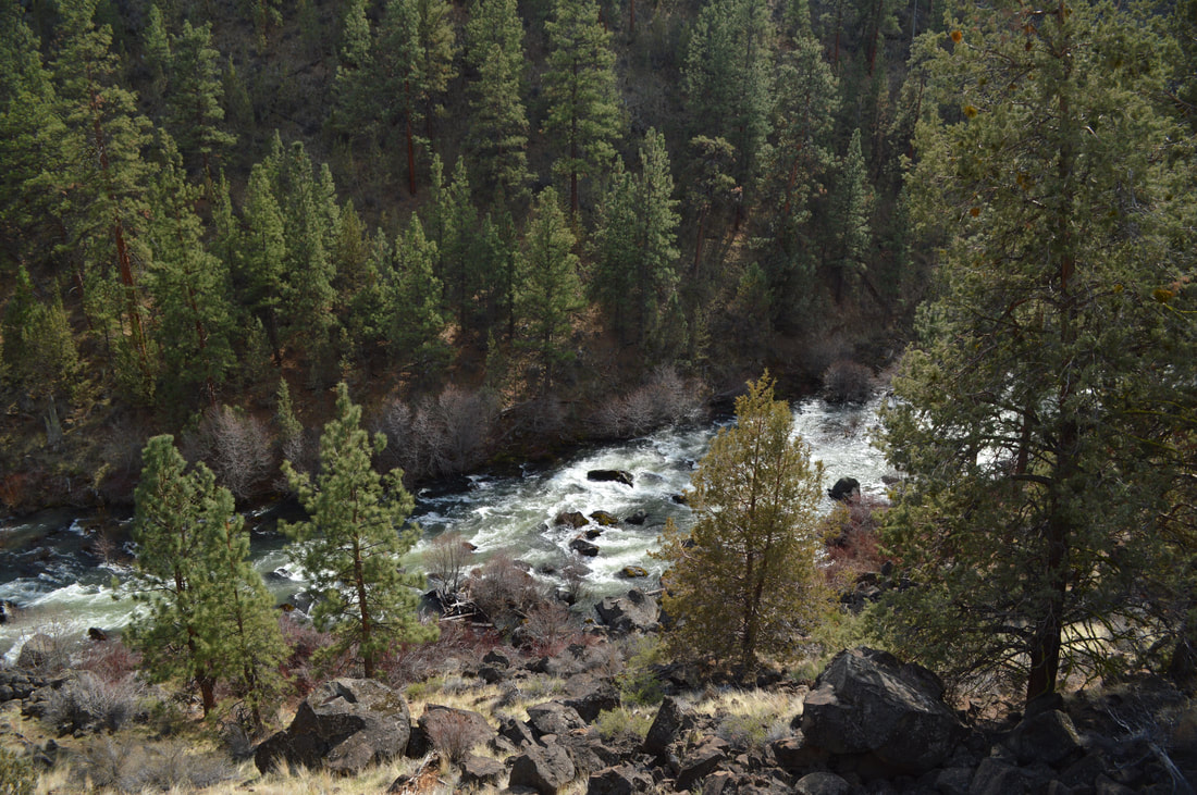
This section of the river is about 15-25 feet wide, and in almost every season you can see kayakers passing by. The big rocks and bushes at the river's edge also allow for excellent fishing if you have an Oregon fishing license! The river is blue-green in color, the bushes right at the river's edge are red in the winter time, and the huge Ponderosa pines and rugged rocks create some of the most beautiful images. If you are wanting to do some nature and landscape photography, this is the place to go. |
|
|
|
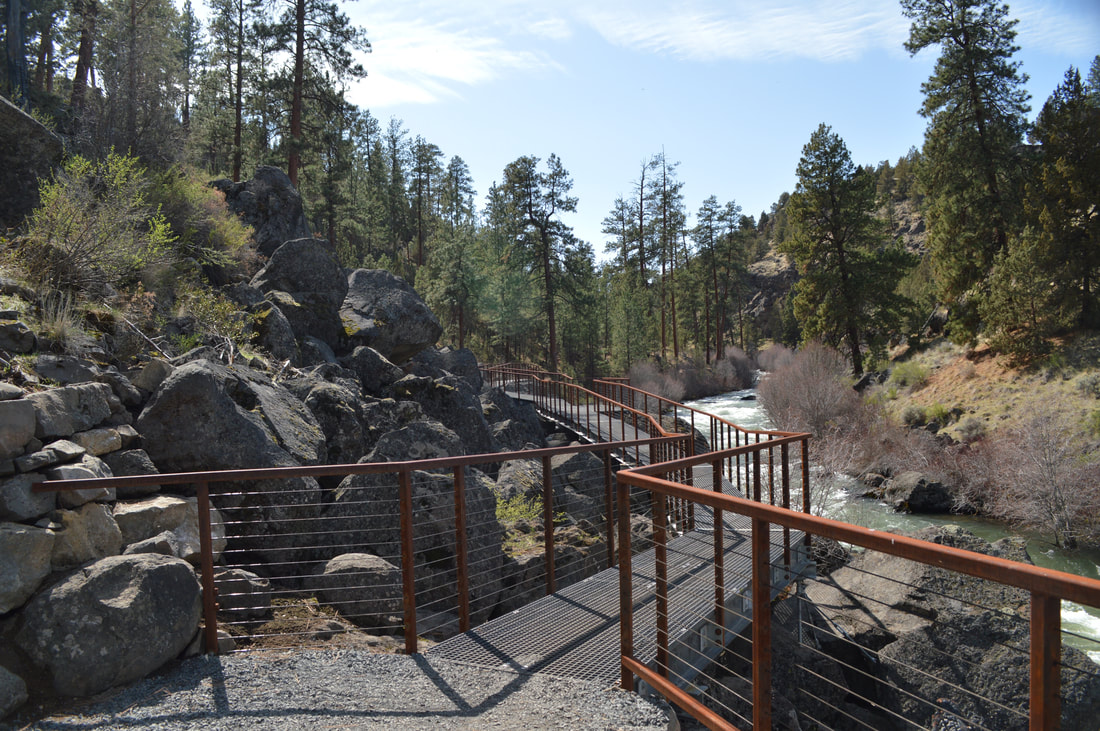
The trail is very easy and at the 1.5 mile mark it used to disappear into a large hillside of boulders. A beautiful bridge has been built to cross the boulders safely and the trail now continues until you hit the boundary for Riley Ranch Nature Reserve.
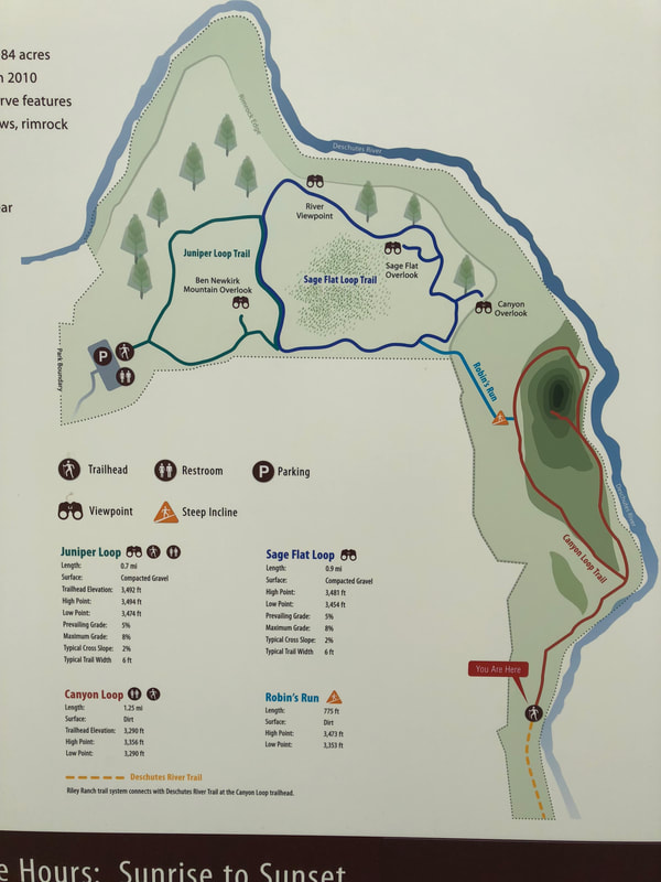
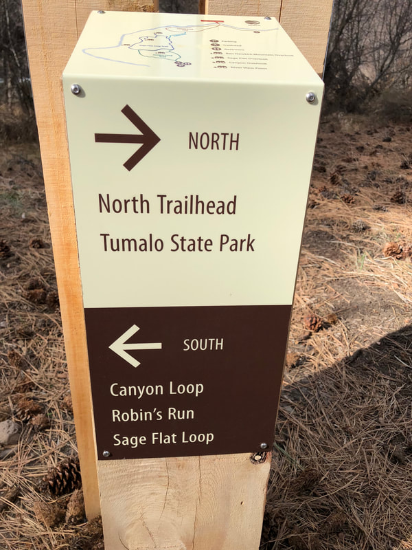
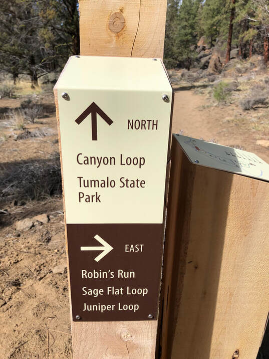
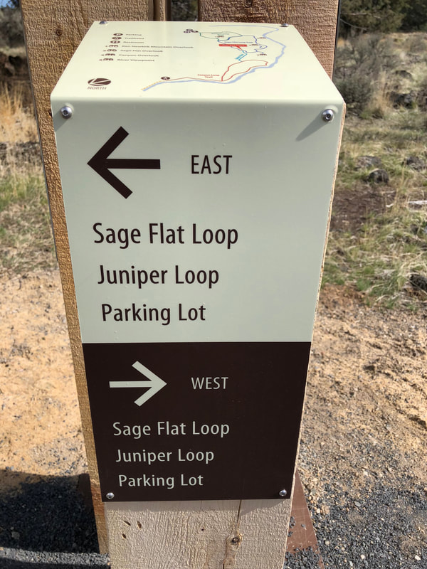
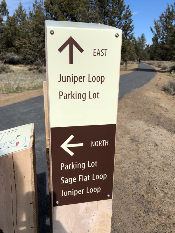
The Deschutes River Trail does allow dogs, but once you get to Riley Ranch Nature Reserve you will have to turn around as there are no dogs allowed. You will also see a big board with a nice comprehensive map on it. I suggest taking a picture of the map with your phone because the many sign posts throughout the reserve can get a little bit confusing and it's easy to forget what trail you're on. Each trail is its own short loop and |
the mileage is on the map so you can essentially make the hike as long as you want. If you want to do the Deschutes River Trail and all of the loops at Riley Nature Reserve, you will hike a total of 6.6 miles. If you just want to hike the Deschutes River trail and decide to turn around at Riley Nature Reserve, you will end up hiking a total of 4 miles.
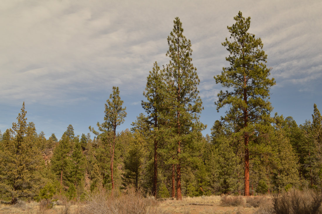
(large ponderosa pine trees)
|
|
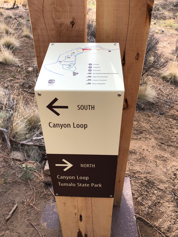
Start on the Canyon Loop Trail and walk through beautiful meadows with giant Ponderosa pine trees to your left and the beautiful Deschutes River on your right. When you come to a sign post, head to the right and you will start the loop portion of the Canyon Loop Trail. This section of trail continues along the river some more.
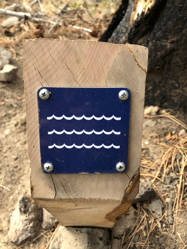
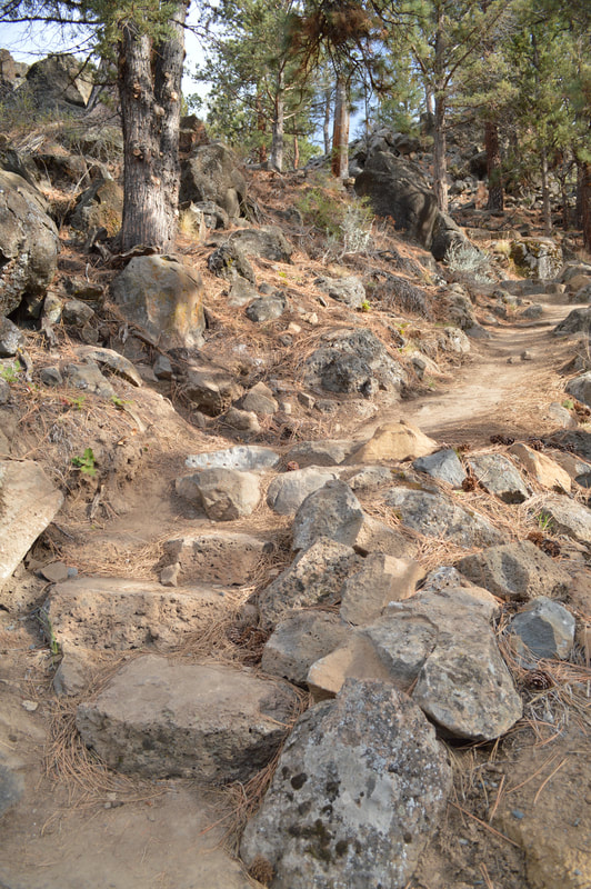
There are special posts with blue signs on them that mark the paths that you are allowed to take down to the river. The river is very beautiful and there is a lot of wildlife so to follow Leave No Trace Principles, please do not make your own trail down to the river or perpetuate a foot path that does not have one of these signs. After coming to another sign, you will continue onto Robin's Run, the only steep part of this entire hike, which takes you from the river's bank up to a beautiful plateau. There are steps made out of rocks that have been built into the trail and there are a total of 7 switchbacks.
There are special posts with blue signs on them that mark the paths that you are allowed to take down to the river. The river is very beautiful and there is a lot of wildlife so to follow Leave No Trace Principles, please do not make your own trail down to the river or perpetuate a foot path that does not have one of these signs. After coming to another sign, you will continue onto Robin's Run, the only steep part of this entire hike, which takes you from the river's bank up to a beautiful plateau. There are steps made out of rocks that have been built into the trail and there are a total of 7 switchbacks.
|
|
|
|
|
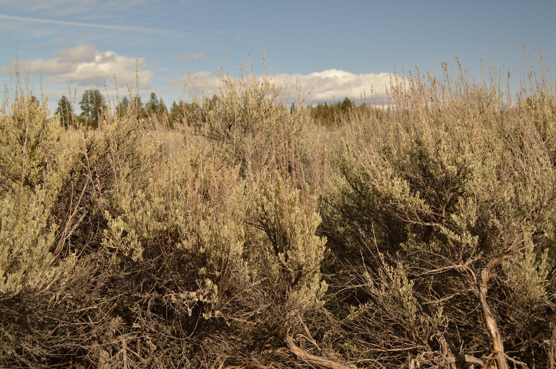
Once you have completed Robin's Run you will come to another trail split. Here you will continue to the right to start the Sage Flat Loop. Here all the trails are compacted gravel, which makes for a really nice and easy walk. You will see a quick detour to a lookout. Here you can see the canyon below as well as the Three Sisters on a clear day. Continue on the Sage Flat Loop and enjoy the huge field of sage to your left. This area is especially beautiful at golden hour and sunset. And if you come here early in the morning you are likely to see deer roaming around this area and eagles soaring high above the river. |

(viewpoint)
|
|
Continue on the Sage Flat Loop and you will see a Sage Flat overlook as well as a river overlook. The only thing that takes away from this really feeling like a nature reserve is that you can see houses built on the cliffs above the river. But the river below is absolutely beautiful and from above you can really see its blue-green color.
|
Once you get to another trail sign, you can either go right and do the short Juniper Loop, or you can go left and continue the Sage Flat Loop. The Juniper Loop is nothing special. The trail winds tightly through some Juniper trees and leads to the Riley Ranch Nature Reserve parking lot. If you have to use the restroom you can do so there.
|
|
|
On the way back you will just stay right at all of the trail junctions to continue the loops and head back to the Tumalo State Park parking lot. All of the signs are very clear, and if you think you are going to get confused just run a GPS track on your phone (via Gaia or Strava) and you will not get lost.
On your way back on the Canyon Loop trail you will see some historic artifacts such as an old wagon wheel and an axil, as well as the remains of an old settler's cabin. Please don't disturb these artifacts. The Deschutes River Trail at Tumalo State Park and Riley Ranch Nature Reserve offers some beautiful short hikes close to Bend. This area is accessible year-round and offers swimming, fishing, hiking and kayaking (kayaking for experts only)! This State Park is small, but totally worth going to especially during the off season when there aren't as many people. Whether you're wanting to just hike the 4 miles along the Deschutes river, or hike the entire way to Riley Ranch Nature Reserve, it is easy and perfect for the whole family! |
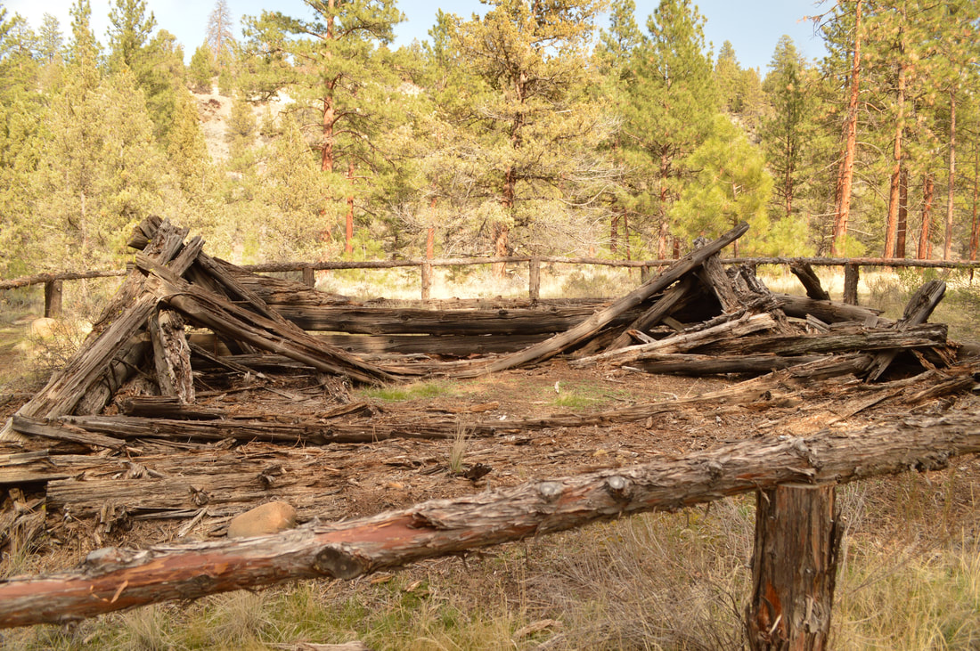
(remnants of old cabin)
Directions:
From Bend
- Drive 6.5 miles on US-20 towards Sisters until you see the sign for Tumalo State Park. Here you will turn left onto Old Bend Redmond Hwy. and take an almost immediate right onto O.B. Riley Rd. This road winds for about a mile until you see the campground on your left and across the bridge you'll see the recreation area on your right.
- Total of 123 miles via Sisters.
- Total of 126 miles via Sisters.
- Total of 160 miles via Redmond.
- Total of 179 miles via Bend.
-This trail write-up was last updated April 2018-
*All pictures are taken by Franziska Weinheimer
*All pictures are taken by Franziska Weinheimer
*Disclaimer: The trail descriptions, mileage, GPS tracks and difficulty ratings depicted on this website are never 100% accurate. Always hike at your own risk, using your own knowledge, equipment and common sense. Franziska Weinheimer/Hike Oregon are not responsible if you or anyone in your party gets injured or lost while attempting one of these or any other hikes.