Hike Oregon
  • Home
  • *Store*
  • About the author
  • How to use this site
  • Resources
    • Wildflowers
    • Videos
  • Best Oregon Hikes
    • 20 Epic Oregon Wildflower Hikes
    • Top 10 Oregon Spring Hikes
    • 20 Best Oregon Waterfall Hikes
    • Top 10 Oregon Hikes for Kids
    • 5 Weekend Backpacking Trips in Oregon
    • Top One Night Backpacking Trips in Oregon
    • Top Fall Foliage Hikes In Oregon
    • Top 10 Oregon Summer Hikes
    • Top 10 Swimming Spots In Oregon
    • Top 10 Oregon Fall Hikes
    • Sno-Parks In Central Oregon
    • Top 10 Oregon Winter Hikes
    • Top Low Elevation Winter Hikes
  • Oregon Sno-Parks
    • Maxwell Sno-Park
    • Potato Hill Sno-Park
    • Ray Benson Sno-Park
      • Brandenburg Shelter
    • Santiam Sno-Park
    • Three Creek Sno-Park
    • Virginia Meissner Sno-Park
      • Meissner Shelter Loop
      • Nordeen Shelter
    • Gold Lake Sno-Park
      • Westview Shelter to Eagle Rock Overlook
      • Marilyn Lakes Loop
  • Portland
    • Powell Butte
    • Forest Park
    • Hamilton Mountain
    • Latourell Falls
    • Multnomah/Wahkeena Falls
    • Dog Mountain
    • Coyote Wall
    • Mitchell Point
    • Table Rock
    • Tamanawas Falls
    • Trillium Lake
    • East Zigzag Mountain (members only)
  • Salem
    • Abiqua Falls
    • Silver Falls State Park
    • Marion Lake to Marion Mountain
    • Jefferson Park
  • Sweet Home
    • Crescent Mountain
    • Iron Mountain
    • McDowell Creek Falls
    • Middle Santiam River (members only)
    • Lower Soda Creek Falls (members only)
    • Rooster Rock (members only)
  • McKenzie Bridge/Blue River
    • Macduff Mountain
    • Proxy Falls
    • Clear Lake
    • Sahalie/Koosah Falls
    • Blue Pool
    • Erma Bell Lakes
    • Olallie Mountain
    • Horsepasture Mountain
    • Tidbits Mountain
    • Castle Rock
    • East Fork Trail (members only)
    • Rainbow Falls Overlook (members only)
    • Frissell Point (members only)
    • Chucksney Mountain (members only)
    • Substitute Point (members only)
  • Sisters/Santiam Pass
    • Coffin Mountain
    • Trappers Butte and Scar Mountain
    • Black Butte
    • Tam McArthur Rim
    • Black Crater
    • Scott Mountain
    • Obsidian Trail
    • Three Fingered Jack Loop
    • Square Lake
    • Canyon Creek Meadows
    • Patjens Lakes
    • Craig Lake (members only)
    • Chush Falls (members only)
    • Rockpile Lake (members only)
    • Santiam Lake (members only)
    • Camp Lake (members only)
    • Park Meadow to Golden Lake (members only)
  • Bend/Redmond/LaPine
    • Steins Pillar
    • Chimney Rock
    • Steelhead Falls
    • Tumalo State Park
    • Tumalo Falls
    • Tumalo Mountain
    • No Name Lake
    • Green Lakes
    • Moraine Lake
    • South Sister Summit
    • Muskrat Lake
    • Paulina Peak
    • Peter Skene Ogden Trail (members only)
  • Eugene
    • Ridgeline Trail
    • Mount Pisgah Summit
    • Mount Pisgah Arboretum
    • Shotgun Creek
    • Mount June
    • Lawler
    • Tire Mountain
    • Goodman Creek
    • Brice Creek
    • Trestle Creek Falls
    • Moon Falls
    • Elijah Bristow State Park
    • South Willamette Trail (members only)
    • Eula Ridge (members only)
    • Eagle's Rest (members only)
  • Oakridge
    • Deception Creek
    • North Salmon Creek
    • Grasshopper Ridge
    • Larison Creek
    • Bunchgrass Ridge
    • Salt Creek Falls
    • Waldo Lake Loop
    • South Waldo Loop
    • The Twins
    • Rosary Lakes
    • Fawn Lake
    • Windy Lakes
    • Divide Lake
    • Diamond Peak Summit
    • Cowhorn Mountain
    • Wall Creek Warm Springs (members only)
    • Moon Point (members only)
    • Bobby Lake (members only)
    • Lillian Falls (members only)
    • Middle Fork Willamette Trail (members only)
    • Pool Creek Falls (members only)
    • Dead Mountain (members only)
    • Larison Rock (members only)
    • Eddeeleo Lakes (members only)
    • Waldo Mountain Lookout (members only)
    • Blair Lake to Mule Mountain (members only)
    • Rigdon Lakes loop (members only)
  • Oregon Coast
    • Cascade Head
    • Drift Creek Falls
    • Sweet Creek Falls
    • Alsea Falls
    • Kentucky Falls
    • Marys Peak North Ridge
    • Marys Peak East Ridge
    • Cape Perpetua Loops
    • Hobbit Trail to Heceta Head
    • North Fork Smith River (members only)
    • Cummins Ridge (member's only)
    • Horse Creek (members only)
    • Siltcoos Lake (members only)
    • William Finley Wildlife Refuge (members only)
  • Southern Oregon
    • Fall Creek Falls
    • Watson Falls
    • Wild Rogue Loop
    • Mt. Thielsen
    • The Watchman
    • Mount Scott
    • The Pinnacles
    • Lower Table Rock
    • Pilot Rock
    • Wagner Butte
    • Mt. McLoughlin
    • Lemolo Falls (members only)
    • Fern Falls (members only)
  • Eastern Oregon
    • Painted Cove
    • Mount Howard
    • Anthony Lake Loop
    • Schneider Cabin (members only)
    • Strawberry Lake & Falls (members only)
  • Oregon PCT sections
    • PCT: OR-58 to Charlton Lake
    • PCT: Santiam Pass to Rockpile Lake
  • Tips & Tricks
    • Leave No Trace
    • Top Tips For Hiking With Infants And Toddlers
    • Poison Oak, Ivy and Sumac
    • How to dress for cold weather hikes
    • Hiker Holiday Gift Guide 2019
    • Outdoor Holiday Gift Guide 2018
    • Hiking Holiday Gift Guide 2017
  • Reviews
    • Outdoor Herbivore Backpacking Food Review
    • Osprey Aura AG 65 Backpack review
    • Big Agnes Fly Creek UL2 review
    • REI Quarter Dome 1 review
  • Adventure Stories
    • Hiking The Rae Lakes Loop
    • 110 Miles on the PCT
    • The Loop Around Three Fingered Jack
    • Jefferson Wilderness

Potato Hill Sno-Park

​

Potato Hill Summit & Hashbrown Loop

​
Get the printable version of this hike

Hike details:

Mileage: 4 miles round trip w/ 1,100 ft. elevation gain (Jack Pine Road out and back) OR 
7.4 miles w/ 1,390 ft. elevation gain (Potato Hill Summit and Hashbrown Loop)
Approximate hike time: 4 hours 6 minutes w/ an average pace of 1.8 mph (for the entire loop)
Difficulty: Moderate to difficult (depending on if you have to break trail)
Trail usage: Low on weekdays, medium on sunny weekends
​
Highest elevation: 5,190 ft. Lowest elevation: 4,045 ft.
General location: 24 miles west of Sisters - Willamette National Forest
Accessible: Year-round 
(The sno-park trails are accessible for winter recreation as soon as about 2 feet of snow have accumulated, usually by mid-December. This one generally melts out some time around late March or early April).
Permits required: Sno-park pass is required from November 1 - April 30 for parking.
Pit toilet at trailhead: No
Trail allows: Dogs on leash, snowshoeing, cross-country skiing
Possible dangers: Snow cornice (overhangs) at the summit of Potato Hill.
Picture
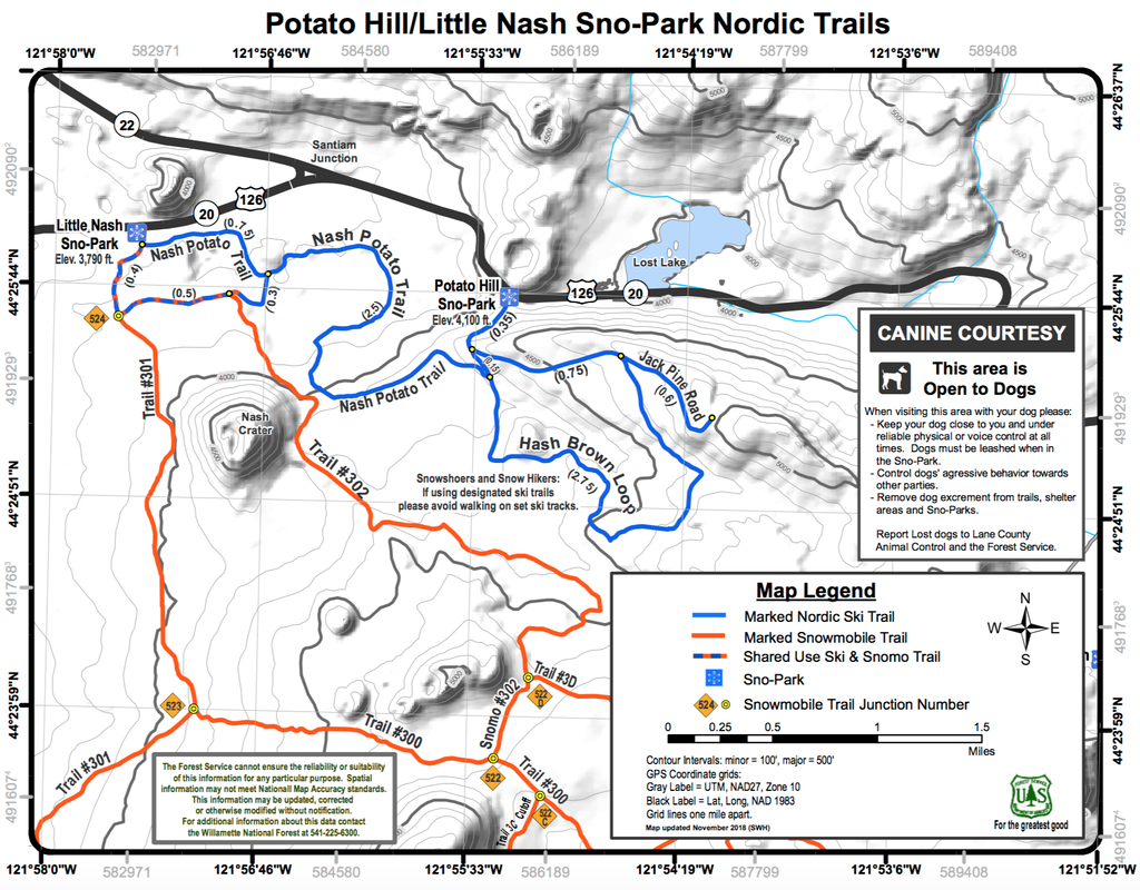
(map of the entire Potato Hill Sno Park - click to enlarge)
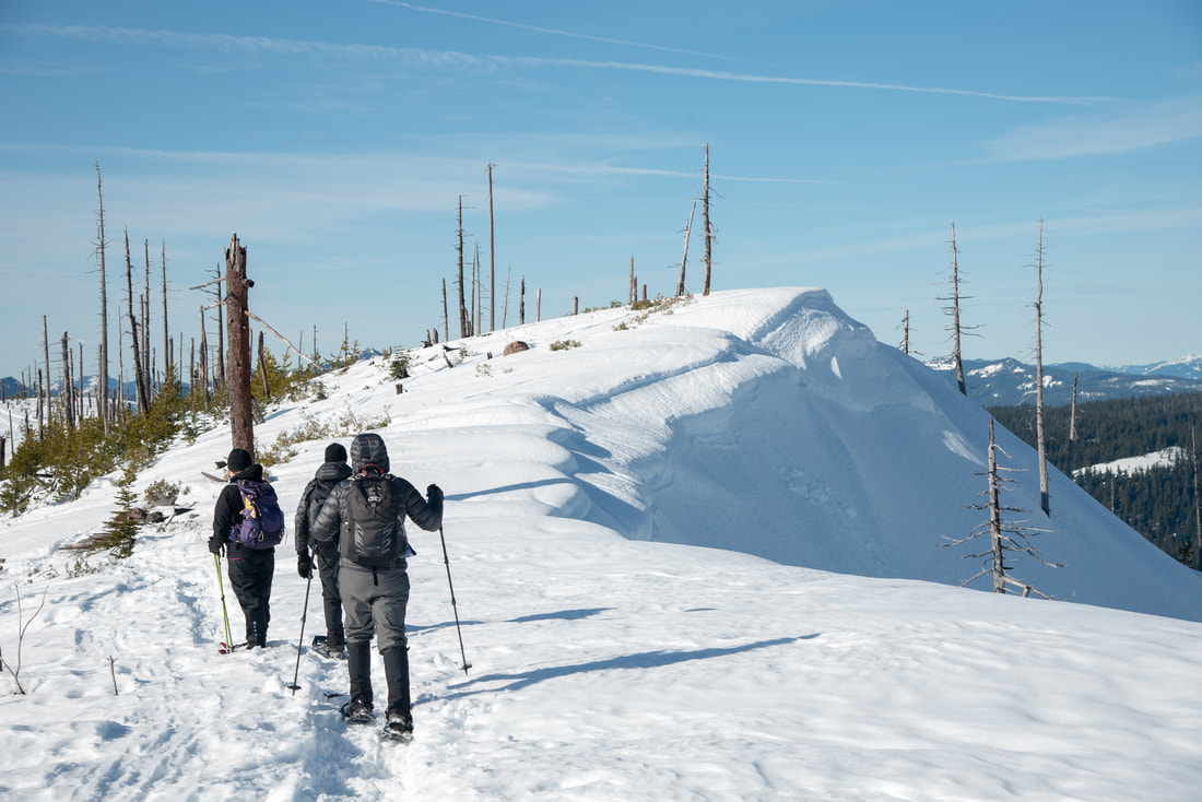
Potato Hill Sno-Park is one of the smaller sno-parks in the Central Oregon Cascades, but can be combined with nearby Little Nash Sno-Park, especially if you're on cross-country skis or a snowmobile. If you are snowshoeing, the Hash Brown Loop and/or going up Jack Pine Road and the summit of Potato Hill will make for a great all-day excursion. 
Potato Hill Sno Park start of trail
Hash Brown loop trail Potato Hill Sno Park
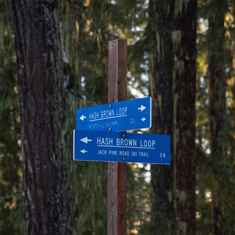
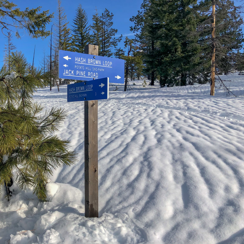
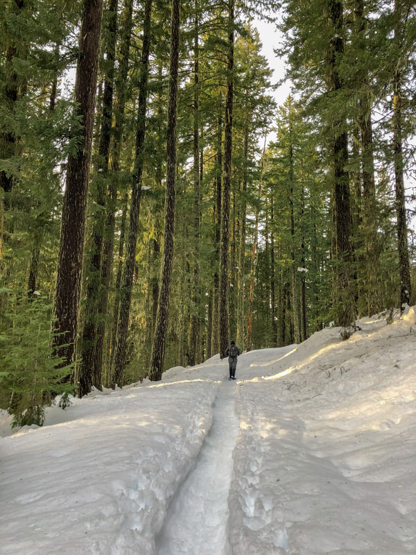
Potato Hill Sno-Park has a small parking area that will fit about 20 cars and it is one of the few sno-parks that does not have a pit toilet. The trailhead has a large map and the beginning of the trail is a wide road that winds uphill for 0.36 miles to a sign. The entire sno-park is very well marked with blue signs and blue diamonds. To start the Hash Brown Loop and/or go up Jack Pine Road/Potato Hill Summit, you will take a left at the sign. The road/trail continues through the forest for another 0.87 miles to another sign. Here the views start opening up and you will have to make a decision on what length you want your trip to be. 
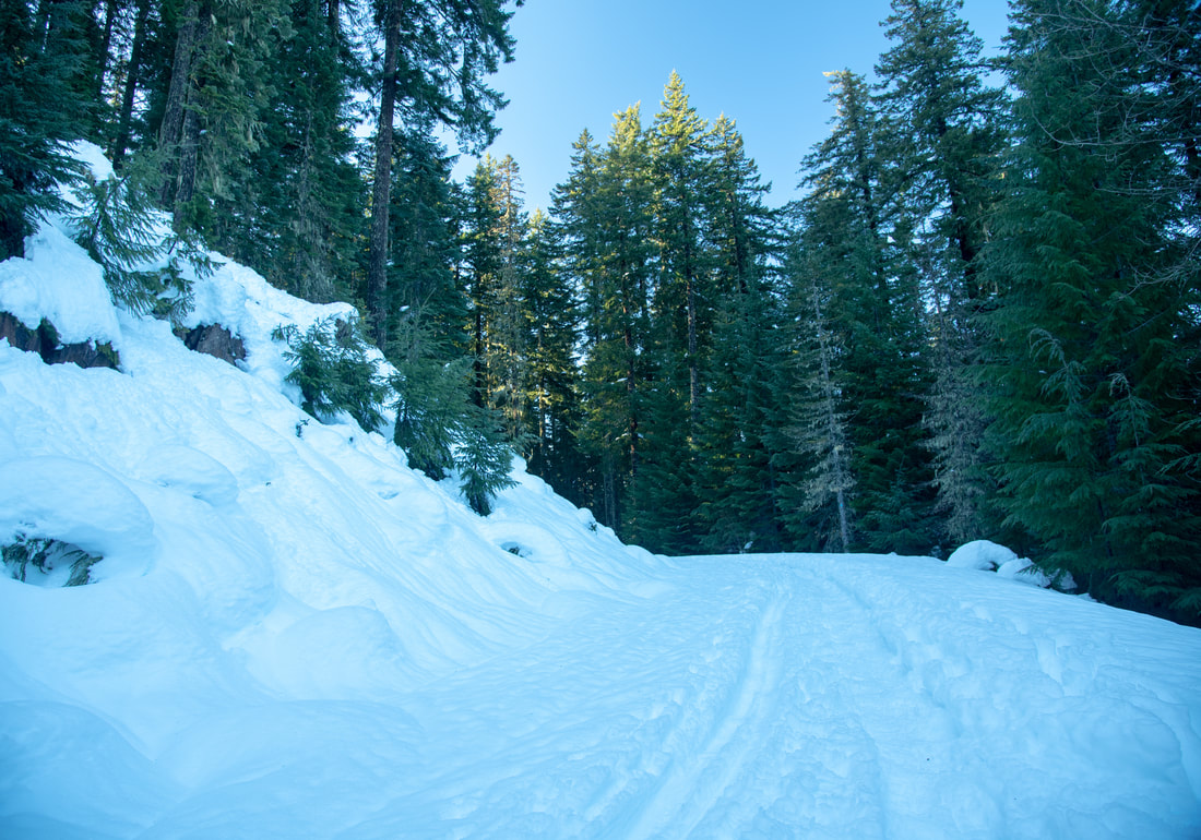
Hash Brown Trail To Jack Pine Road Potato Hill Sno Park
(Jack Pine Road)
Jack Pine Road Ski Trail Sign Potato Hill-Sno Park
Potato Hill Sno Park side trail to viewpoint
If you are looking for a shorter 4 mile round trip excursion, you can opt to go up Jack Pine Road and summit Potato Hill for those spectacular views and then head back down. If you would like to extend your trip, you can summit Potato Hill and then head back down and complete the Hash Brown Loop, which is a 7.4 mile trek.
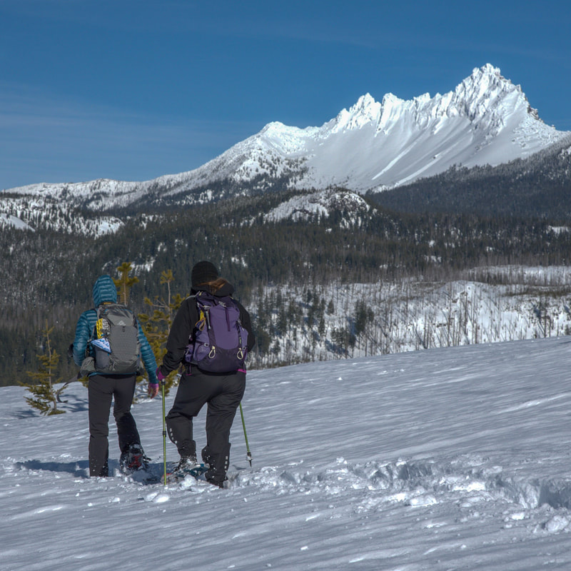
Regardless of the route you choose, at the Jack Pine Road and Hash Brown Loop sign there is a nice little 0.2 mile out and back to a gorgeous viewpoint that everyone should take. Take a left at the sign through the burnt trees and it will lead you to the edge of the hillside where you can see Lost Lake and Three Fingered Jack. 
Lost-Lake-and-Three Fingered Jack view Potato Hill Sno Park
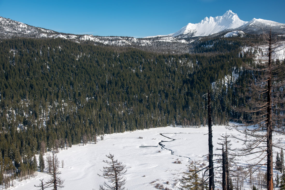
(Lost Lake and Three Fingered Jack from viewpoint)
Jack Pine Road Potato Hill Sno Park
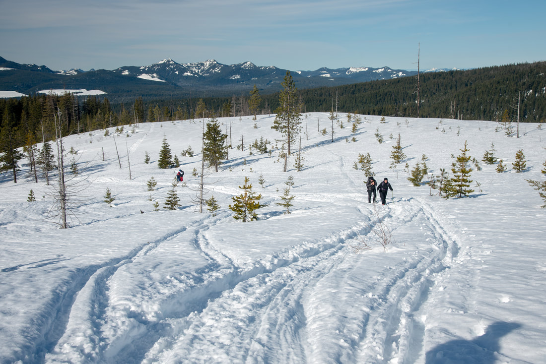
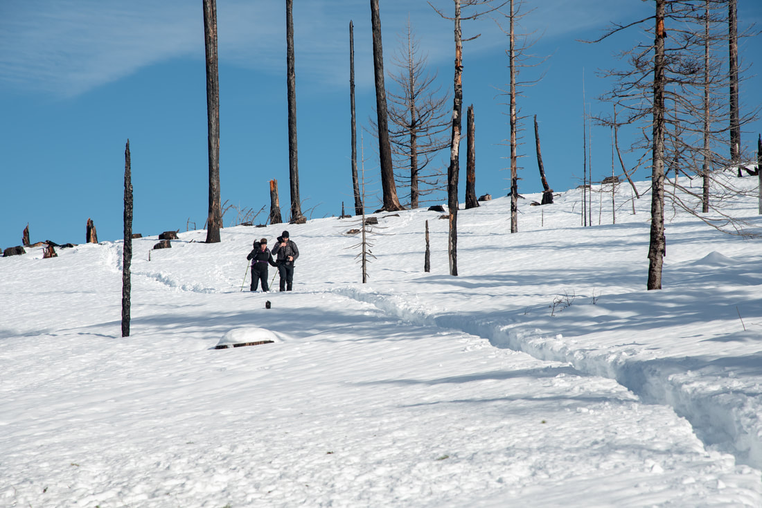
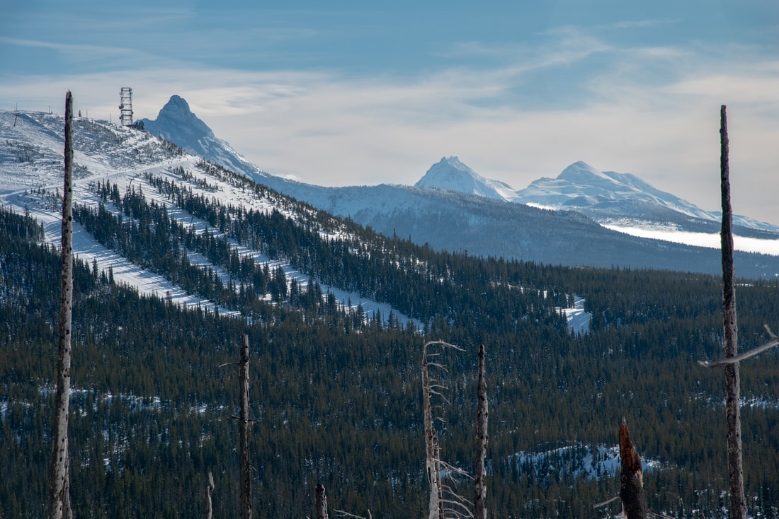
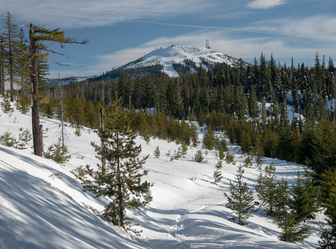
After the viewpoint side excursion, continue up Jack Pine Road. Here the terrain starts to open up and tracks start going all over the place. Continue heading uphill for 1.1 miles to the summit of Potato Hill. The views along the way and from the top are incredible. You can see the old cascade crest to the west, Sand Mountain and Hoodoo close by, as well as Mt. Jefferson and Three Fingered Jack to the north. To the south you will see Mt. Washington as well as the Three Sisters, and to the east you will see Black Butte and highway 20 winding over Santiam Pass. 
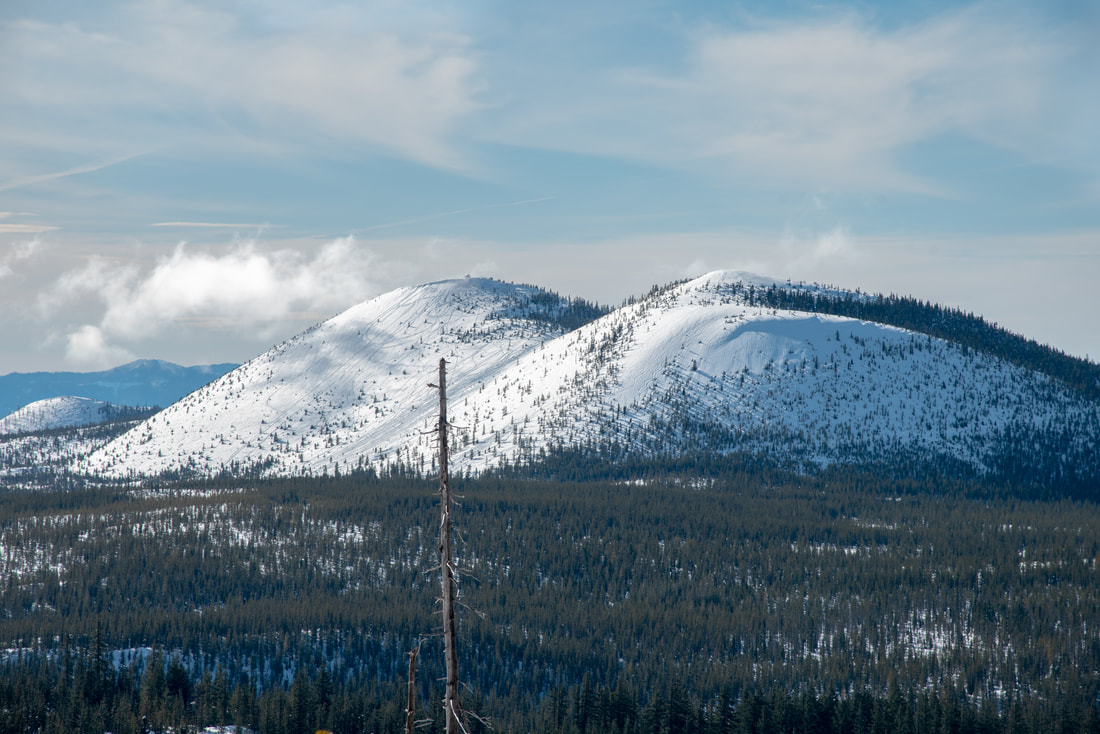
View of Sand Mountain Potato Hill Sno Park
(Sand Mountain)
Mt. Jefferson and Three Fingered Jack view from Potato Hill
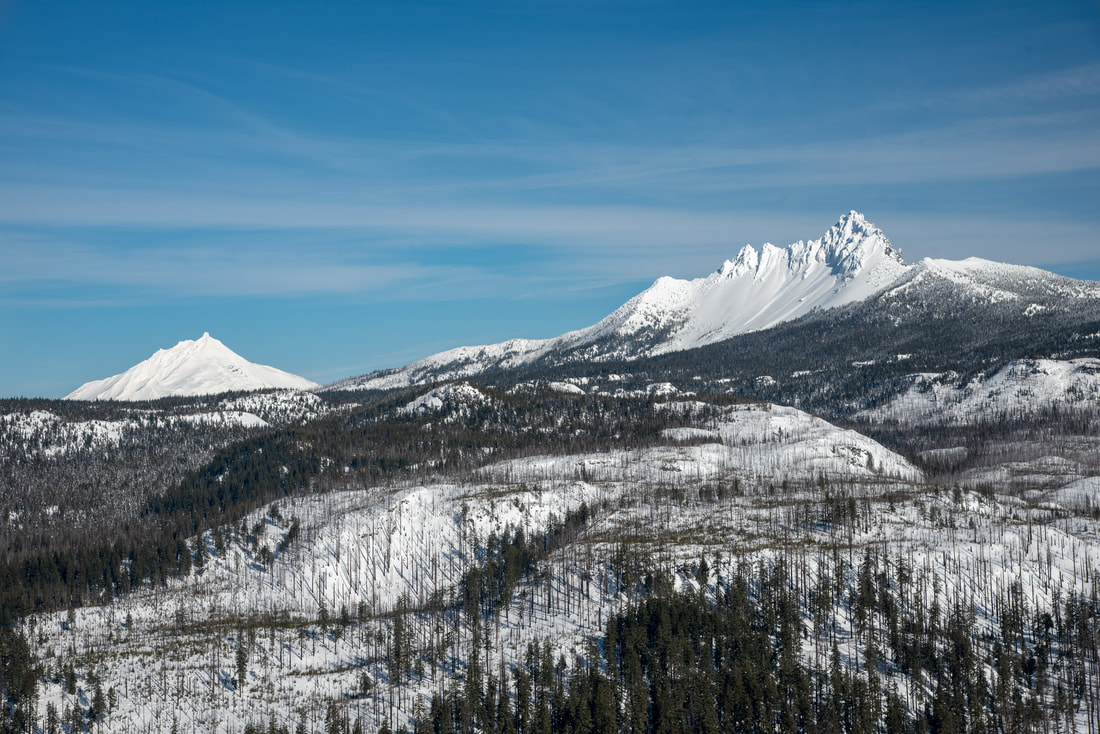
(Mount Jefferson and Three Fingered Jack)
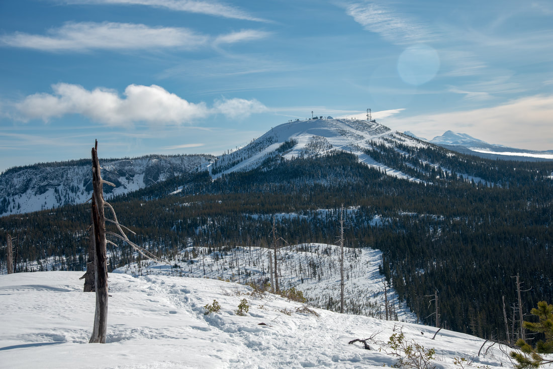
Hoodoo Ski Area view from Potato Hill summit
(Hoodoo Ski Area)
Santiam Pass and Black Butte from Potato Hill summit
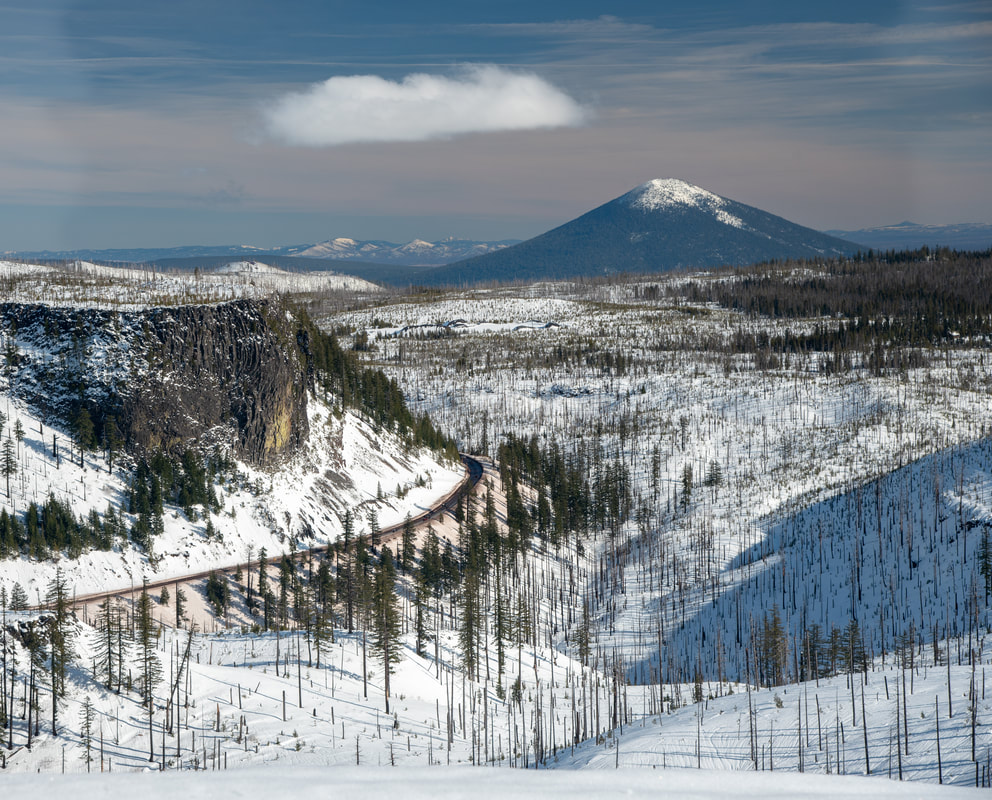
(US-20 Santiam Pass and Black Butte)
Potato Hill summit Potato Hill Sno Park
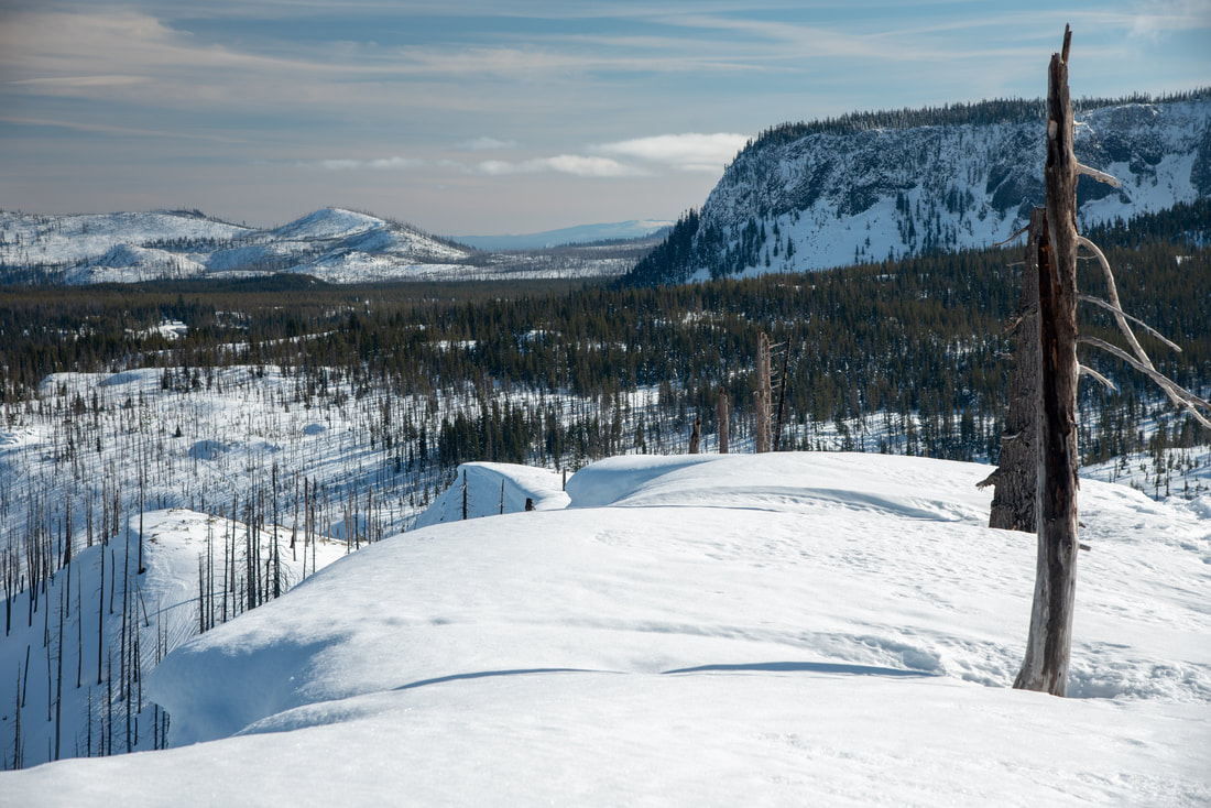
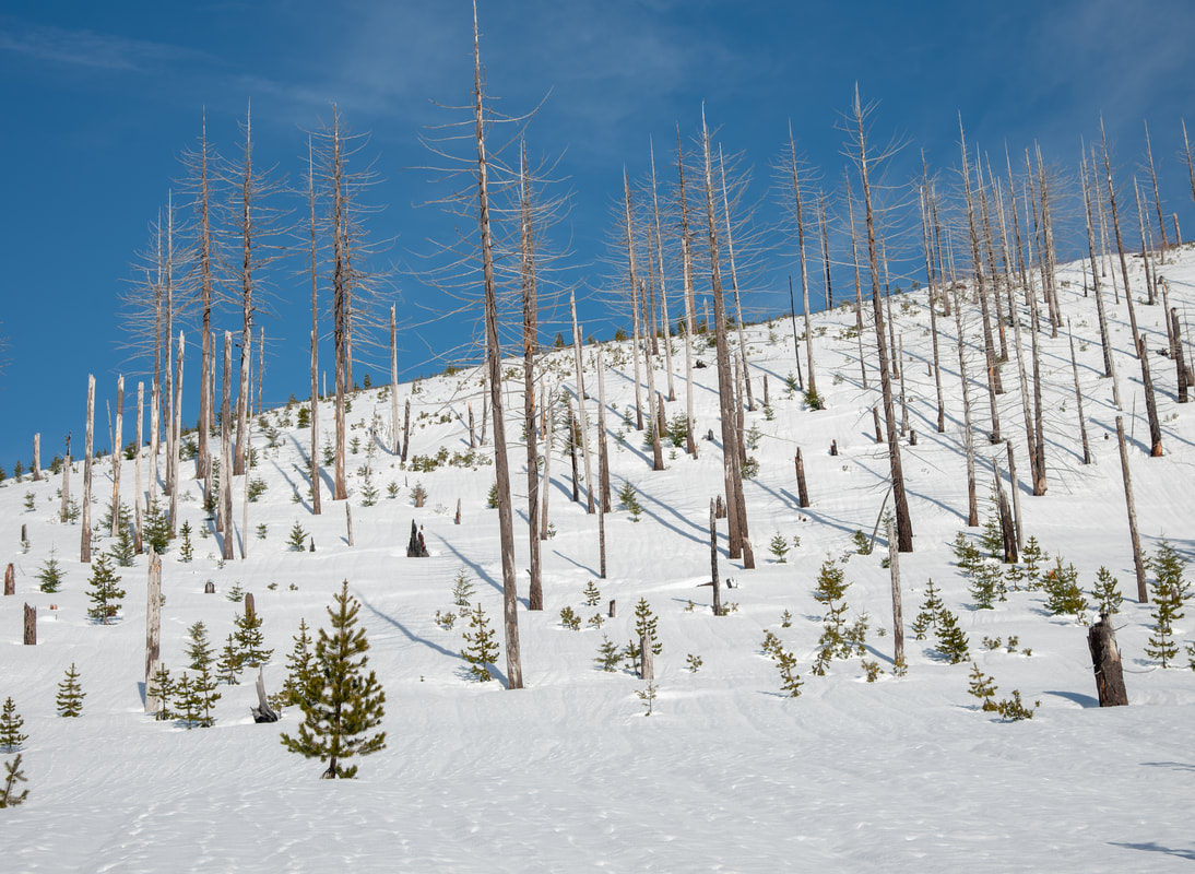
(example of snow cornice on top of Potato Hill)
Snowshoeing at Potato Hill Sno Park
When you're at the top of Potato Hill, make sure that you don't get too close to the edge because the snow creates cornices which are not stable and can break off easily. On sunny days, enjoy 360 degree views of the mountains at the summit of Potato Hill. If it isn't too windy, this is a great place to have a lunch break. 
Three Fingered Jack Jack Pine Road Potato Hill Sno Park
(Picture by Jeremy Henricks)
Mt. Washington and the Three Sisters from Potato Hill Sno Park
(Mount Washington and the Three Sisters)
Hash Brown Loop Potato Hill Sno Park
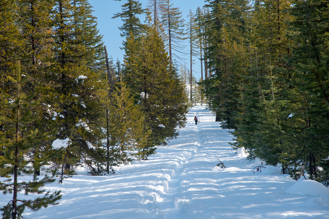
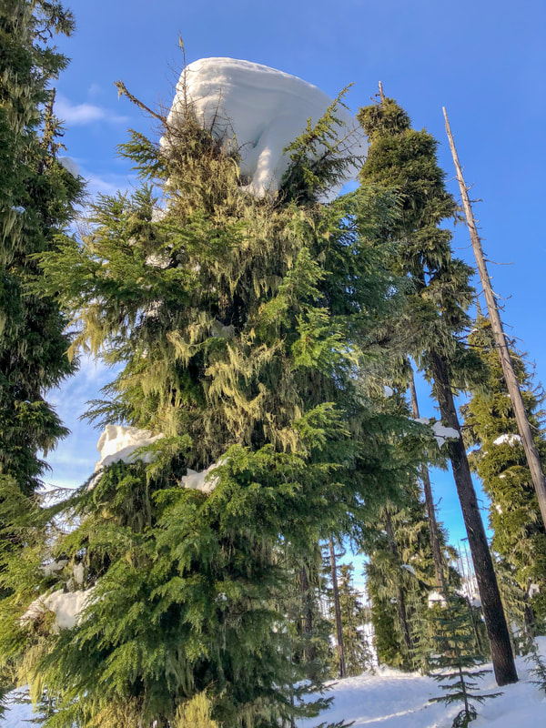
From the summit of Potato Hill, head back down the way you came and back to the Hash Brown Loop sign. If you want to continue and do the Hash Brown Loop, you will now continue to your left and follow the blue diamonds on the trees. The Hash Brown Loop is 3.2 miles long and this trail is more narrow, especially once you get into the thicker trees, but it offers a different kind of beauty and more solitude than the trek on the Jack Pine Road. 
Burnt trees at Potato Hill Sno Park
After enjoying 3.2 miles of quiet serenity winding through the moss and snow laden trees, you will come back to the first trail split sign that you saw and you have finished the Hash Brown Loop. From there it is merely another 0.36 miles along the wide road back down to the car. 
Big trees along the Hashbrown loop Potato Hill Sno Park
Snowshoeing Hashbrown loop Potato Hill Sno Park
Potato Hill Sno-Park has many opportunities for some wonderful snowshoe excursions. Because these trails are steep in some areas and are not as groomed as some other sno-parks, it is not recommended for first timers. The views that you get at this sno-park are absolutely incredible and definitely rival some of the more popular sno-parks in the area. Whether you do the shorter out and back or the longer loop, even on a sunny day you will not see the kinds of crowds like at some of the larger and more groomed sno-parks nearby like Ray Benson and Maxwell Sno-Park. Enjoy the views, the quiet forests and beautiful snowy trails! 
Potato Hill Sno Park Hashbrown Loop

Directions:

​From Bend
  • Drive on US-97 north to exit 135A and merge onto US-20 west towards Sisters for 19.9 miles. In Sisters at the roundabout take the 2nd exit and stay on US-20 west for another 24 miles to the destination on your left. (Total of 47.2 miles)
​From Eugene
  • Take OR-126 east toward Springfield. At a traffic light use the two left lanes to turn left, following signs to continue on OR-126 for another 72.6 miles. Shortly after Clear Lake Resort, take a slight right onto US-20 east for 4.4 miles and then the destination will be on your right. (Total of 81.3 miles)
From Salem
  • Take OR-22 east toward Detroit Lake/Bend for a total of 80.2 miles, then take a slight left onto US-20 east for 1.1 miles to the destination on your right. (Total of 84.8 miles)
From Portland
  • Drive on I-5 south towards Salem for 45.3 miles, then use the right 2 lanes to take exit 253 for OR-22 east toward Detroit Lake/Bend. Stay on OR-22 for a total of 80.2 miles, then take a slight left onto US-20 east for 1.1 miles to the destination on your right. (Total of 128 miles)
From Medford
  • Drive on I-5 north for 170 miles to Eugene. Take exit 194A to merge onto OR-126 east toward Springfield for about 6.6 miles. At a traffic light use the two left lanes to turn left and continue on OR-126 for 72.6 miles. Shortly after Clear Lake Resort, take a slight right onto US-20 east for 4.4 miles and then the destination will be on your right. (Total of 245 miles)
*All pictures unless otherwise marked are taken by Franziska Weinheimer
*Disclaimer: The trail descriptions, mileage, GPS tracks and difficulty ratings depicted on this website are never 100% accurate. Always hike at your own risk, using your own knowledge, equipment and common sense. Franziska Weinheimer/Hike Oregon are not responsible if you or anyone in your party gets injured or lost while attempting one of these or any other hikes. ​​​

HIKED HERE RECENTLY? PLEASE LEAVE A TRIP REPORT BELOW:

© Hike Oregon 2022
P.O. Box 41911
​Eugene, OR 97404
Proudly powered by Weebly
  • Home
  • *Store*
  • About the author
  • How to use this site
  • Resources
    • Wildflowers
    • Videos
  • Best Oregon Hikes
    • 20 Epic Oregon Wildflower Hikes
    • Top 10 Oregon Spring Hikes
    • 20 Best Oregon Waterfall Hikes
    • Top 10 Oregon Hikes for Kids
    • 5 Weekend Backpacking Trips in Oregon
    • Top One Night Backpacking Trips in Oregon
    • Top Fall Foliage Hikes In Oregon
    • Top 10 Oregon Summer Hikes
    • Top 10 Swimming Spots In Oregon
    • Top 10 Oregon Fall Hikes
    • Sno-Parks In Central Oregon
    • Top 10 Oregon Winter Hikes
    • Top Low Elevation Winter Hikes
  • Oregon Sno-Parks
    • Maxwell Sno-Park
    • Potato Hill Sno-Park
    • Ray Benson Sno-Park
      • Brandenburg Shelter
    • Santiam Sno-Park
    • Three Creek Sno-Park
    • Virginia Meissner Sno-Park
      • Meissner Shelter Loop
      • Nordeen Shelter
    • Gold Lake Sno-Park
      • Westview Shelter to Eagle Rock Overlook
      • Marilyn Lakes Loop
  • Portland
    • Powell Butte
    • Forest Park
    • Hamilton Mountain
    • Latourell Falls
    • Multnomah/Wahkeena Falls
    • Dog Mountain
    • Coyote Wall
    • Mitchell Point
    • Table Rock
    • Tamanawas Falls
    • Trillium Lake
    • East Zigzag Mountain (members only)
  • Salem
    • Abiqua Falls
    • Silver Falls State Park
    • Marion Lake to Marion Mountain
    • Jefferson Park
  • Sweet Home
    • Crescent Mountain
    • Iron Mountain
    • McDowell Creek Falls
    • Middle Santiam River (members only)
    • Lower Soda Creek Falls (members only)
    • Rooster Rock (members only)
  • McKenzie Bridge/Blue River
    • Macduff Mountain
    • Proxy Falls
    • Clear Lake
    • Sahalie/Koosah Falls
    • Blue Pool
    • Erma Bell Lakes
    • Olallie Mountain
    • Horsepasture Mountain
    • Tidbits Mountain
    • Castle Rock
    • East Fork Trail (members only)
    • Rainbow Falls Overlook (members only)
    • Frissell Point (members only)
    • Chucksney Mountain (members only)
    • Substitute Point (members only)
  • Sisters/Santiam Pass
    • Coffin Mountain
    • Trappers Butte and Scar Mountain
    • Black Butte
    • Tam McArthur Rim
    • Black Crater
    • Scott Mountain
    • Obsidian Trail
    • Three Fingered Jack Loop
    • Square Lake
    • Canyon Creek Meadows
    • Patjens Lakes
    • Craig Lake (members only)
    • Chush Falls (members only)
    • Rockpile Lake (members only)
    • Santiam Lake (members only)
    • Camp Lake (members only)
    • Park Meadow to Golden Lake (members only)
  • Bend/Redmond/LaPine
    • Steins Pillar
    • Chimney Rock
    • Steelhead Falls
    • Tumalo State Park
    • Tumalo Falls
    • Tumalo Mountain
    • No Name Lake
    • Green Lakes
    • Moraine Lake
    • South Sister Summit
    • Muskrat Lake
    • Paulina Peak
    • Peter Skene Ogden Trail (members only)
  • Eugene
    • Ridgeline Trail
    • Mount Pisgah Summit
    • Mount Pisgah Arboretum
    • Shotgun Creek
    • Mount June
    • Lawler
    • Tire Mountain
    • Goodman Creek
    • Brice Creek
    • Trestle Creek Falls
    • Moon Falls
    • Elijah Bristow State Park
    • South Willamette Trail (members only)
    • Eula Ridge (members only)
    • Eagle's Rest (members only)
  • Oakridge
    • Deception Creek
    • North Salmon Creek
    • Grasshopper Ridge
    • Larison Creek
    • Bunchgrass Ridge
    • Salt Creek Falls
    • Waldo Lake Loop
    • South Waldo Loop
    • The Twins
    • Rosary Lakes
    • Fawn Lake
    • Windy Lakes
    • Divide Lake
    • Diamond Peak Summit
    • Cowhorn Mountain
    • Wall Creek Warm Springs (members only)
    • Moon Point (members only)
    • Bobby Lake (members only)
    • Lillian Falls (members only)
    • Middle Fork Willamette Trail (members only)
    • Pool Creek Falls (members only)
    • Dead Mountain (members only)
    • Larison Rock (members only)
    • Eddeeleo Lakes (members only)
    • Waldo Mountain Lookout (members only)
    • Blair Lake to Mule Mountain (members only)
    • Rigdon Lakes loop (members only)
  • Oregon Coast
    • Cascade Head
    • Drift Creek Falls
    • Sweet Creek Falls
    • Alsea Falls
    • Kentucky Falls
    • Marys Peak North Ridge
    • Marys Peak East Ridge
    • Cape Perpetua Loops
    • Hobbit Trail to Heceta Head
    • North Fork Smith River (members only)
    • Cummins Ridge (member's only)
    • Horse Creek (members only)
    • Siltcoos Lake (members only)
    • William Finley Wildlife Refuge (members only)
  • Southern Oregon
    • Fall Creek Falls
    • Watson Falls
    • Wild Rogue Loop
    • Mt. Thielsen
    • The Watchman
    • Mount Scott
    • The Pinnacles
    • Lower Table Rock
    • Pilot Rock
    • Wagner Butte
    • Mt. McLoughlin
    • Lemolo Falls (members only)
    • Fern Falls (members only)
  • Eastern Oregon
    • Painted Cove
    • Mount Howard
    • Anthony Lake Loop
    • Schneider Cabin (members only)
    • Strawberry Lake & Falls (members only)
  • Oregon PCT sections
    • PCT: OR-58 to Charlton Lake
    • PCT: Santiam Pass to Rockpile Lake
  • Tips & Tricks
    • Leave No Trace
    • Top Tips For Hiking With Infants And Toddlers
    • Poison Oak, Ivy and Sumac
    • How to dress for cold weather hikes
    • Hiker Holiday Gift Guide 2019
    • Outdoor Holiday Gift Guide 2018
    • Hiking Holiday Gift Guide 2017
  • Reviews
    • Outdoor Herbivore Backpacking Food Review
    • Osprey Aura AG 65 Backpack review
    • Big Agnes Fly Creek UL2 review
    • REI Quarter Dome 1 review
  • Adventure Stories
    • Hiking The Rae Lakes Loop
    • 110 Miles on the PCT
    • The Loop Around Three Fingered Jack
    • Jefferson Wilderness