Hike Oregon
  • Home
  • *Store*
  • About the author
  • How to use this site
  • Resources
    • Wildflowers
    • Videos
  • Best Oregon Hikes
    • Best Rainy Day Hikes In Oregon
    • Top 10 Oregon Fall Hikes
    • Underrated Fall Foliage Hikes In Oregon
    • 20 Best Oregon Waterfall Hikes
    • Sno-Parks In Central Oregon
    • Top 10 Oregon Winter Hikes
    • Top Low Elevation Winter Hikes
    • Easy Hikes in Oregon
    • Top 10 Oregon Hikes for Kids
    • Top 10 Oregon Spring Hikes
    • Top One Night Backpacking Trips in Oregon
    • 5 Weekend Backpacking Trips in Oregon
    • 20 Epic Oregon Wildflower Hikes
    • 9 Amazing Oregon Summit Hikes
    • Top 10 Oregon Summer Hikes
    • Top 10 Swimming Spots In Oregon
    • 20 Central Oregon Day Hikes
  • Oregon Sno-Parks
    • Maxwell Sno-Park
    • Potato Hill Sno-Park
    • Ray Benson Sno-Park
      • Brandenburg Shelter
    • Santiam Sno-Park
    • Three Creek Sno-Park
    • Virginia Meissner Sno-Park
      • Meissner Shelter Loop
      • Nordeen Shelter
    • Gold Lake Sno-Park
      • Westview Shelter to Eagle Rock Overlook
      • Marilyn Lakes Loop
    • Ikenick Sno-Park (members only)
  • Southern Washington
    • Hamilton Mountain
    • Dog Mountain
    • Coyote Wall
    • Mount St. Helens
  • Portland
    • Powell Butte
    • Forest Park
    • Latourell Falls
    • Multnomah/Wahkeena Falls
    • Eagle Creek
    • Mitchell Point
    • Table Rock
    • Tamanawas Falls
    • Trillium Lake
    • East Zigzag Mountain (members only)
  • Salem
    • Abiqua Falls
    • Silver Falls State Park
    • Dome Rock
    • Marion Lake to Marion Mountain
    • Jefferson Park via Whitewater Trail
  • Corvallis
    • William Finley Wildlife Refuge
      • Campbell Boardwalk
      • Woodpecker Loop
      • Mill Hill Loop
      • Beaver Pond Loop
    • Marys Peak East Ridge
    • Marys Peak North Ridge
    • Alsea Falls and Green Peak Falls
    • Corvallis to Sea Trail - Sugarbowl Creek segment (members only)
  • Sweet Home
    • Crescent Mountain
    • Iron Mountain
    • McDowell Creek Falls
    • Middle Santiam River (members only)
    • Lower Soda Creek Falls (members only)
    • Rooster Rock (members only)
  • McKenzie Bridge/Blue River
    • Macduff Mountain
    • Proxy Falls
    • Clear Lake
    • Sahalie/Koosah Falls
    • Blue Pool
    • Erma Bell Lakes
    • Olallie Mountain
    • Horsepasture Mountain
    • Tidbits Mountain
    • Castle Rock
    • Separation Lake (members only)
    • Lowder Mountain (members only)
    • East Fork Trail (members only)
    • Rainbow Falls Overlook (members only)
    • Frissell Point (members only)
    • Substitute Point (members only)
  • Sisters/Santiam Pass
    • Coffin Mountain
    • Trappers Butte and Scar Mountain
    • Maxwell Butte
    • Black Butte
    • Whychus Creek Trail
    • Tam McArthur Rim
    • Black Crater
    • Scott Mountain
    • Obsidian Trail
    • Metolius Preserve
    • Three Fingered Jack Loop
    • Square Lake
    • Canyon Creek Meadows
    • Patjens Lakes
    • Craig Lake (members only)
    • Chush Falls (members only)
    • Rockpile Lake (members only)
    • Santiam Lake (members only)
    • Camp Lake (members only)
    • Park Meadow to Golden Lake (members only)
  • Bend/Redmond/LaPine
    • Steins Pillar
    • Chimney Rock
    • Steelhead Falls
    • Tumalo State Park
    • Shevlin Park Loop
    • Tumalo Falls
    • Tumalo Mountain
    • No Name Lake
    • Green Lakes
    • Moraine Lake
    • South Sister Summit
    • Horse Lake
    • Muskrat Lake
    • Paulina Peak
    • The Badlands - Flatiron Rock Trail
    • Peter Skene Ogden Trail (members only)
  • Eugene
    • Ridgeline Trail
    • Mount Pisgah Summit
    • Mount Pisgah Arboretum
    • Shotgun Creek
    • Mount June
    • Lawler
    • Tire Mountain
    • Hardesty Mountain
    • Goodman Creek
    • Brice Creek
    • Trestle Creek Falls
    • Parker Falls
    • Moon Falls
    • Elijah Bristow State Park
    • South Willamette Trail (members only)
    • Eula Ridge (members only)
    • Eagle's Rest (members only)
  • Oakridge
    • Deception Butte
    • North Salmon Creek
    • Sourgrass Mountain
    • Grasshopper Ridge
    • Larison Creek
    • Bunchgrass Ridge
    • Salt Creek Falls
    • Waldo Lake Loop
    • South Waldo Loop
    • The Twins
    • Rosary Lakes
    • Yoran Lake
    • Fawn Lake
    • Windy Lakes
    • Divide Lake
    • Diamond Peak via Rockpile Lake Trailhead
    • Diamond Peak via Summit Lake
    • Cowhorn Mountain
    • Klovdahl Bay (members only)
    • Verdun Trail (members only)
    • Heckletooth Mountain (members only)
    • Wall Creek Warm Springs (members only)
    • Moon Point (members only)
    • Bobby Lake (members only)
    • Lillian Falls (members only)
    • Middle Fork Willamette Trail (members only)
    • Pool Creek Falls (members only)
    • Dead Mountain (members only)
    • Larison Rock (members only)
    • Quinn Lakes & Eddeeleo Lakes (members only)
    • Waldo Mountain Lookout (members only)
    • Blair Lake to Spring Prairie (members only)
    • Rigdon Lakes loop (members only)
  • Oregon Coast
    • Cascade Head
    • Drift Creek Falls
    • Sweet Creek Falls
    • Beaver Creek Falls
    • Kentucky Falls
    • Hobbit Trail to Heceta Head
    • Valley Trail to China Creek
    • Sutton Creek Trail (members only)
    • North Fork Smith River (members only)
    • Cummins Ridge (member's only)
    • Horse Creek (members only)
    • Siltcoos Lake (members only)
  • Southern Oregon
    • Fall Creek Falls
    • Watson Falls
    • Wild Rogue Loop
    • Mt. Thielsen
    • Crater Lake National Park
      • The Watchman
      • Mount Scott
      • The Pinnacles
    • Lower Table Rock
    • Pilot Rock
    • Wagner Butte
    • Mt. McLoughlin
    • Lemolo Falls (members only)
    • Fern Falls (members only)
  • Eastern Oregon
    • Painted Cove
    • Anthony Lake Loop
    • Mount Howard
    • Eagle Cap summit
    • Schneider Cabin (members only)
    • Strawberry Lake & Strawberry Falls (members only)
  • Northern California
    • Taylor & Hogan Lake (members only)
  • Oregon PCT sections
    • PCT: CA border to Callahan's
  • Tips & Tricks
    • Leave No Trace
    • Safety Tips for Solo Hiking & Backpacking
    • Nutrition On The Trail
    • How Much Water To Carry When Backpacking
    • Storing Your Bear Canister When Backpacking
    • How To Pick The Right Backpacking Tent
    • Top Tips For Hiking With Infants And Toddlers
    • Poison Oak, Ivy and Sumac
    • How to dress for cold weather hikes
  • Reviews and Gear
    • Choosing and Using Trekking Poles
    • A Guide to Choosing the Perfect Backpacking Pack
    • Hiking Pants and Leggings
    • Jackets for Hiking and Backpacking
    • Long Sleeved Shirts For Cold Weather Hiking
    • Stay Kühl This Summer
    • Outdoor Herbivore Backpacking Food Review
    • Osprey Aura AG 65 Backpack review
    • Big Agnes Fly Creek UL2 review
    • REI Quarter Dome 1 review
    • Hike Oregon's Gear Favorites
    • Outdoorsy Holiday Gift Guide 2022
    • Hiker Holiday Gift Guide 2019
    • Outdoor Holiday Gift Guide 2018
    • Hiking Holiday Gift Guide 2017
  • Adventure Stories
    • Hiking The Rae Lakes Loop
    • 110 Miles on the PCT
    • Three Fingered Jack Adventures
    • Jefferson Wilderness

Bunchgrass Ridge

​
Get the printable version of this hike

Hike details:

Mileage: 6.25 miles round trip w/ 1,300 ft. elevation gain (to viewpoint at Big Bunchgrass)
11.6 miles round trip w/ 2,800 ft. elevation gain (to viewpoint at Bunchgrass Ridge)
Approximate hike time: 2 hours 43 minutes w/ an average pace of 2.3 mph 
(to viewpoint at Big Bunchgrass)
5 hours 2 minutes w/ an average pace of 2.3 mph (to viewpoint at Bunchgrass Ridge)
Difficulty: Moderate to difficult

Trail usage: Low on weekdays, moderate on summer weekends (mainly lots of mountain bikers)
​
Highest elevation: 5,880 ft. Lowest elevation: 5,200 ft.
General location: 24 miles east of Oakridge - Willamette National Forest
Accessible: June through November
(Best time to go is in mid to late June when the wildflowers are blooming).
Permits required: N/A
Pit toilet at trailhead: No
Trail allows: ​Dogs on leash, mountain biking, camping
​
Possible dangers: N/A - there have been cougar sightings on this trail in the last two years, but cougars are pretty much everywhere you hike in Oregon.
Eugene to Pacific Crest Big Bunchgrass Trail
Big Bunchgrass Ridge trailhead
(trailhead parking area)

Description:

The Bunchgrass Ridge Trail is a section of the Eugene to Crest Trail, which connects Waldo Lake to Lowell. This section is primarily used for summer and early fall mountain biking, but because there are so many trailheads along the whole trail where you can access different sections, the shorter sections are popular with day hikers as well, especially when the wildflowers are blooming. The section from Waldo Lake (Betty Lake trailhead) to Oakridge is a total of 29 miles and would be a great 1-2 night backpacking trip option.
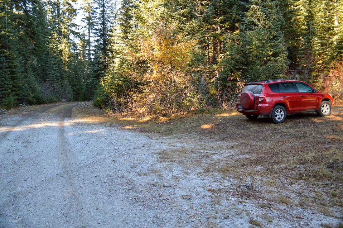
The trailhead is relatively easy to find. Keep an eye out for the trail sign on your left and a very large pull-out on the right where there is room for about 8 cars to park. The parking pull-out area does have some grass growing, so please do not park on the grass if it is during the hot dry summer and fire danger is high.​
Big Bunchgrass Trail in the woods
Eugene to Pacific Crest sign
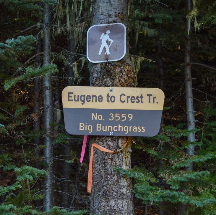
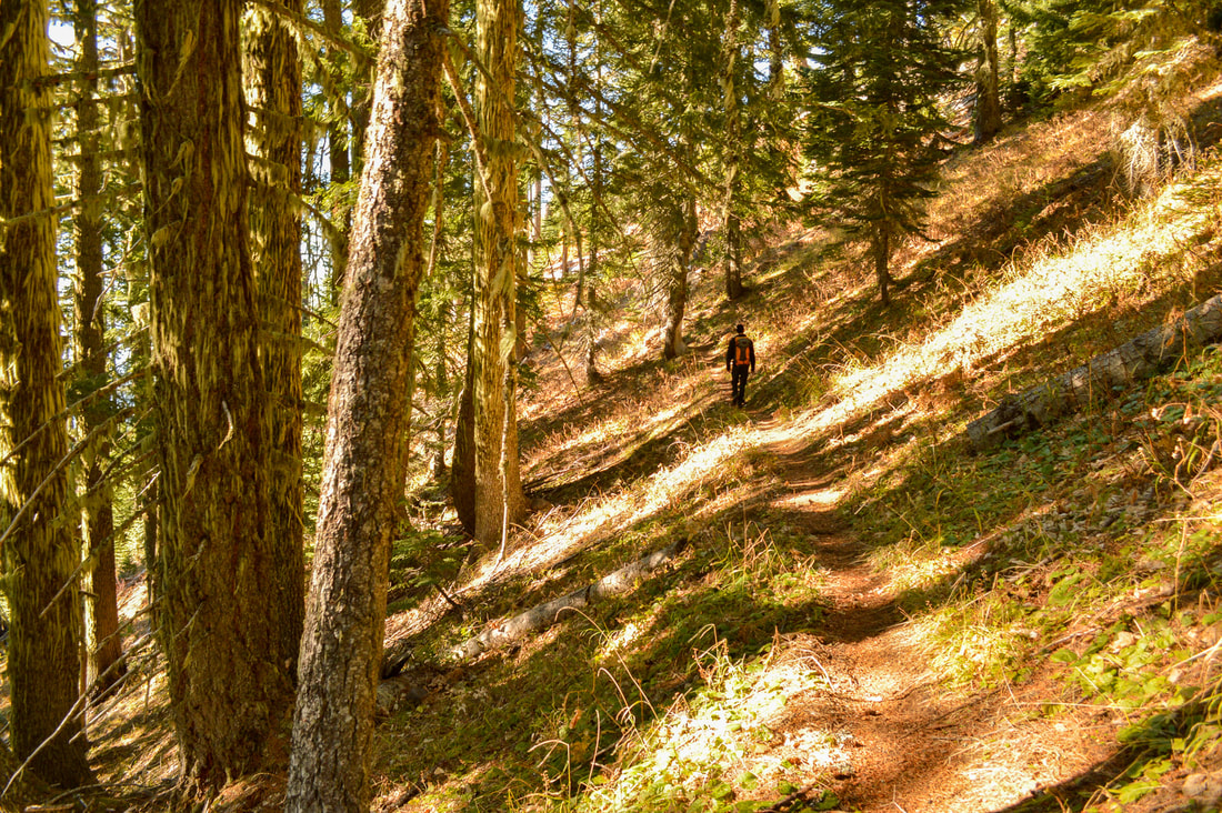
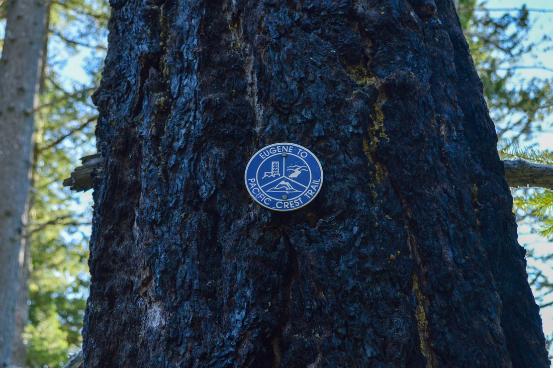
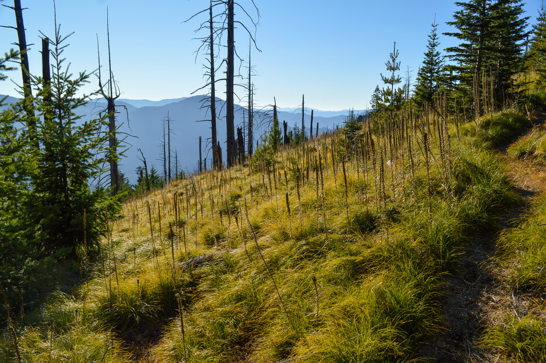
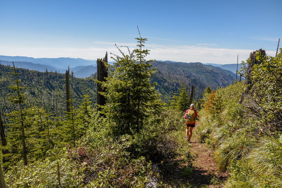
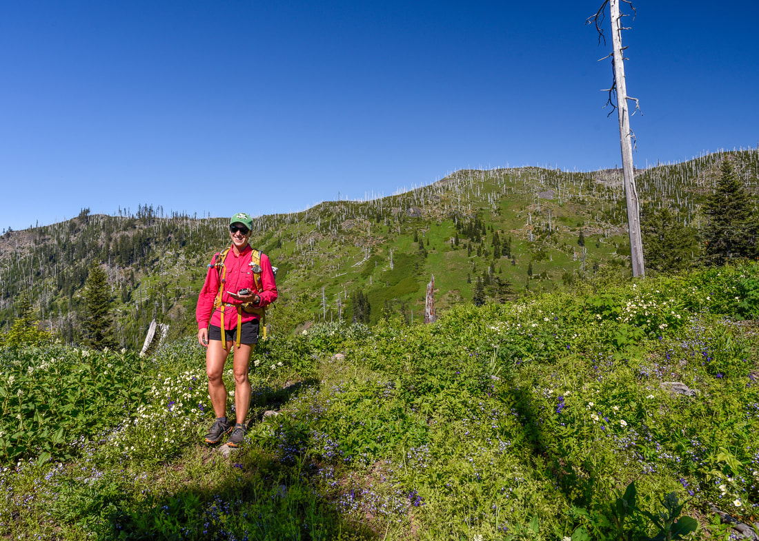
Because the Bunchgrass Ridge Trail is a part of the Eugene to Crest Trail system, on the trail signs you will not only see Bunchgrass ​Ridge Trail, but you will also frequently see the blue and white circular Eugene to Pacific Crest emblem. The first 1.4 miles of the hike take you mostly through a forest, with short spurts that cross steep wildflower meadows. During the month of June and early July, you will find gorgeous flowers blooming the hillside, such as bear grass, fireweed, California corn lily and many more!
Bunchgrass Ridge Trail
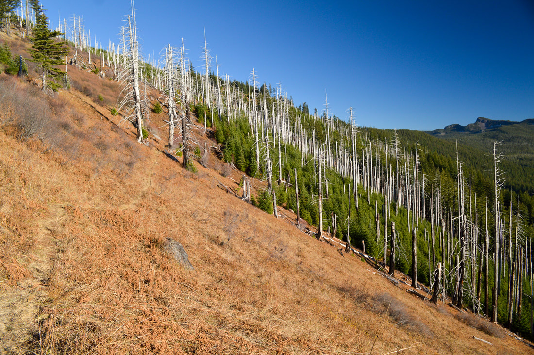
(example of trail along the steep hillside)
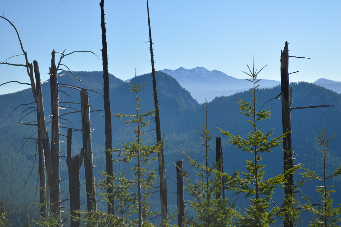
Diamond Peak from Big Bunchgrass
(Diamond Peak)
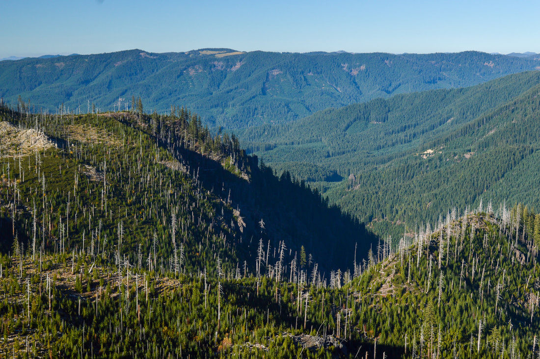
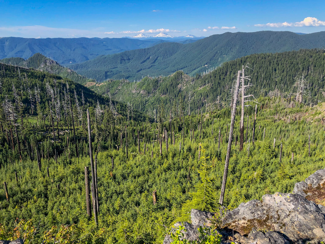
After 1.4 miles the trail continues to traverse large open meadows, and you will see some amazing views of Diamond Peak in the distance and the steep hills in the foreground are Verdun Rock, Hells Half Acre and Mount David Douglas. At 2.4 miles you will come to a trail split. The trail going downhill to the left is the trail that comes up from the lower trailhead. You can start the hike at the lower trailhead if you want to make it shorter, however this trailhead doesn't receive as much use and it takes you on a very steep sketchy road that doesn't get maintained much. At the trail junction you will stay to the right and continue going uphill.
Bunchgrass Ridge
(Diamond Peak, Verdun Rock, Hells Half Acre and Mount David Douglas)
Bunchgrass Ridge bear grass bloom
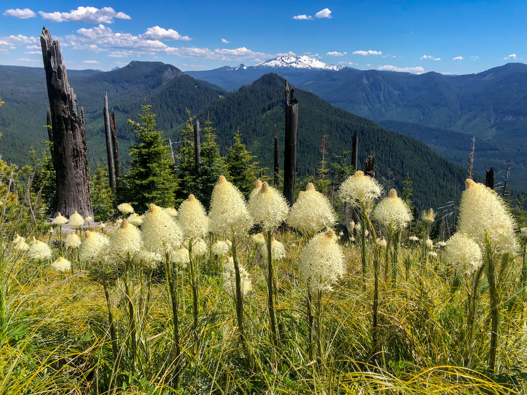
(beginning of bear grass bloom in mid-June)
Big Bunchgrass Ridge Trail
(bear grass in November)
Big Bunchgrass
Sign post along Big Bunchgrass Ridge Trail
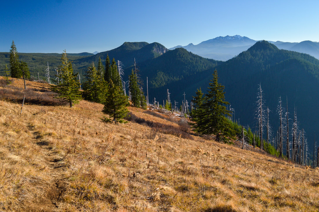
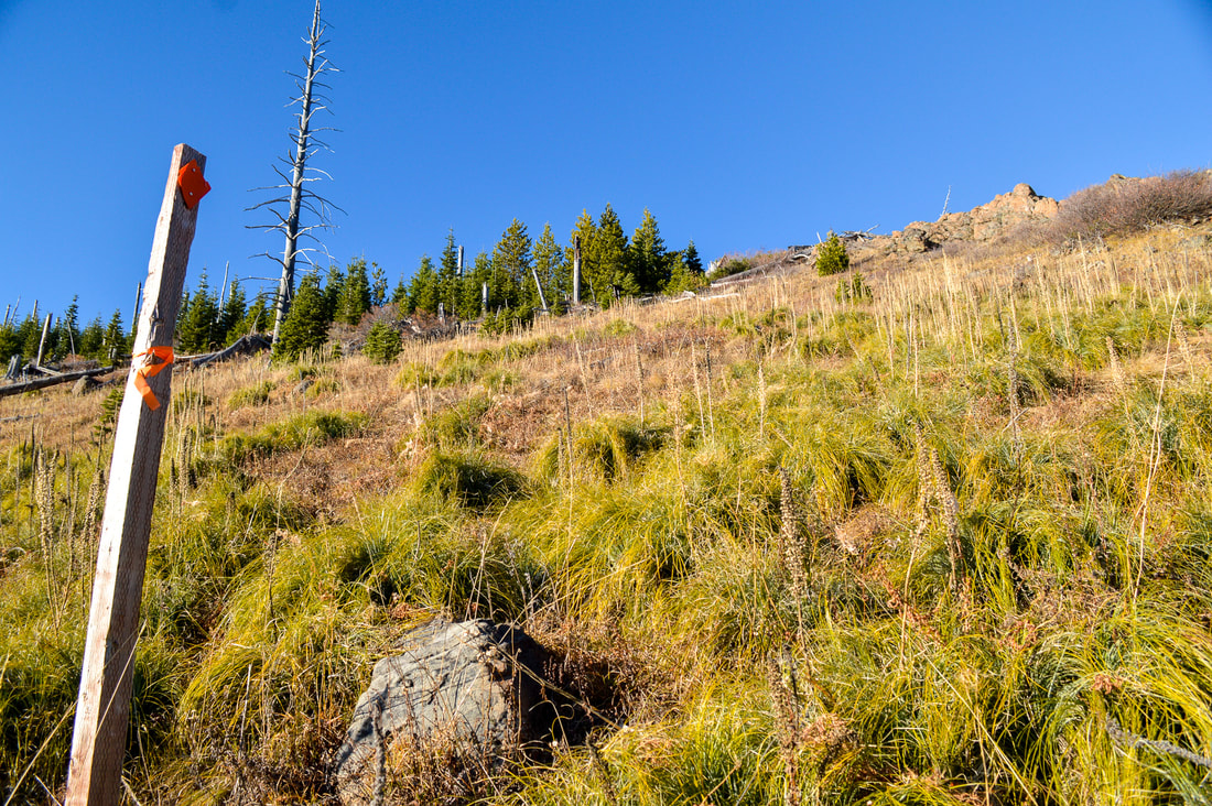
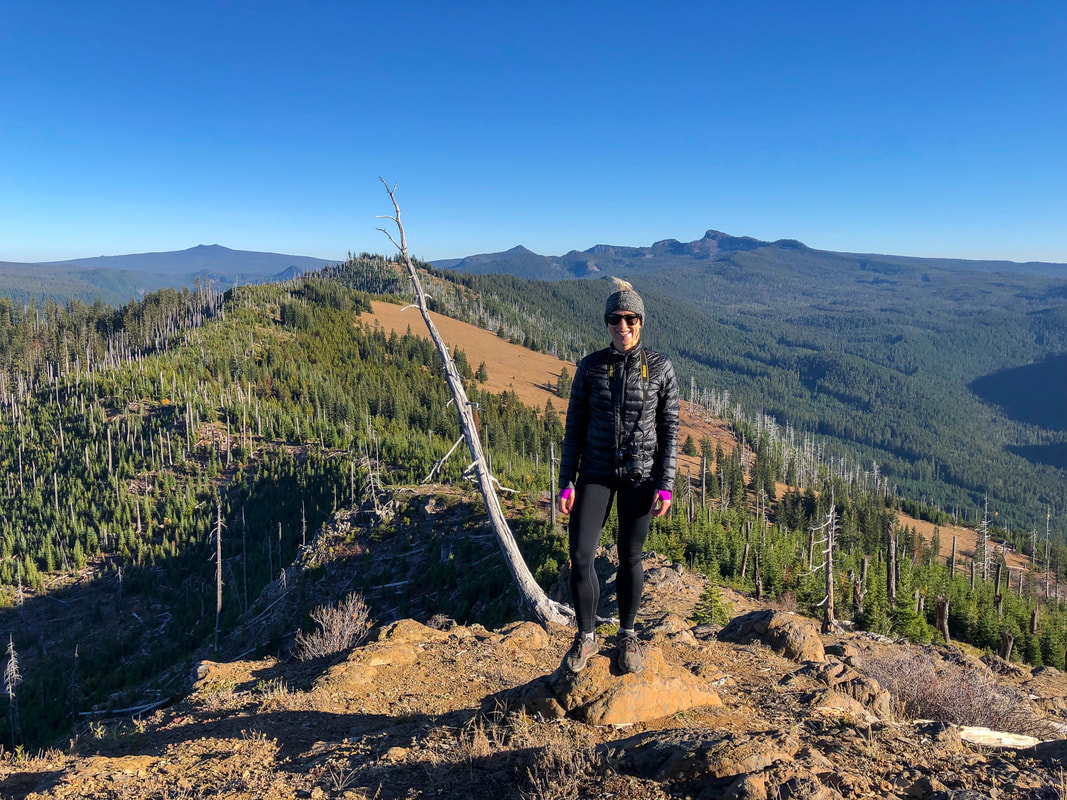
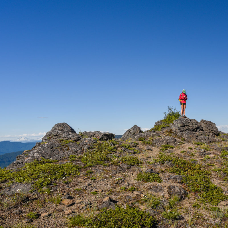
At around 3 miles you will see a post with bright ribbon tied to it and an orange diamond. This is where the Bunchgrass Ridge Trail continues on to the west if you wanted to continue on to Bunchgrass Ridge if you wanted to make this hike longer, and this is also where you can head up to the rocky viewpoint area of Big Bunchgrass. You can see the rocks that you are heading towards from the marker post. From here it is just 0.2 miles to the top.
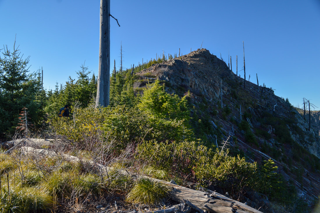
On top of Big Bunchgrass
(rocky viewpoint)
Diamond Peak from the top of Big Bunchgrass
Panorama from Big Bunchgrass Ridge
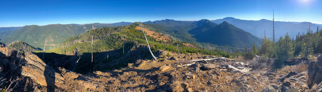
(panorama from the top of Big Bunchgrass)
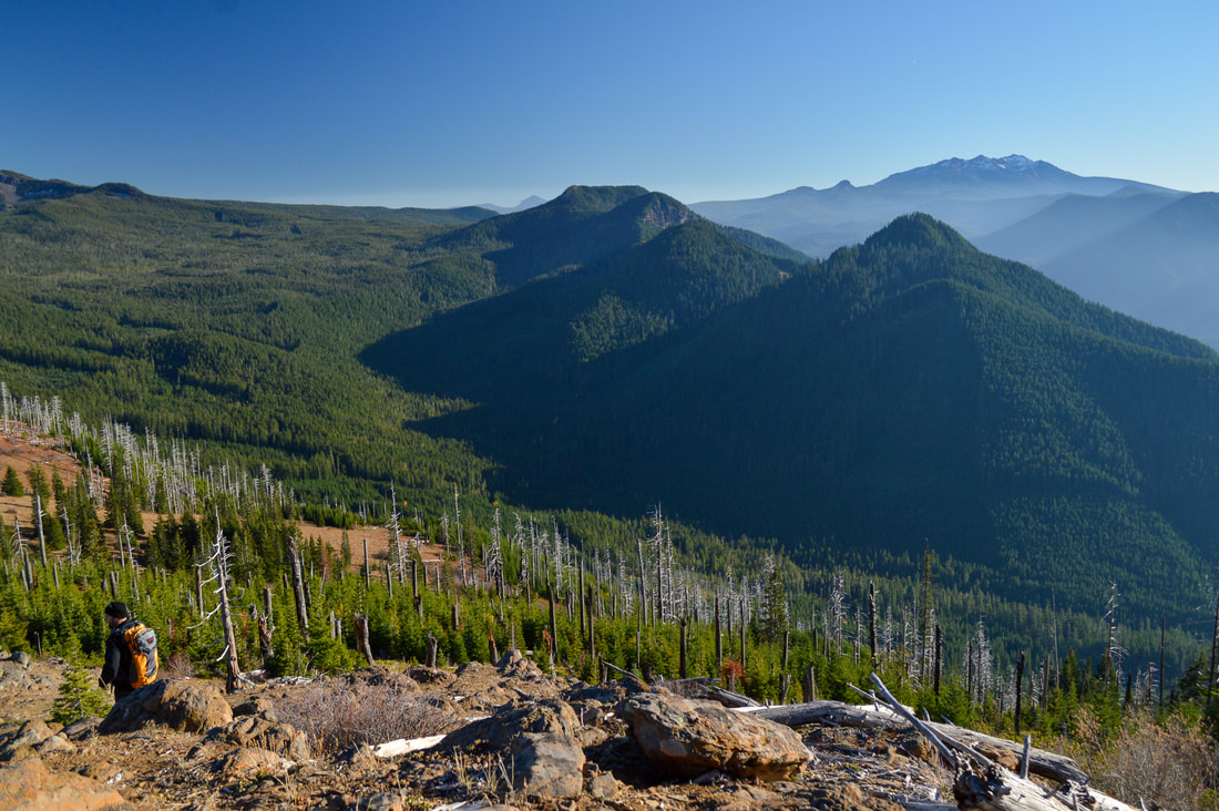
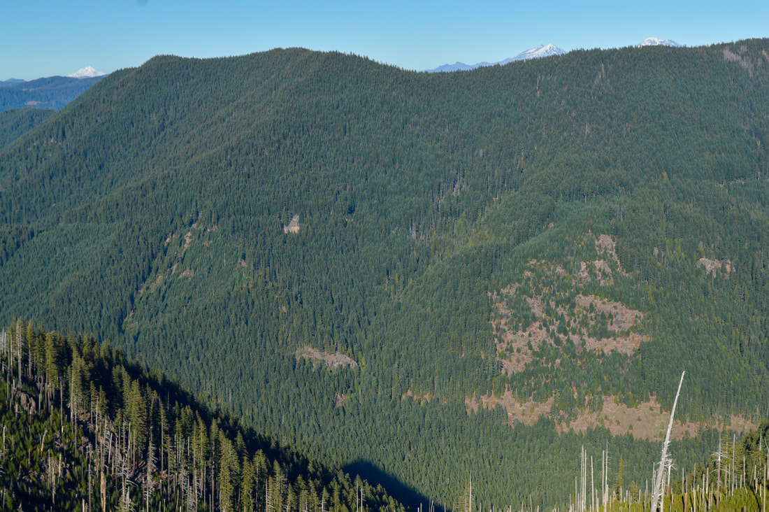
The high point of Big Bunchgrass is at 5,700 ft. and from there ​you will get some awesome views of Diamond Peak, Fuji Mountain, Maiden Peak, the Twins, the tip of the Three Sisters and Mount Jefferson and of course all of the hills, valleys and ridges in between. If you want to keep the hike to 6.25 miles, you would  head back from this viewpoint. If you want to hike a total of 11.6 miles, you will continue on the Eugene to Crest Trail to the other Bunchgrass Ridge viewpoint. This second viewpoint is actually at a lower elevation than the first viewpoint, but because of the different angle it is at, you can see Mount Jefferson and the Three Sisters much better. It is also a bigger viewpoint with great spots to sit and truly enjoy this stunning view. 
View from Big Bunchgrass
View from the top of Big Bunchgrass
(Fuji Mountain and the Twins in the distance)
View of the Three Sisters and Mt. Jefferson from Big Bunchgrass
(Mount Jefferson and the Three Sisters peaking up over the ridge)
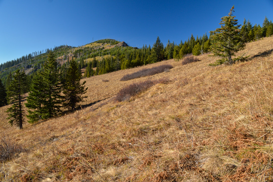
Keep in mind that if you want to go to the second viewpoint, you are not only signing up for more mileage, but also a lot more elevation gain. The high point of this ridgeline is just shortly after the first viewpoint at 5,880 feet so from here, the trail takes you steeply downhill via 7 short switchbacks through an old burn scar that offers absolutely no shade. After going down to 5,200 feet the trail meanders along this lower ridgeline for 0.9 miles, then the trail dips down once again all the way to 5,000 feet where you will come to a little saddle. Here you will see a lush meadow full of wildflowers that bloom in mid-June. From here it is 0.6 miles to the second Bunchgrass Ridge viewpoint and you will gain 495 feet of elevation. This rocky viewpoint is absolutely incredible and gives you 360 degree views. The views of Mount Jefferson and the Three Sisters and Broken Top are absolutely amazing from here, as well as the view of Diamond Peak and the entire Bunchgrass Ridge that you just hiked. 
Eugene to Crest Trail Bunchgrass Ridge section
(trail heading downhill via switchbacks - picture by Jeremy Henricks)
Hike Oregon on the Bunchgrass Ridge Trail
(5,000 foot wildflower saddle - picture by Jeremy Henricks)
Bunchgrass Ridge is a vastly underrated hike in the Oakridge area and it offers wildflowers, epic views and some decent elevation gain if you're looking for it. You can choose to make this a moderate level hike by making your end point the first viewpoint, or you can choose the more difficult hike option by continuing on to the second viewpoint. Whichever you choose, you will love this hike as it is a wonderful place to be in the summer and fall.
Bunchgrass Ridge Trail viewpoint
(second Bunchgrass Ridge viewpoint - picture by Jeremy Henricks)
view of the Three Sisters from Bunchgrass Ridge
(Mount Jefferson and the Three Sisters from the second Bunchgrass Ridge viewpoint)

Directions:

From Eugene
  • Drive OR-58 east through the town of Oakridge for a total of 50.6 miles. Right after passing underneath a train trestle, turn left onto Eagle Creek Rd/NF-5883. Stay on this gravel road for 6.2 miles, then turn right onto NF-5883 for 0.4 miles. Continue straight onto NF-379 until you see the large turn out on your right. (Total of 65.8 miles)
From Bend
  • Drive US-97 south for 46.9 miles. In the town of Crescent, turn right onto Crescent Rd/Crescent Cutoff Rd. and stay on this road for 12 miles until you T into OR-58. Turn right and stay on OR-58 west for a total of 22.1 miles. Turn right onto Eagle Creek Rd/NF-5883. Stay on this gravel road for 6.2 miles, then turn right onto NF-5883 for 0.4 miles. Continue straight onto NF-379 until you see the large turn out on your right. (Total of 89.2 miles)
From Salem
  • It is a total of 127 miles via Eugene. ​​
​From Portland
  • It is a total of 170 miles via Eugene.
From Medford
  • It is a total of 159 miles via Eugene.
​*All pictures unless otherwise marked are taken by Franziska Weinheimer 
*Disclaimer: The trail descriptions, mileage, GPS tracks and difficulty ratings depicted on this website are never 100% accurate. Always hike at your own risk, using your own knowledge, equipment and common sense. Franziska Weinheimer/Hike Oregon are not responsible if you or anyone in your party gets injured or lost while attempting one of these or any other hikes. 

rHIKED HERE RECENTLY? PLEASE LEAVE A TRIP REPORT BELOW:

© Hike Oregon 2025
P.O. Box 41911
​Eugene, OR 97404
Proudly powered by Weebly
  • Home
  • *Store*
  • About the author
  • How to use this site
  • Resources
    • Wildflowers
    • Videos
  • Best Oregon Hikes
    • Best Rainy Day Hikes In Oregon
    • Top 10 Oregon Fall Hikes
    • Underrated Fall Foliage Hikes In Oregon
    • 20 Best Oregon Waterfall Hikes
    • Sno-Parks In Central Oregon
    • Top 10 Oregon Winter Hikes
    • Top Low Elevation Winter Hikes
    • Easy Hikes in Oregon
    • Top 10 Oregon Hikes for Kids
    • Top 10 Oregon Spring Hikes
    • Top One Night Backpacking Trips in Oregon
    • 5 Weekend Backpacking Trips in Oregon
    • 20 Epic Oregon Wildflower Hikes
    • 9 Amazing Oregon Summit Hikes
    • Top 10 Oregon Summer Hikes
    • Top 10 Swimming Spots In Oregon
    • 20 Central Oregon Day Hikes
  • Oregon Sno-Parks
    • Maxwell Sno-Park
    • Potato Hill Sno-Park
    • Ray Benson Sno-Park
      • Brandenburg Shelter
    • Santiam Sno-Park
    • Three Creek Sno-Park
    • Virginia Meissner Sno-Park
      • Meissner Shelter Loop
      • Nordeen Shelter
    • Gold Lake Sno-Park
      • Westview Shelter to Eagle Rock Overlook
      • Marilyn Lakes Loop
    • Ikenick Sno-Park (members only)
  • Southern Washington
    • Hamilton Mountain
    • Dog Mountain
    • Coyote Wall
    • Mount St. Helens
  • Portland
    • Powell Butte
    • Forest Park
    • Latourell Falls
    • Multnomah/Wahkeena Falls
    • Eagle Creek
    • Mitchell Point
    • Table Rock
    • Tamanawas Falls
    • Trillium Lake
    • East Zigzag Mountain (members only)
  • Salem
    • Abiqua Falls
    • Silver Falls State Park
    • Dome Rock
    • Marion Lake to Marion Mountain
    • Jefferson Park via Whitewater Trail
  • Corvallis
    • William Finley Wildlife Refuge
      • Campbell Boardwalk
      • Woodpecker Loop
      • Mill Hill Loop
      • Beaver Pond Loop
    • Marys Peak East Ridge
    • Marys Peak North Ridge
    • Alsea Falls and Green Peak Falls
    • Corvallis to Sea Trail - Sugarbowl Creek segment (members only)
  • Sweet Home
    • Crescent Mountain
    • Iron Mountain
    • McDowell Creek Falls
    • Middle Santiam River (members only)
    • Lower Soda Creek Falls (members only)
    • Rooster Rock (members only)
  • McKenzie Bridge/Blue River
    • Macduff Mountain
    • Proxy Falls
    • Clear Lake
    • Sahalie/Koosah Falls
    • Blue Pool
    • Erma Bell Lakes
    • Olallie Mountain
    • Horsepasture Mountain
    • Tidbits Mountain
    • Castle Rock
    • Separation Lake (members only)
    • Lowder Mountain (members only)
    • East Fork Trail (members only)
    • Rainbow Falls Overlook (members only)
    • Frissell Point (members only)
    • Substitute Point (members only)
  • Sisters/Santiam Pass
    • Coffin Mountain
    • Trappers Butte and Scar Mountain
    • Maxwell Butte
    • Black Butte
    • Whychus Creek Trail
    • Tam McArthur Rim
    • Black Crater
    • Scott Mountain
    • Obsidian Trail
    • Metolius Preserve
    • Three Fingered Jack Loop
    • Square Lake
    • Canyon Creek Meadows
    • Patjens Lakes
    • Craig Lake (members only)
    • Chush Falls (members only)
    • Rockpile Lake (members only)
    • Santiam Lake (members only)
    • Camp Lake (members only)
    • Park Meadow to Golden Lake (members only)
  • Bend/Redmond/LaPine
    • Steins Pillar
    • Chimney Rock
    • Steelhead Falls
    • Tumalo State Park
    • Shevlin Park Loop
    • Tumalo Falls
    • Tumalo Mountain
    • No Name Lake
    • Green Lakes
    • Moraine Lake
    • South Sister Summit
    • Horse Lake
    • Muskrat Lake
    • Paulina Peak
    • The Badlands - Flatiron Rock Trail
    • Peter Skene Ogden Trail (members only)
  • Eugene
    • Ridgeline Trail
    • Mount Pisgah Summit
    • Mount Pisgah Arboretum
    • Shotgun Creek
    • Mount June
    • Lawler
    • Tire Mountain
    • Hardesty Mountain
    • Goodman Creek
    • Brice Creek
    • Trestle Creek Falls
    • Parker Falls
    • Moon Falls
    • Elijah Bristow State Park
    • South Willamette Trail (members only)
    • Eula Ridge (members only)
    • Eagle's Rest (members only)
  • Oakridge
    • Deception Butte
    • North Salmon Creek
    • Sourgrass Mountain
    • Grasshopper Ridge
    • Larison Creek
    • Bunchgrass Ridge
    • Salt Creek Falls
    • Waldo Lake Loop
    • South Waldo Loop
    • The Twins
    • Rosary Lakes
    • Yoran Lake
    • Fawn Lake
    • Windy Lakes
    • Divide Lake
    • Diamond Peak via Rockpile Lake Trailhead
    • Diamond Peak via Summit Lake
    • Cowhorn Mountain
    • Klovdahl Bay (members only)
    • Verdun Trail (members only)
    • Heckletooth Mountain (members only)
    • Wall Creek Warm Springs (members only)
    • Moon Point (members only)
    • Bobby Lake (members only)
    • Lillian Falls (members only)
    • Middle Fork Willamette Trail (members only)
    • Pool Creek Falls (members only)
    • Dead Mountain (members only)
    • Larison Rock (members only)
    • Quinn Lakes & Eddeeleo Lakes (members only)
    • Waldo Mountain Lookout (members only)
    • Blair Lake to Spring Prairie (members only)
    • Rigdon Lakes loop (members only)
  • Oregon Coast
    • Cascade Head
    • Drift Creek Falls
    • Sweet Creek Falls
    • Beaver Creek Falls
    • Kentucky Falls
    • Hobbit Trail to Heceta Head
    • Valley Trail to China Creek
    • Sutton Creek Trail (members only)
    • North Fork Smith River (members only)
    • Cummins Ridge (member's only)
    • Horse Creek (members only)
    • Siltcoos Lake (members only)
  • Southern Oregon
    • Fall Creek Falls
    • Watson Falls
    • Wild Rogue Loop
    • Mt. Thielsen
    • Crater Lake National Park
      • The Watchman
      • Mount Scott
      • The Pinnacles
    • Lower Table Rock
    • Pilot Rock
    • Wagner Butte
    • Mt. McLoughlin
    • Lemolo Falls (members only)
    • Fern Falls (members only)
  • Eastern Oregon
    • Painted Cove
    • Anthony Lake Loop
    • Mount Howard
    • Eagle Cap summit
    • Schneider Cabin (members only)
    • Strawberry Lake & Strawberry Falls (members only)
  • Northern California
    • Taylor & Hogan Lake (members only)
  • Oregon PCT sections
    • PCT: CA border to Callahan's
  • Tips & Tricks
    • Leave No Trace
    • Safety Tips for Solo Hiking & Backpacking
    • Nutrition On The Trail
    • How Much Water To Carry When Backpacking
    • Storing Your Bear Canister When Backpacking
    • How To Pick The Right Backpacking Tent
    • Top Tips For Hiking With Infants And Toddlers
    • Poison Oak, Ivy and Sumac
    • How to dress for cold weather hikes
  • Reviews and Gear
    • Choosing and Using Trekking Poles
    • A Guide to Choosing the Perfect Backpacking Pack
    • Hiking Pants and Leggings
    • Jackets for Hiking and Backpacking
    • Long Sleeved Shirts For Cold Weather Hiking
    • Stay Kühl This Summer
    • Outdoor Herbivore Backpacking Food Review
    • Osprey Aura AG 65 Backpack review
    • Big Agnes Fly Creek UL2 review
    • REI Quarter Dome 1 review
    • Hike Oregon's Gear Favorites
    • Outdoorsy Holiday Gift Guide 2022
    • Hiker Holiday Gift Guide 2019
    • Outdoor Holiday Gift Guide 2018
    • Hiking Holiday Gift Guide 2017
  • Adventure Stories
    • Hiking The Rae Lakes Loop
    • 110 Miles on the PCT
    • Three Fingered Jack Adventures
    • Jefferson Wilderness