Hike Oregon
  • Home
  • *Store*
  • About the author
  • How to use this site
  • Resources
    • Wildflowers
    • Videos
  • Best Oregon Hikes
    • Top Fall Foliage Hikes In Oregon
    • Top 10 Oregon Fall Hikes
    • 20 Best Oregon Waterfall Hikes
    • Top 10 Oregon Hikes for Kids
    • Sno-Parks In Central Oregon
    • Top 10 Oregon Winter Hikes
    • Top Low Elevation Winter Hikes
    • 9 Amazing Oregon Summit Hikes
    • 20 Central Oregon Day Hikes
    • 20 Epic Oregon Wildflower Hikes
    • 5 Weekend Backpacking Trips in Oregon
    • Top One Night Backpacking Trips in Oregon
    • Top 10 Oregon Summer Hikes
    • Top 10 Swimming Spots In Oregon
    • Top 10 Oregon Spring Hikes
  • Oregon Sno-Parks
    • Maxwell Sno-Park
    • Potato Hill Sno-Park
    • Ray Benson Sno-Park
      • Brandenburg Shelter
    • Santiam Sno-Park
    • Three Creek Sno-Park
    • Virginia Meissner Sno-Park
      • Meissner Shelter Loop
      • Nordeen Shelter
    • Gold Lake Sno-Park
      • Westview Shelter to Eagle Rock Overlook
      • Marilyn Lakes Loop
  • Southern Washington
    • Hamilton Mountain
    • Dog Mountain
    • Coyote Wall
    • Mount St. Helens
  • Portland
    • Powell Butte
    • Forest Park
    • Latourell Falls
    • Multnomah/Wahkeena Falls
    • Eagle Creek
    • Mitchell Point
    • Table Rock
    • Tamanawas Falls
    • Trillium Lake
    • East Zigzag Mountain (members only)
  • Salem
    • Abiqua Falls
    • Silver Falls State Park
    • Dome Rock
    • Marion Lake to Marion Mountain
    • Jefferson Park
  • Corvallis
    • Marys Peak East Ridge
    • Marys Peak North Ridge
    • Alsea Falls and Green Peak Falls
    • Corvallis to Sea Trail - Sugarbowl Creek segment (members only)
  • Sweet Home
    • Crescent Mountain
    • Iron Mountain
    • McDowell Creek Falls
    • Middle Santiam River (members only)
    • Lower Soda Creek Falls (members only)
    • Rooster Rock (members only)
  • McKenzie Bridge/Blue River
    • Macduff Mountain
    • Proxy Falls
    • Clear Lake
    • Sahalie/Koosah Falls
    • Blue Pool
    • Erma Bell Lakes
    • Olallie Mountain
    • Horsepasture Mountain
    • Tidbits Mountain
    • Castle Rock
    • Lowder Mountain (members only)
    • East Fork Trail (members only)
    • Rainbow Falls Overlook (members only)
    • Frissell Point (members only)
    • Chucksney Mountain (members only)
    • Substitute Point (members only)
  • Sisters/Santiam Pass
    • Coffin Mountain
    • Trappers Butte and Scar Mountain
    • Maxwell Butte
    • Black Butte
    • Whychus Creek Trail
    • Tam McArthur Rim
    • Black Crater
    • Scott Mountain
    • Obsidian Trail
    • Metolius Preserve
    • Three Fingered Jack Loop
    • Square Lake
    • Canyon Creek Meadows
    • Patjens Lakes
    • Craig Lake (members only)
    • Chush Falls (members only)
    • Rockpile Lake (members only)
    • Santiam Lake (members only)
    • Camp Lake (members only)
    • Park Meadow to Golden Lake (members only)
  • Bend/Redmond/LaPine
    • Steins Pillar
    • Chimney Rock
    • Steelhead Falls
    • Tumalo State Park
    • Tumalo Falls
    • Tumalo Mountain
    • No Name Lake
    • Green Lakes
    • Moraine Lake
    • South Sister Summit
    • Horse Lake
    • Muskrat Lake
    • Paulina Peak
    • Peter Skene Ogden Trail (members only)
  • Eugene
    • Ridgeline Trail
    • Mount Pisgah Summit
    • Mount Pisgah Arboretum
    • Shotgun Creek
    • Mount June
    • Lawler
    • Tire Mountain
    • Goodman Creek
    • Brice Creek
    • Trestle Creek Falls
    • Moon Falls
    • Elijah Bristow State Park
    • South Willamette Trail (members only)
    • Eula Ridge (members only)
    • Eagle's Rest (members only)
  • Oakridge
    • Deception Creek
    • North Salmon Creek
    • Grasshopper Ridge
    • Larison Creek
    • Bunchgrass Ridge
    • Salt Creek Falls
    • Waldo Lake Loop
    • South Waldo Loop
    • The Twins
    • Rosary Lakes
    • Yoran Lake
    • Fawn Lake
    • Windy Lakes
    • Divide Lake
    • Diamond Peak Summit
    • Cowhorn Mountain
    • Wall Creek Warm Springs (members only)
    • Moon Point (members only)
    • Bobby Lake (members only)
    • Lillian Falls (members only)
    • Middle Fork Willamette Trail (members only)
    • Pool Creek Falls (members only)
    • Dead Mountain (members only)
    • Larison Rock (members only)
    • Quinn Lakes & Eddeeleo Lakes (members only)
    • Waldo Mountain Lookout (members only)
    • Blair Lake to Spring Prairie (members only)
    • Rigdon Lakes loop (members only)
  • Oregon Coast
    • Cascade Head
    • Drift Creek Falls
    • Sweet Creek Falls
    • Beaver Creek Falls
    • Kentucky Falls
    • Hobbit Trail to Heceta Head
    • Valley Trail to China Creek
    • North Fork Smith River (members only)
    • Cummins Ridge (member's only)
    • Horse Creek (members only)
    • Siltcoos Lake (members only)
  • Southern Oregon
    • Fall Creek Falls
    • Watson Falls
    • Wild Rogue Loop
    • Mt. Thielsen
    • Crater Lake National Park
      • The Watchman
      • Mount Scott
      • The Pinnacles
    • Lower Table Rock
    • Pilot Rock
    • Wagner Butte
    • Mt. McLoughlin
    • Lemolo Falls (members only)
    • Fern Falls (members only)
  • Eastern Oregon
    • Painted Cove
    • Anthony Lake Loop
    • Mount Howard
    • Eagle Cap summit
    • Schneider Cabin (members only)
    • Strawberry Lake & Strawberry Falls (members only)
  • Oregon PCT sections
  • Tips & Tricks
    • Leave No Trace
    • How To Pick The Right Backpacking Tent
    • Top Tips For Hiking With Infants And Toddlers
    • Poison Oak, Ivy and Sumac
    • How to dress for cold weather hikes
    • Outdoorsy Holiday Gift Guide 2022
    • Hiker Holiday Gift Guide 2019
    • Outdoor Holiday Gift Guide 2018
    • Hiking Holiday Gift Guide 2017
  • Reviews/Gear
    • Stay Kühl This Summer
    • Outdoor Herbivore Backpacking Food Review
    • Osprey Aura AG 65 Backpack review
    • Big Agnes Fly Creek UL2 review
    • REI Quarter Dome 1 review
  • Adventure Stories
    • Hiking The Rae Lakes Loop
    • 110 Miles on the PCT
    • Three Fingered Jack Adventures
    • Jefferson Wilderness

Dome Rock

​

via Tumble Creek South Trailhead

​
Get the printable version of this hike

Hike details:

​Mileage: 10 miles round trip w/ 3,195 ft. elevation gain
Approximate hike time: 4 hours 20 minutes w/ an average pace of 2.3 mph
Difficulty: Difficult
Trail usage: Low on the Tumble Creek Trail, medium to high from the Tumble Creek Trailhead North
Highest elevation: 4,830 ft. Lowest elevation: 1,575 ft.
General location: 45 miles east of Salem - Willamette National Forest
Accessible: May through mid-December
(Best time to go is during cooler weather since the majority of the trail is burned and exposed and will get very hot).
Permits required: N/A
Pit toilet at trailhead: No
Trail allows: Dogs, camping
Possible dangers: Risk of falling, hiking through burned areas where branches can fall at any time.
Tumble Ridge Dome Rock sign

Description:

Dome Rock is a steep hike near the town of Detroit that gives you a great glimpse at the devastation of the Beachie Creek and Lionshead Fires of 2020. If you are looking for a longer hike and/or a place to camp, you can head down to Tumble Lake, where you will see the unique Sitka Spruce trees that grow near the lake. Generally you don't see Sitka Spruce much in Oregon because they prefer more Northern climates such as Northern Canada and Alaska. This is apparently the farthest south you will see these types of trees (some remain alive and standing even after the fire).

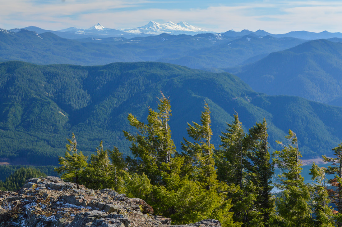
The first 0.4 miles of the hike are along an old road along a Tumble Creek and you have to keep your eyes out for the Tumble Ridge Trail that splits off and goes up to your right. It is easy to miss, especially after the fire burned the sign down. Right after getting onto the actual Tumble Ridge Trail, you will go up 5 short switchbacks and then the trail goes through an area that was logged before the fire so the burnt trees are sparse here and you can get beautiful views of Detroit Lake and Mount Jefferson. 
Mt. Jefferson from Tumble Ridge Trail
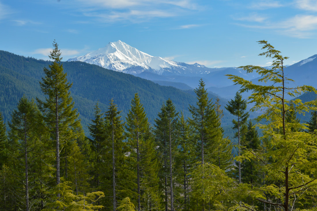
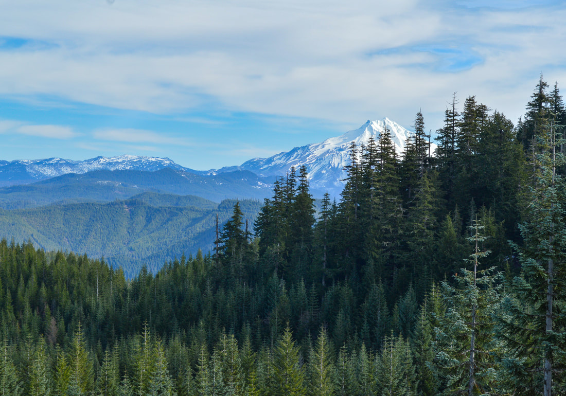
(Mount Jefferson view from the trail before the 2020 fire)
Detroit Lake from Tumble Ridge Trail post fire
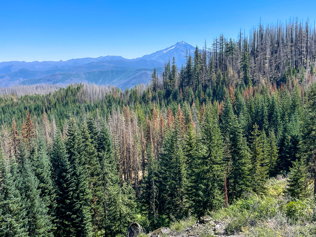
(Mount Jefferson & Detroit Lake view from the trail post fire)
burned Tumble Ridge Trail
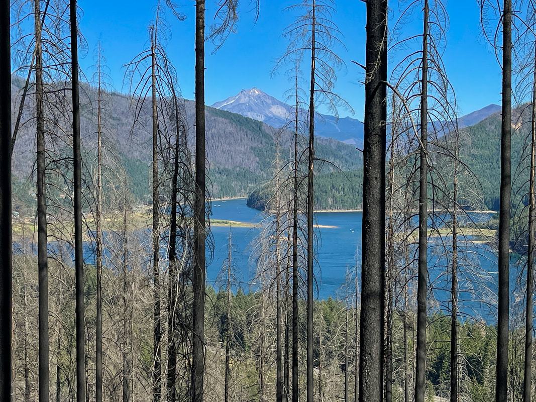
At the 1.25 mile mark, the trail starts to switchback again. Now the switchbacks are a lot longer, as you gain 720 feet of elevation in just shy of a mile. Here the trail traverses a short ridge and then the views open up. There are large rock formations to your right, and you can see Detroit Lake below and Mount Washington and the Three Sisters off in the distance to the south. 
View of Detroit Lake and the Three Sisters from Tumble Ridge Trail
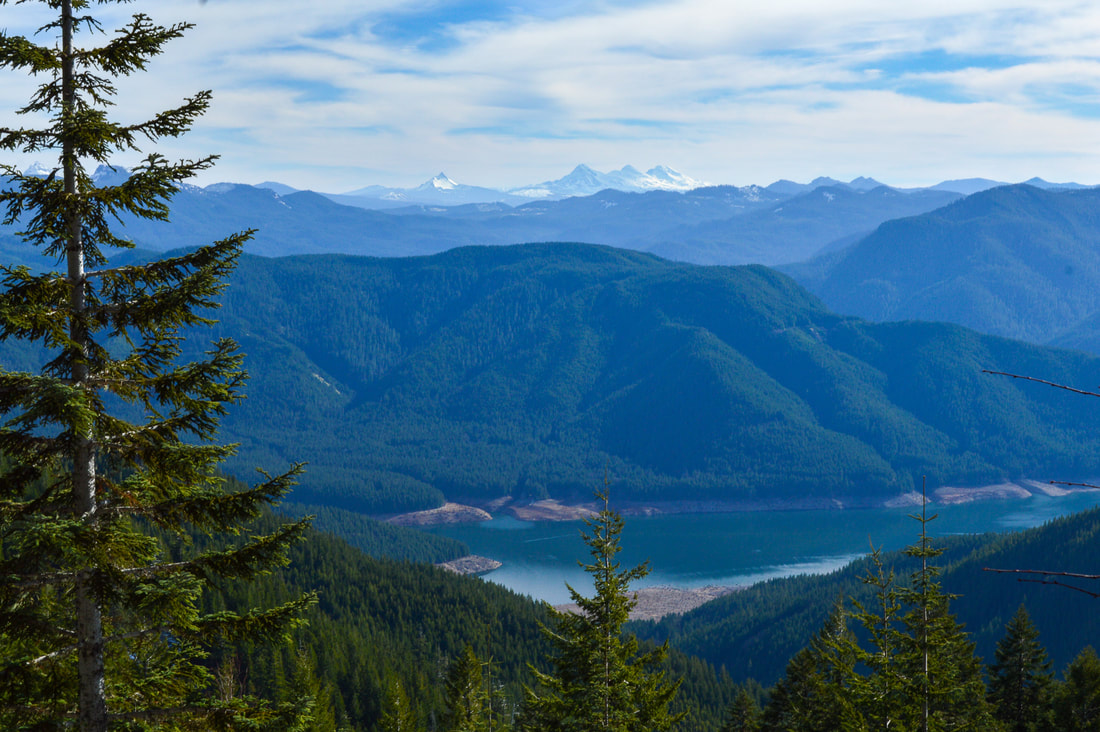
(Detroit Lake and the Three Sisters pre fire)
view of Detroit Lake post fire
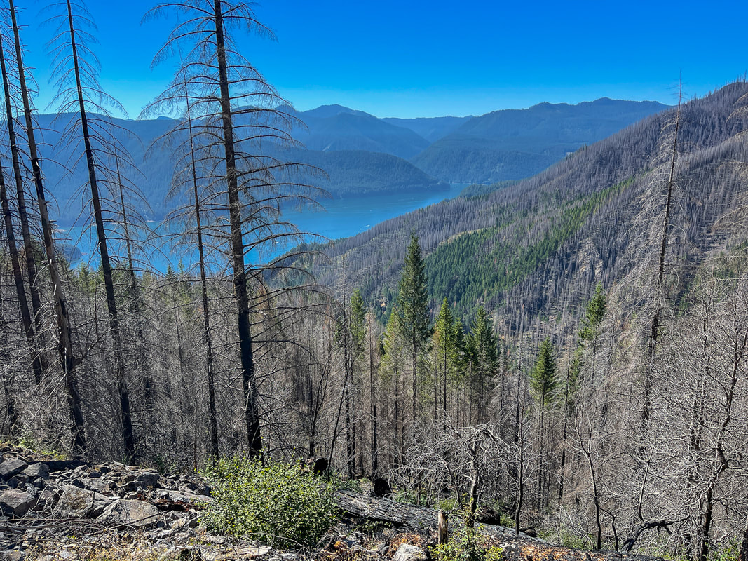
(Detroit Lake post fire)
Tumble Ridge trail through thick bushes
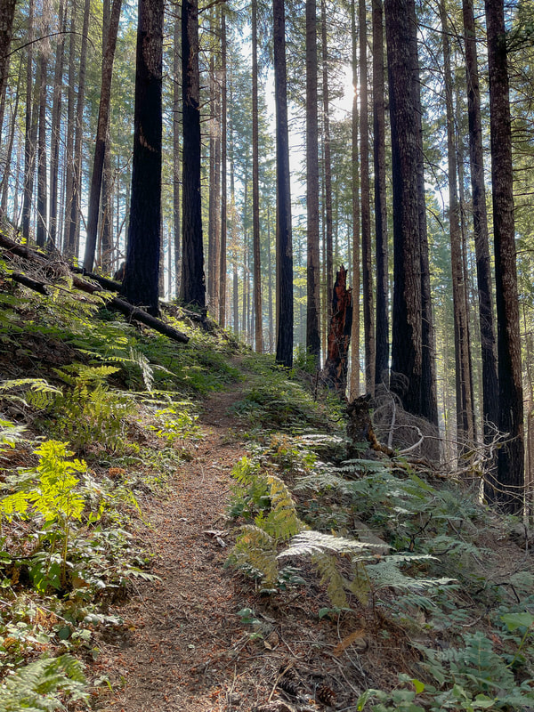
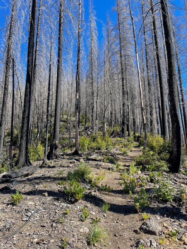
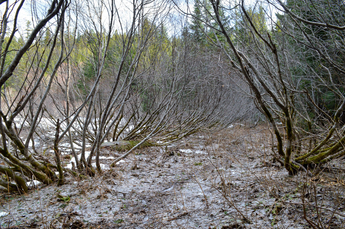
The trail re-enters the now burned forest as you continue to climb uphill. The elevation gain is fairly gradual but constant. At one point you cross an open flat area where there is a possibility for snow to linger early in the season and it can be difficult to follow the trail through the bushes. At the 4 mile mark, you will pop out onto another Tumble Ridge.
Tumble Ridge Trail 2022
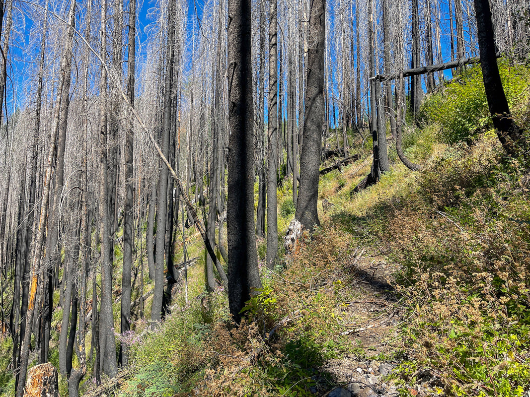
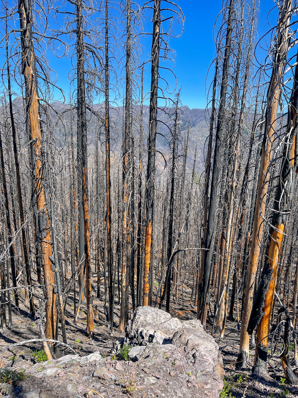
(an example of what the trail looks like post fire)
View of Mt. Jefferson from Tumble Ridge Trail
(pre fire)
Mount Jefferson from Tumble Ridge Trail
(post fire)
Beachie Creak Fire Tumble Ridge Trail
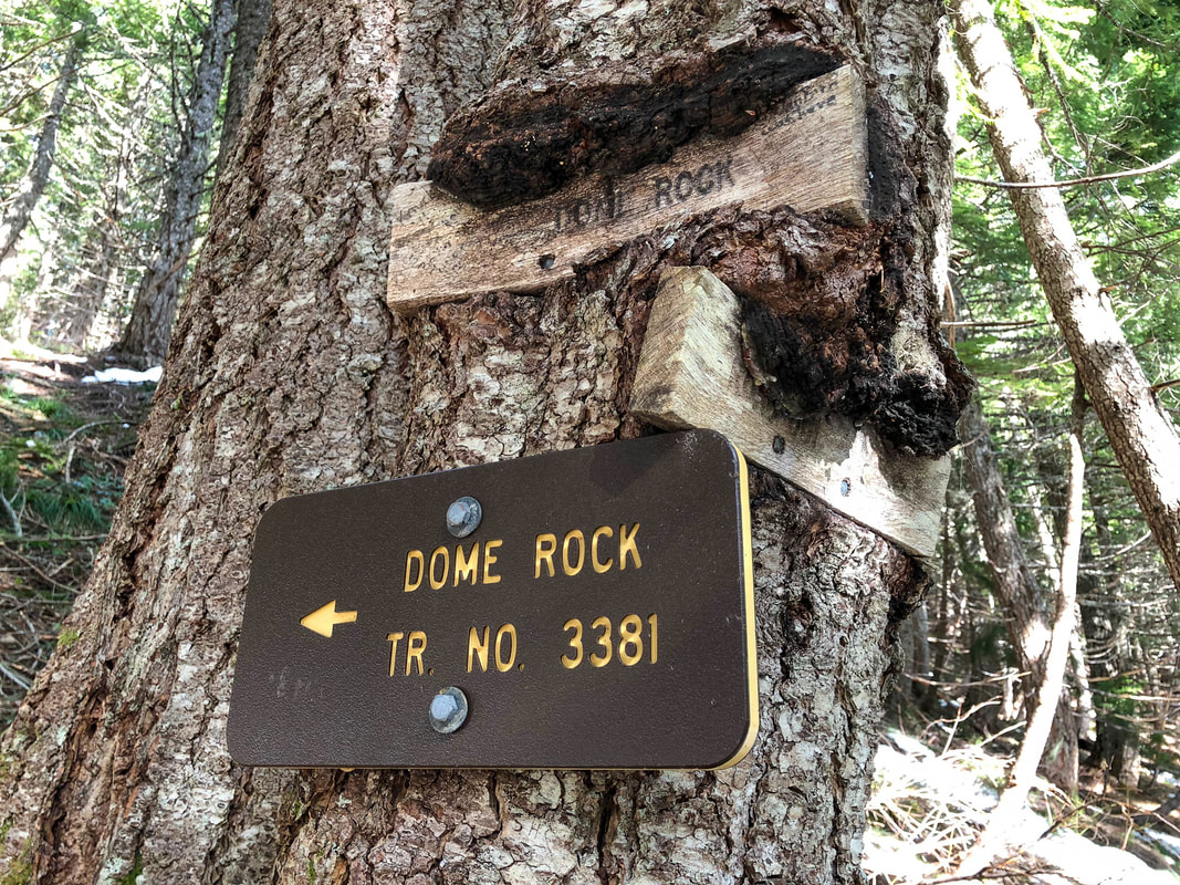
After 0.6 miles of walking along the ridge you will again enter the forest, keep your eyes out for a sign on a tree on your right that marks the trail split to Dome Rock. This sign is very easy to miss because the plastic sign burned away and the two wooden signs are being consumed by the tree! From the sign it's just another 0.4 miles to the summit. ​Since the burn, the approach to the summit is rocky and a bit loose and because there are no more living trees, the steep drop offs become very apparent.

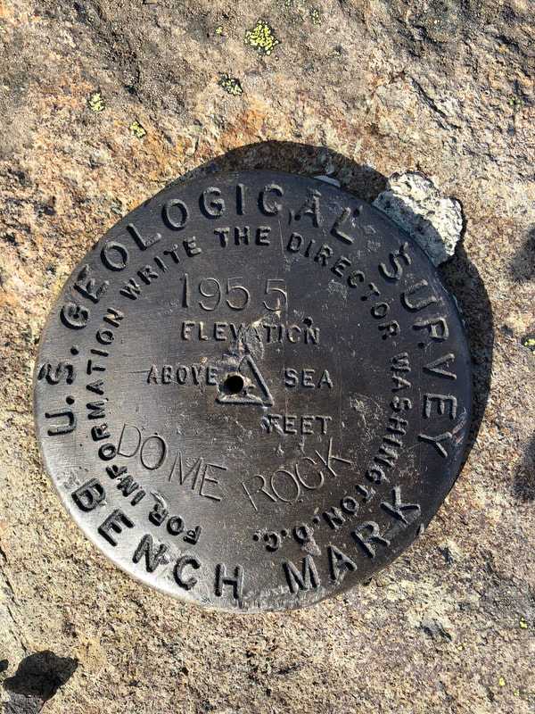
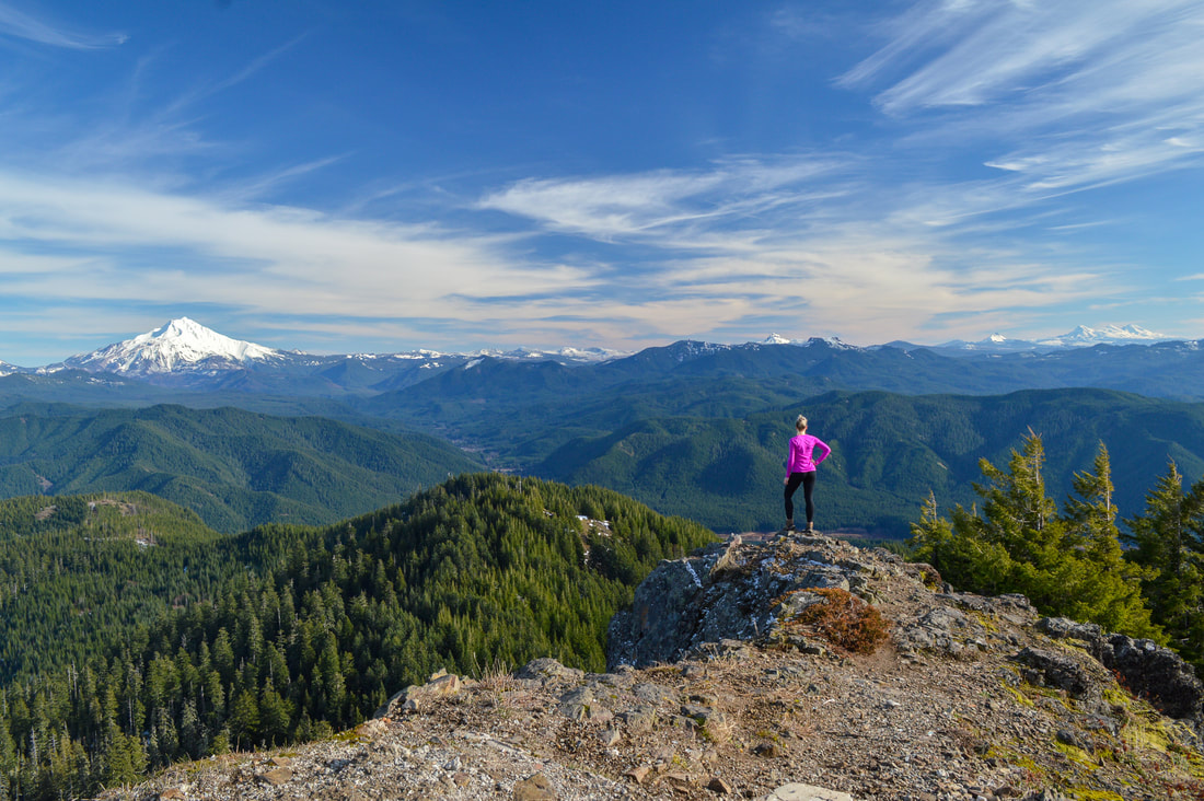
Dome Rock stands at 4,858 ft. tall and the 360 degree views from up there are absolutely incredible! You will see Mount Jefferson and Olallie Butte directly to the east, Three Fingered Jack, Mount Washington and the Three Sisters to the south, and you can even see Mount Hood to the north on a clear day. Detroit Lake looks really far down and you can see how much elevation you gained. Directly to the west you can look down to Tumble Lake, Tumble Rock and Elephant Rock. 
Dome Rock trail junction Tumble Ridge Trail
Dome Rock summit marker
Mt. Jefferson from Dome Rock summit
(Dome Rock summit pre fire)
View of Mt. Jefferson from Dome Rock summit
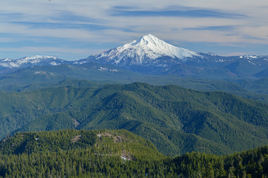
(view of Mount Jefferson from Dome Rock summit pre fire)
Mount Jefferson from Dome Rock
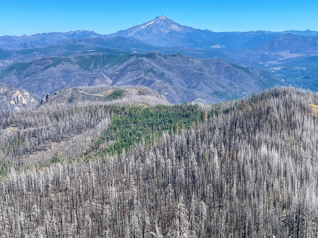
(view of Mount Jefferson from Dome Rock summit post fire)
Mt. Washington and the Three Sisters from Dome Rock summit
(Mount Washington and the Three Sisters from Dome Rock summit pre fire)
Tumble Lake from Dome Rock summit
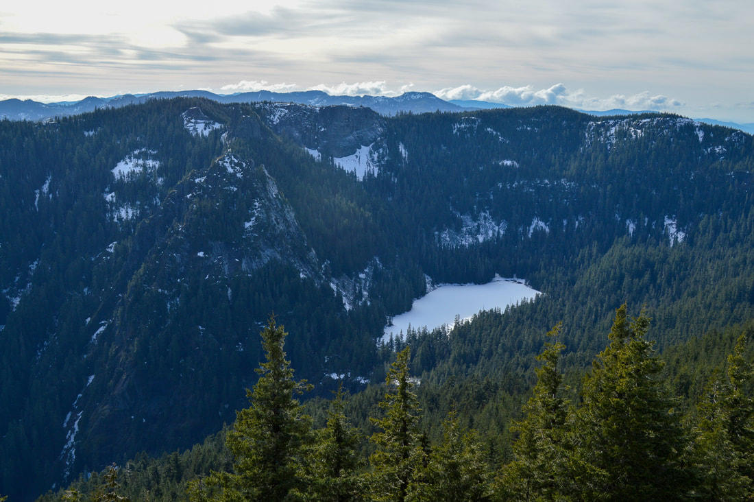
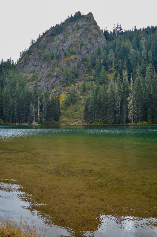
(frozen Tumble Lake pre fire)
Tumble Lake post Beachie Creek Fire
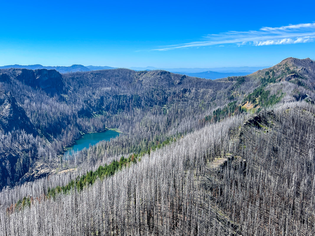
(Tumble Lake post fire)
Cougar tracks along Tumble Ridge Trail
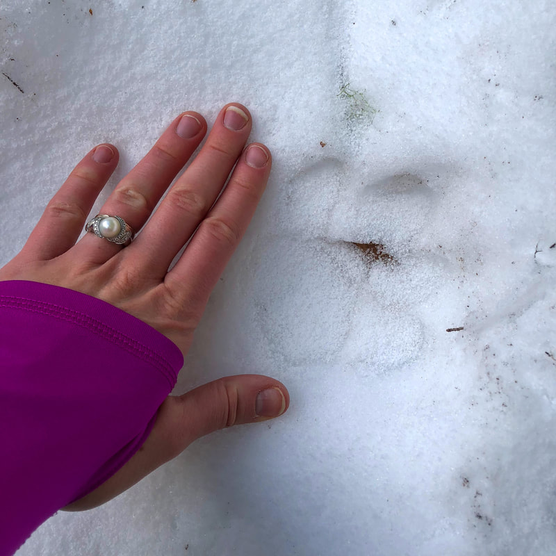
(cougar tracks in the snow in February)
If you want to go down to Tumble Lake, continue right on the Tumble Ridge Trail when you come back down from Dome Rock. You will hike along the ridge trail for another 0.5 miles until you come to a sign pointing to Tumble Lake. Tumble Ridge Trail continues less than half a mile to the upper trailhead at Road 2223. Take the Tumble Lake Trail to your left. It will start going steeply downhill. You will traverse some overgrown meadows where the foliage can be up to your shoulders. Be careful here since there can be lots of gopher and ground squirrel holes and it's easy to step in a hole that you can't see and twist an ankle. After the meadows you will enter the woods again and the trail becomes very rocky. At one point you may think that you have lost the trail, but really the trail has just turned into a gully. The gully dead ends at the shore of Tumble Lake. It is a total of 1.5 miles from the trail split down to the lake (with 900 feet of elevation loss). 
Tumble Rock Tumble Lake
(Tumble Rock and Tumble Lake pre fire)
Tumble Lake, Oregon
(Tumble Lake pre fire)
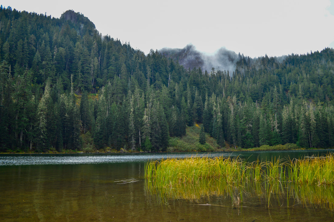
Tumble Lake is absolutely beautiful, at the base of Tumble Rock. It is a shallow but very clear lake, and the shore is a bit swampy with lots of reeds. If you walk along the edge of the lake, you will come to Tumble Falls, where the water from Tumble Lake flows down a large cliff. If you do not want to do this as a day hike, you can camp down here at Tumble Lake, at least you could before the fire, post fire conditions at the lake are unknown at this time. 
​
The hike to Dome Rock is very beautiful and highly recommended to anyone who is up for this type of mileage and elevation gain. You can do a shorter version of this hike if you start up at Road 2223, however this road is steep and has butt-clenchingly steep drop offs (especially now after the fire) and is not recommended to those who are afraid of heights. The longer hike is very rewarding and shows off all of Oregon's beauty from forest to rock formations to insane mountain views!

Directions:

From Salem
  • Drive OR-22 E for 46.2 miles east towards the town of Detroit. Shortly after Mongold Day Use/Detroit Lake State Park, you will find the trailhead on your left. There is room for about 10 cars. (Total of 49.8 miles) 
From Bend
  • Drive north on US-97 north for 2.1 miles and then merge onto US-20 west towards Sisters on Hwy. 20 for 21.5 miles, then take a slight right onto OR-22 towards Detroit. Stay on OR-22 for a total of 31.4 miles to the town of Detroit. 2.6 miles past Detroit, find the trailhead on your right. There is room for about 10 cars. (Total of 82.2 miles)
From Eugene​
  • Drive I-5 north for 39.3 miles then take exit 233 for US-20 toward Albany/Lebanon. Turn left onto US-20 E/Santiam Hwy. SE and after 5.4 miles turn left onto OR-226 E for 6.8 miles and then turn right onto Montgomery Dr. for 2.1 miles then turn left onto Richardson Gap Rd. 2.6 miles. Turn right onto OR-226 for 12.4 miles. In the town of Lyons turn left onto OR-226 E/5th St./Main St. and continue for 1.3 miles and then turn right onto OR-22 E toward Detroit. Stay on this road for 25.2 miles and shortly after Mongold Day Use/Detroit Lake State Park, you will find the trailhead on your left. There is room for about 10 cars. (Total of 97.7 miles)
From Portland
  • Total of 92.5 miles via Salem.
From Medford
  • Total of 261 miles via Eugene.​
To get a more in-depth and personal view of this hike, watch the YouTube video. KEEP IN MIND THIS VIDEO WAS MADE BEFORE THE FIRE!
-This trail write-up was last updated September, 2022-
​*All pictures are taken by Franziska Weinheimer
*Disclaimer: The trail descriptions, mileage, GPS tracks and difficulty ratings depicted on this website are never 100% accurate. Always hike at your own risk, using your own knowledge, equipment and common sense.  Franziska Weinheimer/Hike Oregon are not responsible if you or anyone in your party gets injured or lost while attempting one of these or any other hikes. 

HIKED HERE RECENTLY? PLEASE LEAVE A TRIP REPORT BELOW:

© Hike Oregon 2023
P.O. Box 41911
​Eugene, OR 97404
Proudly powered by Weebly
  • Home
  • *Store*
  • About the author
  • How to use this site
  • Resources
    • Wildflowers
    • Videos
  • Best Oregon Hikes
    • Top Fall Foliage Hikes In Oregon
    • Top 10 Oregon Fall Hikes
    • 20 Best Oregon Waterfall Hikes
    • Top 10 Oregon Hikes for Kids
    • Sno-Parks In Central Oregon
    • Top 10 Oregon Winter Hikes
    • Top Low Elevation Winter Hikes
    • 9 Amazing Oregon Summit Hikes
    • 20 Central Oregon Day Hikes
    • 20 Epic Oregon Wildflower Hikes
    • 5 Weekend Backpacking Trips in Oregon
    • Top One Night Backpacking Trips in Oregon
    • Top 10 Oregon Summer Hikes
    • Top 10 Swimming Spots In Oregon
    • Top 10 Oregon Spring Hikes
  • Oregon Sno-Parks
    • Maxwell Sno-Park
    • Potato Hill Sno-Park
    • Ray Benson Sno-Park
      • Brandenburg Shelter
    • Santiam Sno-Park
    • Three Creek Sno-Park
    • Virginia Meissner Sno-Park
      • Meissner Shelter Loop
      • Nordeen Shelter
    • Gold Lake Sno-Park
      • Westview Shelter to Eagle Rock Overlook
      • Marilyn Lakes Loop
  • Southern Washington
    • Hamilton Mountain
    • Dog Mountain
    • Coyote Wall
    • Mount St. Helens
  • Portland
    • Powell Butte
    • Forest Park
    • Latourell Falls
    • Multnomah/Wahkeena Falls
    • Eagle Creek
    • Mitchell Point
    • Table Rock
    • Tamanawas Falls
    • Trillium Lake
    • East Zigzag Mountain (members only)
  • Salem
    • Abiqua Falls
    • Silver Falls State Park
    • Dome Rock
    • Marion Lake to Marion Mountain
    • Jefferson Park
  • Corvallis
    • Marys Peak East Ridge
    • Marys Peak North Ridge
    • Alsea Falls and Green Peak Falls
    • Corvallis to Sea Trail - Sugarbowl Creek segment (members only)
  • Sweet Home
    • Crescent Mountain
    • Iron Mountain
    • McDowell Creek Falls
    • Middle Santiam River (members only)
    • Lower Soda Creek Falls (members only)
    • Rooster Rock (members only)
  • McKenzie Bridge/Blue River
    • Macduff Mountain
    • Proxy Falls
    • Clear Lake
    • Sahalie/Koosah Falls
    • Blue Pool
    • Erma Bell Lakes
    • Olallie Mountain
    • Horsepasture Mountain
    • Tidbits Mountain
    • Castle Rock
    • Lowder Mountain (members only)
    • East Fork Trail (members only)
    • Rainbow Falls Overlook (members only)
    • Frissell Point (members only)
    • Chucksney Mountain (members only)
    • Substitute Point (members only)
  • Sisters/Santiam Pass
    • Coffin Mountain
    • Trappers Butte and Scar Mountain
    • Maxwell Butte
    • Black Butte
    • Whychus Creek Trail
    • Tam McArthur Rim
    • Black Crater
    • Scott Mountain
    • Obsidian Trail
    • Metolius Preserve
    • Three Fingered Jack Loop
    • Square Lake
    • Canyon Creek Meadows
    • Patjens Lakes
    • Craig Lake (members only)
    • Chush Falls (members only)
    • Rockpile Lake (members only)
    • Santiam Lake (members only)
    • Camp Lake (members only)
    • Park Meadow to Golden Lake (members only)
  • Bend/Redmond/LaPine
    • Steins Pillar
    • Chimney Rock
    • Steelhead Falls
    • Tumalo State Park
    • Tumalo Falls
    • Tumalo Mountain
    • No Name Lake
    • Green Lakes
    • Moraine Lake
    • South Sister Summit
    • Horse Lake
    • Muskrat Lake
    • Paulina Peak
    • Peter Skene Ogden Trail (members only)
  • Eugene
    • Ridgeline Trail
    • Mount Pisgah Summit
    • Mount Pisgah Arboretum
    • Shotgun Creek
    • Mount June
    • Lawler
    • Tire Mountain
    • Goodman Creek
    • Brice Creek
    • Trestle Creek Falls
    • Moon Falls
    • Elijah Bristow State Park
    • South Willamette Trail (members only)
    • Eula Ridge (members only)
    • Eagle's Rest (members only)
  • Oakridge
    • Deception Creek
    • North Salmon Creek
    • Grasshopper Ridge
    • Larison Creek
    • Bunchgrass Ridge
    • Salt Creek Falls
    • Waldo Lake Loop
    • South Waldo Loop
    • The Twins
    • Rosary Lakes
    • Yoran Lake
    • Fawn Lake
    • Windy Lakes
    • Divide Lake
    • Diamond Peak Summit
    • Cowhorn Mountain
    • Wall Creek Warm Springs (members only)
    • Moon Point (members only)
    • Bobby Lake (members only)
    • Lillian Falls (members only)
    • Middle Fork Willamette Trail (members only)
    • Pool Creek Falls (members only)
    • Dead Mountain (members only)
    • Larison Rock (members only)
    • Quinn Lakes & Eddeeleo Lakes (members only)
    • Waldo Mountain Lookout (members only)
    • Blair Lake to Spring Prairie (members only)
    • Rigdon Lakes loop (members only)
  • Oregon Coast
    • Cascade Head
    • Drift Creek Falls
    • Sweet Creek Falls
    • Beaver Creek Falls
    • Kentucky Falls
    • Hobbit Trail to Heceta Head
    • Valley Trail to China Creek
    • North Fork Smith River (members only)
    • Cummins Ridge (member's only)
    • Horse Creek (members only)
    • Siltcoos Lake (members only)
  • Southern Oregon
    • Fall Creek Falls
    • Watson Falls
    • Wild Rogue Loop
    • Mt. Thielsen
    • Crater Lake National Park
      • The Watchman
      • Mount Scott
      • The Pinnacles
    • Lower Table Rock
    • Pilot Rock
    • Wagner Butte
    • Mt. McLoughlin
    • Lemolo Falls (members only)
    • Fern Falls (members only)
  • Eastern Oregon
    • Painted Cove
    • Anthony Lake Loop
    • Mount Howard
    • Eagle Cap summit
    • Schneider Cabin (members only)
    • Strawberry Lake & Strawberry Falls (members only)
  • Oregon PCT sections
  • Tips & Tricks
    • Leave No Trace
    • How To Pick The Right Backpacking Tent
    • Top Tips For Hiking With Infants And Toddlers
    • Poison Oak, Ivy and Sumac
    • How to dress for cold weather hikes
    • Outdoorsy Holiday Gift Guide 2022
    • Hiker Holiday Gift Guide 2019
    • Outdoor Holiday Gift Guide 2018
    • Hiking Holiday Gift Guide 2017
  • Reviews/Gear
    • Stay Kühl This Summer
    • Outdoor Herbivore Backpacking Food Review
    • Osprey Aura AG 65 Backpack review
    • Big Agnes Fly Creek UL2 review
    • REI Quarter Dome 1 review
  • Adventure Stories
    • Hiking The Rae Lakes Loop
    • 110 Miles on the PCT
    • Three Fingered Jack Adventures
    • Jefferson Wilderness