Steins Pillar
Hike details:
Mileage: 4 miles round trip w/ 660 ft. elevation gain
Approximate hike time: 1 hour 44 minutes w/ an average pace of 2.3 mph
Difficulty: Easy
Trail usage: Medium on late spring and early summer weekends, low during any other time
Highest elevation: 4,547 ft. Lowest elevation: 4,082 ft.
General location: 17.6 miles northeast of Prineville - Ochoco National Forest
Accessible: April through November
(Best time to go is mid-May for prime wildflower bloom. Fall is great as well because the temperatures are cooler and there are less people on the trail).
Permits required: N/A
Pit toilet at trailhead: No
Trail allows: Dogs, rock climbing
Possible dangers: N/A
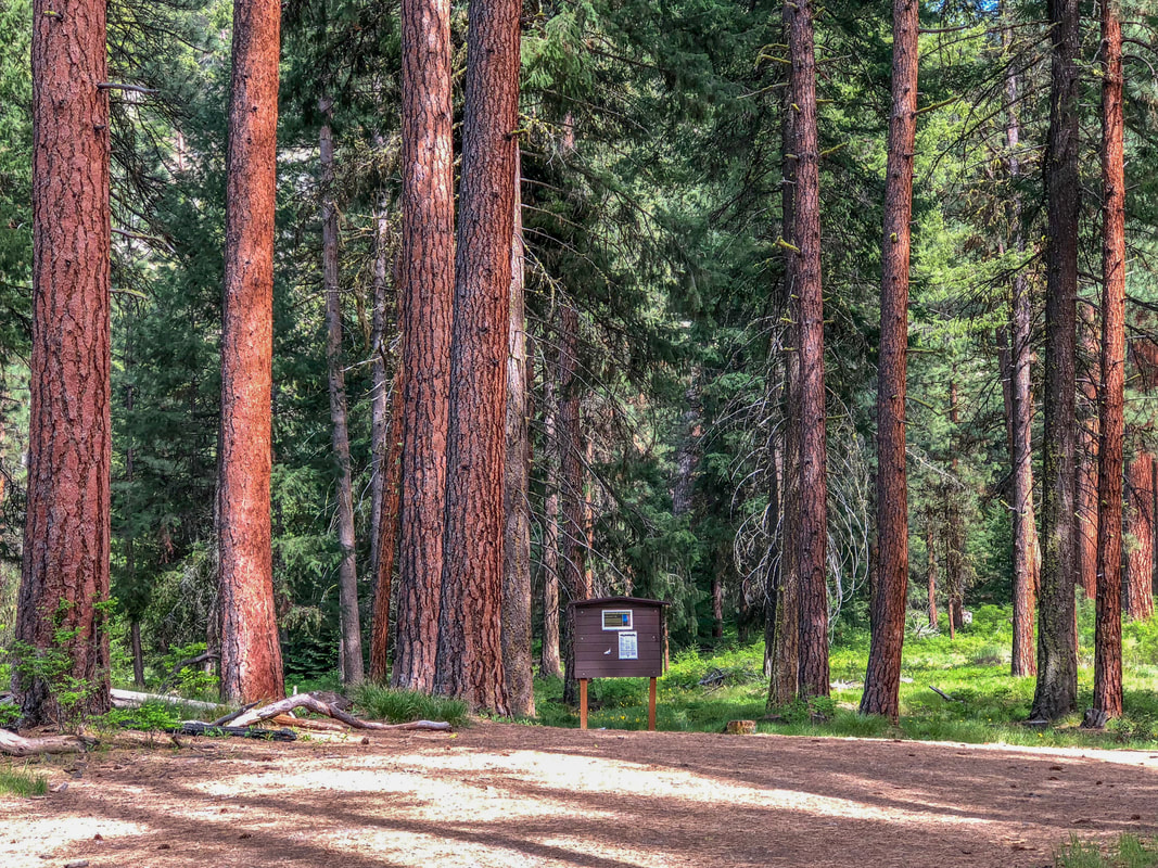
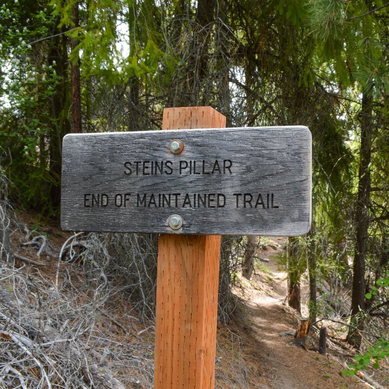
(Steins Pillar trailhead among Ponderosa pines)
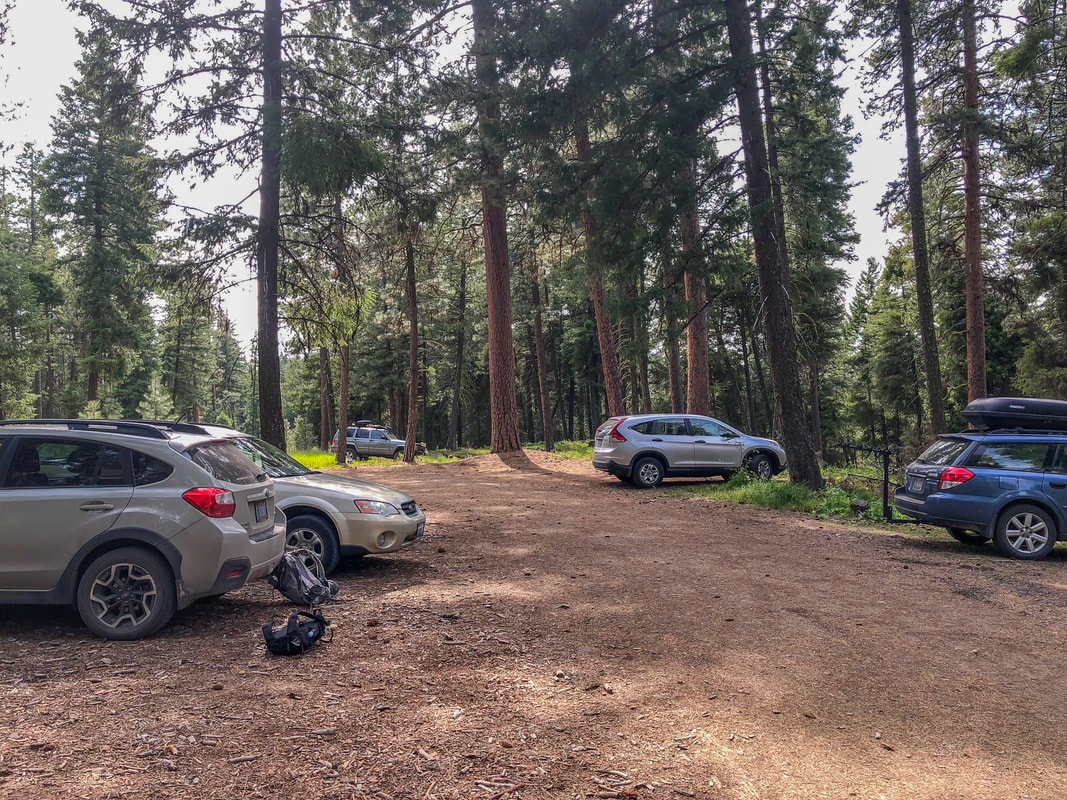
(trailhead parking)
|
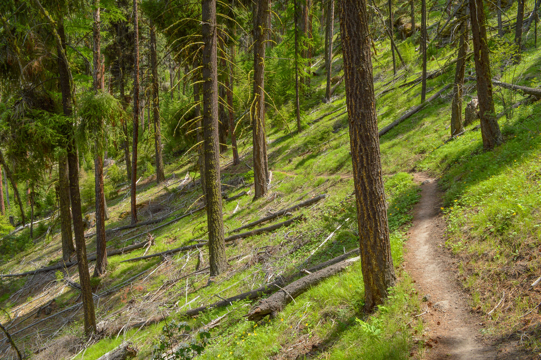
Description:Steins Pillar is a wonderful family friendly hike that is perfect for a day trip in the spring. Among stately Ponderosa pine trees you will see the spacious trailhead parking. The trail begins by trending uphill via 4 short switchbacks through the forest, then continuing along a sidehill before opening up at a ridge.
|
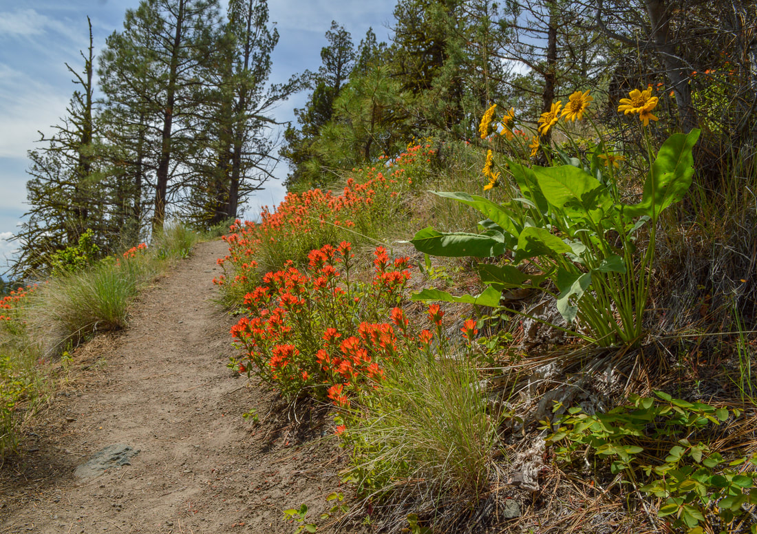
(paintbrush and balsamroot flowers blooming in May)
During the month of May you will see beautiful paintbrush, lupine and balsamroot flowers lining the trail, as well as some wild strawberries. As the trail levels off a bit you will see some views across the Mill Creek Valley, before heading into the woods again. The ponderosa pines along this trail are absolutely stunning and very tall, and you will also see some ancient juniper trees, hemlock and lodgepole pine.
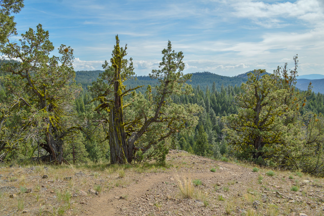
(juniper trees along the Steins Pillar Trail)
|
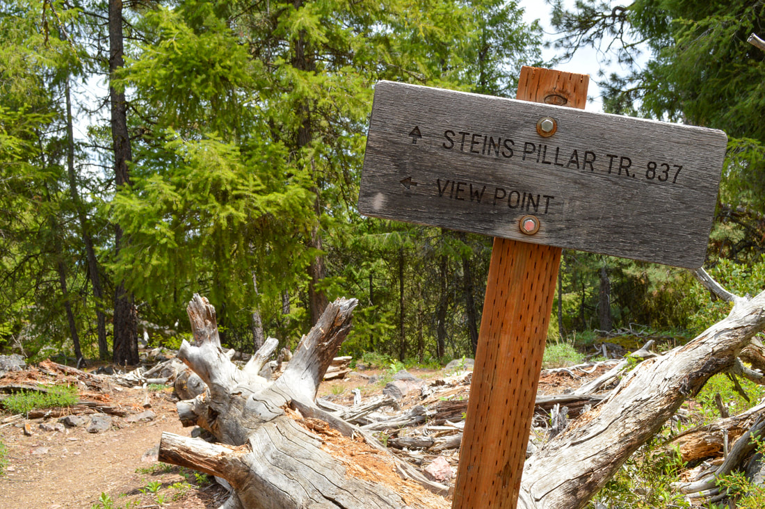
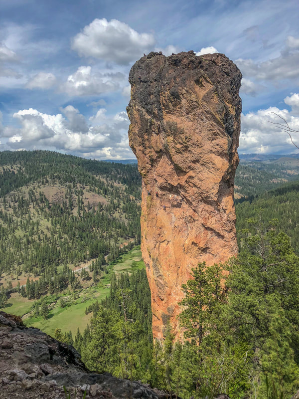
After 1.3 miles you will see a sign for a viewpoint to the left. From here you will get a better view of the Mill Creek Valley and you can see the top of Steins Pillar. Steins Pillar was named after Major Enoch Steen, who was an explorer of this area in the 1860's. Apparently his name was often misspelled and it ended up staying 'Stein' on maps and documents and was never changed.
|
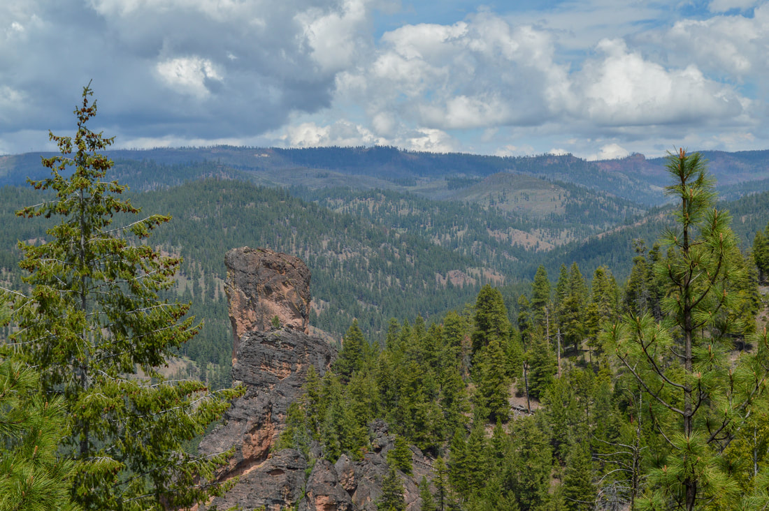
(Steins Pillar and the Mill Creek Valley from viewpoint)
|
|
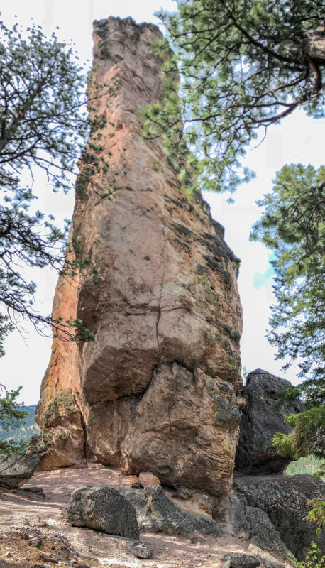
(Steins Pillar from the bottom)
|
|
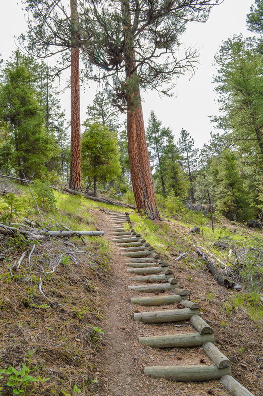
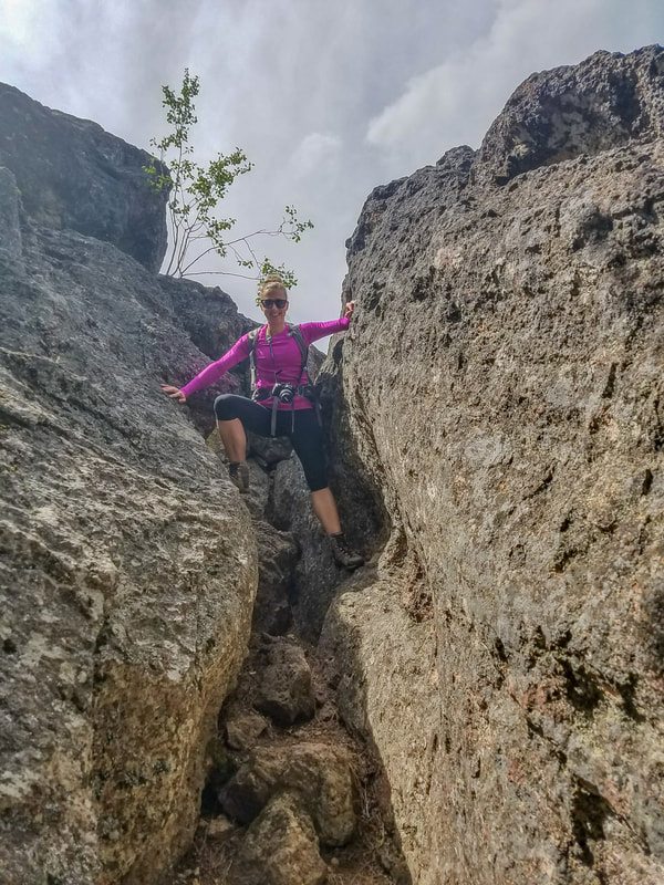
After checking out the viewpoint, the trail meanders downhill a bit via some beautifully built wooden stairs. You will see a sign marking the end of the trail and here you can see 350 foot tall Steins Pillar from the bottom. If you are not hiking with small children, there is a neat viewpoint to the right of Steins Pillar that you can check out, but it does involve some rock scrambling to get to. The viewpoint also has a very steep drop off, but it gives you a face to face view at Steins Pillar. If there are people rock climbing you will be able to watch them and cheer them on as you enjoy a lunch/snack break. If you have been to Smith Rock State Park, Steins Pillar might remind you a little bit of Monkey Face, which is also extremely popular with rock climbers.
|
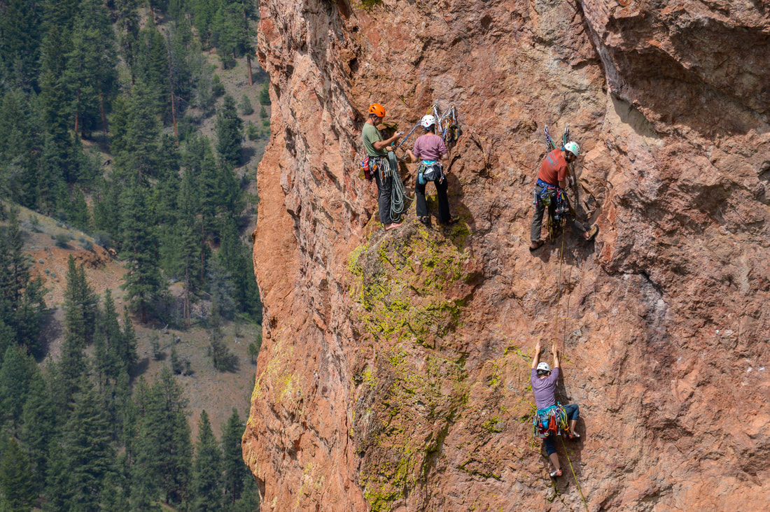
(rock climbers on Steins Pillar)
Steins Pillar is a sweet and easy trail perfect for a spring time family excursion. It is just over an hour drive from Bend and a great way to get introduced to the Ochoco National Forest. There are many other trails nearby as well as campgrounds, so you can easily stay for the weekend.
|
Directions:
From Prineville
- Drive US-26 E for 8.7 miles, then at a fork turn left onto Mill Creek Road for 6.7 miles. Turn right onto Forest Road 3300-500 for 2 winding miles and find the trailhead on your left. (Total of 17.6 miles)
- Total of 51 miles via Prineville.
- Total of 160 miles via Prineville.
- Total of 163 miles via Prineville.
- Total of 164 miles via Prineville.
- Total of 223 miles via Prineville.
-This trail write-up was last updated May 2018-
*All pictures are taken by Franziska Weinheimer
*All pictures are taken by Franziska Weinheimer
*Disclaimer: The trail descriptions, mileage, GPS tracks and difficulty ratings depicted on this website are never 100% accurate. Always hike at your own risk, using your own knowledge, equipment and common sense. Franziska Weinheimer/Hike Oregon are not responsible if you or anyone in your party gets injured or lost while attempting one of these or any other hikes.