Hike Oregon
  • Home
  • *Store*
  • About the author
  • How to use this site
  • Resources
    • Wildflowers
    • Videos
  • Best Oregon Hikes
    • 20 Epic Oregon Wildflower Hikes
    • 5 Weekend Backpacking Trips in Oregon
    • Top 10 Swimming Spots In Oregon
    • 9 Amazing Oregon Summit Hikes
    • Top 10 Oregon Summer Hikes
    • 20 Central Oregon Day Hikes
    • Top One Night Backpacking Trips in Central Oregon
    • Top 10 Oregon Hikes for Kids
    • 20 Best Oregon Waterfall Hikes
    • Underrated Fall Foliage Hikes In Oregon
    • Top 10 Oregon Fall Hikes
    • Best Rainy Day Hikes In Oregon
    • Sno-Parks In Central Oregon
    • Top 10 Oregon Winter Hikes
    • Top Low Elevation Winter Hikes
    • Easy Hikes in Oregon
    • Top 10 Oregon Spring Hikes
  • Oregon Sno-Parks
    • Maxwell Sno-Park
    • Potato Hill Sno-Park
    • Ray Benson Sno-Park
      • Brandenburg Shelter
    • Santiam Sno-Park
    • Three Creek Sno-Park
    • Virginia Meissner Sno-Park
      • Meissner Shelter Loop
      • Nordeen Shelter
    • Gold Lake Sno-Park
      • Westview Shelter to Eagle Rock Overlook
      • Marilyn Lakes Loop
    • Ikenick Sno-Park (members only)
  • Southern Washington
    • Hamilton Mountain
    • Dog Mountain
    • Coyote Wall
    • Mount St. Helens
  • Portland
    • Powell Butte
    • Forest Park
    • Latourell Falls
    • Multnomah/Wahkeena Falls
    • Eagle Creek
    • Mitchell Point
    • Table Rock
    • Tamanawas Falls
    • Trillium Lake
    • East Zigzag Mountain (members only)
  • Salem
    • Abiqua Falls
    • Silver Falls State Park
    • Dome Rock
    • Marion Lake to Marion Mountain
    • Jefferson Park via Whitewater Trail
  • Corvallis
    • William Finley Wildlife Refuge
      • Campbell Boardwalk
      • Woodpecker Loop
      • Mill Hill Loop
      • Beaver Pond Loop
    • Marys Peak East Ridge
    • Marys Peak North Ridge
    • Alsea Falls and Green Peak Falls
    • Corvallis to Sea Trail - Sugarbowl Creek segment (members only)
  • Sweet Home
    • Crescent Mountain
    • Iron Mountain
    • McDowell Creek Falls
    • Middle Santiam River (members only)
    • Lower Soda Creek Falls (members only)
    • Rooster Rock (members only)
  • McKenzie Bridge/Blue River
    • Macduff Mountain
    • Proxy Falls
    • Clear Lake
    • Sahalie/Koosah Falls
    • Blue Pool
    • Erma Bell Lakes
    • Olallie Mountain
    • Horsepasture Mountain
    • Tidbits Mountain
    • Castle Rock
    • Separation Lake (members only)
    • Lowder Mountain (members only)
    • East Fork Trail (members only)
    • Rainbow Falls Overlook (members only)
    • Frissell Point (members only)
    • Substitute Point (members only)
  • Sisters/Santiam Pass
    • Coffin Mountain
    • Trappers Butte and Scar Mountain
    • Maxwell Butte
    • Black Butte
    • Whychus Creek Trail
    • Tam McArthur Rim
    • Black Crater
    • Scott Mountain
    • Obsidian Trail
    • Metolius Preserve
    • Three Fingered Jack Loop
    • Square Lake
    • Canyon Creek Meadows
    • Patjens Lakes
    • Craig Lake (members only)
    • Chush Falls (members only)
    • Rockpile Lake (members only)
    • Santiam Lake (members only)
    • Camp Lake (members only)
    • Park Meadow to Golden Lake (members only)
  • Bend/Redmond/LaPine
    • Steins Pillar
    • Chimney Rock
    • Steelhead Falls
    • Tumalo State Park
    • Shevlin Park Loop
    • Tumalo Falls
    • Tumalo Mountain
    • No Name Lake
    • Green Lakes
    • Moraine Lake
    • South Sister Summit
    • Horse Lake
    • Muskrat Lake
    • Paulina Peak
    • The Badlands - Flatiron Rock Trail
    • Peter Skene Ogden Trail (members only)
  • Eugene
    • Ridgeline Trail
    • Mount Pisgah Summit
    • Mount Pisgah Arboretum
    • Shotgun Creek
    • Mount June
    • Lawler
    • Tire Mountain
    • Hardesty Mountain
    • Goodman Creek
    • Brice Creek
    • Trestle Creek Falls
    • Parker Falls
    • Moon Falls
    • Elijah Bristow State Park
    • South Willamette Trail (members only)
    • Eula Ridge (members only)
    • Eagle's Rest (members only)
  • Oakridge
    • Deception Butte
    • North Salmon Creek
    • Sourgrass Mountain
    • Grasshopper Ridge
    • Larison Creek
    • Bunchgrass Ridge
    • Salt Creek Falls
    • Waldo Lake Loop
    • South Waldo Loop
    • The Twins
    • Rosary Lakes
    • Yoran Lake
    • Fawn Lake
    • Windy Lakes
    • Divide Lake
    • Diamond Peak via Rockpile Lake Trailhead
    • Diamond Peak via Summit Lake
    • Cowhorn Mountain
    • Klovdahl Bay (members only)
    • Verdun Trail (members only)
    • Heckletooth Mountain (members only)
    • Wall Creek Warm Springs (members only)
    • Moon Point (members only)
    • Bobby Lake (members only)
    • Lillian Falls (members only)
    • Middle Fork Willamette Trail (members only)
    • Pool Creek Falls (members only)
    • Dead Mountain (members only)
    • Larison Rock (members only)
    • Quinn Lakes & Eddeeleo Lakes (members only)
    • Waldo Mountain Lookout (members only)
    • Blair Lake to Spring Prairie (members only)
    • Rigdon Lakes loop (members only)
  • Oregon Coast
    • Cascade Head
    • Drift Creek Falls
    • Sweet Creek Falls
    • Beaver Creek Falls
    • Kentucky Falls
    • Hobbit Trail to Heceta Head
    • Valley Trail to China Creek
    • Sutton Creek Trail (members only)
    • North Fork Smith River (members only)
    • Cummins Ridge (member's only)
    • Horse Creek (members only)
    • Siltcoos Lake (members only)
  • Southern Oregon
    • Fall Creek Falls
    • Watson Falls
    • Wild Rogue Loop
    • Mt. Thielsen
    • Crater Lake National Park
      • The Watchman
      • Mount Scott
      • The Pinnacles
    • Lower Table Rock
    • Pilot Rock
    • Wagner Butte
    • Mt. McLoughlin
    • Lemolo Falls (members only)
    • Fern Falls (members only)
  • Eastern Oregon
    • Painted Cove
    • Anthony Lake Loop
    • Mount Howard
    • Eagle Cap summit
    • Schneider Cabin (members only)
    • Strawberry Lake & Strawberry Falls (members only)
  • Northern California
    • Taylor & Hogan Lake (members only)
  • Oregon PCT sections
    • PCT: CA border to Callahan's
  • Tips & Tricks
    • Leave No Trace
    • Safety Tips for Solo Hiking & Backpacking
    • Nutrition On The Trail
    • How Much Water To Carry When Backpacking
    • Storing Your Bear Canister When Backpacking
    • How To Pick The Right Backpacking Tent
    • Top Tips For Hiking With Infants And Toddlers
    • Poison Oak, Ivy and Sumac
    • How to dress for cold weather hikes
  • Reviews and Gear
    • Choosing and Using Trekking Poles
    • A Guide to Choosing the Perfect Backpacking Pack
    • Hiking Pants and Leggings
    • Jackets for Hiking and Backpacking
    • Long Sleeved Shirts For Cold Weather Hiking
    • Stay Kühl This Summer
    • Outdoor Herbivore Backpacking Food Review
    • Osprey Aura AG 65 Backpack review
    • Big Agnes Fly Creek UL2 review
    • REI Quarter Dome 1 review
    • Hike Oregon's Gear Favorites
    • Outdoorsy Holiday Gift Guide 2022
    • Hiker Holiday Gift Guide 2019
    • Outdoor Holiday Gift Guide 2018
    • Hiking Holiday Gift Guide 2017
  • Adventure Stories
    • Hiking The Rae Lakes Loop
    • 110 Miles on the PCT
    • Three Fingered Jack Adventures
    • Jefferson Wilderness

Clear Lake

​
Get the printable version of this hike

Hike details:

Mileage: 5 mile loop w/ 560 ft. elevation gain
Approximate hike time: 2 hours 10 minutes w/ an average pace of 2.3 mph
Difficulty: Easy 
Trail usage: High on weekends during all seasons, medium on summer and fall weekdays, low during the winter and early spring weekdays 
Highest elevation: 3,100 ft. Lowest elevation: 3,020 ft.
General location: 21 miles north of McKenzie Bridge - Willamette National Forest
Accessible: April through early December for hiking, mid-December through early March for snowshoeing or cross-country skiing
(Best time to go is end of September to mid-October when the foliage along the lake is changing color).

Permits required: N/A
Pit toilet at trailhead: Yes
Trail allows: Dogs, mountain biking (on the McKenzie River Trail only - not on the whole loop), snowshoeing and cross-country skiing
Possible dangers: N/A
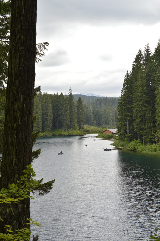
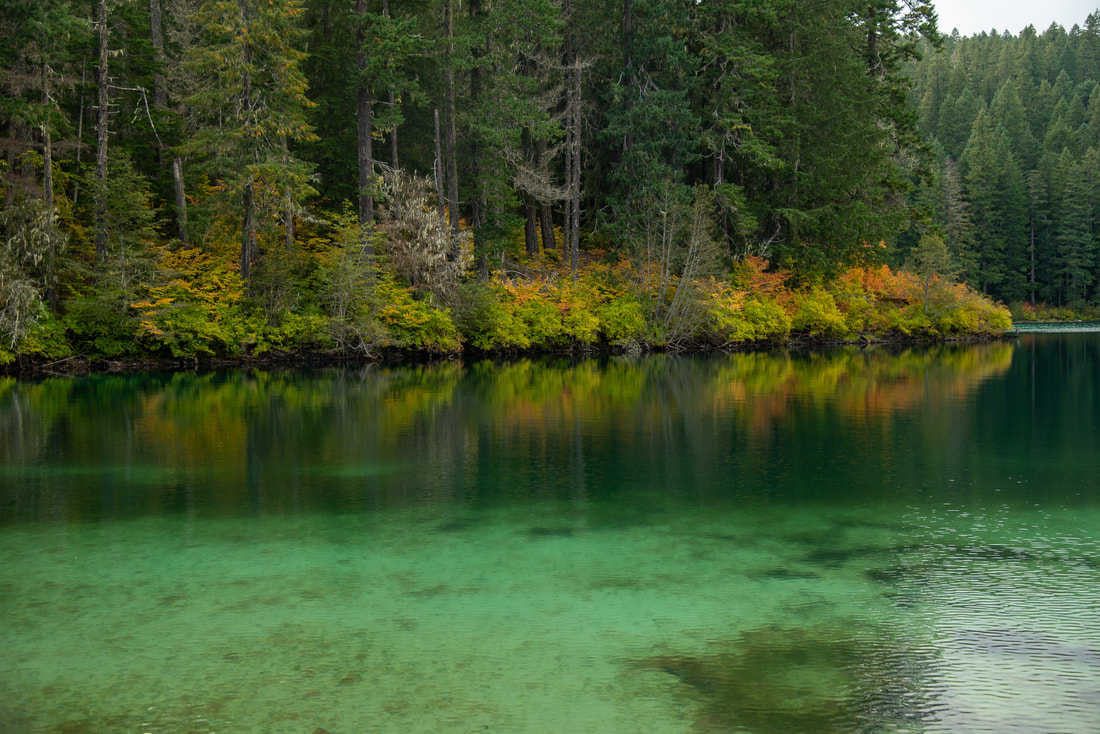
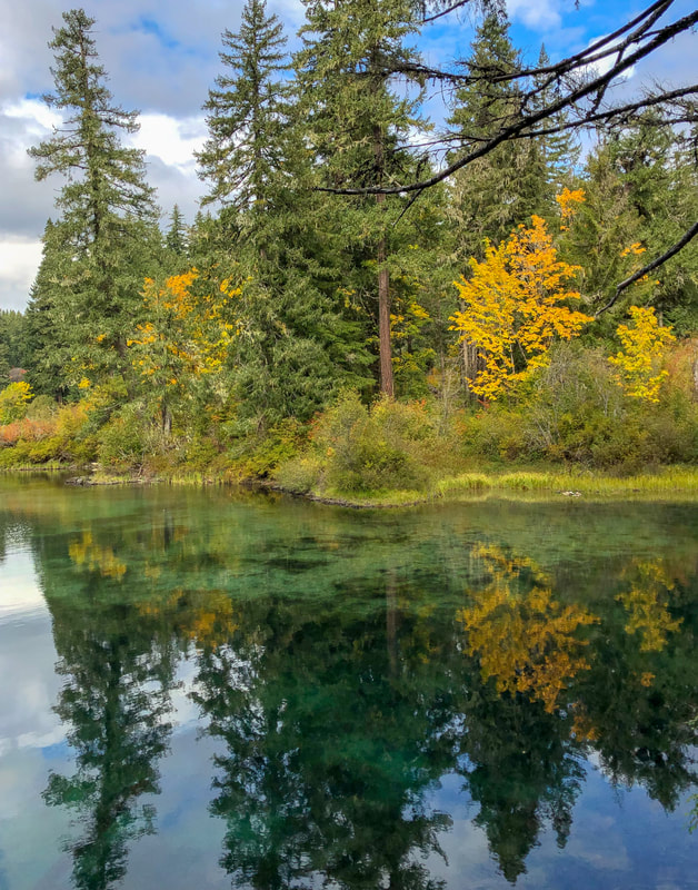
Clear Lake hike bridge

Description​:

Clear Lake is a popular place to recreate whether it be hiking, fishing, canoeing, kayaking, mountain biking, or snowshoeing/cross-country skiing in the winter time. Clear Lake was formed 3,000 years ago when lava flowed from nearby Sand Mountain and dammed the McKenzie River. This created a clear, cold lake where you can still see petrified tree snags from long ago below the surface of the water. Clear Lake has a maximum depth of about 56 feet and here you will find rainbow trout and eastern brook trout which are stocked and there are some native cutthroat trout in the lake as well.
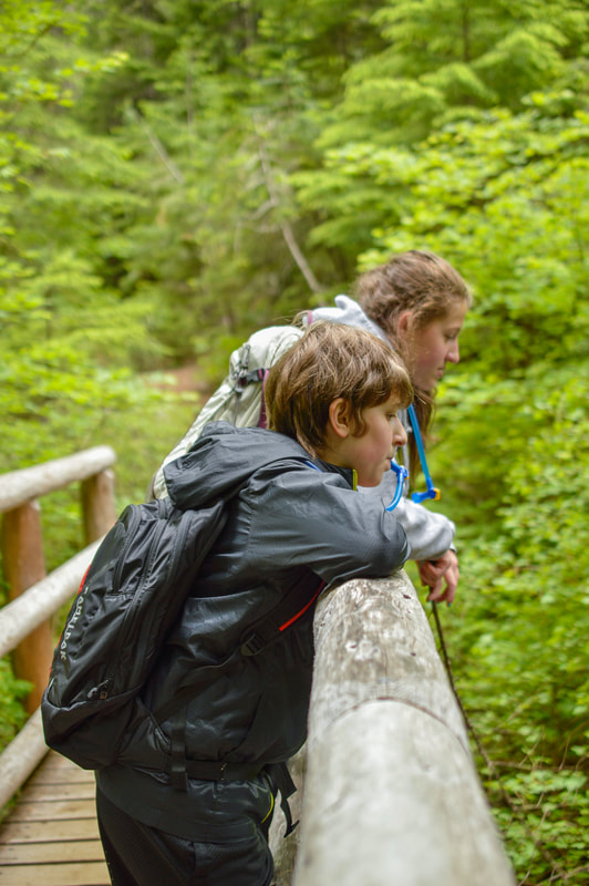
​​To do the loop around Clear Lake, you will park at the lodge (the day use area with the bathroom is just to the right of the lodge) and hike to the left of the lodge. Pass the cabins that you can rent out, and this is where you find the trail. After 0.7 miles you will come to a bridge that crosses Ikenick Creek.
Clear Lake Bridge with fall foliage
Cross the bridge and continue on for 0.5 miles until you come to another bridge that crosses Fish Lake Creek. Right before the bridge you will see a sign on the left for the McKenzie River trailhead. This is where mountain bikers start when they do the entire 26 mile long McKenzie River Trail. If you are here in the winter and there is snow on the bridge, it is recommended that you take off your skis or snowshoes and cross the creek bed instead of the bridge. There is rarely any water in this creek except in spring. It is not recommended that you cross the bridge with snow on it. The bridge is pretty narrow, and the snow can pile up past the railings, which means you can easily slide off and fall 20 feet into a dry rocky creek bed. ​

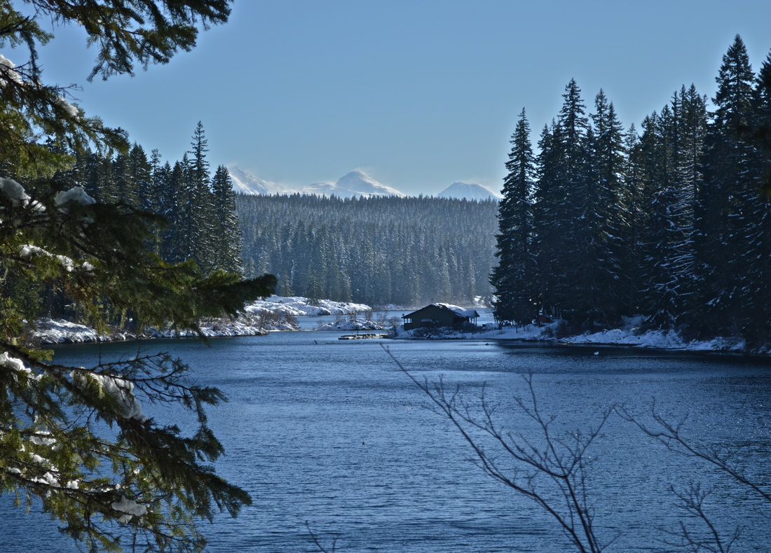
​After the bridge, you will head uphill a bit more (the incline is more noticeable in the winter with snowshoes than in the summer on a dry trail), until you come to your first view of Clear Lake. Looking at the lake from this angle is pretty cool and on a clear day you can see the Three Sisters in the background.

The bridge crossing Fish Lake Creek in winter along the Clear Lake hiking trail
Clear Lake lodge along the Clear Lake hiking trail
The Three Sisters across Clear Lake along the Clear Lake hiking trail
From the bridge it is 0.5 miles to the Great Spring. If you thought that Clear Lake was blue, you will be awestruck when you see the Great Spring. In the summer you are able to climb down a steep embankment and you can sit right at the spring's edge.​ You can see all the way to the bottom of this clear blue spring and see ancient tree snags.
The Great Spring Clear Lake in the fall
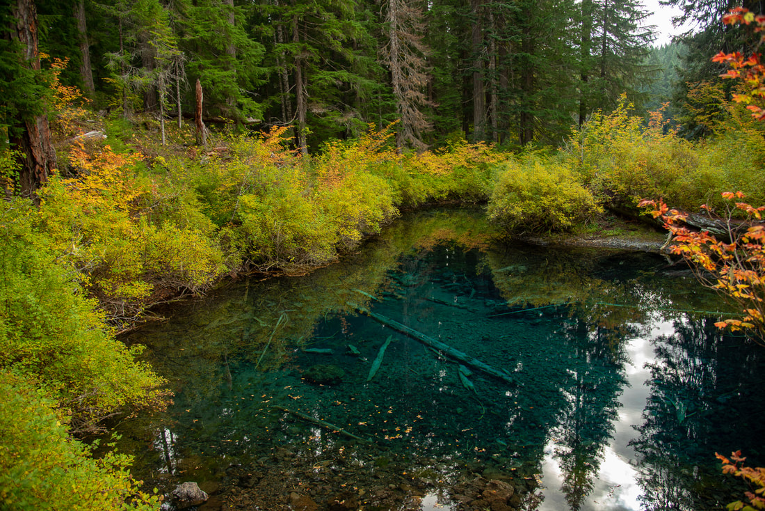
(The Great Spring in the fall)
The Great Spring along the Clear Lake hiking trail
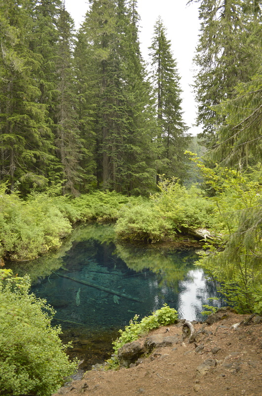
(The Great Spring in the summer)
The Great Spring in winter along the Clear Lake hiking trail
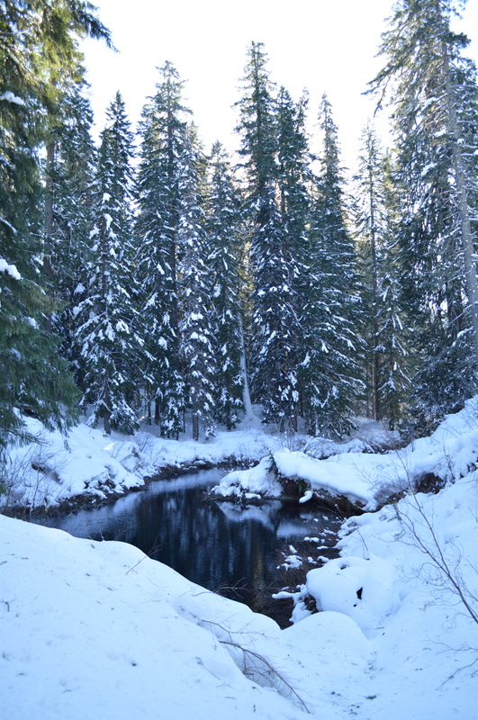
(The Great Spring in the winter)
Lava flow along the Clear lake hiking trail
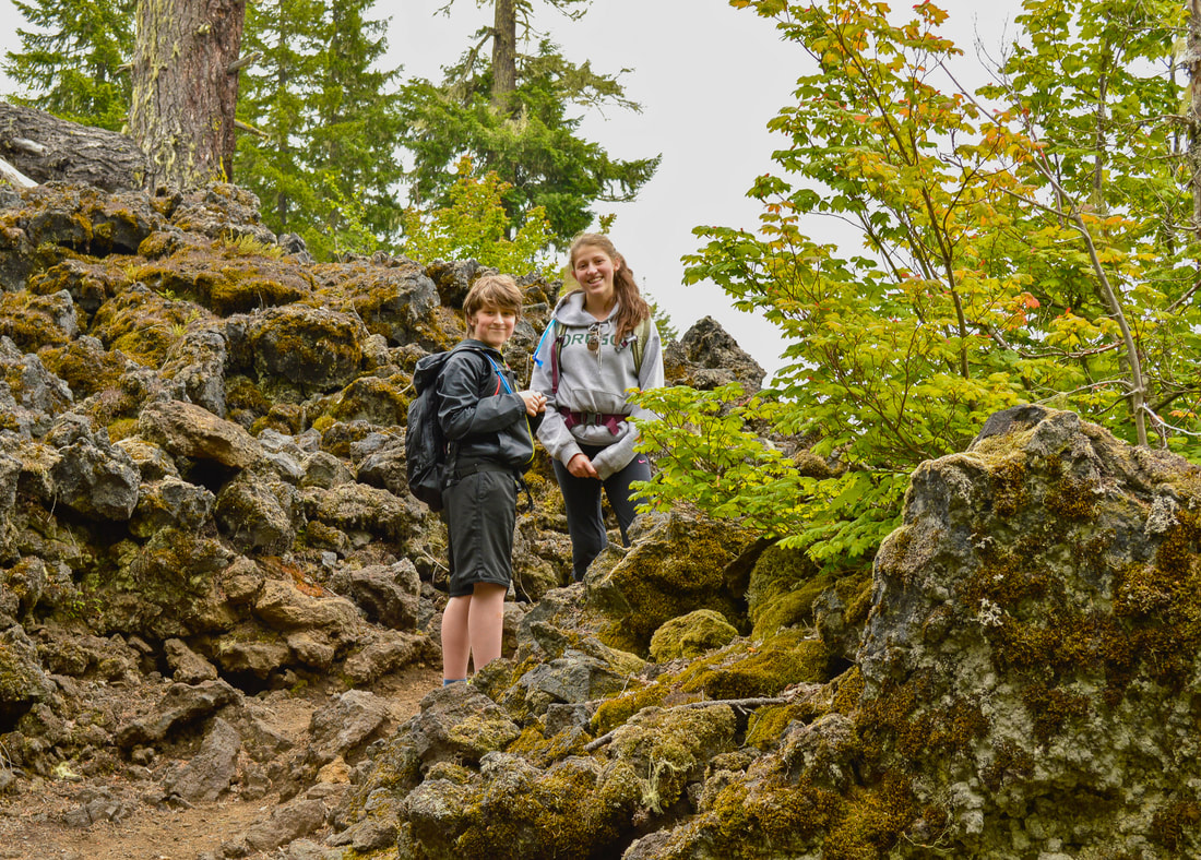
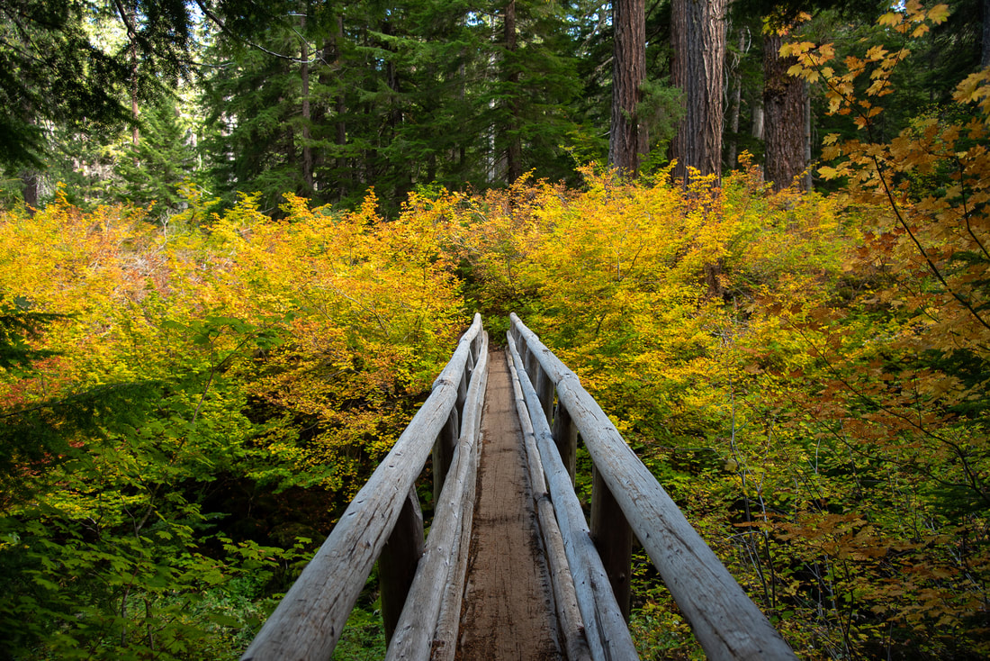
About 0.3 miles past the Great Spring, you will start seeing amazing views of the entire lake. There are no motorboats allowed on Clear Lake so it is always nice and quiet. You can rent row boats at the lodge during the late spring, summer and early fall season, and the fishing here is pretty good. The lake is stocked with rainbow and eastern brook trout, and there are also some native cutthroat trout. There is a 1 mile of a lava section, where they have paved the path in some places so that no one has to clamber over the sharp lava rocks. You can even mountain bike here, since this section of the trail is part of the McKenzie River Trail. The lava section is much more difficult to navigate in the winter, and unless there has been a lot of snowshoe or ski traffic before you, you will most likely have to blaze your own trail.
Clear Lake trail through lava
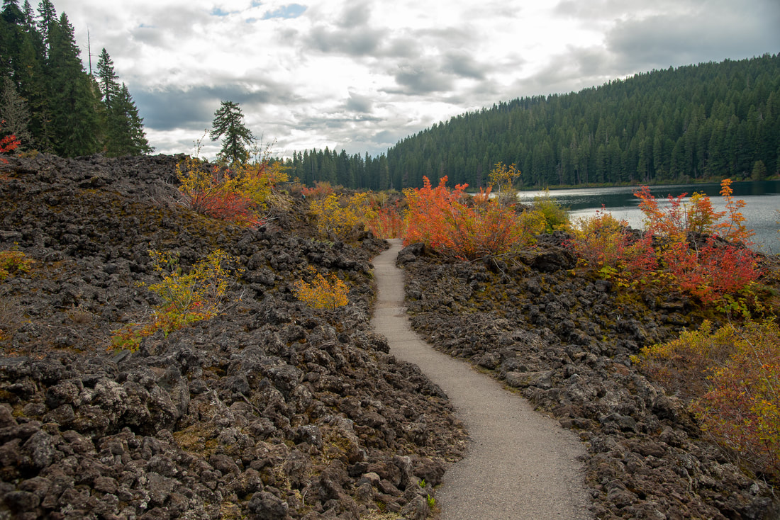
(the lava section in the fall)
Lava flow in the winter along the Clear Lake hiking trail
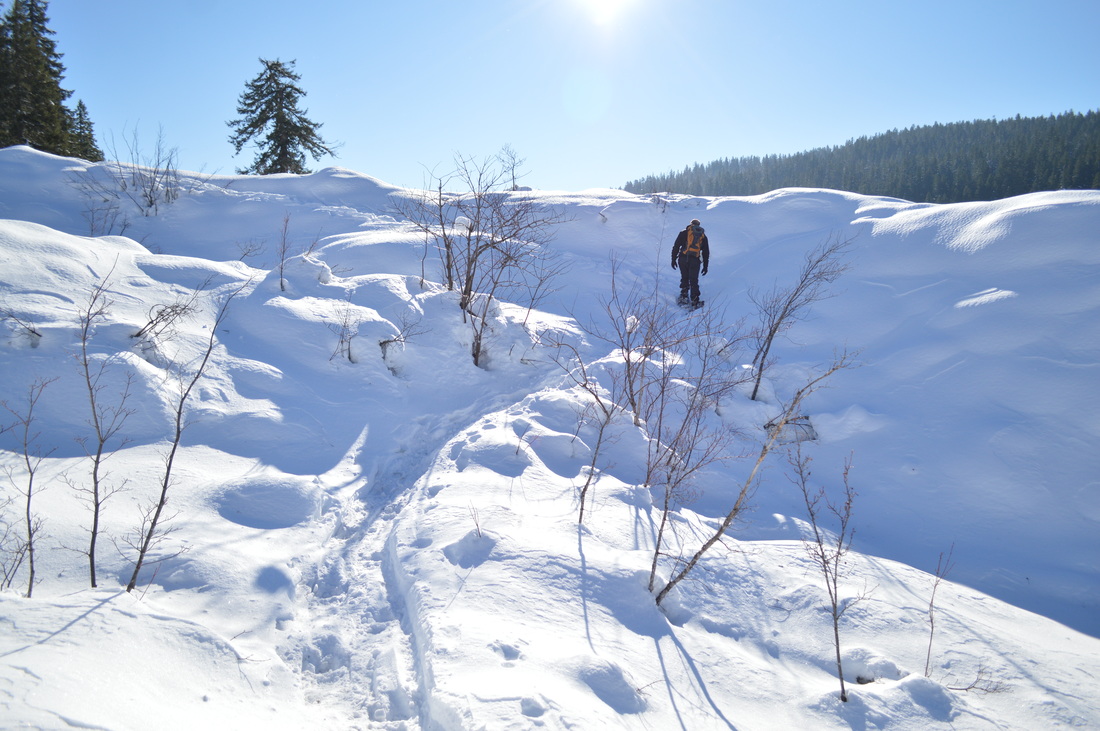
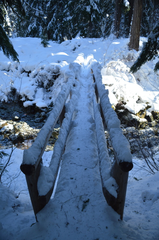
(the lava section in the winter)
Clear Lake Oregon best fall foliage hike
The Clear Lake loop is highly recommended for everyone! It is one of the most well maintained trails, pretty flat and not very challenging, which allows you and the whole family to easily enjoy the beauty around you. This is the perfect place to hike in fall (late September to mid-October) when the leaves are changing color but there is still sun out which makes the lake look extra clear. If you can, it is cool to do this hike during all 4 seasons to see how it changed. This is one of Oregon's most beautiful hikes, so expect there to be quite a few people hiking here on weekends during the spring, summer and fall. ​
Clear Lake in fall

Directions:

From Bend
  • Drive north on US-97 and then merge onto US-20 west towards Sisters. At Santiam Junction stay to the right and merge onto OR-126/20 and then stay left at the next junction and continue on OR-126 towards Eugene. Between mileposts 3 and 4 look for a sign that says Clear Lake Resort, and turn onto a narrow paved road that winds down to the lodge. *In the winter if you don't have 4 wheel drive or a car that has decent traction in the snow, do not park down at the lake. They do not plow this access road to the lodge and it is pretty steep. You can park across the highway at the sno park (to park here you will need a sno park pass though). (Total of 58 miles)
From Eugene
  • Drive OR-126 20 miles east of the town of McKenzie Bridge. Between mileposts 3 and 4 look for a sign that says Clear Lake Resort, and turn onto a narrow paved road that winds down to the lodge. *In the winter if you don't have 4 wheel drive or a car that has decent traction in the snow, do not park down at the lake. They do not plow this access road to the lodge and it is pretty steep. You can park across the highway at the sno park (to park here you will need a sno park pass though). (Total of 73.4 miles)
From Salem
  • Drive on OR-22 east towards Detroit. At Santiam Junction stay to the right and merge onto OR-126/20 and then stay left at the next junction and continue on OR-126 towards Eugene. Between mileposts 3 and 4 look for a sign that says Clear Lake Resort, and turn onto a narrow paved road that winds down to the lodge. *In the winter if you don't have 4 wheel drive or a car that has decent traction in the snow, do not park down at the lake. They do not plow this access road to the lodge and it is pretty steep. You can park across the highway at the sno park (to park here you will need a sno park pass though). (Total of 92.4 miles)
From Portland
  • It is a total of 138 miles via Salem.
From Medford
  • It is a total of 237 miles via Eugene.
To get a more in-depth and personal view of this hike, watch the YouTube video.
-This trail write-up was last updated September 2019-
*All pictures are taken by Franziska Weinheimer
*Disclaimer: The trail descriptions, mileage, GPS tracks and difficulty ratings depicted on this website are never 100% accurate. Always hike at your own risk, using your own knowledge, equipment and common sense.  Franziska Weinheimer/Hike Oregon are not responsible if you or anyone in your party gets injured or lost while attempting one of these or any other hikes. 

HIKED HERE RECENTLY? PLEASE LEAVE A TRIP REPORT BELOW:

© Hike Oregon 2025
P.O. Box 41911
​Eugene, OR 97404
Proudly powered by Weebly
  • Home
  • *Store*
  • About the author
  • How to use this site
  • Resources
    • Wildflowers
    • Videos
  • Best Oregon Hikes
    • 20 Epic Oregon Wildflower Hikes
    • 5 Weekend Backpacking Trips in Oregon
    • Top 10 Swimming Spots In Oregon
    • 9 Amazing Oregon Summit Hikes
    • Top 10 Oregon Summer Hikes
    • 20 Central Oregon Day Hikes
    • Top One Night Backpacking Trips in Central Oregon
    • Top 10 Oregon Hikes for Kids
    • 20 Best Oregon Waterfall Hikes
    • Underrated Fall Foliage Hikes In Oregon
    • Top 10 Oregon Fall Hikes
    • Best Rainy Day Hikes In Oregon
    • Sno-Parks In Central Oregon
    • Top 10 Oregon Winter Hikes
    • Top Low Elevation Winter Hikes
    • Easy Hikes in Oregon
    • Top 10 Oregon Spring Hikes
  • Oregon Sno-Parks
    • Maxwell Sno-Park
    • Potato Hill Sno-Park
    • Ray Benson Sno-Park
      • Brandenburg Shelter
    • Santiam Sno-Park
    • Three Creek Sno-Park
    • Virginia Meissner Sno-Park
      • Meissner Shelter Loop
      • Nordeen Shelter
    • Gold Lake Sno-Park
      • Westview Shelter to Eagle Rock Overlook
      • Marilyn Lakes Loop
    • Ikenick Sno-Park (members only)
  • Southern Washington
    • Hamilton Mountain
    • Dog Mountain
    • Coyote Wall
    • Mount St. Helens
  • Portland
    • Powell Butte
    • Forest Park
    • Latourell Falls
    • Multnomah/Wahkeena Falls
    • Eagle Creek
    • Mitchell Point
    • Table Rock
    • Tamanawas Falls
    • Trillium Lake
    • East Zigzag Mountain (members only)
  • Salem
    • Abiqua Falls
    • Silver Falls State Park
    • Dome Rock
    • Marion Lake to Marion Mountain
    • Jefferson Park via Whitewater Trail
  • Corvallis
    • William Finley Wildlife Refuge
      • Campbell Boardwalk
      • Woodpecker Loop
      • Mill Hill Loop
      • Beaver Pond Loop
    • Marys Peak East Ridge
    • Marys Peak North Ridge
    • Alsea Falls and Green Peak Falls
    • Corvallis to Sea Trail - Sugarbowl Creek segment (members only)
  • Sweet Home
    • Crescent Mountain
    • Iron Mountain
    • McDowell Creek Falls
    • Middle Santiam River (members only)
    • Lower Soda Creek Falls (members only)
    • Rooster Rock (members only)
  • McKenzie Bridge/Blue River
    • Macduff Mountain
    • Proxy Falls
    • Clear Lake
    • Sahalie/Koosah Falls
    • Blue Pool
    • Erma Bell Lakes
    • Olallie Mountain
    • Horsepasture Mountain
    • Tidbits Mountain
    • Castle Rock
    • Separation Lake (members only)
    • Lowder Mountain (members only)
    • East Fork Trail (members only)
    • Rainbow Falls Overlook (members only)
    • Frissell Point (members only)
    • Substitute Point (members only)
  • Sisters/Santiam Pass
    • Coffin Mountain
    • Trappers Butte and Scar Mountain
    • Maxwell Butte
    • Black Butte
    • Whychus Creek Trail
    • Tam McArthur Rim
    • Black Crater
    • Scott Mountain
    • Obsidian Trail
    • Metolius Preserve
    • Three Fingered Jack Loop
    • Square Lake
    • Canyon Creek Meadows
    • Patjens Lakes
    • Craig Lake (members only)
    • Chush Falls (members only)
    • Rockpile Lake (members only)
    • Santiam Lake (members only)
    • Camp Lake (members only)
    • Park Meadow to Golden Lake (members only)
  • Bend/Redmond/LaPine
    • Steins Pillar
    • Chimney Rock
    • Steelhead Falls
    • Tumalo State Park
    • Shevlin Park Loop
    • Tumalo Falls
    • Tumalo Mountain
    • No Name Lake
    • Green Lakes
    • Moraine Lake
    • South Sister Summit
    • Horse Lake
    • Muskrat Lake
    • Paulina Peak
    • The Badlands - Flatiron Rock Trail
    • Peter Skene Ogden Trail (members only)
  • Eugene
    • Ridgeline Trail
    • Mount Pisgah Summit
    • Mount Pisgah Arboretum
    • Shotgun Creek
    • Mount June
    • Lawler
    • Tire Mountain
    • Hardesty Mountain
    • Goodman Creek
    • Brice Creek
    • Trestle Creek Falls
    • Parker Falls
    • Moon Falls
    • Elijah Bristow State Park
    • South Willamette Trail (members only)
    • Eula Ridge (members only)
    • Eagle's Rest (members only)
  • Oakridge
    • Deception Butte
    • North Salmon Creek
    • Sourgrass Mountain
    • Grasshopper Ridge
    • Larison Creek
    • Bunchgrass Ridge
    • Salt Creek Falls
    • Waldo Lake Loop
    • South Waldo Loop
    • The Twins
    • Rosary Lakes
    • Yoran Lake
    • Fawn Lake
    • Windy Lakes
    • Divide Lake
    • Diamond Peak via Rockpile Lake Trailhead
    • Diamond Peak via Summit Lake
    • Cowhorn Mountain
    • Klovdahl Bay (members only)
    • Verdun Trail (members only)
    • Heckletooth Mountain (members only)
    • Wall Creek Warm Springs (members only)
    • Moon Point (members only)
    • Bobby Lake (members only)
    • Lillian Falls (members only)
    • Middle Fork Willamette Trail (members only)
    • Pool Creek Falls (members only)
    • Dead Mountain (members only)
    • Larison Rock (members only)
    • Quinn Lakes & Eddeeleo Lakes (members only)
    • Waldo Mountain Lookout (members only)
    • Blair Lake to Spring Prairie (members only)
    • Rigdon Lakes loop (members only)
  • Oregon Coast
    • Cascade Head
    • Drift Creek Falls
    • Sweet Creek Falls
    • Beaver Creek Falls
    • Kentucky Falls
    • Hobbit Trail to Heceta Head
    • Valley Trail to China Creek
    • Sutton Creek Trail (members only)
    • North Fork Smith River (members only)
    • Cummins Ridge (member's only)
    • Horse Creek (members only)
    • Siltcoos Lake (members only)
  • Southern Oregon
    • Fall Creek Falls
    • Watson Falls
    • Wild Rogue Loop
    • Mt. Thielsen
    • Crater Lake National Park
      • The Watchman
      • Mount Scott
      • The Pinnacles
    • Lower Table Rock
    • Pilot Rock
    • Wagner Butte
    • Mt. McLoughlin
    • Lemolo Falls (members only)
    • Fern Falls (members only)
  • Eastern Oregon
    • Painted Cove
    • Anthony Lake Loop
    • Mount Howard
    • Eagle Cap summit
    • Schneider Cabin (members only)
    • Strawberry Lake & Strawberry Falls (members only)
  • Northern California
    • Taylor & Hogan Lake (members only)
  • Oregon PCT sections
    • PCT: CA border to Callahan's
  • Tips & Tricks
    • Leave No Trace
    • Safety Tips for Solo Hiking & Backpacking
    • Nutrition On The Trail
    • How Much Water To Carry When Backpacking
    • Storing Your Bear Canister When Backpacking
    • How To Pick The Right Backpacking Tent
    • Top Tips For Hiking With Infants And Toddlers
    • Poison Oak, Ivy and Sumac
    • How to dress for cold weather hikes
  • Reviews and Gear
    • Choosing and Using Trekking Poles
    • A Guide to Choosing the Perfect Backpacking Pack
    • Hiking Pants and Leggings
    • Jackets for Hiking and Backpacking
    • Long Sleeved Shirts For Cold Weather Hiking
    • Stay Kühl This Summer
    • Outdoor Herbivore Backpacking Food Review
    • Osprey Aura AG 65 Backpack review
    • Big Agnes Fly Creek UL2 review
    • REI Quarter Dome 1 review
    • Hike Oregon's Gear Favorites
    • Outdoorsy Holiday Gift Guide 2022
    • Hiker Holiday Gift Guide 2019
    • Outdoor Holiday Gift Guide 2018
    • Hiking Holiday Gift Guide 2017
  • Adventure Stories
    • Hiking The Rae Lakes Loop
    • 110 Miles on the PCT
    • Three Fingered Jack Adventures
    • Jefferson Wilderness