Marys Peak
North Ridge Trail
Hike details:
Mileage: 9.8 miles round trip w/ 2,417 ft. elevation gain
Approximate hike time: 4 hours 15 minutes w/ an average pace of 2.3 mph
Difficulty: Difficult
Trail usage: Low
Highest elevation: 4,065 ft. Lowest elevation: 1,715 ft.
General location: 15.2 miles west of Corvallis - Siuslaw National Forest
Accessible: April through December (the summit of Marys Peak gets snow during the winter months)
(Best time to go is May for wildflowers and October, November, December if you want to enjoy the area with less people).
Permits required: N/A
Pit toilet at trailhead: No
Trail allows: Dogs on leash no longer than 6 feet, mountain biking
Possible dangers: N/A
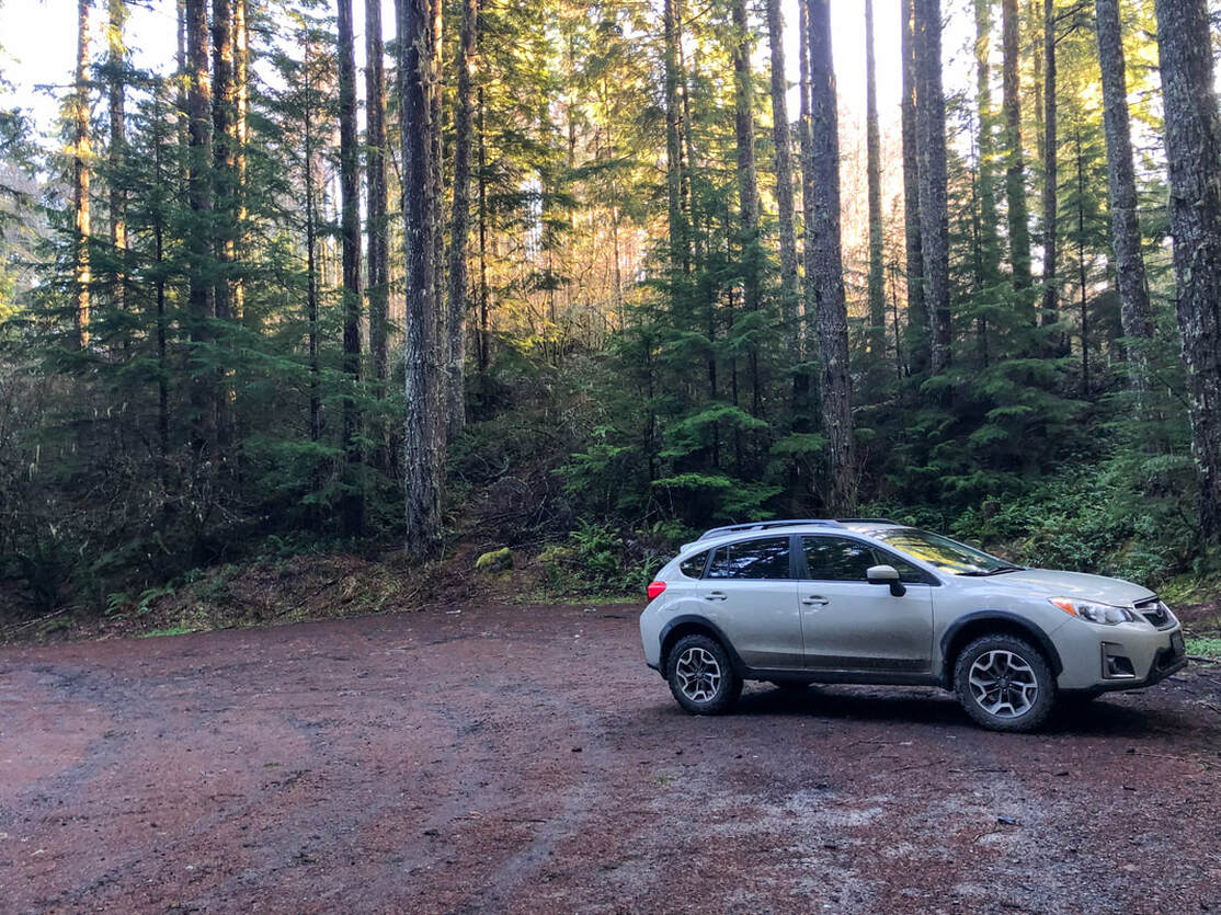
(Woods Creek Trailhead parking area)
|
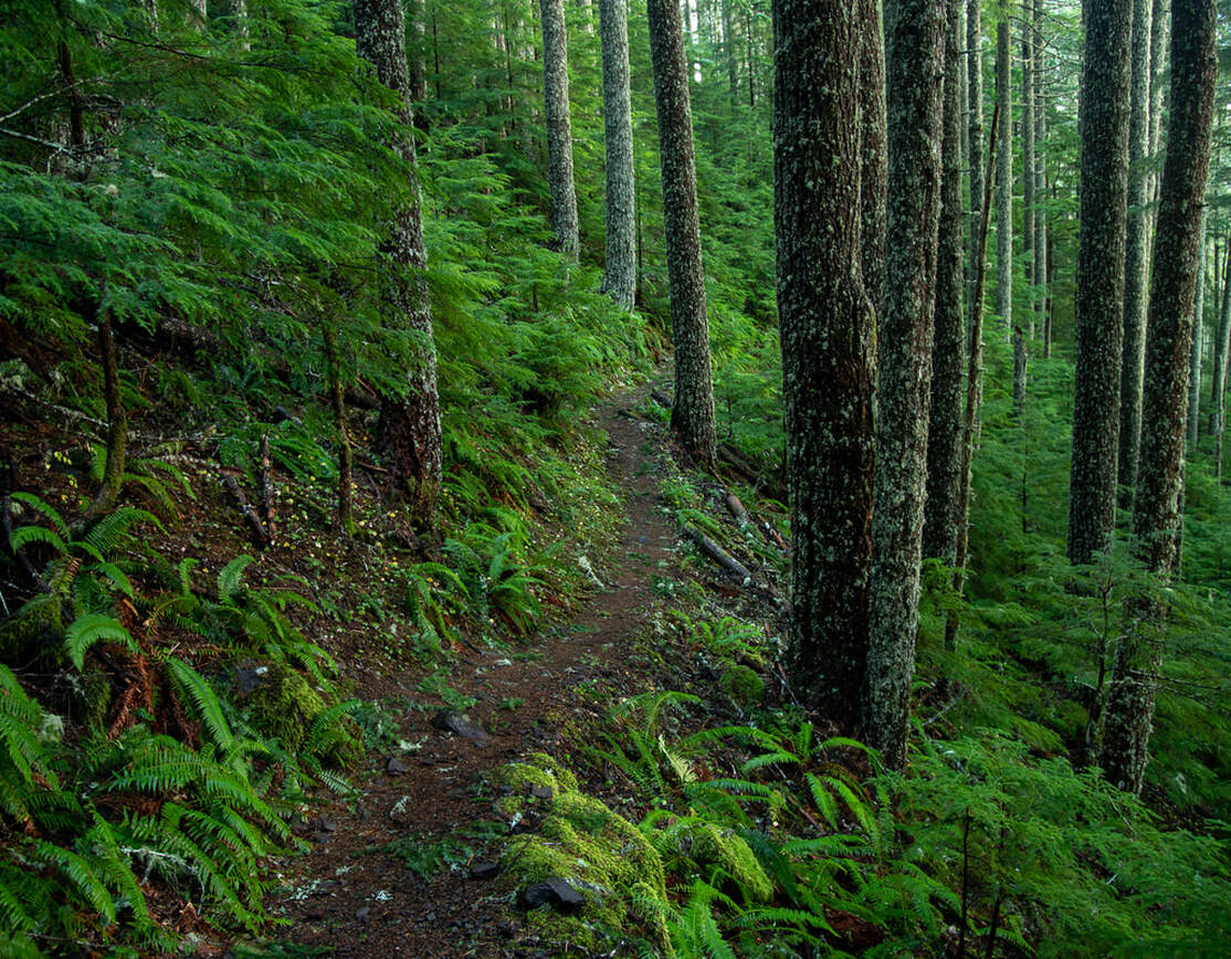
Description:The North Ridge Trail is definitely more difficult than some of the other routes up to the summit of Marys Peak, but it is also one of the less traveled routes which means lots of solitude through one of the most beautiful forests in the Coast Range.
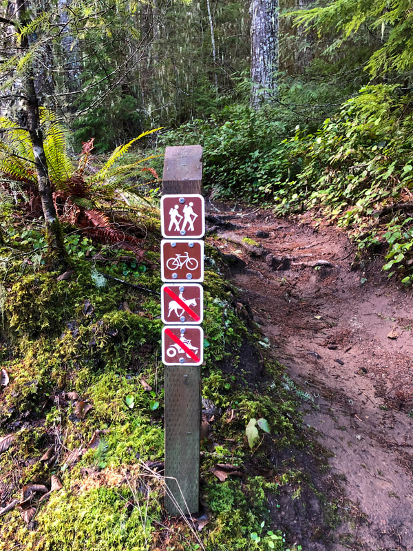
The trailhead is a large turnout on the left side of a gravel road right before a gate. There is room here for about 8-10 cars. You will find the trailhead located right behind the closed gate on the right, marked by a small post that lets you know what modes of transportation are allowed on the trail. This is a popular trail with mountain bikers, but mountain biking is prohibited on all Marys Peak trails from October 15th to May 15th. During the winter and early spring months you will not have to worry about mountain bikers barreling down this trail. |
|
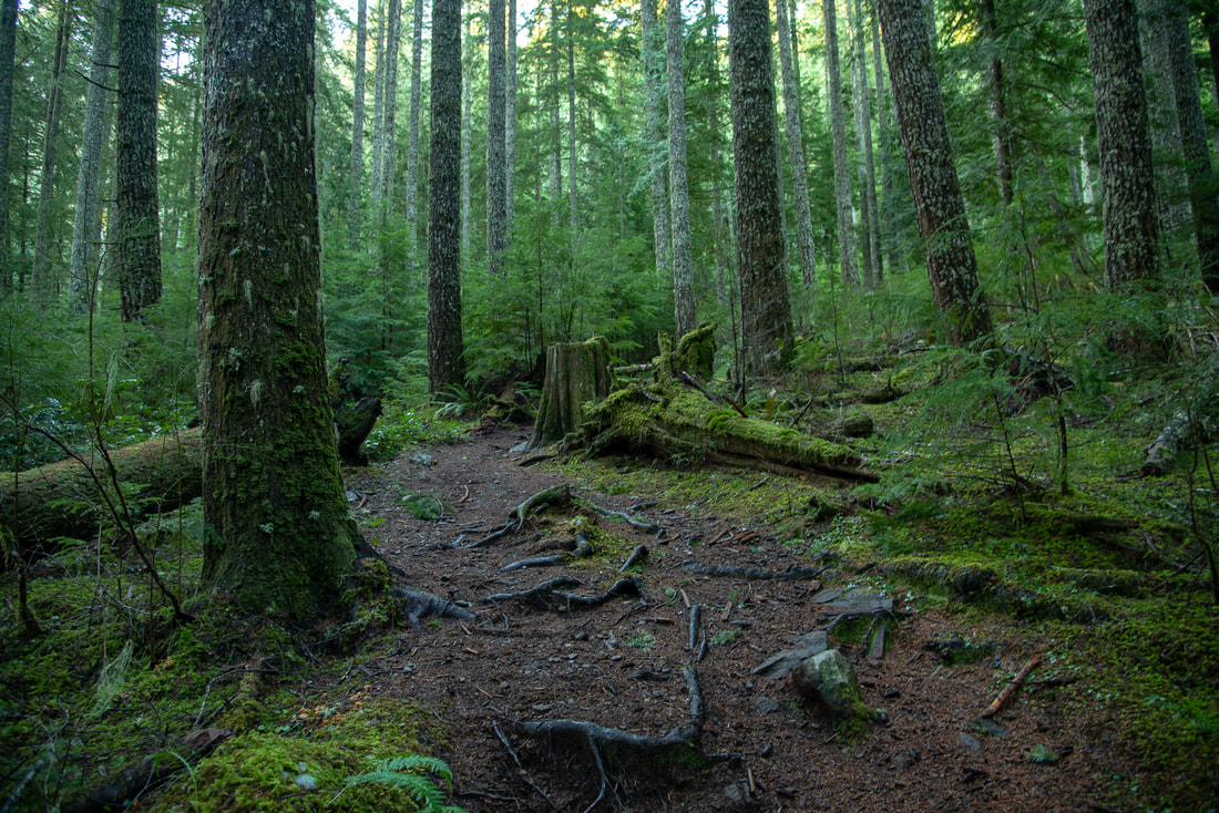
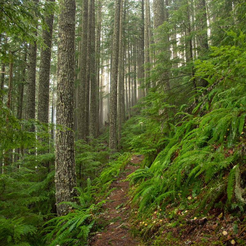
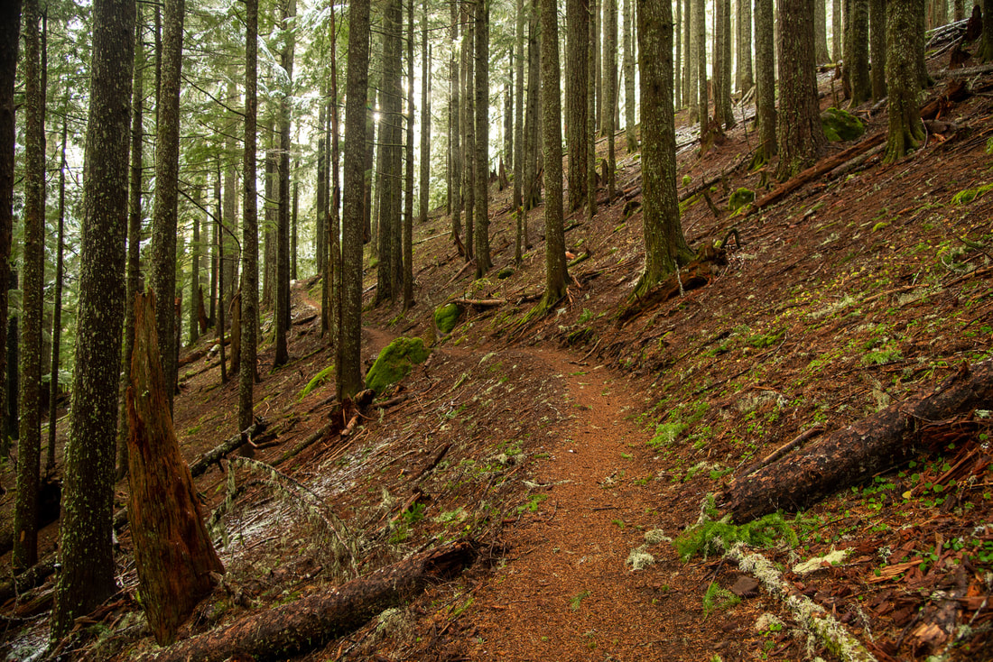
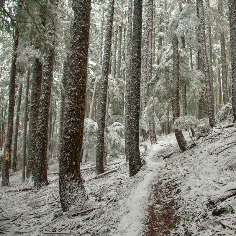
You will hike half a mile, gradually going uphill through a very dense, green mossy forest. After that first half mile the trail starts to switchback. Over the next 2.8 miles there will be a total of 15 switchbacks. The more elevation that you gain, the more the forest changes from having dense fern undergrowth to a more sparse forest floor. If you are going in early December, you will likely to start seeing some snow as well.
|
|
|
|
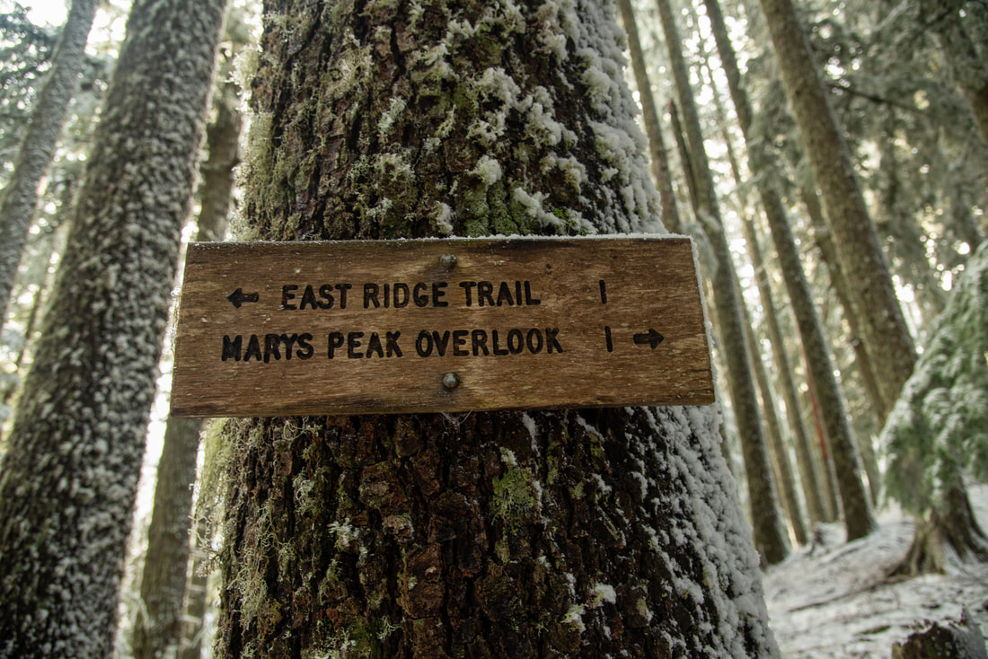
At the last switchback, you will see a trail split and a sign for the East Ridge Trail to the left. From here it is only another 0.6 miles to the Marys Peak parking lot. This part of the trail still gains elevation, but the trail traverses a ridge and all of a sudden you will come out of the forest and see the parking lot. The Marys Peak parking lot is very large and here you will have an opportunity to use the pit toilet that is located there. From the parking lot it is just another 0.7 miles to the summit.
|
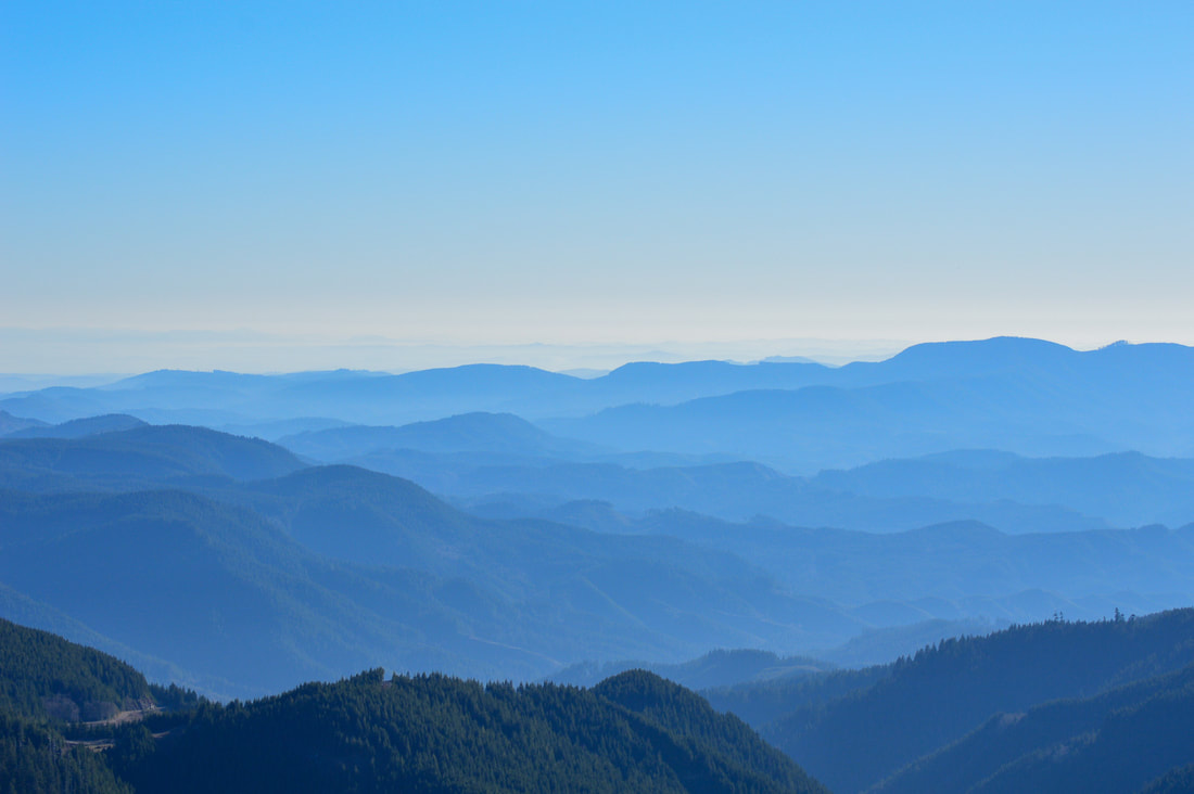
(Coast Range)
|
|
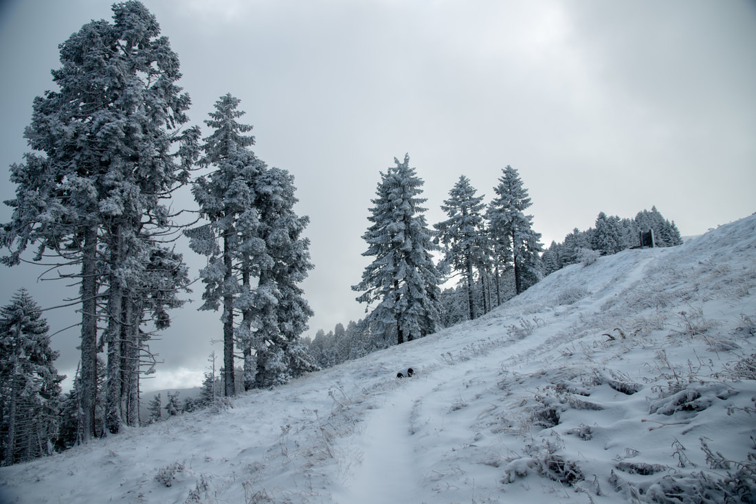
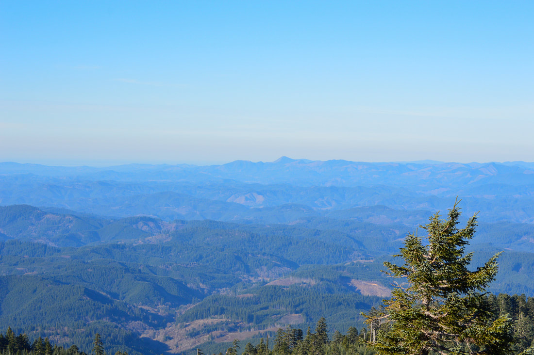
On a clear day from the summit of Marys Peak you will get 360 degree views! To the west you will see the layers of hills that form the Coast Range and on a very clear day you can see all the way to the Pacific Ocean. To the east you will see the string of the Cascade Mountain Range from Diamond Peak, the Three Sisters, Mt. Washington, Mt. Jefferson and all the way up to Mt. Hood. It can get hazy in the valley on warm days which does make it hard to see the mountains sometimes. Also keep in mind that Marys Peak is the tallest peak in the Oregon Coast Range and therefore frequently makes its own weather. Even on days where the weather forecast for the area says it is totally clear and sunny, the top of Marys Peak will oftentimes have some swirling clouds over it and it can be windy and a good 10 degrees colder up there than at the trailhead, so come prepared.
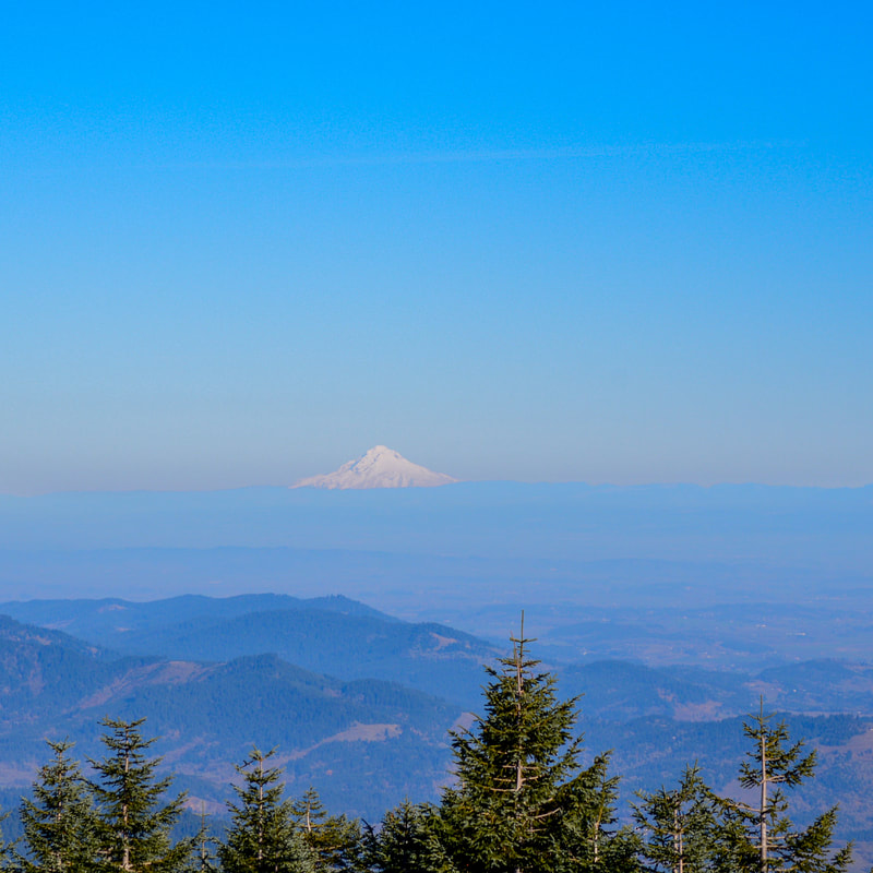
(Mount Hood)
|
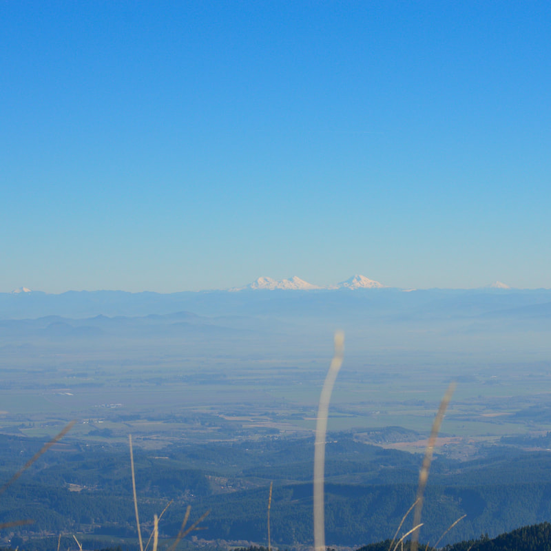
(the Three Sisters)
|
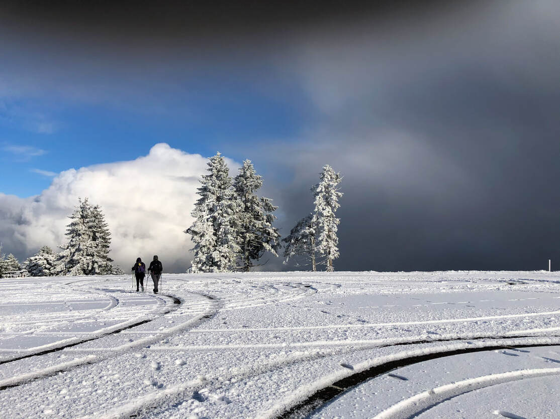
(Marys Peak upper parking lot in December)
Marys Peak North Ridge Trail is perfect for those hikers who want to hike big miles and work for those views! The trail is rated difficult only because of the mileage and elevation gain. The tread of the trail is very good and even (no off camber terrain), but you will encounter a few roots which can be slippery when wet. The forest that you hike through is ever changing and absolutely stunning in every season! Keep in mind that if you are hiking this trail between May 15 and October 15 you will have to keep an eye and ear out for mountain bikers who shuttle to the top of Marys Peak and use this trail to bike down.
Directions:
From Corvallis
- Drive US-20 west toward Philomath for 5.3 miles. Drive through Philomath and continue for 1.8 miles on US-20. At milepost 48 turn left onto Woods Creek Road (this road turns into gravel) for 7.6 miles to a locked gate and the large trailhead turnout on your left. (Total of 14.7 miles)
- Drive I-5 north toward Albany for 34 miles. Take exit 228 for OR-34 toward Lebanon/Corvallis and turn left onto OR-34 W for 9.7 miles to Corvallis. Use the left 2 lanes to turn left onto OR-34/OR-34 Bypass W (which turns into US-20) for 6.2 miles to Philomath. Drive through Philomath and continue for 1.8 miles on US-20. At milepost 48 turn left onto Woods Creek Road (this road turns into gravel) for 7.6 miles to a locked gate and the large trailhead turnout on your left. (Total of 62 miles)
- Drive I-5 south for 25.2 miles then take Take exit 228 for OR-34 toward Lebanon/Corvallis and turn right onto OR-34 W for 9.7 miles to Corvallis. Use the left 2 lanes to turn left onto OR-34/OR-34 Bypass W (which turns into US-20) for 6.2 miles to Philomath. Drive through Philomath and continue for 1.8 miles on US-20. At milepost 48 turn left onto Woods Creek Road (this road turns into gravel) for 7.6 miles to a locked gate and the large trailhead turnout on your left. (Total of 54.5 miles)
- Drive US-97 north then take exit 135A to merge onto US-20 W toward Sisters. Stay on US-20 for 45 miles and then keep left to stay on US-20 W for 60.5 miles. In the town of Lebanon after you see the Jack In The Box on the left, turn left onto Airport Road for 2.2 miles, then make a slight right onto Denny School Rd. for 1.3 miles. Turn left onto OR-34 W/Corvallis-Lebanon Hwy 210 and stay on this road for 15.2 miles. In the town of Corvallis use the left 2 lanes to turn left onto OR-34/OR-34 Bypass W (which turns into US-20) for 6.2 miles to Philomath. Drive through Philomath and continue for 1.8 miles on US-20. At milepost 48 turn left onto Woods Creek Road (this road turns into gravel) for 7.6 miles to a locked gate and the large trailhead turnout on your left. (Total of 143.4 miles)
- It is a total of 97.2 miles via Salem.
- It is a total of 225.4 miles via Eugene
|
To get a more in-depth and personal view of this hike, watch the YouTube video.
|
-This trail write-up was last updated June, 2022-
*All pictures are taken by Franziska Weinheimer *Disclaimer: The trail descriptions, mileage, GPS tracks and difficulty ratings depicted on this website are never 100% accurate. Always hike at your own risk, using your own knowledge, equipment and common sense. Franziska Weinheimer/Hike Oregon are not responsible if you or anyone in your party gets injured or lost while attempting one of these or any other hikes.
|