Black Butte
Hike details:
Mileage: 4 miles round trip w/ 1,600 ft. elevation gain
Approximate hike time: 1 hour 45 minutes w/ an average pace of 2.3 mph
Difficulty: Moderate
Trail usage: High to very high on weekends, medium on summer weekdays, low on autumn weekdays
Highest elevation: 6,430 ft. Lowest elevation: 4,837 ft.
General location: 15 miles northwest of Sisters - Deschutes National Forest
Accessible: Early May through November
(Best time to go is May before there are too many people vacationing in the area. Mid-September through October is also a great time to go for cooler weather).
Permits required: Northwest Forest Pass required for parking
Pit toilet at trailhead: Yes
Trail allows: Dogs on leash
Possible dangers: Steep hillside which can be dangerous when there is still lingering snow on the north side.
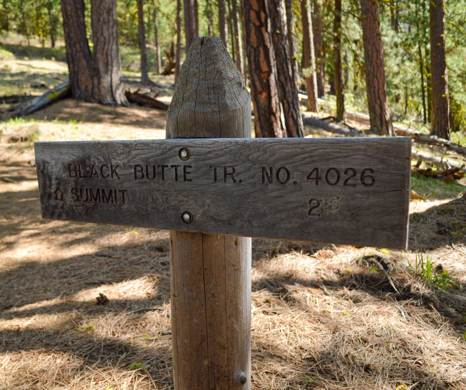
(Black Butte trailhead sign)
|
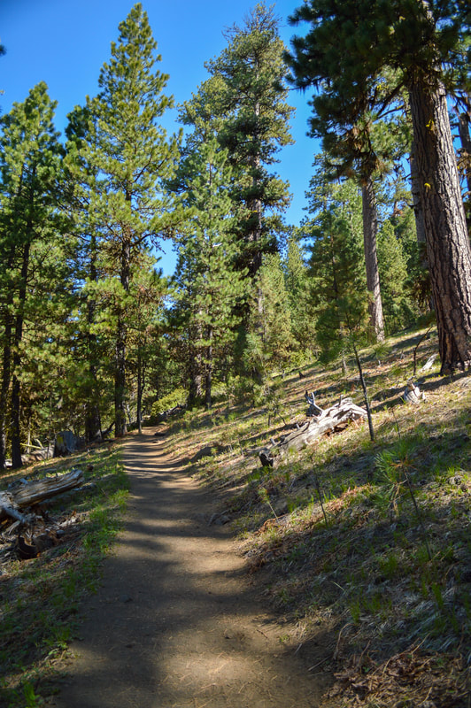
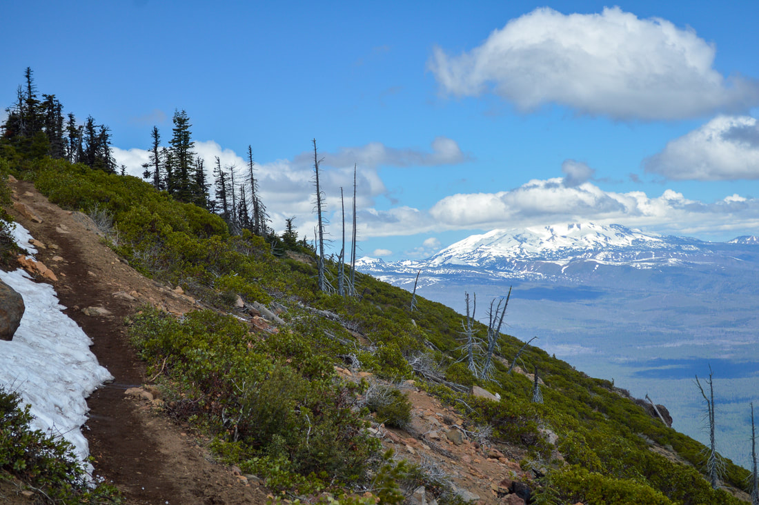
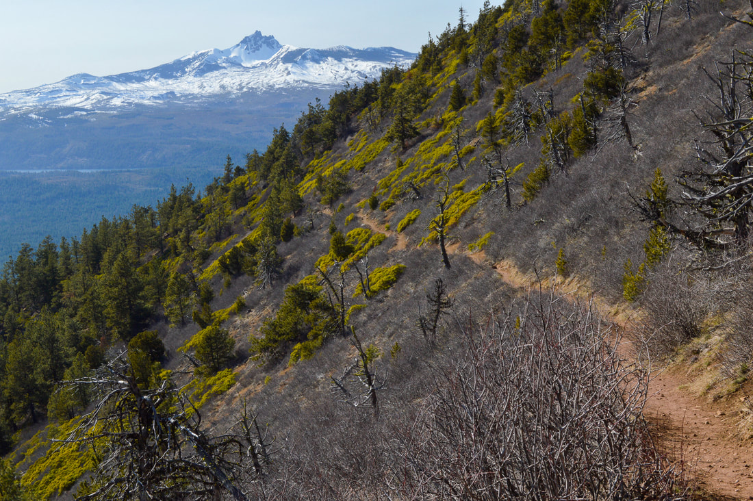
Description:Black Butte was formed before the last Ice Age and because of its unique location, it was one of Oregon's first fire lookout sites. The 2 mile trail to the top starts at 4,837 ft. and then gains 1,600 feet of elevation in those two short miles, making it a pretty steep hike. The trail starts in an old-growth Ponderosa pine forest and the path is fairly wide and easy to walk on. At the 0.7 mile mark, the trail switchbacks and after a total of 1.1 miles the trail emerges from the forest and from here on you no longer have tree cover. Always bring sun protection of some kind when doing this hike, even if there is some cloud cover. The high elevation in Central Oregon makes it so that you can easily get a sunburn even if it is hazy. Here the trail starts to narrow a bit, but it is still quite easy to pass people who are coming down.
|
|
|
(trail on the north side in early May)
|
(trail on the north side in early June)
|
(62-foot lookout tower built in 1995)
|
(Mount Washington from the summit)
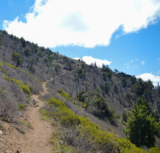
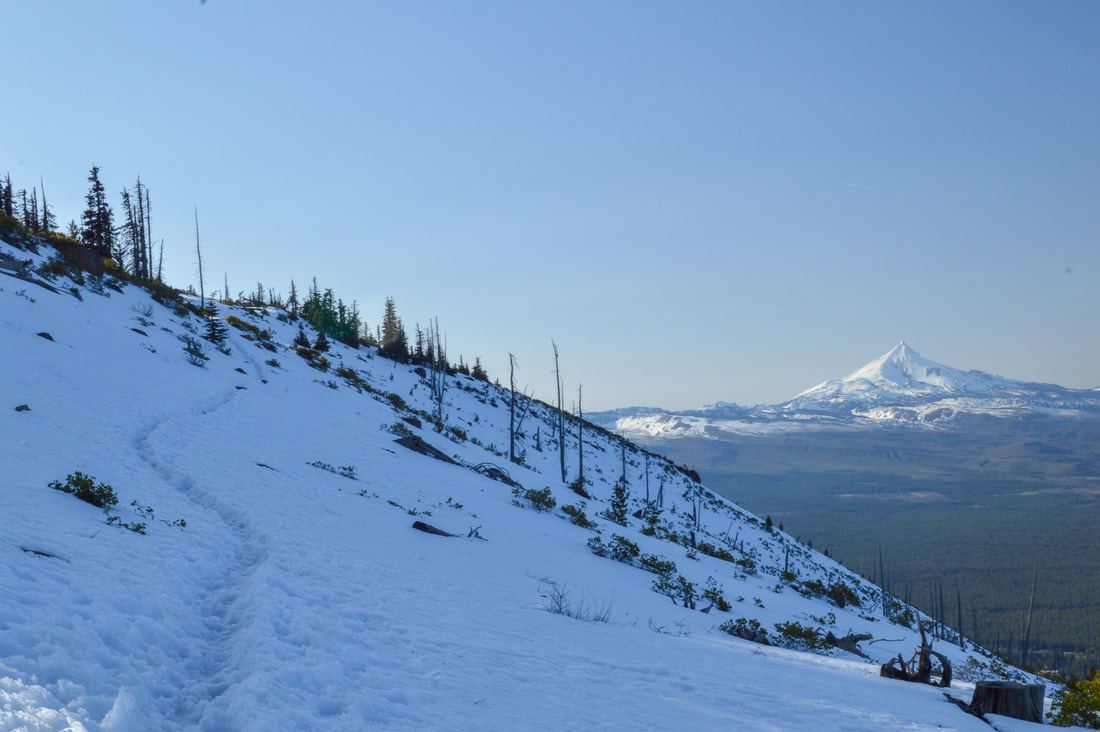
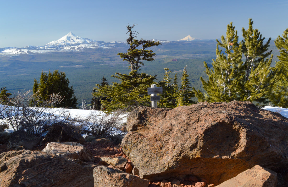
At the 1.7 mile mark, the trail starts to wrap around the northeast side of the mountain. Because it is continually shaded here in the spring, this slope holds onto snow the longest, but it is usually melted off by mid-June. If you hike Black Butte before the snow has melted off, be very careful here because the slope is extremely steep and if you slip down, it could be quite dangerous. When you traverse this hillside you can see majestic Mount Jefferson (Seekseekqua) to the north.
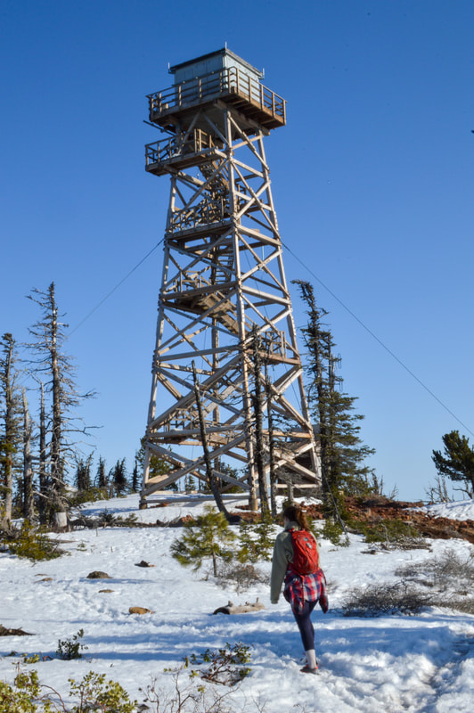
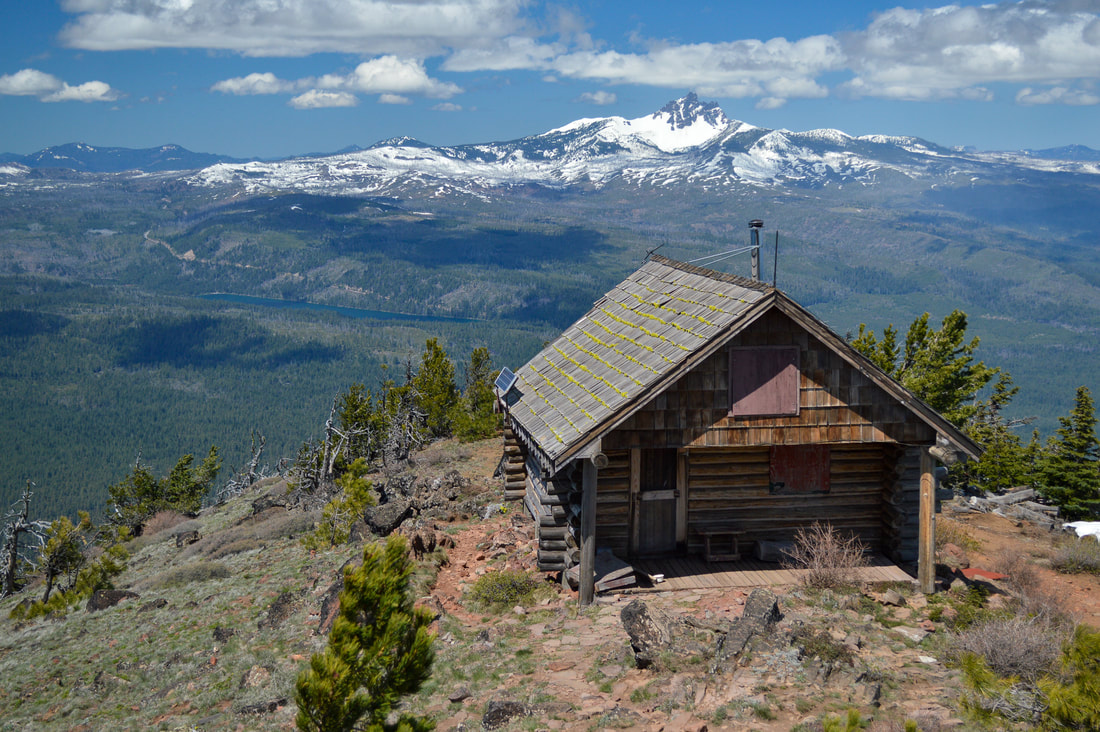
The first fire lookout tower that you will see on your left is the 62-foot tall tower that was built in 1995. It replaced the 82-foot tower that was there previously which was constructed in 1934. |
(the Three Sisters)
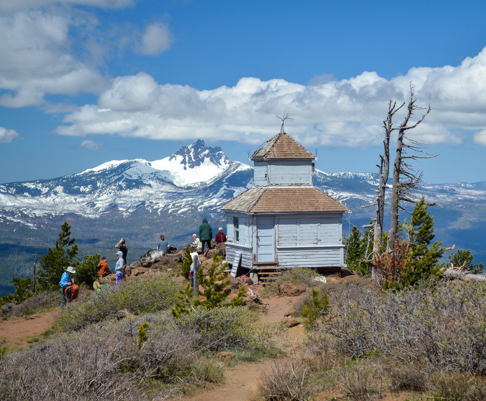
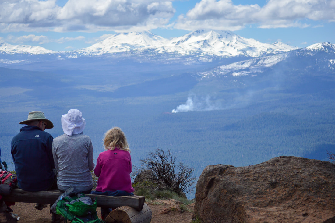
After another 0.3 miles walking along the northeast hillside, you will arrive at the summit which is large and very open. You will see the cupola-style fire lookout which was built in 1923 and completely renovated in 2019. From the summit you can see almost all of the Oregon Cascade mountains. Mount Bachelor, Broken Top, the Three Sisters, Black Crater, Mount Washington, Three Fingered Jack, Mount Jefferson, Olallie Butte and Mount Hood.
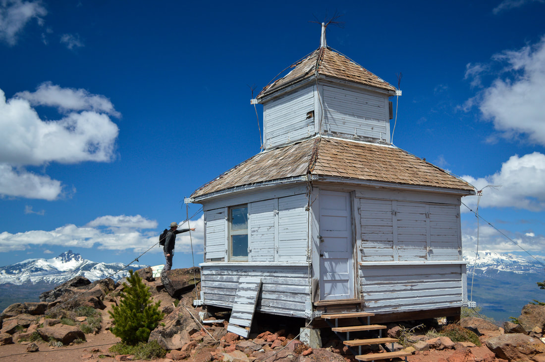
(1923 cupola-style fire lookout has recently been restored)
(view of Mount Jefferson and Mount Hood to the north)
The old one room cabin that used to sit in a meadow below the summit to the west was burned down by the Forest Service in 2016. This is where the seasonal Forest Service staff would live when they kept an eye out for fires. With all of the new satellite technology and airplanes doing most of the work now, fire lookouts are not used much anymore in Oregon.
(cabin built in 1980, burned down by the Forest Service in 2016)
Black Butte is one of Central Oregon's most iconic hikes and for good reason. The short distance allows for easy access to a great view, making it very family friendly even for those who aren't avid hikers. The trail is in wonderful condition and is only rated moderate because of the elevation gain. Keep in mind that this trail does get very hot and dusty during the summertime so come prepared with sun protection and lots of water. It is also one of Central Oregon's most popular trails, so it gets extremely crowded on summer weekends, so arrive early if you want to be able to park at the trailhead.
(view of Mount Washington from the trail)
Directions:
From Bend
- Drive US-97 north and take exit 135A to merge onto US-20 W toward Sisters for 19.9 miles. At the traffic circle, take the 2nd exit and stay on US-20 W and continue on for 5.1 miles. Turn right onto B-S Logging Rd/Green Ridge Rd/NF-11 for 3.8 miles, then turn left onto SW Black Butte Rd/NF-1110 for 1.9 miles. SW Black Butte Rd turns slightly right and becomes NF-1110/NF-99 and continue for 2.1 miles, then make a sharp right onto NF-1110 for another 1.1 miles to the trailhead at the road's end. These last 1.1 miles are pretty steep and can sometimes be rough with large stutter bumps. (Total of 37.1 miles)
- Drive on OR-125 E for 6.8 miles, then use the left 2 lanes to turn left onto OR-126 E/Main St. and continue on for a total of 68.2 miles. Take a slight right onto US-20 E and stay on this road for 23.3 miles. Turn left onto B-S Logging Rd/Green Ridge Rd/NF-11 for 3.8 miles, then turn left onto SW Black Butte Rd/NF-1110 for 1.9 miles. SW Black Butte Rd turns slightly right and becomes NF-1110/NF-99 and continue for 2.1 miles, then make a sharp right onto NF-1110 for another 1.1 miles to the trailhead at the road's end. These last 1.1 miles are pretty steep and can sometimes be rough with large stutter bumps. (Total of 109 miles)
- Drive OR-22 E toward Bend for a total of 80.2 miles, then take a slight left and merge onto US-20 E for 20 more miles. Turn left onto B-S Logging Rd/Green Ridge Rd/NF-11 for 3.8 miles, then turn left onto SW Black Butte Rd/NF-1110 for 1.9 miles. SW Black Butte Rd turns slightly right and becomes NF-1110/NF-99 and continue for 2.1 miles, then make a sharp right onto NF-1110 for another 1.1 miles to the trailhead at the road's end. These last 1.1 miles are pretty steep and can sometimes be rough with large stutter bumps. (Total of 113 miles)
- Total of 155 miles via Salem.
- Total of 209 miles via Bend.
-This trail write-up was last updated August 2023-
*All pictures are taken by Franziska Weinheimer
*All pictures are taken by Franziska Weinheimer
*Disclaimer: The trail descriptions, mileage, GPS tracks and difficulty ratings depicted on this website are never 100% accurate. Always hike at your own risk, using your own knowledge, equipment and common sense. Franziska Weinheimer/Hike Oregon are not responsible if you or anyone in your party gets injured or lost while attempting one of these or any other hikes.