
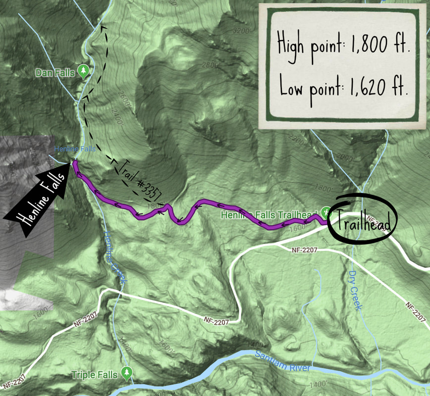
Henline Falls
Hike details:
Mileage: 1.8 miles out and back w/ 270 ft. elevation gain
Approximate hike time: 1 hour w/ an average pace of 2 mph
Difficulty: Easy
Trail usage: Medium on weekends, low on weekdays, very low traffic during the winter season.
General location: 40 miles east of Salem off of North Fork Rd. - Opal Creek Wilderness - Willamette National Forest
Suggested seasons: Spring, summer, fall, winter
(Best time to go is winter and early spring, because there are less people and the waterfall will be flowing nicely. In mid-April there are often many butterflies in the area).
Permits required: Self issue wilderness permit May 22 - Oct. 31 & Annual Northwest Forest Pass for parking
Pit toilet at trailhead: N/A
Trail allows: Dogs on leash
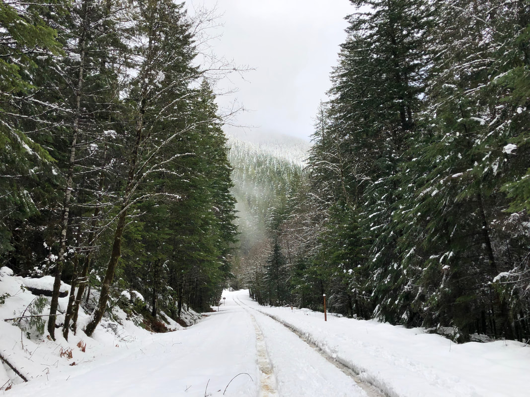
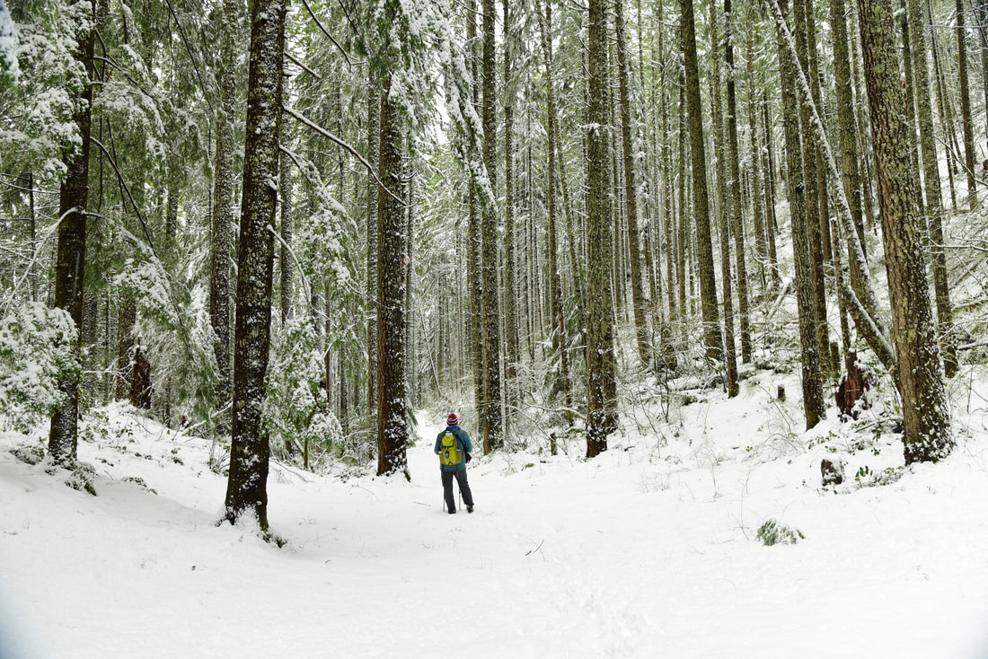
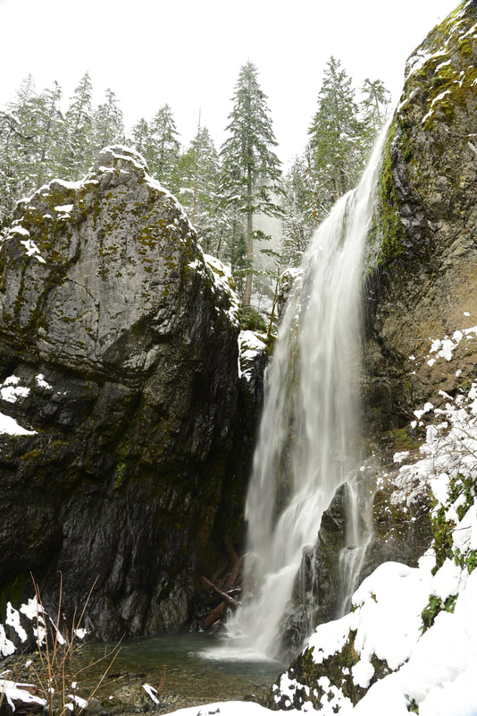
(Road and trailhead in the winter - February 2019)
Description:
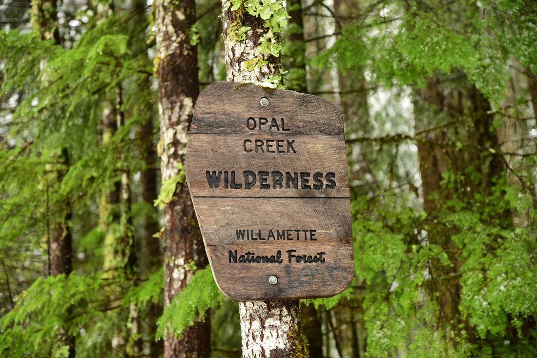
Henline Falls Trail #3348 is a very easy out and back hike, perfect even for those folks who rarely hike. Because this trail is located in the Opal Creek Wilderness before starting on your hike you will have to fill out a free self issue wilderness permit if you hike here from Memorial Day to October 31st.
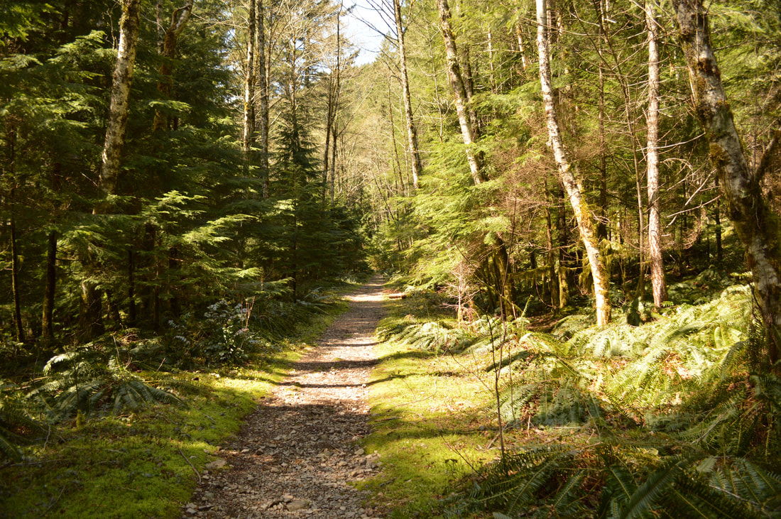
The trail starts off very wide and level because this section used to be a forest service road, allowing kids to run up and down the trail and for adults to talk side by side. The trail takes you through a forest of red alder, Douglas fir trees, and western hemlock, with salal, Oregon grape, and sword fern littering the forest floor.
The trail starts off very wide and level because this section used to be a forest service road, allowing kids to run up and down the trail and for adults to talk side by side. The trail takes you through a forest of red alder, Douglas fir trees, and western hemlock, with salal, Oregon grape, and sword fern littering the forest floor.
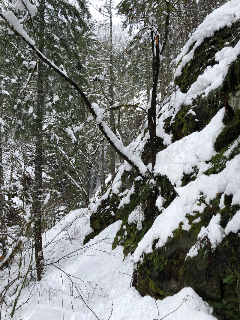
The trail does narrow a bit as you get closer to the waterfall. You will see a trail that goes steeply up the hill on your right. This is trail #3357 and it takes you up to the top of the waterfall and then meanders along the creek to the family of other waterfalls along Henline Creek.
|
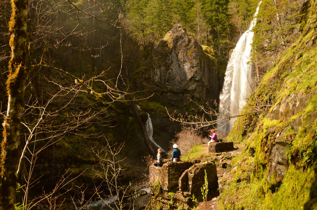
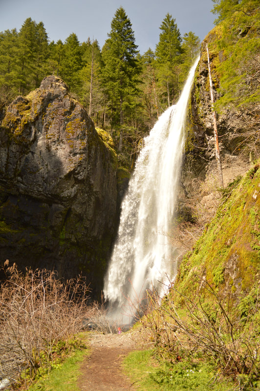
After passing the concrete foundation of the old Silver King Mine’s power plant and water wheel from the 1930’s, you will see impressive 125 ft. Henline Falls. The blue-green pool that the waterfall crashes into continuously changes with each season, which makes this hike a must-see during all times of the year. In the spring time the torrential flow of the falls can make it difficult to take photos as your lens will be obscured with spray. |
|
(April 2017)
|
(February 2019)
|
To the right of the falls there is an old mine shaft that was drilled 1,700 feet into the hillside when the mine was active, but no gold was ever found in this shaft. Now there is a bat gate 20 feet into the tunnel. One of the best photos can be taken from the trail near the mine shaft, where you can see Henline Falls, as well as a smaller no name waterfall on the other side, both plummeting into the pool below.
Overall, this is a must-see waterfall hike suited for all ages and hiking skill levels. The smooth terrain allows for an easy jaunt to one of the top waterfalls in Oregon.
Overall, this is a must-see waterfall hike suited for all ages and hiking skill levels. The smooth terrain allows for an easy jaunt to one of the top waterfalls in Oregon.
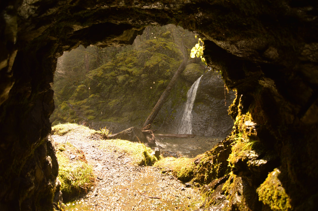
(view from the inside of the old mine)
Directions:
From Salem
- Drive OR-22 east towards Detroit for 21.8 miles. At the town of Mehama’s second flashing lights, turn left onto N. Fork Rd. for 15.4 miles then fork left onto NF-2207 for 1.4 miles and find the trailhead on your left. (Total of 42.1 miles)
- Drive I-5 north towards Albany. Take exit 233 for US-20 towards Albany/Lebanon. Turn left onto US-20 east for 5.4 miles then merge left onto OR-226 east and stay on this road for 23.9 miles until the road ends at OR-22. Turn right and at Mehama’s second flashing lights, turn left onto N. Fork Rd. for 15.4 miles then fork left onto NF-2207 for 1.4 miles and find the trailhead on your left. (Total of 90.1 miles)
- From Bend take Hwy. 97 north towards Redmond, then merge onto US-20 west towards Sisters. After the town of Sisters, continue another 21.5 miles on US-20 and then merge right onto OR-22 west towards Detroit. In the town of Gates turn right onto Gates Hill Rd. for 3.7 miles then turn right onto N. Fork Rd. After 4.9 miles fork left onto NF-2207 for 1.4 miles and find the trailhead on your left. (Total of 108 miles)
- From Portland it is a total of 87.4 miles via Salem.
- From Medford it is a total of 253 miles via Eugene and Salem.
*All pictures are taken by Franziska Weinheimer
*Disclaimer: the trail descriptions, mileage, GPS tracks and difficulty ratings depicted on this website are never 100% accurate. Always hike at your own risk, using your own knowledge, equipment and common sense. Franziska Weinheimer/Hike Oregon are not responsible if you or anyone in your party gets injured or lost while attempting one of these or any other hikes.