Hike Oregon
  • Home
  • *Store*
  • About the author
  • How to use this site
  • Resources
    • Wildflowers
    • Videos
  • Best Oregon Hikes
    • Top Fall Foliage Hikes In Oregon
    • Top 10 Oregon Fall Hikes
    • 20 Best Oregon Waterfall Hikes
    • Top 10 Oregon Hikes for Kids
    • Sno-Parks In Central Oregon
    • Top 10 Oregon Winter Hikes
    • Top Low Elevation Winter Hikes
    • 9 Amazing Oregon Summit Hikes
    • 20 Central Oregon Day Hikes
    • 20 Epic Oregon Wildflower Hikes
    • 5 Weekend Backpacking Trips in Oregon
    • Top One Night Backpacking Trips in Oregon
    • Top 10 Oregon Summer Hikes
    • Top 10 Swimming Spots In Oregon
    • Top 10 Oregon Spring Hikes
  • Oregon Sno-Parks
    • Maxwell Sno-Park
    • Potato Hill Sno-Park
    • Ray Benson Sno-Park
      • Brandenburg Shelter
    • Santiam Sno-Park
    • Three Creek Sno-Park
    • Virginia Meissner Sno-Park
      • Meissner Shelter Loop
      • Nordeen Shelter
    • Gold Lake Sno-Park
      • Westview Shelter to Eagle Rock Overlook
      • Marilyn Lakes Loop
  • Southern Washington
    • Hamilton Mountain
    • Dog Mountain
    • Coyote Wall
    • Mount St. Helens
  • Portland
    • Powell Butte
    • Forest Park
    • Latourell Falls
    • Multnomah/Wahkeena Falls
    • Eagle Creek
    • Mitchell Point
    • Table Rock
    • Tamanawas Falls
    • Trillium Lake
    • East Zigzag Mountain (members only)
  • Salem
    • Abiqua Falls
    • Silver Falls State Park
    • Dome Rock
    • Marion Lake to Marion Mountain
    • Jefferson Park
  • Corvallis
    • Marys Peak East Ridge
    • Marys Peak North Ridge
    • Alsea Falls and Green Peak Falls
    • Corvallis to Sea Trail - Sugarbowl Creek segment (members only)
  • Sweet Home
    • Crescent Mountain
    • Iron Mountain
    • McDowell Creek Falls
    • Middle Santiam River (members only)
    • Lower Soda Creek Falls (members only)
    • Rooster Rock (members only)
  • McKenzie Bridge/Blue River
    • Macduff Mountain
    • Proxy Falls
    • Clear Lake
    • Sahalie/Koosah Falls
    • Blue Pool
    • Erma Bell Lakes
    • Olallie Mountain
    • Horsepasture Mountain
    • Tidbits Mountain
    • Castle Rock
    • Lowder Mountain (members only)
    • East Fork Trail (members only)
    • Rainbow Falls Overlook (members only)
    • Frissell Point (members only)
    • Chucksney Mountain (members only)
    • Substitute Point (members only)
  • Sisters/Santiam Pass
    • Coffin Mountain
    • Trappers Butte and Scar Mountain
    • Maxwell Butte
    • Black Butte
    • Whychus Creek Trail
    • Tam McArthur Rim
    • Black Crater
    • Scott Mountain
    • Obsidian Trail
    • Metolius Preserve
    • Three Fingered Jack Loop
    • Square Lake
    • Canyon Creek Meadows
    • Patjens Lakes
    • Craig Lake (members only)
    • Chush Falls (members only)
    • Rockpile Lake (members only)
    • Santiam Lake (members only)
    • Camp Lake (members only)
    • Park Meadow to Golden Lake (members only)
  • Bend/Redmond/LaPine
    • Steins Pillar
    • Chimney Rock
    • Steelhead Falls
    • Tumalo State Park
    • Tumalo Falls
    • Tumalo Mountain
    • No Name Lake
    • Green Lakes
    • Moraine Lake
    • South Sister Summit
    • Horse Lake
    • Muskrat Lake
    • Paulina Peak
    • Peter Skene Ogden Trail (members only)
  • Eugene
    • Ridgeline Trail
    • Mount Pisgah Summit
    • Mount Pisgah Arboretum
    • Shotgun Creek
    • Mount June
    • Lawler
    • Tire Mountain
    • Goodman Creek
    • Brice Creek
    • Trestle Creek Falls
    • Moon Falls
    • Elijah Bristow State Park
    • South Willamette Trail (members only)
    • Eula Ridge (members only)
    • Eagle's Rest (members only)
  • Oakridge
    • Deception Creek
    • North Salmon Creek
    • Grasshopper Ridge
    • Larison Creek
    • Bunchgrass Ridge
    • Salt Creek Falls
    • Waldo Lake Loop
    • South Waldo Loop
    • The Twins
    • Rosary Lakes
    • Yoran Lake
    • Fawn Lake
    • Windy Lakes
    • Divide Lake
    • Diamond Peak Summit
    • Cowhorn Mountain
    • Wall Creek Warm Springs (members only)
    • Moon Point (members only)
    • Bobby Lake (members only)
    • Lillian Falls (members only)
    • Middle Fork Willamette Trail (members only)
    • Pool Creek Falls (members only)
    • Dead Mountain (members only)
    • Larison Rock (members only)
    • Quinn Lakes & Eddeeleo Lakes (members only)
    • Waldo Mountain Lookout (members only)
    • Blair Lake to Spring Prairie (members only)
    • Rigdon Lakes loop (members only)
  • Oregon Coast
    • Cascade Head
    • Drift Creek Falls
    • Sweet Creek Falls
    • Beaver Creek Falls
    • Kentucky Falls
    • Hobbit Trail to Heceta Head
    • Valley Trail to China Creek
    • North Fork Smith River (members only)
    • Cummins Ridge (member's only)
    • Horse Creek (members only)
    • Siltcoos Lake (members only)
  • Southern Oregon
    • Fall Creek Falls
    • Watson Falls
    • Wild Rogue Loop
    • Mt. Thielsen
    • Crater Lake National Park
      • The Watchman
      • Mount Scott
      • The Pinnacles
    • Lower Table Rock
    • Pilot Rock
    • Wagner Butte
    • Mt. McLoughlin
    • Lemolo Falls (members only)
    • Fern Falls (members only)
  • Eastern Oregon
    • Painted Cove
    • Anthony Lake Loop
    • Mount Howard
    • Eagle Cap summit
    • Schneider Cabin (members only)
    • Strawberry Lake & Strawberry Falls (members only)
  • Oregon PCT sections
  • Tips & Tricks
    • Leave No Trace
    • How To Pick The Right Backpacking Tent
    • Top Tips For Hiking With Infants And Toddlers
    • Poison Oak, Ivy and Sumac
    • How to dress for cold weather hikes
    • Outdoorsy Holiday Gift Guide 2022
    • Hiker Holiday Gift Guide 2019
    • Outdoor Holiday Gift Guide 2018
    • Hiking Holiday Gift Guide 2017
  • Reviews/Gear
    • Stay Kühl This Summer
    • Outdoor Herbivore Backpacking Food Review
    • Osprey Aura AG 65 Backpack review
    • Big Agnes Fly Creek UL2 review
    • REI Quarter Dome 1 review
  • Adventure Stories
    • Hiking The Rae Lakes Loop
    • 110 Miles on the PCT
    • Three Fingered Jack Adventures
    • Jefferson Wilderness

Diamond Peak

​

via Summit Lake

​
Get the printable version of this hike

Hike details:

Mileage: 11.25 miles out and back w/ 3,190 ft. elevation gain
Approximate hike time: 5 hours 37 minutes w/ an average pace of 2 mph
Difficulty: Very difficult (some route finding is involved)
Trail usage: Low to medium (depending on if it's PCT thru-hiker season)
​
Highest elevation: 8,743 ft. Lowest elevation: 5,590 ft.
General location: 40 miles southeast of Oakridge - Deschutes National Forest - Diamond Peak Wilderness
Suggested seasons: Late summer, early fall
(Best time to go is late August and through the month of September to avoid terrible mosquitoes and hot temperatures).
Permits required: N/A
Pit toilet at trailhead: Yes
Trail allows: ​Dogs, horses (on the PCT only), camping
Possible dangers: steep drop offs near the summit and losing the climber trail
Sign for PCT at Summit Lake

Description​:

Diamond Peak summit is one of the best and most underrated summit hikes in the Oregon Cascade range. There are a few different routes up the mountain, but the route starting at Summit Lake is by far the easiest. Summit Lake has a small first come first serve campground if you want to spend the night after a long day of summiting. There is also a lot of primitive camping along the Pacific Crest Trail near Summit Lake, as well as near small ponds on the way to the Diamond Peak climber trail. 
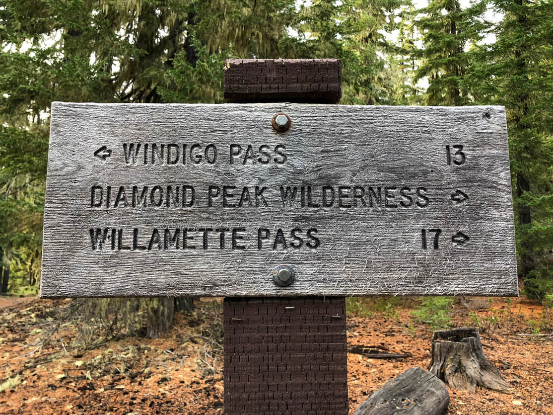
There is a large parking area across the road from Summit Lake campground where there is room for about 20 cars to park. Here you will see a trailhead sign and a sign for the Pacific Crest Trail. Southbound it is 13 miles to Windigo Pass, which is near Cowhorn Mountain. You will take the trail northbound for a total of 4.45 miles.
Small pond along the Pacific Crest Trail near Summit Lake Oregon
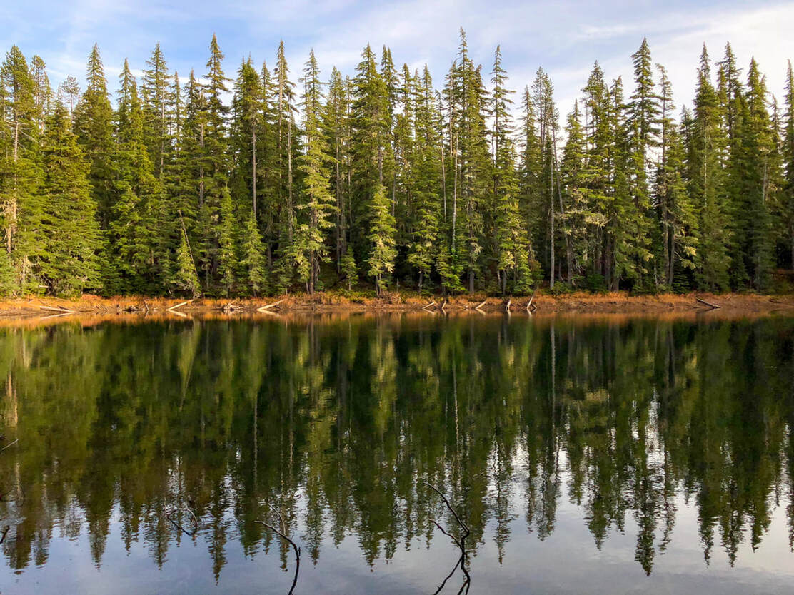
(small pond along the PCT)
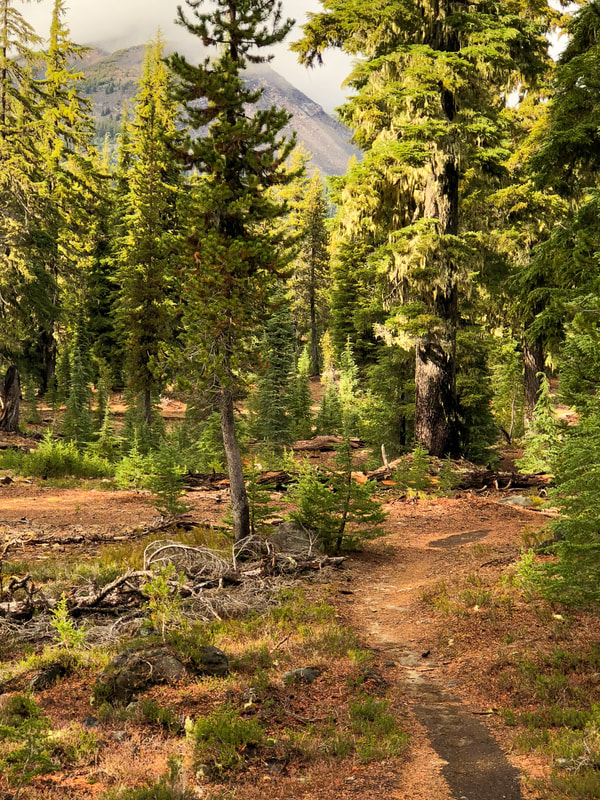
This section of the Pacific Crest Trail is extremely mellow and only gains a total of 1,010 feet of elevation during the entire 4.45 miles that you are on it. The trail takes you through a beautiful forest and past many small ponds. Keep in mind this area is infested with mosquitoes from mid-June to mid-August. PCT thru-hikers have said that the mosquitoes at Summit Lake are some of the worst they have ever experienced! Even though this is the Pacific Crest Trail, besides the few weeks that the bubble of thru-hikers come through, this area is not as well traveled as some other areas in Central Oregon because it is so remote. There is a lot of wildlife here and in fall it is a popular hunting area. You can see bear, elk, cougar, and there have even been wolf sightings. At 3.1 miles you will see a trail cross the PCT. The trail to the left takes you to Rockpile and Marie Lake and the trail to the right is a connector trail and would eventually take you to Fawn Lake.  ​
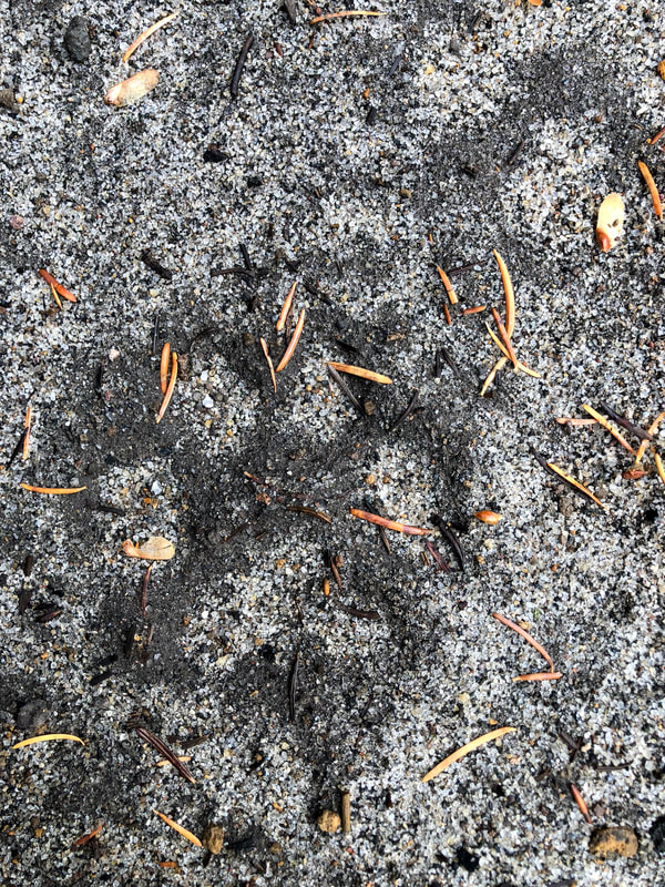
Cougar tracks along the Pacific Crest Trail
(cougar tracks)
Pacific Crest Trail by Summit Lake
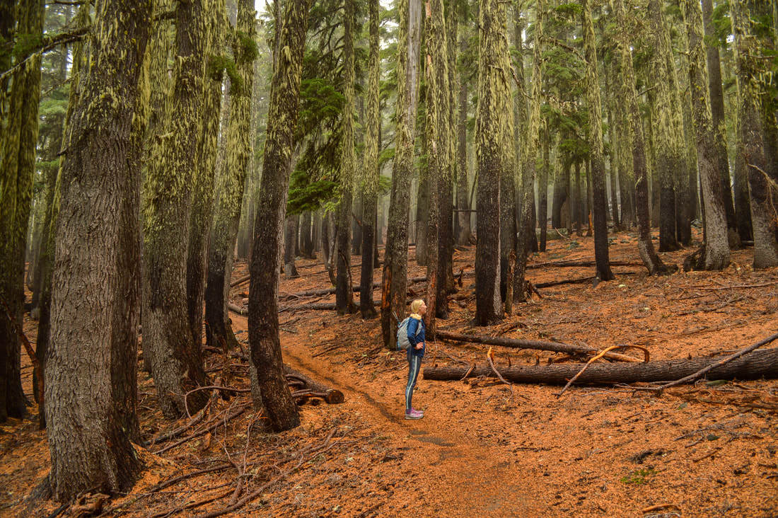
(Pacific Crest Trail from Summit Lake)
Diamond Peak from Pacific Crest Trail
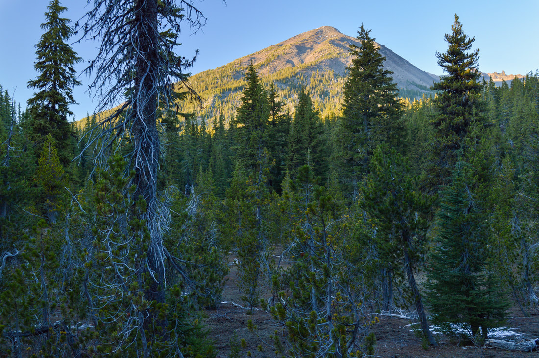
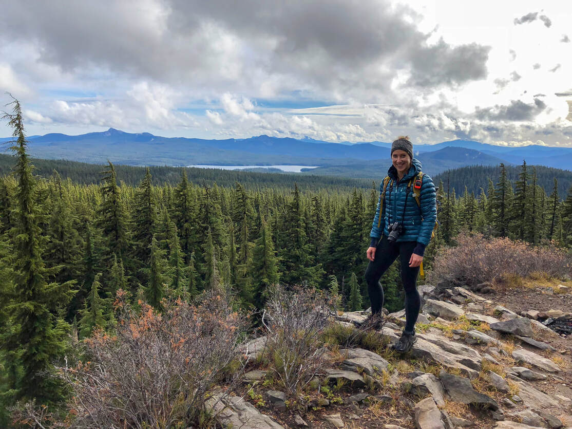
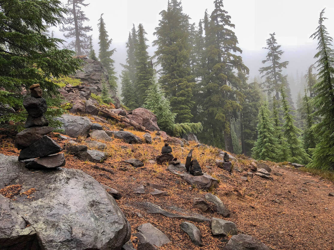
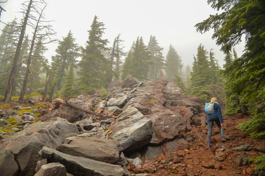
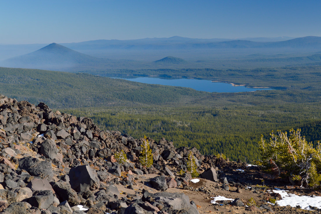
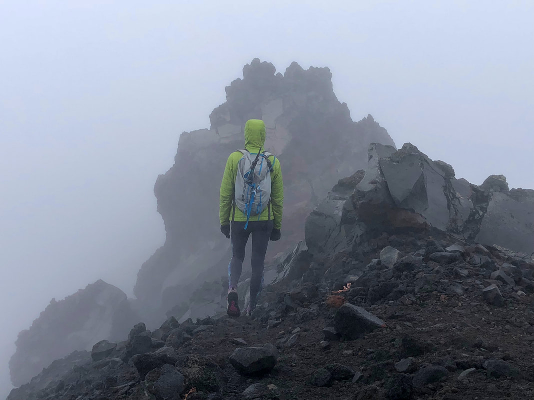
As you get closer to the Diamond Peak climber trail junction, you will catch glimpses of the mountain through the trees. The spot where the climber trail meets the PCT is fairly obvious, even if there aren't rock cairns there yet. The trail comes out from the woods and turns a sharp corner coming to a large open area with some rocks and a great view of Summit Lake, Cowhorn Mountain and Thielsen. This is a great PCT camping spot, and one of the only spots ​where you will have phone service. From here you will see various rock cairns and a faint trail going up to the left. There is no official climber trail like there is on South Sister or Mt. Bailey, but this is one of the most popular routes up Diamond Peak so it tends to be well marked with rock cairns, especially if you go later in the summer season. 
View of Diamond Peak from the Pacific Crest Trail
(view of Diamond Peak from the PCT)
Pacific Crest Trail viewpoint and camp spot
(PCT viewpoint and camp spot)
Pacific Crest Trail and Diamond Peak climber trail junction
(Diamond Peak climber trail junction)
Start of Diamond Peak climber trail
Diamond Peak climber trail
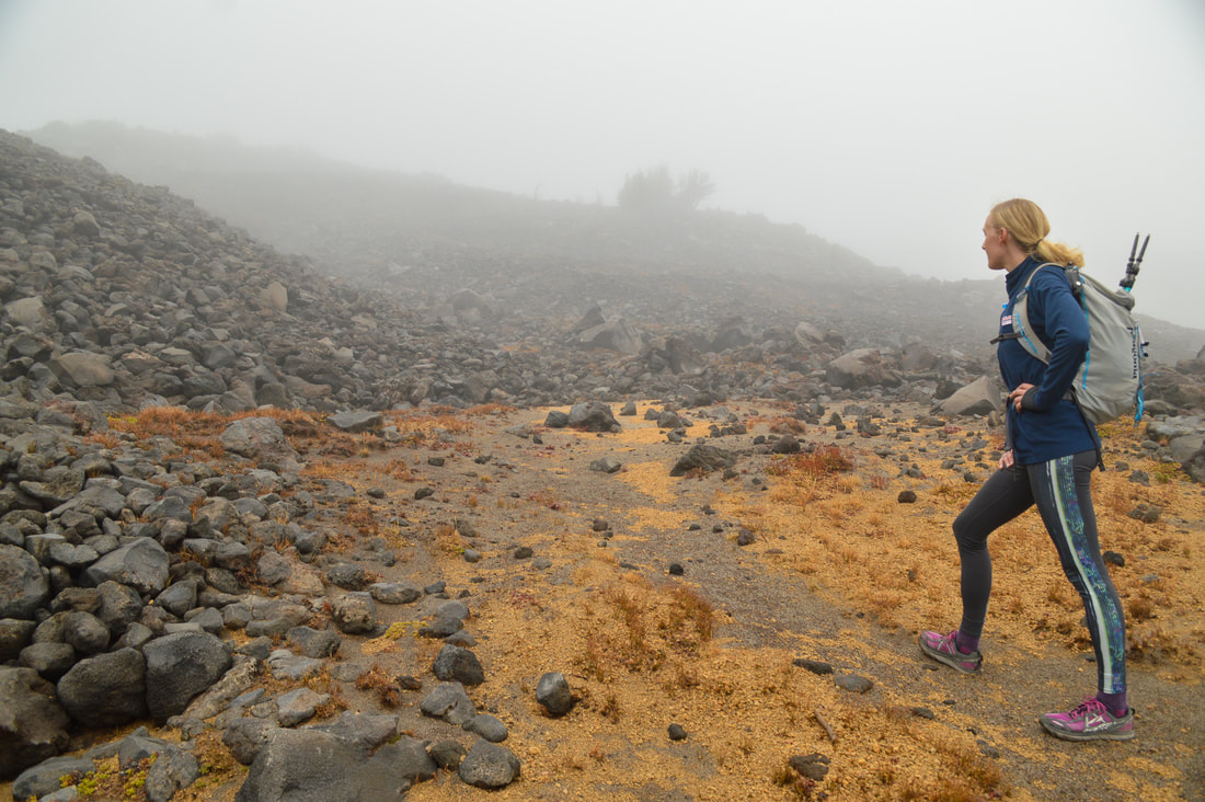
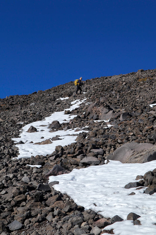
From the junction the climber trail immediately starts going steeply uphill. It is exactly 1.06 miles to the false summit and you will gain a whopping 1,800 feet of elevation in just that one mile! It is very steep and the rocks are loose, so take it slow. Having trekking poles helps immensely!
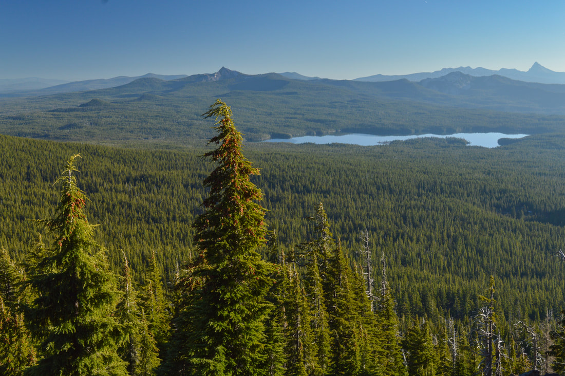
The first section of the climber trail is still through the trees so the ground isn't as loose as further up. You have some large rocks to hold onto if you need help with footing. Sometimes the route isn't really obvious, but just continue looking up and follow the rock cairns. Once you hit timberline, you will start seeing some spectacular views to the south of Summit Lake, Cowhorn Mountain and Mount Thielsen and northeast towards Crescent Lake. 
Rock cairns marking the Diamond Peak climber trail
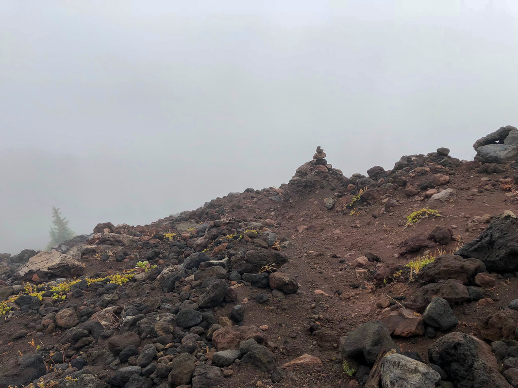
(follow rock cairns up the mountain)
Summit Lake and Mt. Thielsen view from Diamond Peak.jpg
(view of Summit Lake, Cowhorn Mountain, Sawtooth Mountain & Mount Thielsen)
Crescent Lake view from Diamond Peak
(view of Crescent Lake)
Start of Diamond Peak climber trail boulder section
(start of rocky/boulder section)
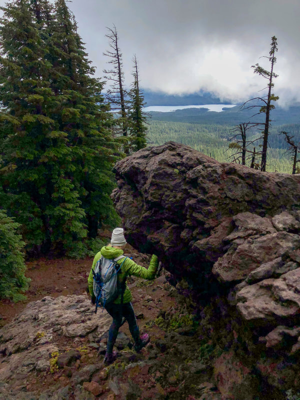
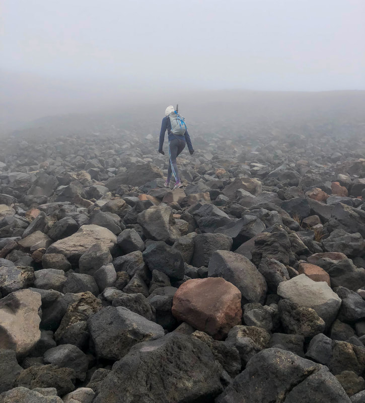
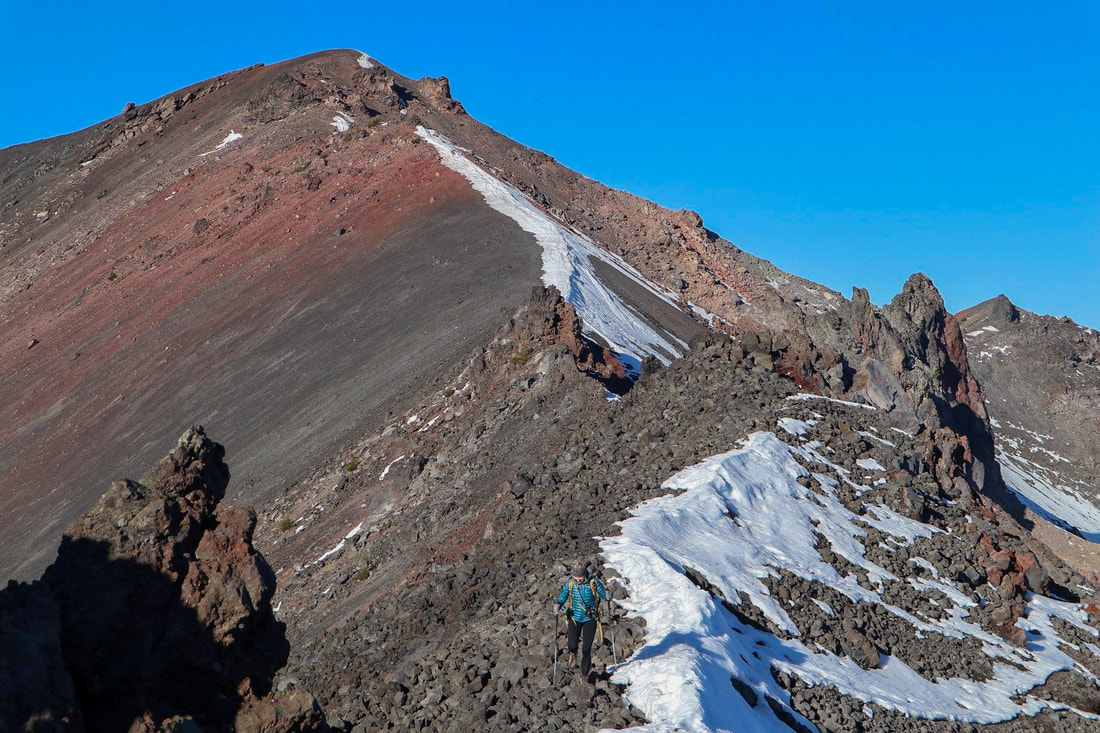
Shortly after hitting timberline you will come to a very obvious spot where the rocky/boulder section starts. This is the last push to the false summit. Here you won't see any rock cairns, but it's easy to see that you just go straight up. These rocks are loose so choose your footing wisely and just take it slow. Once you crest the boulder field you will be at Diamond Peak's false summit. 
Boulder section Diamond Peak climber trail
(picture by Holly Voltin)
Boulder section of the Diamond Peak climber trail
(this incline is a 60% grade)
Diamond Peak false summit in the fog
(false summit)
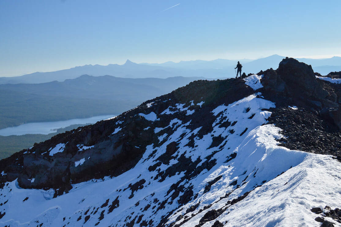
From the false summit you will hike along Diamond Peak's spine another 0.4 miles to the top, gaining your last 545 feet of elevation. The spine can look sketchy and narrow from the false summit, but it is about 3-4 feet wide in most spots. If you have trekking poles, put them away at the false summit so that you can have both of your hands free for maneuvering around the rock spires, the only slightly sketchy part of this whole hike. If you are not wanting to maneuver the rock holds to get past the spires on the way to the summit you can stay at the false summit. You will still have great views from there towards the south as well as to the east and west.
Diamond Peak false summit
(view of the spine from the false summit - picture by Holly Voltin)
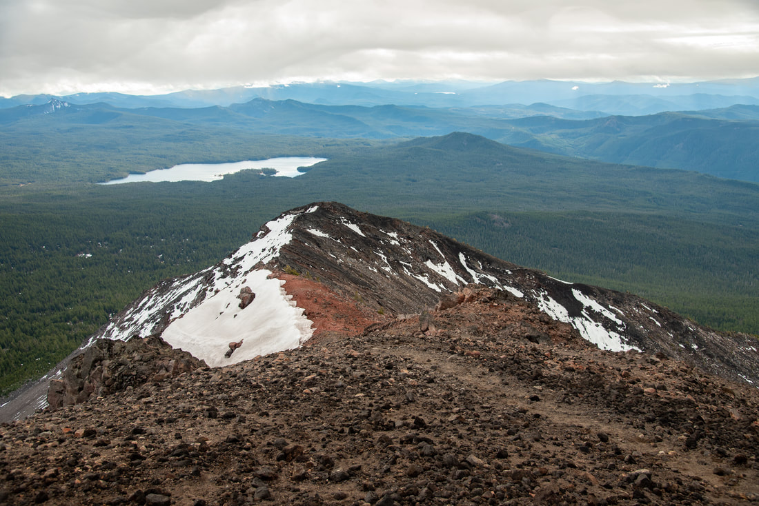
The summit is spectacular though and offers views of the rest of Diamond Peak's arms, and you can see Waldo Lake, Willamette Pass, Maiden Peak, the Three Sisters and Mt. Bachelor in the distance to the north. To the south you will see Mt. Thielsen and Summit Lake where you came from. The summit is fairly large and flat and during non-windy conditions (which is rare) you could even spend the night up there and witness a life changing sunset and sunrise. For the way down, be careful to not go the wrong way. It is very easy to continue going straight down after the rocky/boulder area, which will put you out at Marie Lake, the small lake near Rockpile Trail. Navigating the way down with the GPS track that you recorded when going up will be very helpful. 
Diamond Peak climber trail with views to the south
(view looking south of the false summit from the spine)
View of Waldo Lake from Diamond Peak summit
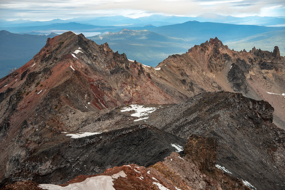
(view to the north from Diamond Peak summit)
Diamond Peak is absolutely incredible and one of Oregon's most underrated summits! It is rated 'very difficult' only because there is route finding involved near the top as well as maneuvering around the spine's rock spires. The rest of the hike would definitely be rated easy to moderate. When thinking about the timing of your hike and making sure you have enough daylight hours, keep in mind that the last 1.5 miles of this hike (the actual climb) will take between 1.5-2 hours and it is pretty slow going on the way down too. Because the rocks are loose you have to watch your footing carefully. Once you get back down to the PCT it is easy cruising though. 
Diamond Peak climber trail from the summit
(view to the south from Diamond Peak summit)

Directions:

​**If you Google directions to Summit Lake DO NOT take the suggested route even if Google says it is faster. The 6 miles of road NF-398 from Crescent Lake to Summit Lake is some of the roughest road you will ever experience in Oregon and the road gets worse every single year. This road should not be attempted unless you have a very high clearance Jeep or 4Runner. Even with these high clearance cars the 6 miles will likely take about 45 minutes to 1 hour to navigate. For reference, a Subaru Crosstrek barely made it 3 years ago. 
From Oakridge
  • ​Drive OR-58 east to the outskirts of town and then turn right onto  Hills Creek Rd/Kitson Springs Rd. for 0.5 miles. Turn right onto US Forest Service Rd 21 then almost immediately turn left onto NF-21. Stay on this road for a total of 10.3 miles. The road will cross a bridge, stay right on NF-21 for another 21 paved miles. Turn left onto Rigdon Rd/US Frst Service Rd. 21 for 0.5 miles, then turn left onto FS-380 for 0.2 miles. Continue onto Rigdon Rd/US Frst Service Rd. 380 for 4.1 miles, then at a sign for Summit Lake continue straight onto NF-380 for 1.8 rough miles. The trailhead will be on your left. (Total of 41.1 miles.)
From Medford
  • Drive on OR-62 east for 49.5 miles, then make a slight left onto OR-230 N for 23.8 miles. Turn left onto OR-138 W and stay on this road for 9.4 miles. Turn right onto NF-60 for 4.5 miles, then turn left onto NF-2612 for 1.2 miles. At a fork take a slight right for 0.3 miles, then continue straight onto NF-700 for 5.2 miles. Continue straight onto NF-770 for 0.7 miles, then continue onto FS-6000. 770 for another 2 miles. Turn right onto NF-2154 for 1 mile, turn right to stay on NF-2154 for 2.5 miles. NF-2154 turns slightly left and becomes NF-215. After 0.5 miles, turn right onto FS-2154 then immediately turn left onto NF-398 for 2.1 miles. At a junction turn left to stay on NF-398 at a sign for Summit Lake. After 2 rough miles, the trailhead will be on your left. (Total of 112 miles)
​From Bend
  • Total of 138.5 miles via Oakridge. Total of 76.4 miles via Crescent Lake and NF-398 which requires a high clearance vehicle.
From Eugene
  • Total of 84.7 miles via Oakridge.
From Salem
  • Total of 146 miles via Oakridge.
From Portland
  • Total of 189 miles via Oakridge.
*All pictures unless otherwise marked are taken by Franziska Weinheimer
*Disclaimer: The trail descriptions, mileage, GPS tracks and difficulty ratings depicted on this website are never 100% accurate. Always hike at your own risk, using your own knowledge, equipment and common sense. Franziska Weinheimer/Hike Oregon are not responsible if you or anyone in your party gets injured or lost while attempting one of these or any other hikes.

HIKED HERE RECENTLY? PLEASE LEAVE A TRIP REPORT BELOW:

© Hike Oregon 2023
P.O. Box 41911
​Eugene, OR 97404
Proudly powered by Weebly
  • Home
  • *Store*
  • About the author
  • How to use this site
  • Resources
    • Wildflowers
    • Videos
  • Best Oregon Hikes
    • Top Fall Foliage Hikes In Oregon
    • Top 10 Oregon Fall Hikes
    • 20 Best Oregon Waterfall Hikes
    • Top 10 Oregon Hikes for Kids
    • Sno-Parks In Central Oregon
    • Top 10 Oregon Winter Hikes
    • Top Low Elevation Winter Hikes
    • 9 Amazing Oregon Summit Hikes
    • 20 Central Oregon Day Hikes
    • 20 Epic Oregon Wildflower Hikes
    • 5 Weekend Backpacking Trips in Oregon
    • Top One Night Backpacking Trips in Oregon
    • Top 10 Oregon Summer Hikes
    • Top 10 Swimming Spots In Oregon
    • Top 10 Oregon Spring Hikes
  • Oregon Sno-Parks
    • Maxwell Sno-Park
    • Potato Hill Sno-Park
    • Ray Benson Sno-Park
      • Brandenburg Shelter
    • Santiam Sno-Park
    • Three Creek Sno-Park
    • Virginia Meissner Sno-Park
      • Meissner Shelter Loop
      • Nordeen Shelter
    • Gold Lake Sno-Park
      • Westview Shelter to Eagle Rock Overlook
      • Marilyn Lakes Loop
  • Southern Washington
    • Hamilton Mountain
    • Dog Mountain
    • Coyote Wall
    • Mount St. Helens
  • Portland
    • Powell Butte
    • Forest Park
    • Latourell Falls
    • Multnomah/Wahkeena Falls
    • Eagle Creek
    • Mitchell Point
    • Table Rock
    • Tamanawas Falls
    • Trillium Lake
    • East Zigzag Mountain (members only)
  • Salem
    • Abiqua Falls
    • Silver Falls State Park
    • Dome Rock
    • Marion Lake to Marion Mountain
    • Jefferson Park
  • Corvallis
    • Marys Peak East Ridge
    • Marys Peak North Ridge
    • Alsea Falls and Green Peak Falls
    • Corvallis to Sea Trail - Sugarbowl Creek segment (members only)
  • Sweet Home
    • Crescent Mountain
    • Iron Mountain
    • McDowell Creek Falls
    • Middle Santiam River (members only)
    • Lower Soda Creek Falls (members only)
    • Rooster Rock (members only)
  • McKenzie Bridge/Blue River
    • Macduff Mountain
    • Proxy Falls
    • Clear Lake
    • Sahalie/Koosah Falls
    • Blue Pool
    • Erma Bell Lakes
    • Olallie Mountain
    • Horsepasture Mountain
    • Tidbits Mountain
    • Castle Rock
    • Lowder Mountain (members only)
    • East Fork Trail (members only)
    • Rainbow Falls Overlook (members only)
    • Frissell Point (members only)
    • Chucksney Mountain (members only)
    • Substitute Point (members only)
  • Sisters/Santiam Pass
    • Coffin Mountain
    • Trappers Butte and Scar Mountain
    • Maxwell Butte
    • Black Butte
    • Whychus Creek Trail
    • Tam McArthur Rim
    • Black Crater
    • Scott Mountain
    • Obsidian Trail
    • Metolius Preserve
    • Three Fingered Jack Loop
    • Square Lake
    • Canyon Creek Meadows
    • Patjens Lakes
    • Craig Lake (members only)
    • Chush Falls (members only)
    • Rockpile Lake (members only)
    • Santiam Lake (members only)
    • Camp Lake (members only)
    • Park Meadow to Golden Lake (members only)
  • Bend/Redmond/LaPine
    • Steins Pillar
    • Chimney Rock
    • Steelhead Falls
    • Tumalo State Park
    • Tumalo Falls
    • Tumalo Mountain
    • No Name Lake
    • Green Lakes
    • Moraine Lake
    • South Sister Summit
    • Horse Lake
    • Muskrat Lake
    • Paulina Peak
    • Peter Skene Ogden Trail (members only)
  • Eugene
    • Ridgeline Trail
    • Mount Pisgah Summit
    • Mount Pisgah Arboretum
    • Shotgun Creek
    • Mount June
    • Lawler
    • Tire Mountain
    • Goodman Creek
    • Brice Creek
    • Trestle Creek Falls
    • Moon Falls
    • Elijah Bristow State Park
    • South Willamette Trail (members only)
    • Eula Ridge (members only)
    • Eagle's Rest (members only)
  • Oakridge
    • Deception Creek
    • North Salmon Creek
    • Grasshopper Ridge
    • Larison Creek
    • Bunchgrass Ridge
    • Salt Creek Falls
    • Waldo Lake Loop
    • South Waldo Loop
    • The Twins
    • Rosary Lakes
    • Yoran Lake
    • Fawn Lake
    • Windy Lakes
    • Divide Lake
    • Diamond Peak Summit
    • Cowhorn Mountain
    • Wall Creek Warm Springs (members only)
    • Moon Point (members only)
    • Bobby Lake (members only)
    • Lillian Falls (members only)
    • Middle Fork Willamette Trail (members only)
    • Pool Creek Falls (members only)
    • Dead Mountain (members only)
    • Larison Rock (members only)
    • Quinn Lakes & Eddeeleo Lakes (members only)
    • Waldo Mountain Lookout (members only)
    • Blair Lake to Spring Prairie (members only)
    • Rigdon Lakes loop (members only)
  • Oregon Coast
    • Cascade Head
    • Drift Creek Falls
    • Sweet Creek Falls
    • Beaver Creek Falls
    • Kentucky Falls
    • Hobbit Trail to Heceta Head
    • Valley Trail to China Creek
    • North Fork Smith River (members only)
    • Cummins Ridge (member's only)
    • Horse Creek (members only)
    • Siltcoos Lake (members only)
  • Southern Oregon
    • Fall Creek Falls
    • Watson Falls
    • Wild Rogue Loop
    • Mt. Thielsen
    • Crater Lake National Park
      • The Watchman
      • Mount Scott
      • The Pinnacles
    • Lower Table Rock
    • Pilot Rock
    • Wagner Butte
    • Mt. McLoughlin
    • Lemolo Falls (members only)
    • Fern Falls (members only)
  • Eastern Oregon
    • Painted Cove
    • Anthony Lake Loop
    • Mount Howard
    • Eagle Cap summit
    • Schneider Cabin (members only)
    • Strawberry Lake & Strawberry Falls (members only)
  • Oregon PCT sections
  • Tips & Tricks
    • Leave No Trace
    • How To Pick The Right Backpacking Tent
    • Top Tips For Hiking With Infants And Toddlers
    • Poison Oak, Ivy and Sumac
    • How to dress for cold weather hikes
    • Outdoorsy Holiday Gift Guide 2022
    • Hiker Holiday Gift Guide 2019
    • Outdoor Holiday Gift Guide 2018
    • Hiking Holiday Gift Guide 2017
  • Reviews/Gear
    • Stay Kühl This Summer
    • Outdoor Herbivore Backpacking Food Review
    • Osprey Aura AG 65 Backpack review
    • Big Agnes Fly Creek UL2 review
    • REI Quarter Dome 1 review
  • Adventure Stories
    • Hiking The Rae Lakes Loop
    • 110 Miles on the PCT
    • Three Fingered Jack Adventures
    • Jefferson Wilderness